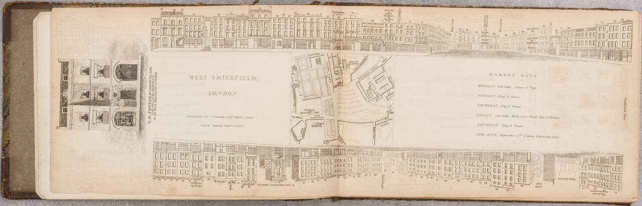
A Nice Set of Tallis's London Views That We Can Find Having Come to the Market. An impressive run of 47 parts (of 88) of John Tallis's fantastic project to provide a view of every major street in London during the late 1830s. This set includes views...
![[Republic of Texas] Carte Des Etats-Unis D'Amerique. . . .1838](/map/small/70864.jpg)
An Early Coast To Coast Map of the United States -- Republic of Texas Fine map of the United States from Coast to Coast, also showing the Republic of Texas just two years after its declaration of independence in 1836. During the 1820s to 1840s, the...
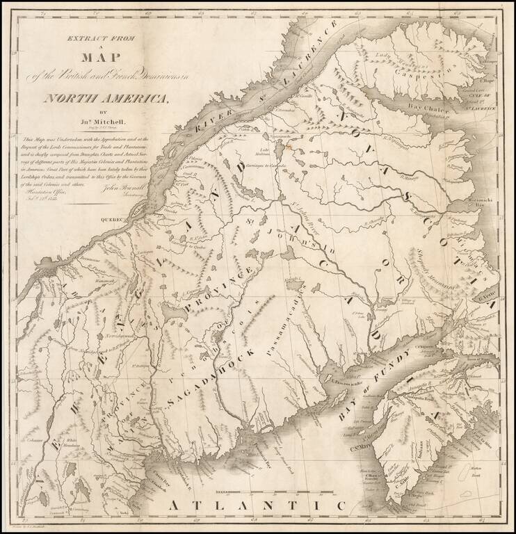
Scarce Map of Maine & Contiguous Regions Showing the Boundary Dispute Ultimately Settled By The Webster-Ashburton Treaty of August 9, 1842. A scarce map depicting the Maine-Canada boundary dispute. This fascinating map depicts the Canada-U.S....
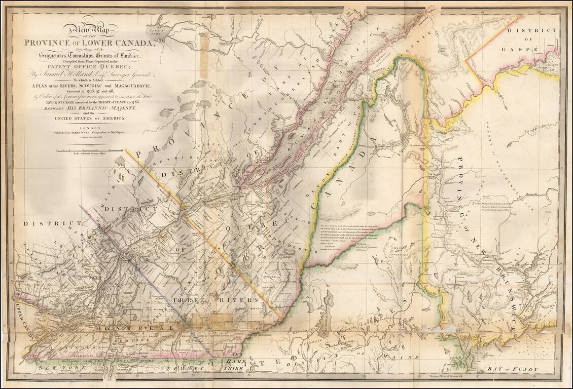
Updated example of this important map of the Lower Province of Canada and Maine, first issued by Faden in 1813. The original Faden map included information concerning over 100 land grants on either side of the St. Lawrence River, including the names...
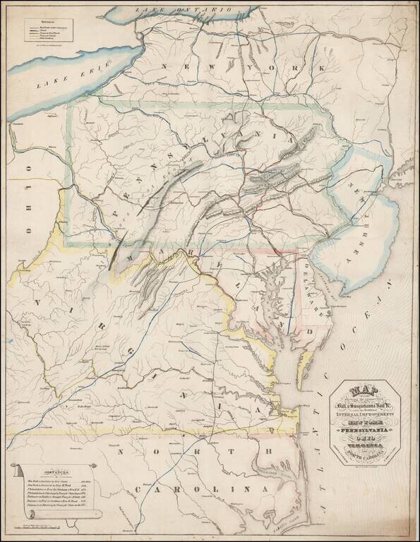
Rare Promotional Map for the Baltimore & Susquehanna Railroad, drawn by I.A. Soiecki. This map is quite possibly the earliest printed map to focus on the Baltimore & Susquehanna Railroad, focusing on railroad lines extending from New York to...
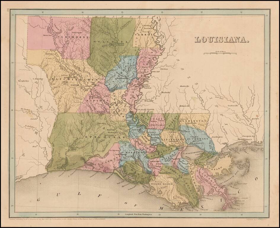
Bradford's large map of Louisiana. The map is hand colored by Parishes, and shows towns, forts, lakes, rivers, and some of the very earliest railroad lines in the South. Many of the early western and northern parishes have not yet been formed, and...
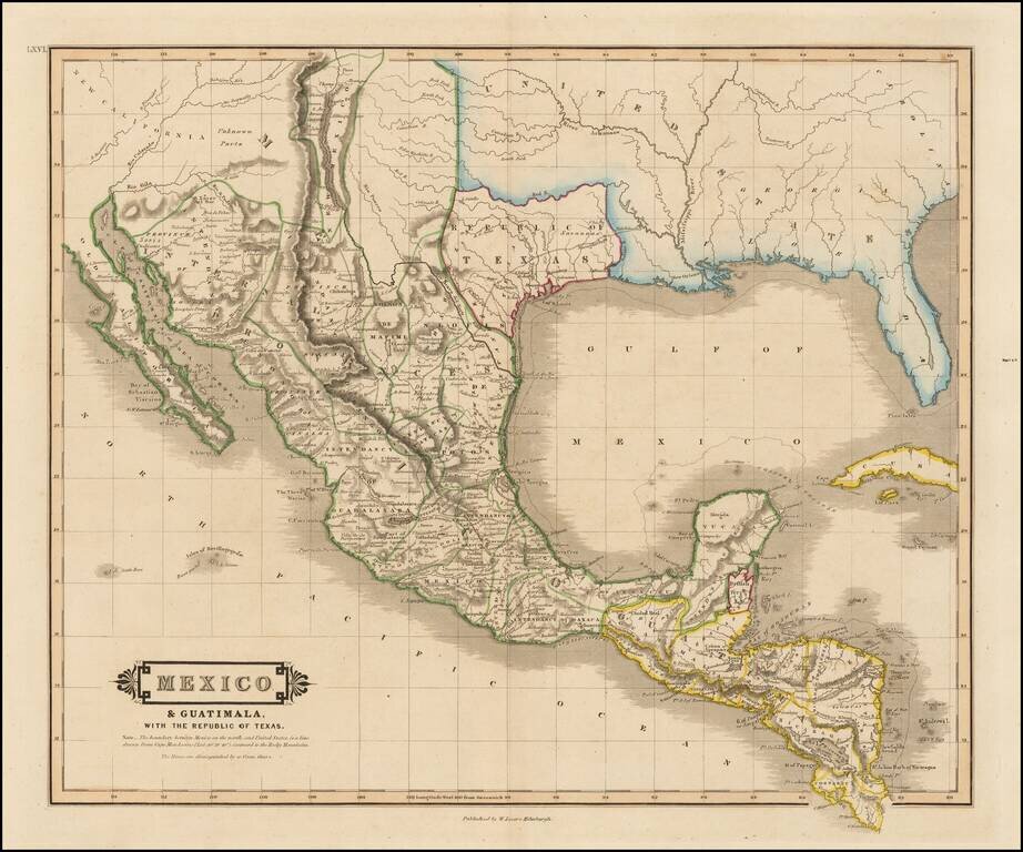
"Republic of Texas" in the Title of the Map Scarce map of Texas, Mexico, Upper California and contigous parts of the Southeastern US, naming the Republic of Texas. The present map is one of the only obtainable printed maps to name the "Republic of...
![Texas [Republic of Texas]](/map/small/64088.jpg)
Nice example of the first edition of Bradford's large map of the Republic of Texas, first published in 1838. In 1835, Bradford issued a small map of the Texas shortly before it became a Republic. In 1838, Bradford issued his Illustrated Atlas, a much...
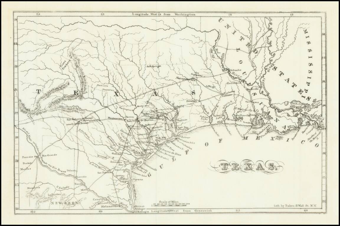
Fine example of Chester Newell's early map of the Republic of Texas, published in 1838. The map shows all of Texas north to the Red River, providing an early look at the Republic, including a fine accounting of its early roads and settlements. The...
![Carte Des Etats-Unis Du Mexique…1838 [Republic of Texas]](/map/small/70909.jpg)
Fine example of Alexandre Emile Lapie's map of the Republic of Texas, New Mexico, Upper California and Mexico. One of the best large format maps of Mexico, Texas and Upper California to appear in a commercial atlas in the 1830s. Texas is clearly...
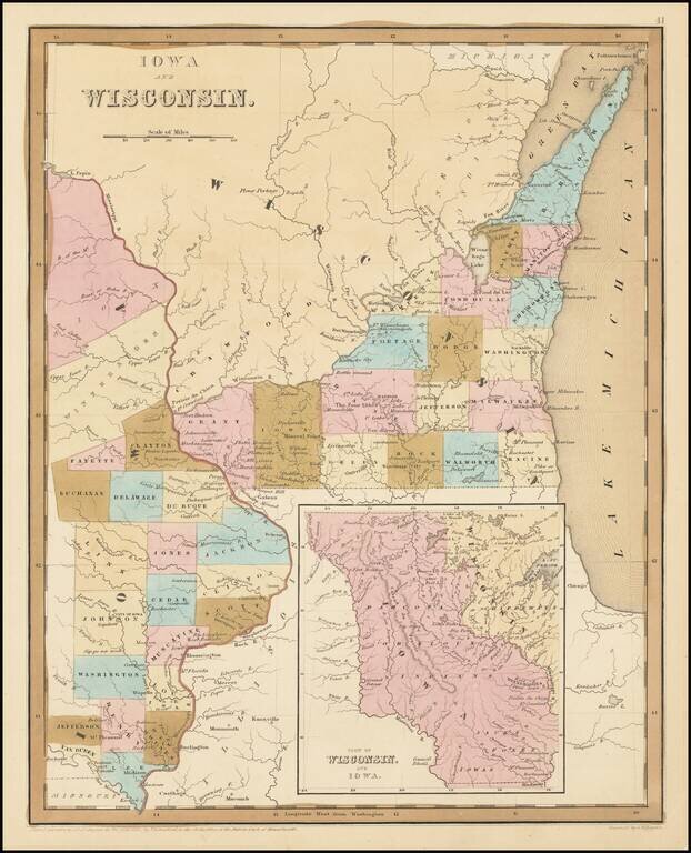
Early Antique Map of Iowa Territory and Wisconsin Territory Important early map of part of Iowa and Wisconsin, with large inset showing all of Iowa Territory and Wisconsin Territory extending to the Canadian Border. Iowa Territory was organized in...
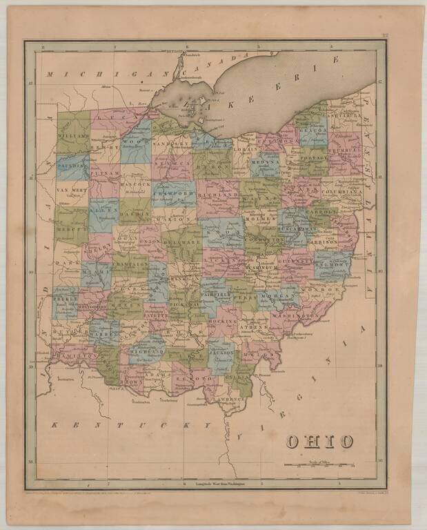
Interesting and detailed map of Ohio, from an early edition of Bradford's Atlas. The map is colored by counties and shows towns, rivers, lakes, roads and other important details.
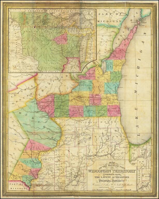
A Foundational Wisconsin Map. This is an important early map of Wisconsin, published only two years after the territory was incorporated. The map centers on the areas now part of southwestern Wisconsin and eastern Iowa. In this area, the most...
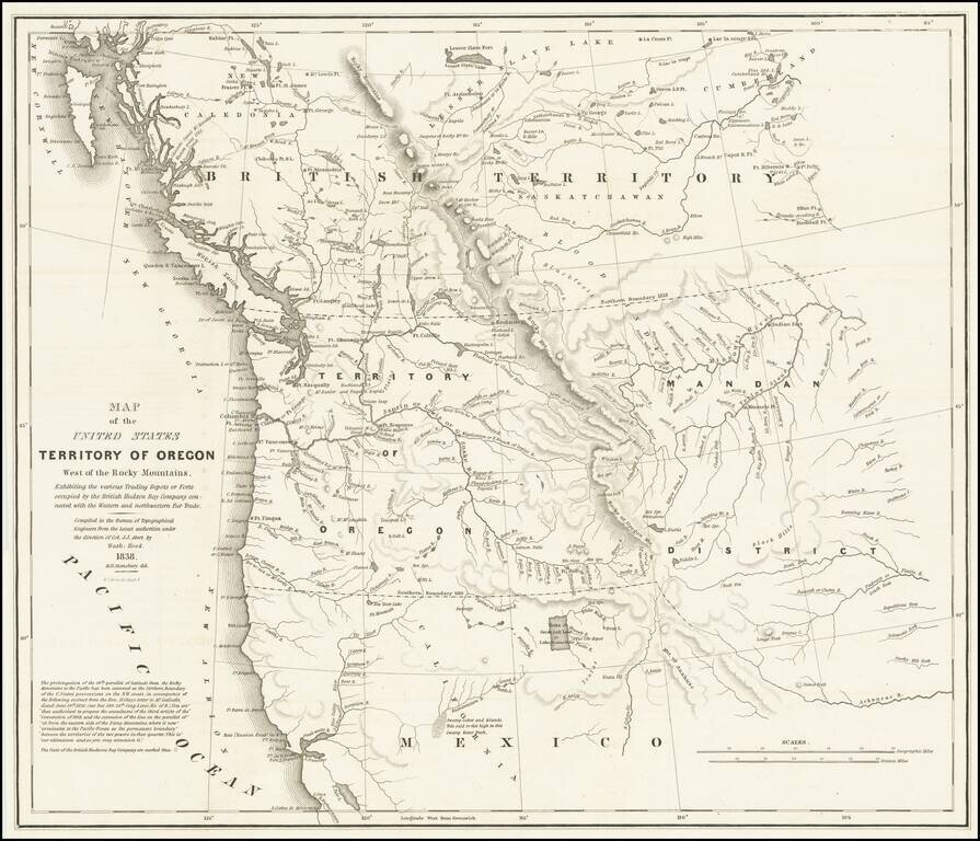
Important Map Showing Oregon Territory used during Congressional Debates about the Status of Oregon Country Hood's landmark map of the Oregon Country was integral to political debates about the area, its place in the growing United States, and its...
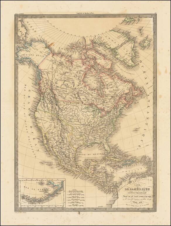
Highly detailed map of North America, with marvelous post Lewis & Clark pre-Fremont cartography. The 54-40 or Fight border of Oregon Territory is shown, with a number of early forts and Hudson Bay Company posts shown in the Northwest. The course...
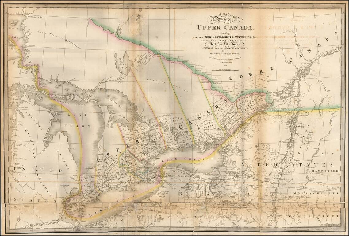
Highly detailed map of the Province of Upper Canada, originally published by David William Smyth and periodically revised over time. Fine map of Upper Canada, showing detailed information on the counties, districts, townships, transportation systems,...