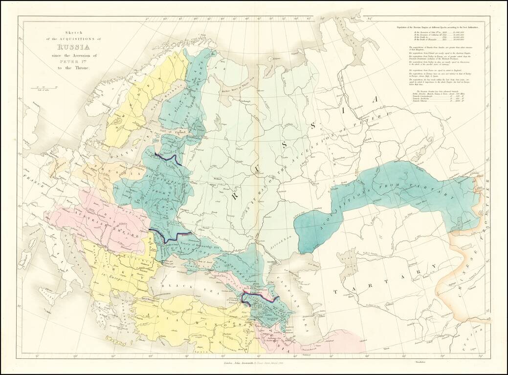
Interesting historical map of Russia, examining the history of Russia from the Reign of Peter the Great in 1689 to the Death of Alexander in 1825.
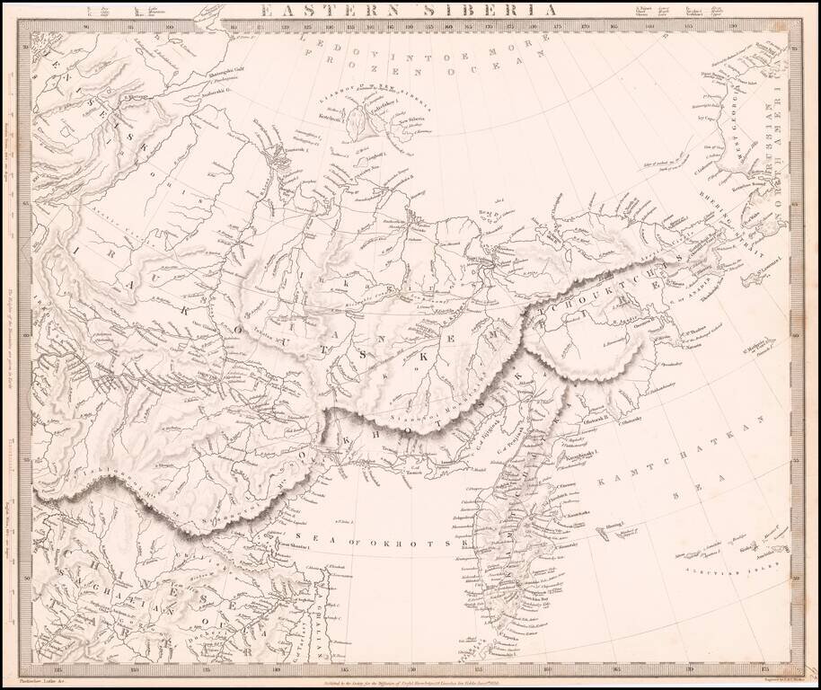
Detailed map of the Eastern Part of Siberia, issued by the Society for the Diffusion of Useful Knowledge (SDUK).
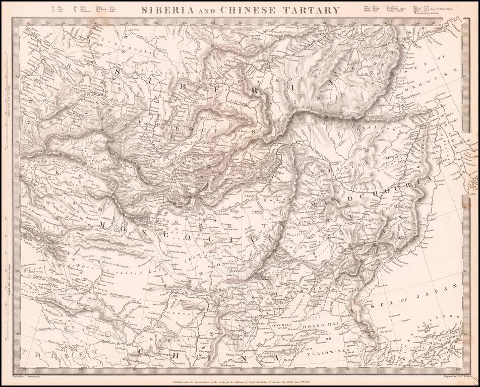
Detailed map of Siberia, Mongolia, Manchuria, etc., issued by the Society for the Diffusion of Useful Knowledge (SDUK).
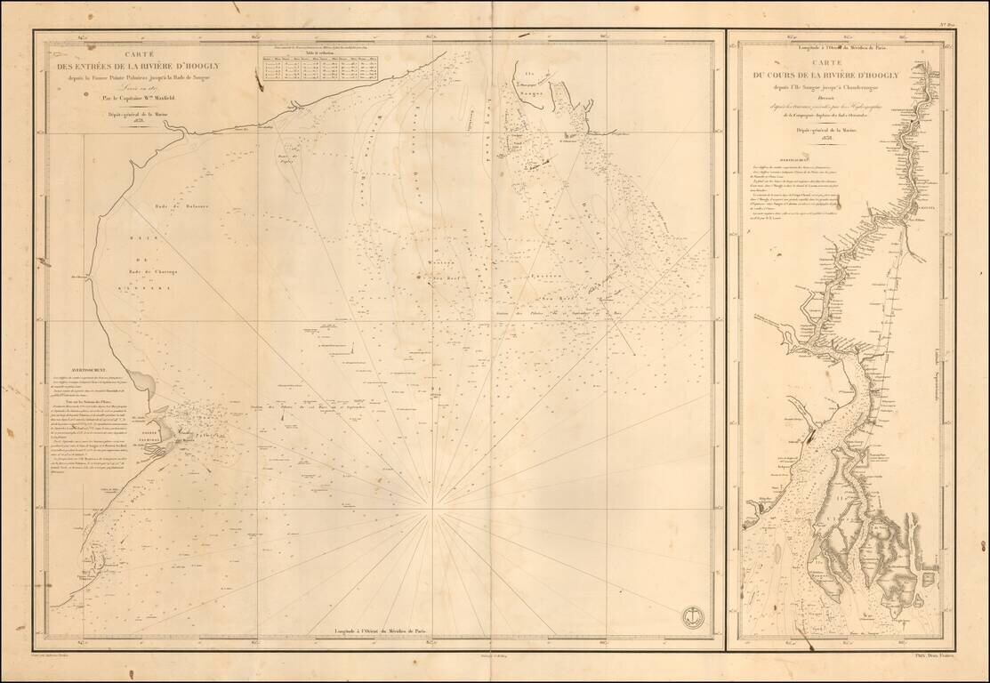
Finely detailed pair of sea charts, covering the northern part of the Bay of Bengal and a chart of the River from the coast to Calcutta and Hoogly. The chart at the right tracks the course of the Hooghly River northward, with an existing post road and...
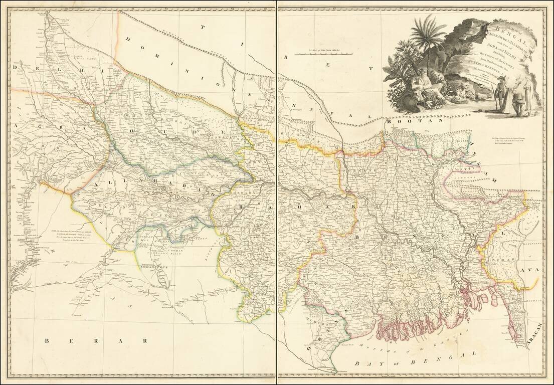
A Rare Late Edition by Wyld Detailed map of the Upper Indian provinces, extending to Tibet in the North and the Bay of Bengal in the South. Th map was drawn by James Rennell F.R.S., Surveyor General of India, and engraved from the original drawing in...
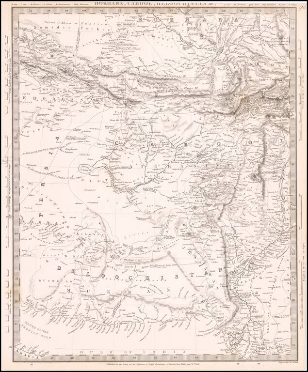
Highly detailed regional map, covering primarily Afghanistan and neighboring regions. Shows the overland routes through the region, along with towns, mountains, rivers and a host of other interesting details.
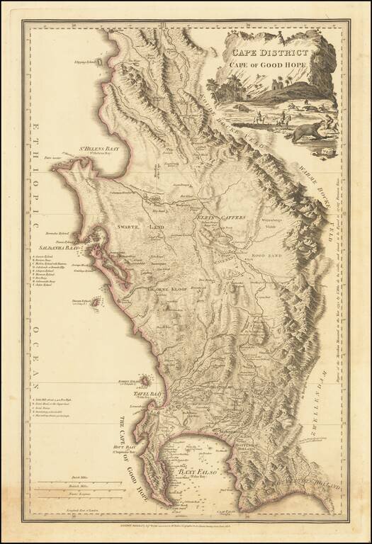
Wyld's Reissue of Faden's Detailed Map of the Cape Town Region. 1838 edition of this highly detailed map of the Dutch Colony on the Cape of Good Hope, first published in 1782. This attractive map gives an idea of contemporary knowledge of the area...
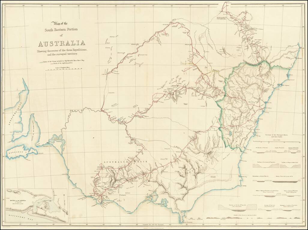
Striking Map of Australia Showing Mitchell’s First Three Important Exploratory Expeditions Fine map of southeast Australia highlighting the routes of Thomas Livingstone Mitchell in his early expeditions to better survey inland Australia. His three...