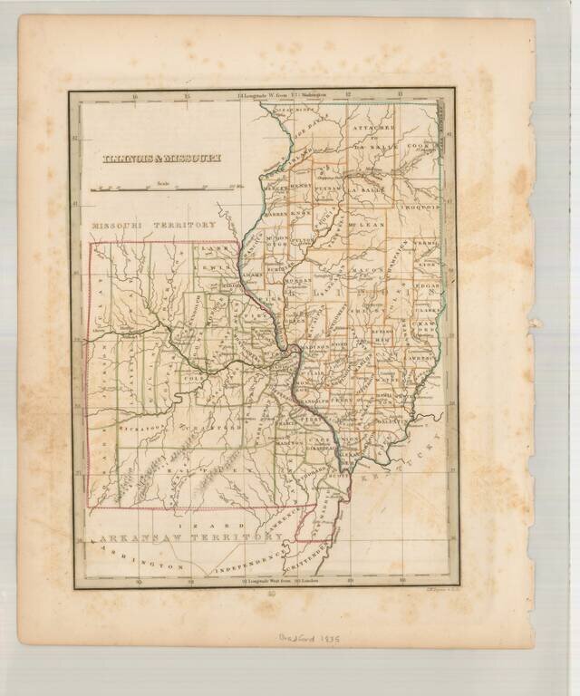
Scarce early map of Missouri & Illinois, also showing Arkansaw Territory to the South and Missouri Territory to the North. A number of early primitive counties still appear, especially in Missouri. Missouri has 38 counties, but lacks the Platte...
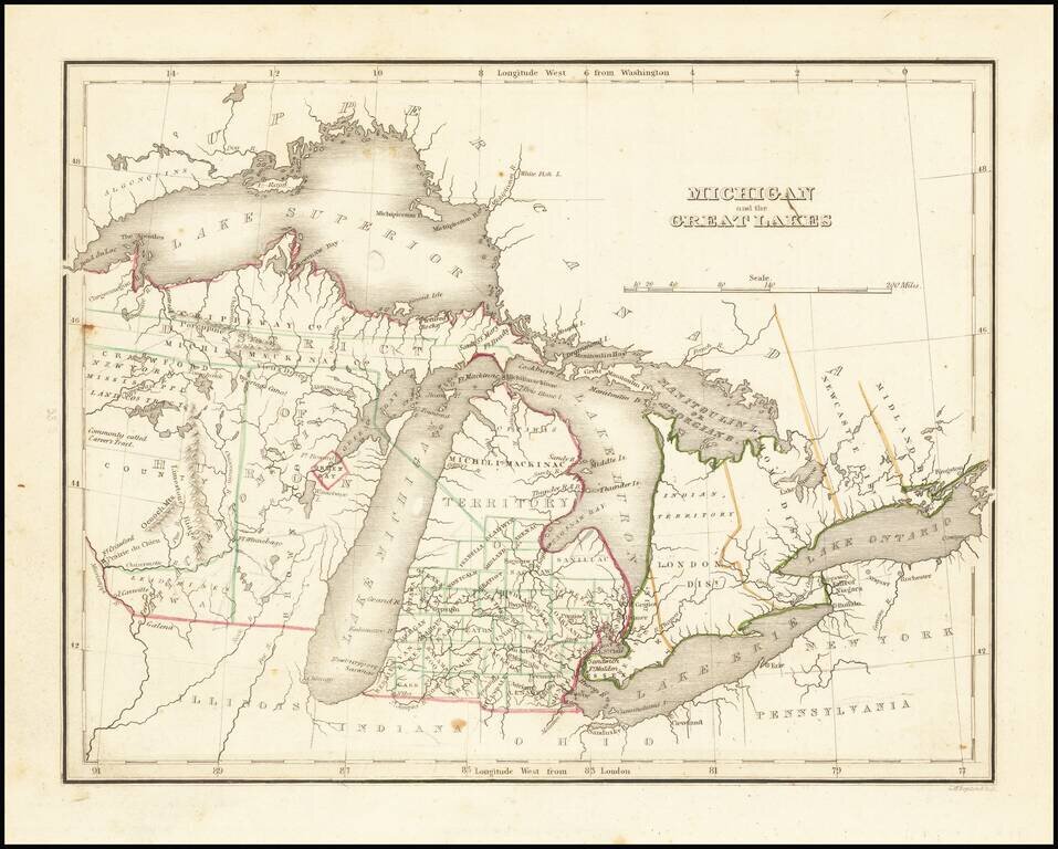
Nice example of this early map of Michigan Territory and adjoining regions (including what would become Wisconsin), published by S.A. Bradford. Michigan proper is shown with counties in the southern half, the north being Ottawa and Michilmackinac...
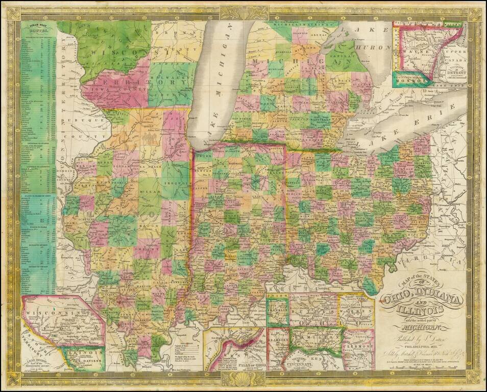
Excellent antique hand-colored engraved map of the eastern Midwest, covering Michigan, Ohio, Indiana, Illinois, and the southern half of Wisconsin. This is a rare later state of Finley's map of eastern Midwest, first issued in 1825, here in the 1835...
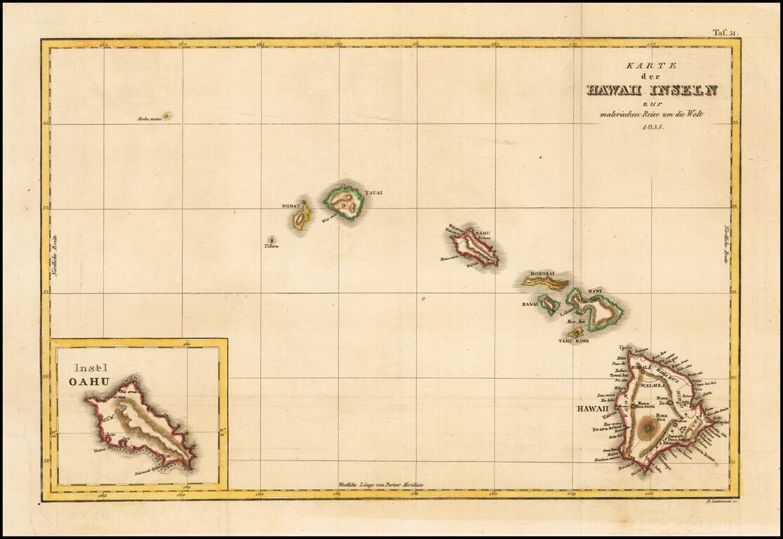
Rare German edition of this early map of Hawaii from D'Urville's Voyage pittoreque autour du Monde, one of the earliest printed maps to include the name Hawaii in its modern English spelling. The map is engraved by Ambrose Tardieu, and shows Nihau,...
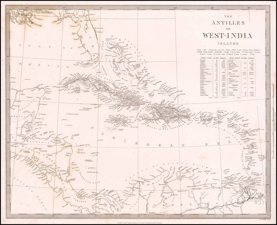
Detailed map of the whole of the West Indies, colored by territorial possession, with a table showing sizes and populations of the various islands. The Society for the Diffusion of Useful Knowledge was active from the 1830s through the 1860s and...
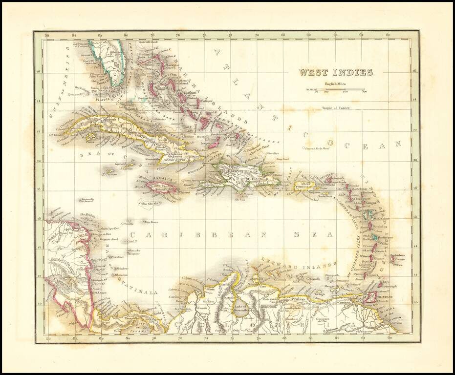
Detailed map of the Caribbean, Southern Florida, and a portion of Central America. Excellent details for a map of this size. Bradford's Comprehensive Atlas launched him as one of the prominent cartographic publishers of the period. This and his...
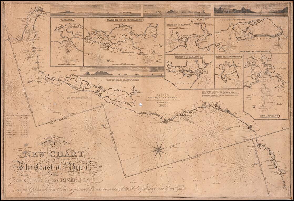
First state of this rare separately issued sea chart of the coast of Brazil, published in London by R & W Blachford. A finely detailed coastal chart, extending from Buenos Aires and the mouth of the Rio de la Plata to Cape Frio, just north of Rio...
![Генеральный Планъ Города Одессы съ Принадлежащею Оному Землею Раздѣленною на 6ть Частей съ показанiемъ Предмѣстiй, селенiй, хуторовъ, садовъ и другихъ Казенныхъ и частныхъ заведенiй. [General Plan of the City of Odessa...]](/map/small/56509.jpg)
One of the Great Ukrainian City Plans. Separately issued, lithographed map of Odessa and environs on two sheets, issued in 1835. The map separates the area into six districts. Plots of land are numbered. Types of land use, roads, and other features...
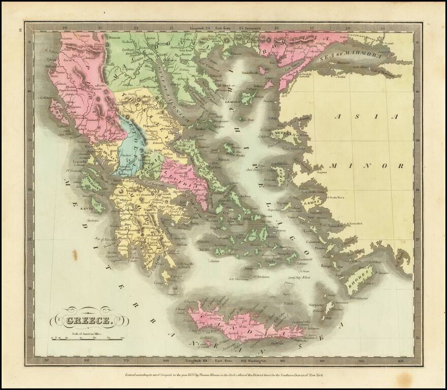
Marvelous detailed map of Greece, Turkey, Macedonia, Crete, and surrounding islands from this scarce American atlas.
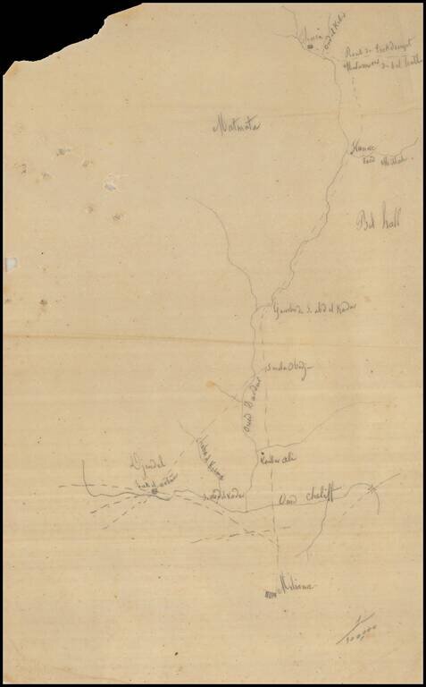
Remarkable Manuscript Collection of the French Invasion of Algeria, From the Collection of the Duke of Orléans Striking collection of 46 manuscript maps, and a few documents, showing northern Algeria. The maps date from the French invasion of Algeria...
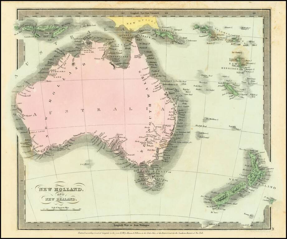
Scarce map of Australia and New Zealand, first published in David Burr's Universal Atlas. Includes a very early and primitive look at the interior of Australia. While the map bears the copyright date of 1834, Rumsey indicates that the atlas was not...
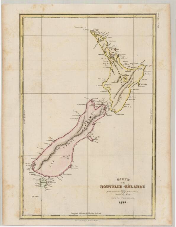
Detailed early map of New Zealand, including a separate Stewart Island. Rear Admiral Jules Sébastien César Dumont d'Urville (1790-1842) was a French explorer and naval officer, who explored the south and western Pacific, Australia, New Zealand, and...

An Important British Admiralty Polar Chart Rare separately published map of the Polar regions, published on June 29, 1835 in London by the British Admiralty. The present example is updated to 1849, which seems to be the the edition ordered for...