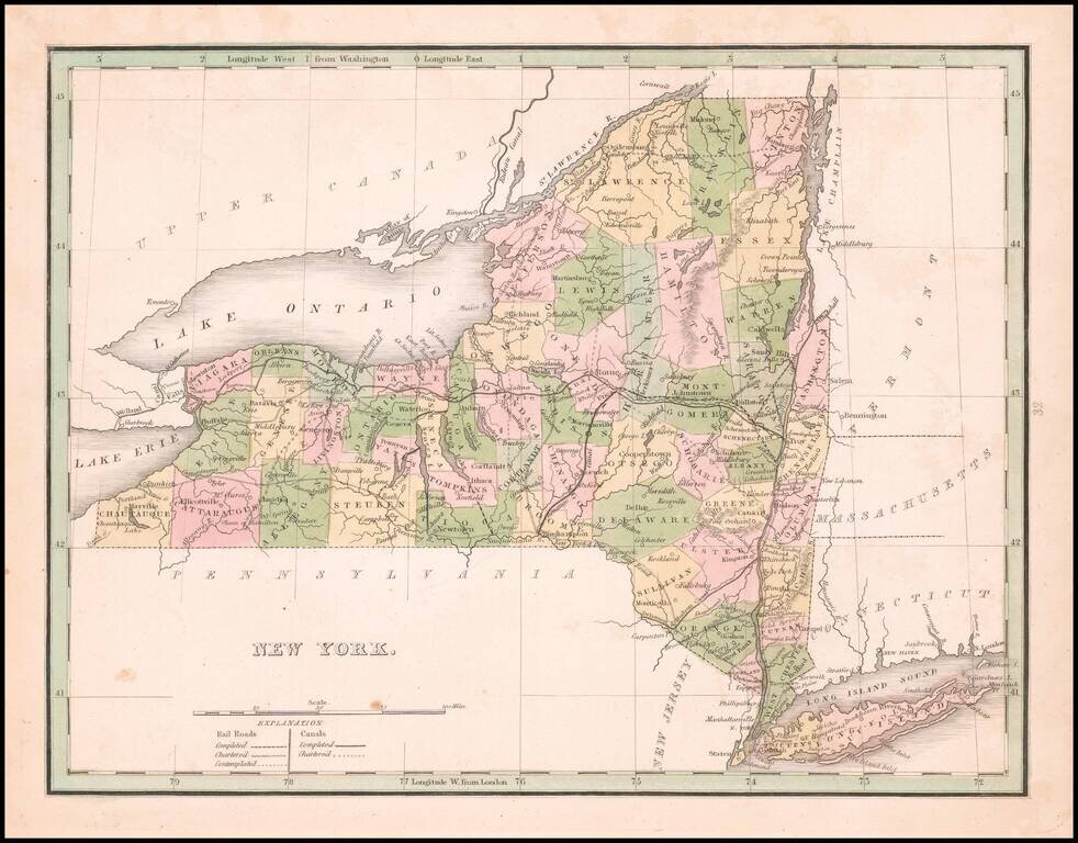
Rare full original color example map of New York from the first edition of Bradford's Comprehensive Atlas. The map is colored by counties and shows towns, rivers, lakes, and other early points of interest. Bradford's Comprehensive Atlas launched him...
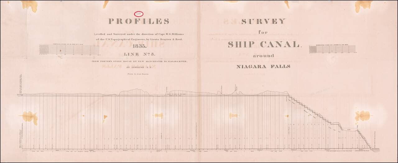
Large plan showing the surveys for a Ship's canal around Niagara Falls, as surveyed by Captain W.G. Williams for the US Corps of Topographical Engineers.
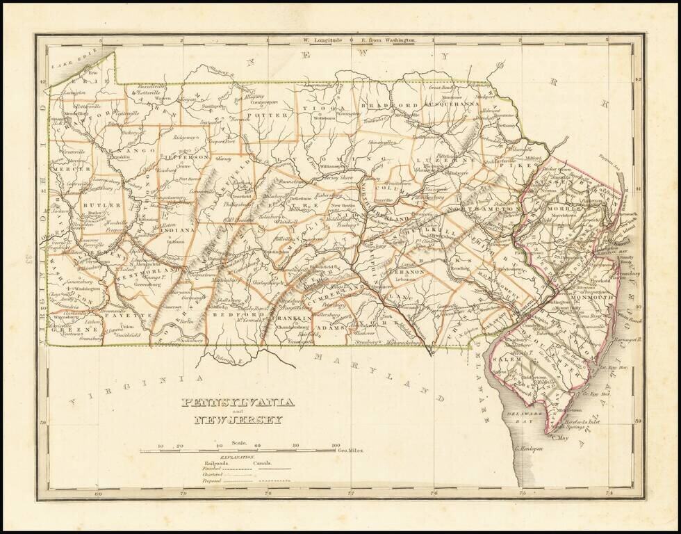
Early map of Pennsylvania and New Jersey, from an early edition of Bradford's Comprehensive Atlas. The map is colored by counties and shows towns, rivers, lakes, bays, harbors, islands and other important places. Bradford's Comprehensive Atlas...
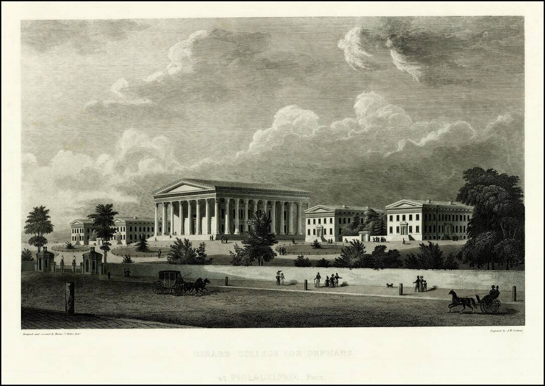
Striking view of the Girard College for Orphans, designed by Thomas Ustick Walter and engraved by A.W. Graham. Girard College was founded in 1833 and opened on January 1, 1848. Founded by Stephen Girard, the school was intended as a school for poor,...
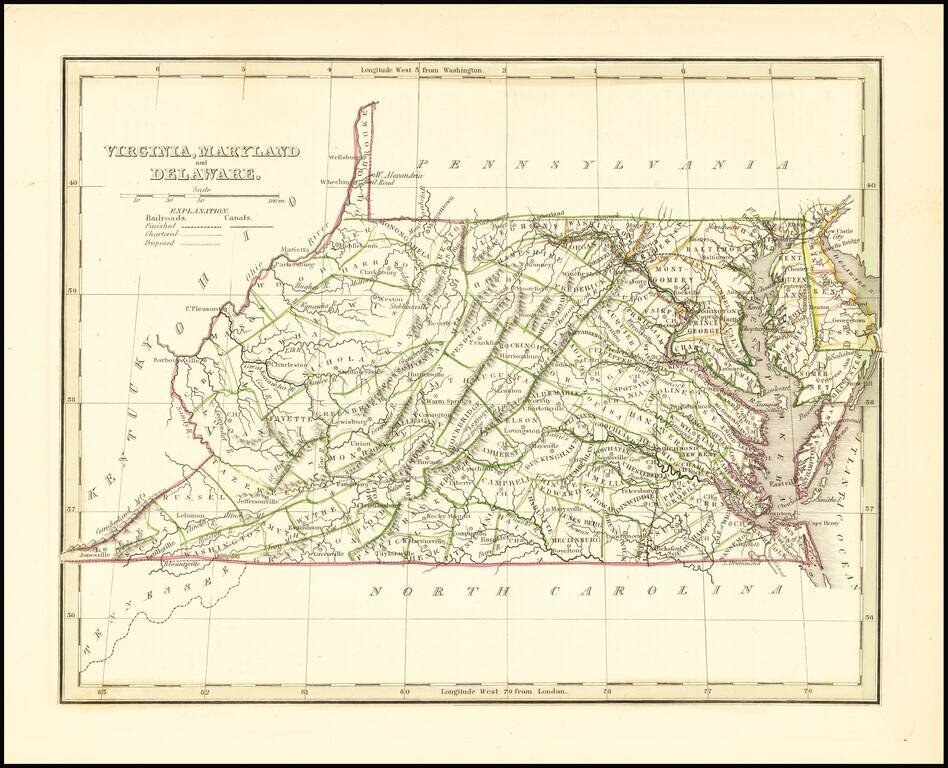
Scarce full original color map of Virginia, Maryland and Delaware from Bradford's Comprehensive Atlas. Shows counties, towns, rivers, and other details. Bradford's Comprehensive Atlas was one of the most successful commercial atlases of the 1830s, at...
![[Pocket Map] Map Of The States Of Louisiana, Mississippi & Alabama Constructed from the latest Authorities. 1831](/map/small/45190.jpg)
First edition of S.A. Mitchell's folding map of Louisaiana, Mississippi and Alabama, engraved by J.H. Young. A remarkably detailed map of the region, with excellent notes throughout, including details on Steam Boat and Stage Coach Routes, Indian...
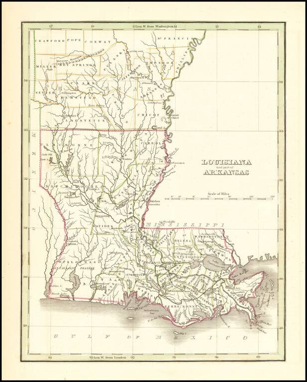
Rare full original color example of this map of Louisiana and the southeastern part of Arkansas, from an early edition of Bradford's first atlas. Early county configurations in Arkansas and parish configurations in Louisiana.
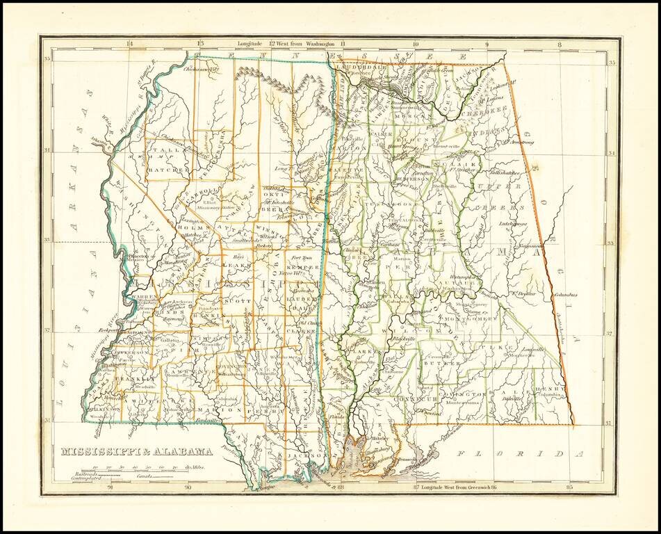
Early map of Mississippi and Alabama, which until about 15 years earlier had comprised a single territory. The eastern part of Alabama is still the lands of the Creek and Cherokee Indians and a number of counties are still not present. The Northern...
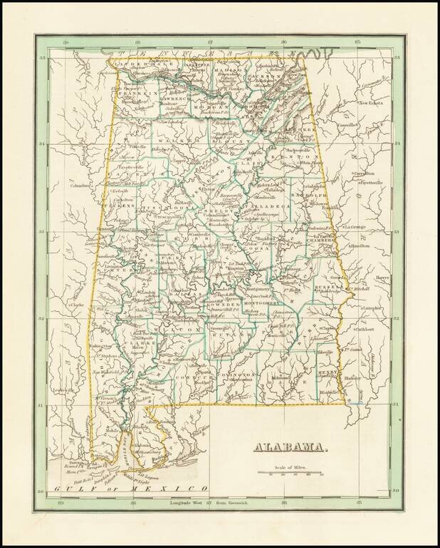
Fine example of this early map of the state of Alabama from Bradford's Comprehensive Atlas. Shows, counties, towns, rivers, etc.
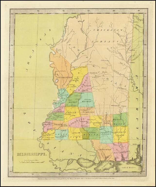
Fine example of David Burr's map of Mississippi, which appeared in his Universal Atlas. The map includes massive Chickasaw and Choctaw Indian regions in the North and Central part of the State, although Monroe and Lound County are now carved out of...
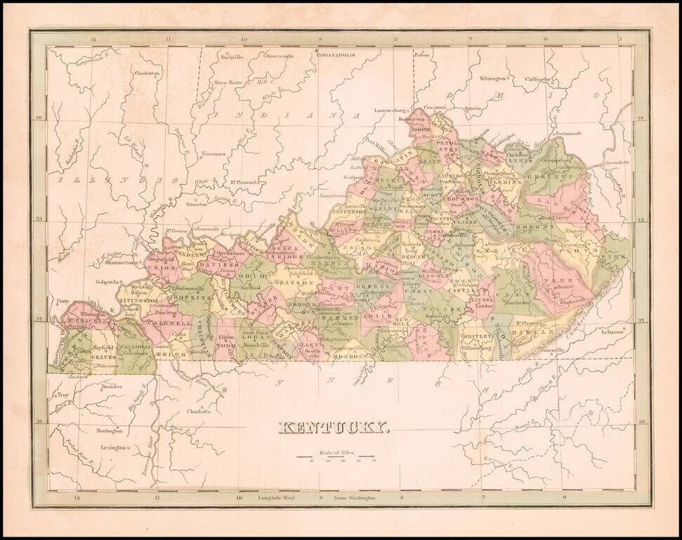
Rare full original color example of the first edition of Bradford's map of Kentucky.
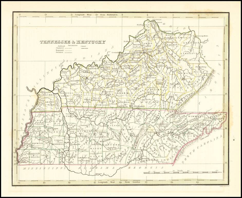
Early map of Kentucky & Tennessee, published by Bradford. Map shows counties in outline color.
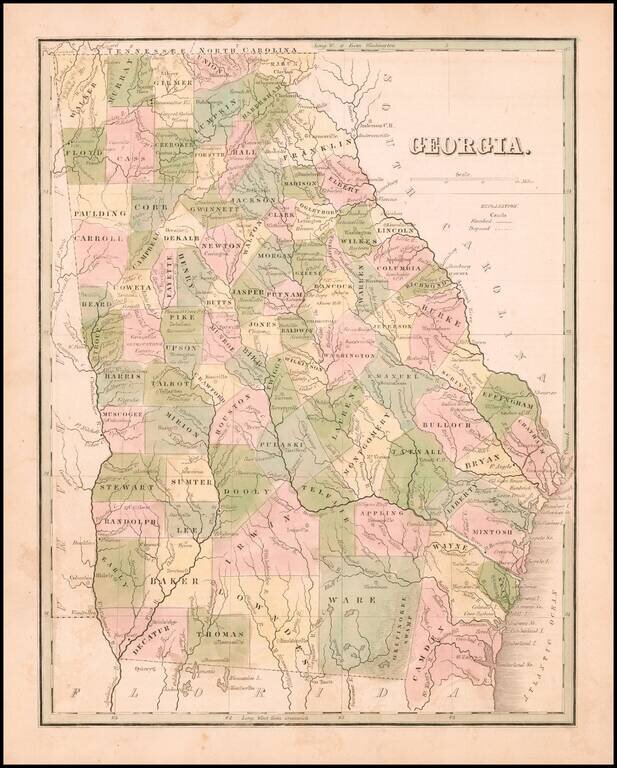
Rare full original color map of Georgia, from Bradford's Comprehensive Atlas. The map is colored by counties and shows towns, rivers, lakes, swamps, and other early points of interest. The Southern counties are still not complete. Bradford's...
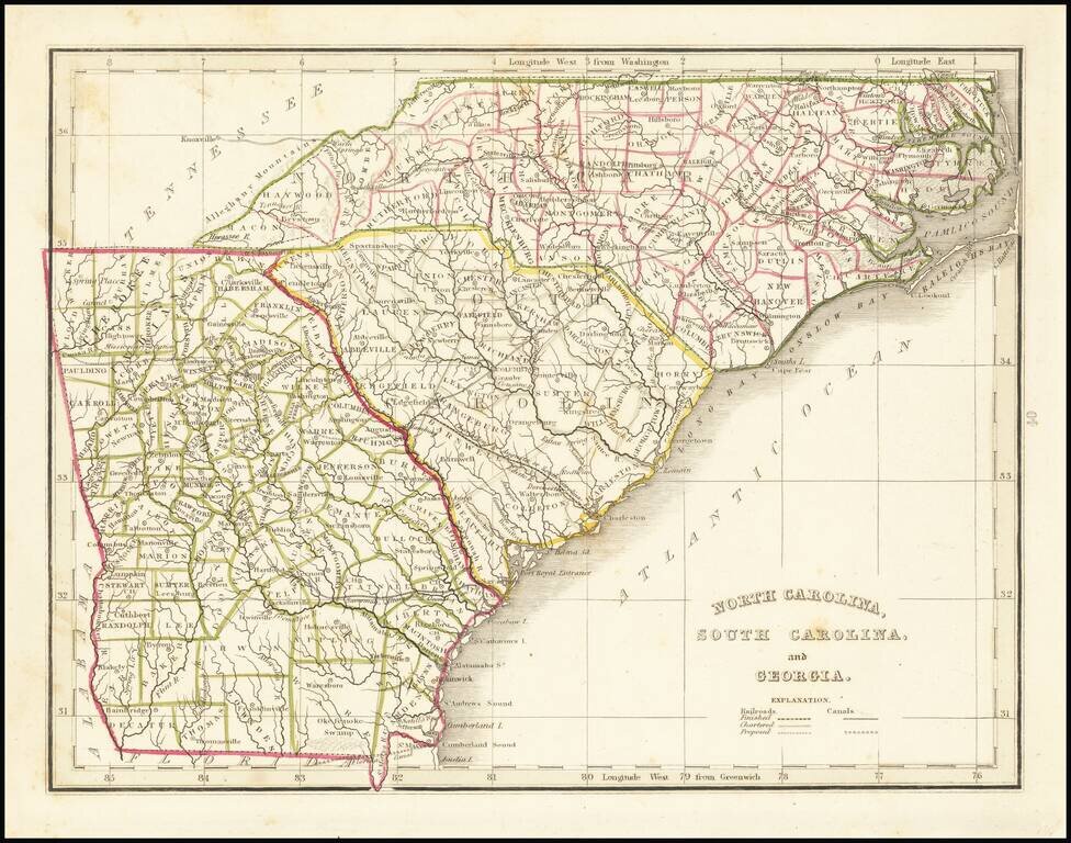
Scarce full original color map of Georgia and the Carolinas, from Bradford's Comprehensive Atlas. Shows counties, towns, rivers, and other details. Bradford's Comprehensive Atlas was one of the most successful commercial atlases of the 1830s, at a...
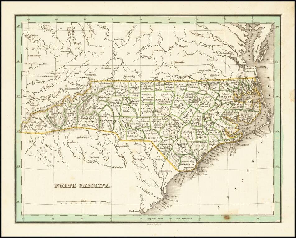
Nice example of this early map of the state of North Carolina from Bradford's Comprehensive Atlas. Shows counties, towns, rivers, etc.
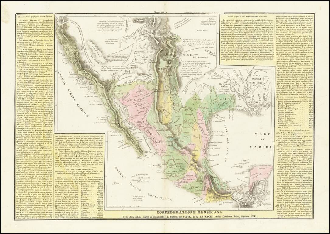
The Reorganization of Mexico Under the Seven Laws & The Republic of Texas A scarce Italian edition of Le Sage's map of Mexico, Upper California and Texas, based largely on Alexandre von Humboldt's map of 1812. The map is richly annotated with...