![Distribution of Vegatables and Snow Line [with] Comparative Lengths of Rivers](/map/small/63018.jpg)
One of the earliest obtainable comparative charts published in the United States. The image is divided into the Torrid, Temperate and Frigid zones. The graphics are color coded to show North America in Blue, South America in Yellow, Europe in Red,...
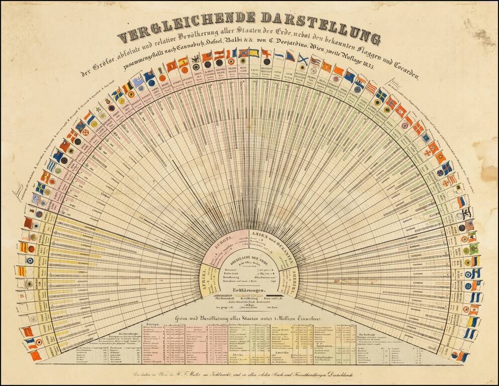
Early Global Statistics Data Visualization Chart. Rare German-language lithographed chart of the population ("Bevölkerung"), area ("Flächeninhalt"), and residents per square mile ("Einw. auft □ M."), along with the flags of many nations of the...
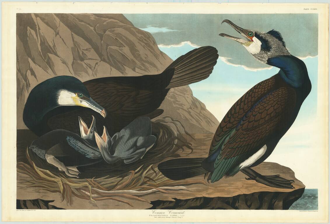
"Look at the birds before you, and mark the affectionate glance of the mother, as she stands beside her beloved younglings!" - John James Audubon, Ornithological Biography, page 458 An exceptional Havell edition John James Audubon aquatinted and...

The First Atlas Printed In India. Rare early school atlas, lithographically printed in Calcutta by pioneer mapmaker Jean-Baptiste Tassin. The School Atlas was likely created in part due to the demand for educational material created by the General...
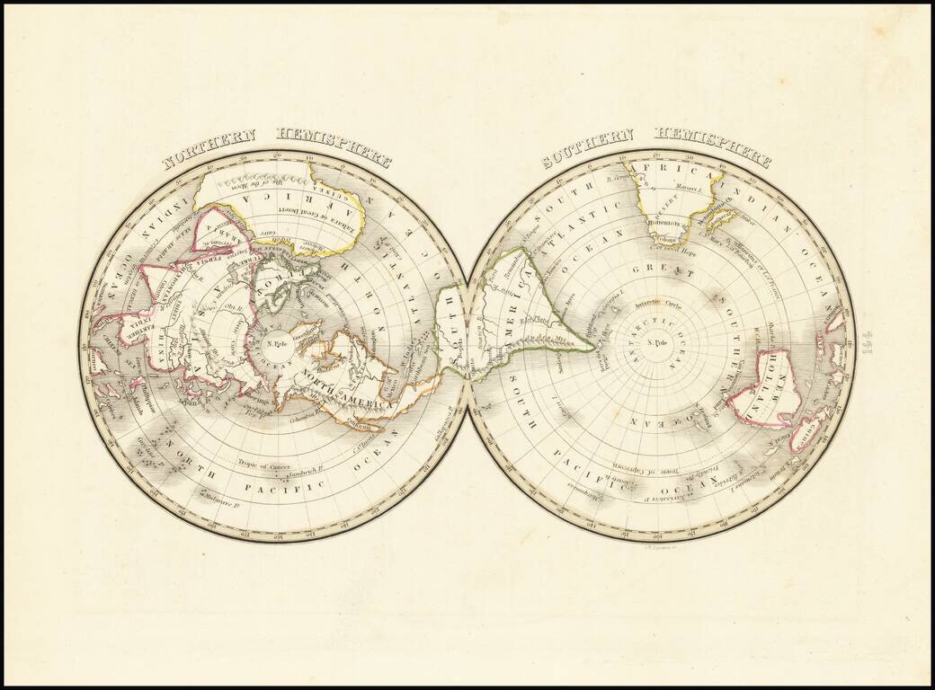
Interesting early American twin-hemispheric map on a polar projection, published in Boston. Still no part of the Antarctic landmass shown.
![[Tracking Noah's Descendants] The Countries of The Ancient World Exhibiting The Probable Settlement of the Descendants of Noah . . .](/map/small/68690.jpg)
This is an interesting map of the ancient world showing the spread of Noah's descendants. Known in biblical scholarship as the Generations of Noah, the sons of Noah were supposed to have spread out to different corners of the world to repopulate the...
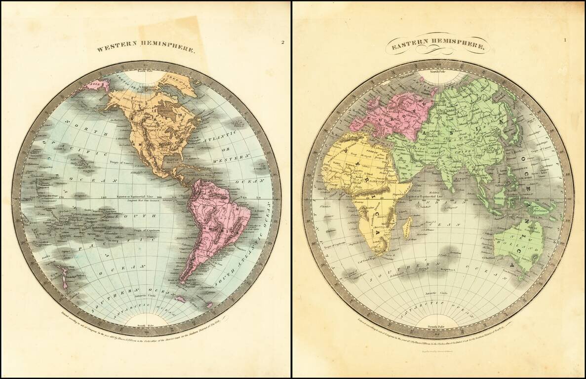
Detailed pair of hemispheric maps of the World, from Burr's Atlas Universal. Shows an oddly configured Australia and Alaska, as well as conjectural knowledge of the Northwest Passage, about 25 years before its discovery.
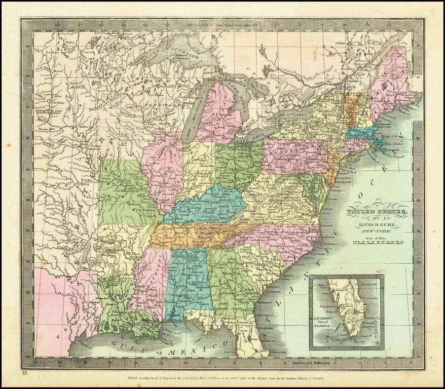
Nice example Bradford's map of the United States, covering the United States from Coast to Coast on the eve of the Independence of Texas. The map shows a massive Oregon Territory, along with a number of Indian Districts (Huron, Sioux, Mandan, Osage...

Alexis de Tocqueville's map of the American Democracy Nice example of the first edition of Alexis De Tocqueville's map of North America. The map provides a simplified picture of the United States, showing the existing states, populations and the...
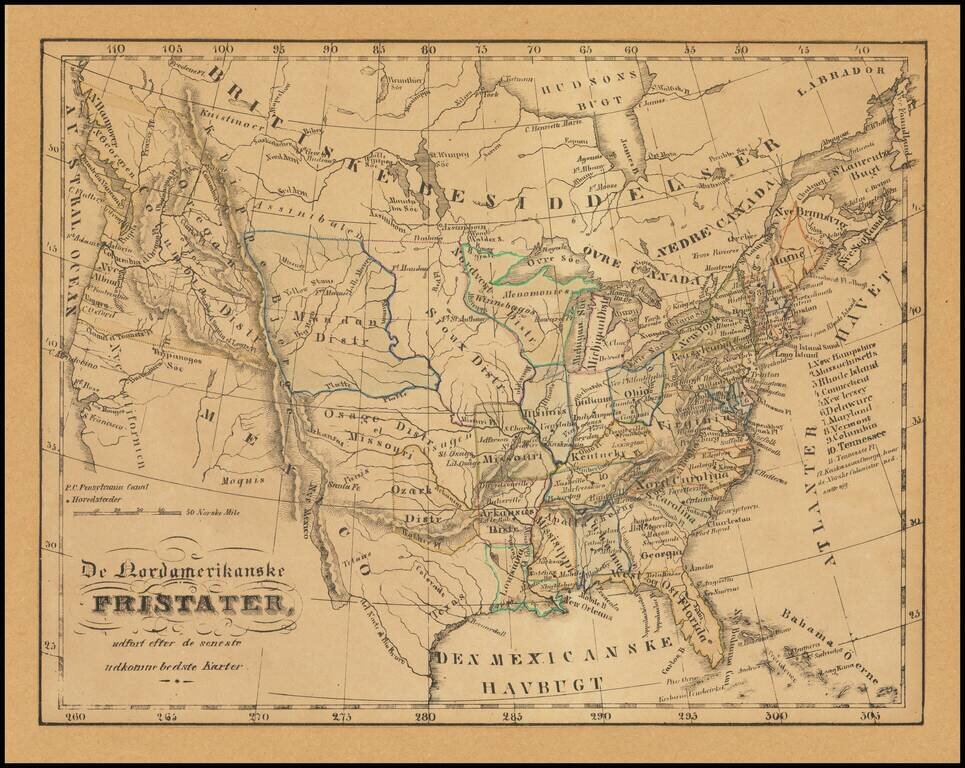
Illustrating Norwegian Settlements In Illinois Rare Norwegian map of the United States from Coast to Coast, published in the first part of the 19th Century. The map almost certainly relates to the promotion of Norwegian settlement near Kaskassias...
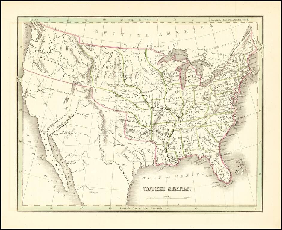
Shows Huron Territory -- The Future Wisconsin Territory Scarce map of the United States, showing a massive Missouri Territory, Huron Territory and Texas. The map provides fine details in the Northwestern part of the map, corresponding to the old...
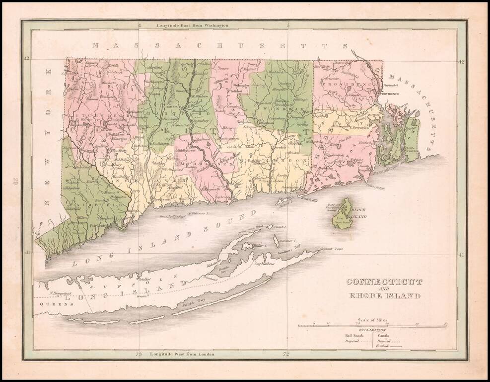
Original color example map of Connecticut and Rhode Island, from an early edition of Bradford's Comprehensive Atlas. The map is colored by counties and shows towns, rivers, lakes, bays, harbors, islands and other important places. Block Island and...
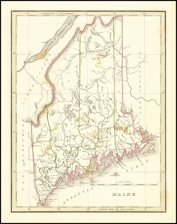
Interesting and detailed map of Maine, from an early edition of Bradford's Comprehensive Atlas. The map is colored by counties and shows towns, rivers, lakes, bays, harbors, islands and other important places. Bradford's Comprehensive Atlas launched...
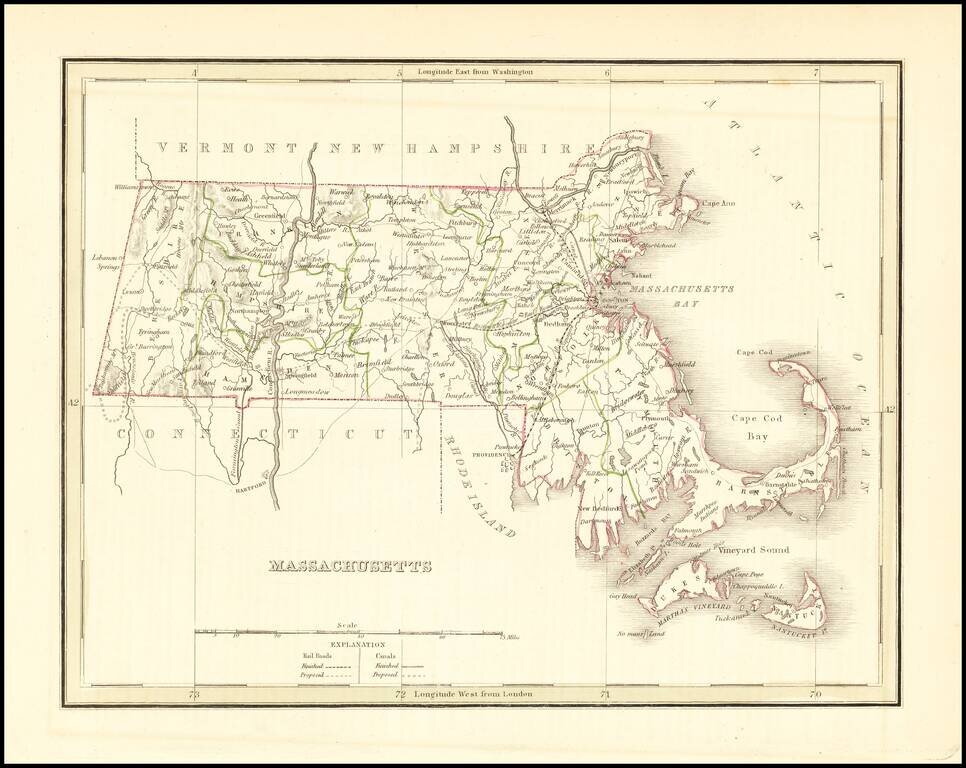
Interesting and detailed map of Massachusetts, from an early edition of Bradford's Comprehensive Atlas. The map is colored by counties and shows towns, rivers, lakes, bays, harbors, islands and other important places. Bradford's Comprehensive Atlas...
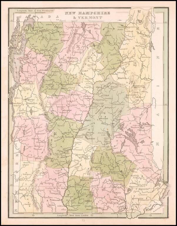
Scarce full original color map of New Hampshire & Vermont, from an early edition of Bradford's Comprehensive Atlas. The map is colored by counties and shows towns, rivers, lakes, and other important places. Bradford's Comprehensive Atlas launched...
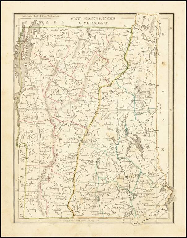
Early atlas map of New Hampshire & Vermont, from an early edition of Bradford's Comprehensive Atlas. The map is colored by counties and shows towns, rivers, lakes, and other important places. Bradford's Comprehensive Atlas launched him as one of...