
A nice early American atlas in the Malte-Brun vein, containing 40 engaged maps in original hand-color. 14 of the maps relate to the Americas, 4 to Africa, 9 to Asia, and the rest to Europe and the World.

Penelope Steel's Map of the Indian Ocean -- Used in an American Circumnavigation in the 1840s. Rare four-sheet blueback sea chart of the Indian and Pacific Oceans, focusing on the trading routes from the east coast of Africa to Canton and New Zealand,...
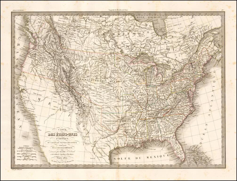
Highly detailed map of the United States from coast to coast. Includes an excellent 54-40 or fight Oregon Territorial Border, terrific post-Lewis & Clark, post-Zebulon Pike view of the Rocky Mountains and excellent treatment of the Southwest and...
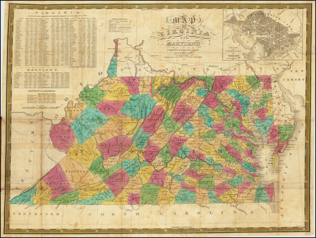
An Early American Map of Virginia & Maryland - Includes White, Free Black & Slave Population Table Second edition of Samuel Augustus Mitchell's separately published map of Virginia and Maryland (with a large inset of Washington DC). The map...
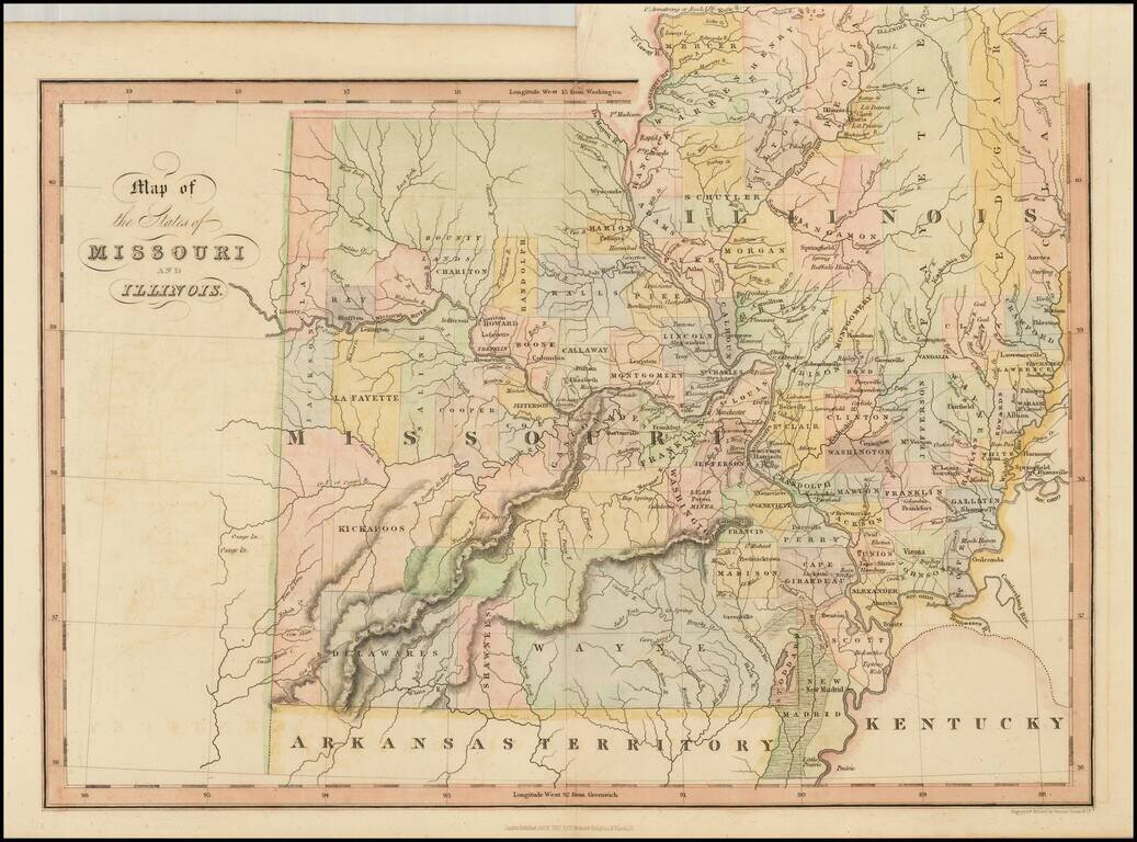
Scarce early map of Missouri and Illinois, hand colored by counties. Many of the western counties are Indian Lands, such as Kickapoo, Delawares, Shawnees, etc. The Boundy Lands are shown in the North. A massive Wayne County dominates the south. A...
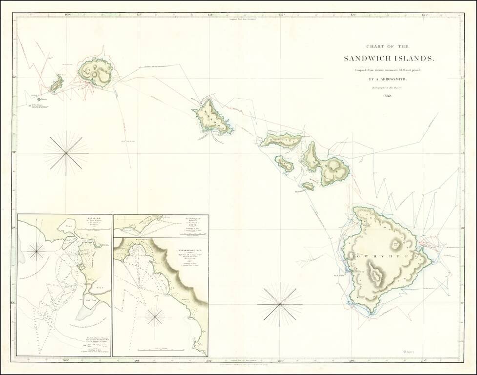
Hawaiian Rarity Rare sea chart of Hawaii, published by Aaron Arrowsmith (and his son Samuel), Hydrographer to the King and the most important English mapmaker of the 19th Century. The map is compiled from manuscript charts and other material this...
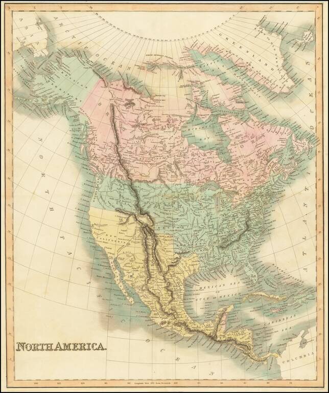
Marvelous map of North America, published In London by Hinton, Simpkin & Marshall. The map includes a double wide Arkansas Territory, massive Missouri Territory extending to the Rocky Mountains, wonderful early Russian Territory with a still...
![Antwerp [Antwerpen/Anvers]](/map/small/66050.jpg)
Highly detailed town plan of Antwerp, including a comparison of principal buildings and an inset of local forts along the Schelde River. One of the best published in a commercial atlas in the 19th Century.
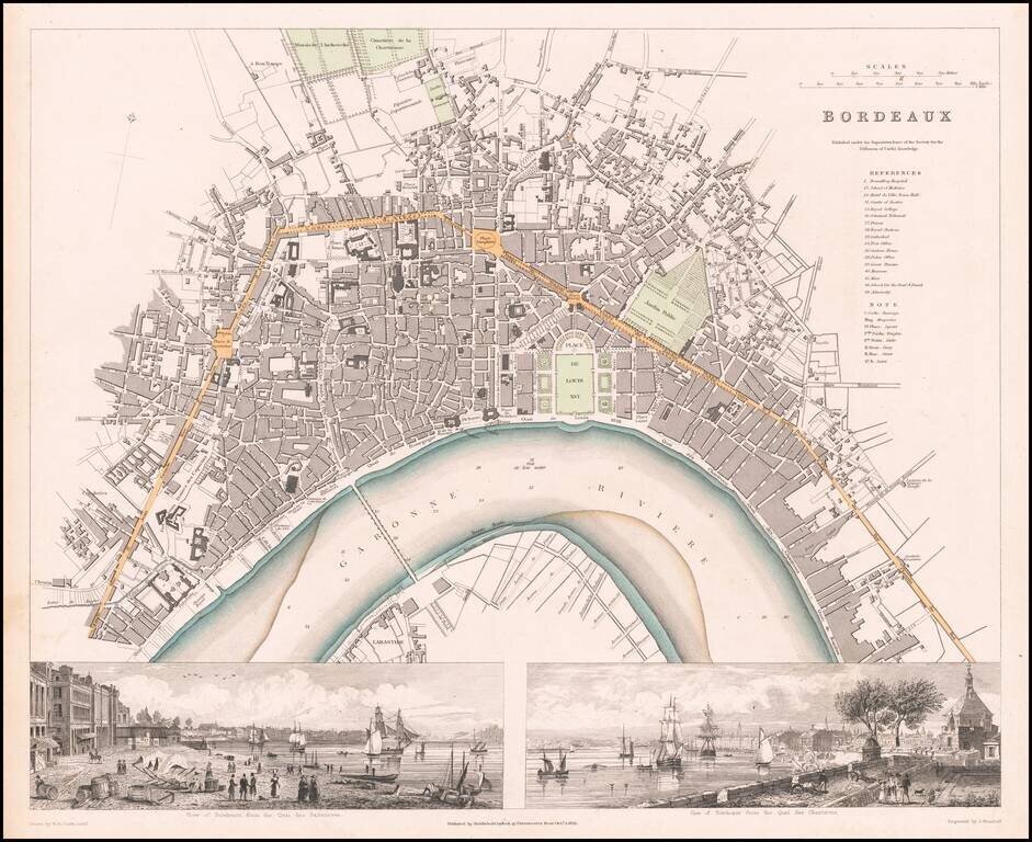
Highly detailed town plan of Bordeaux, with two large views, including the view of Quai de Salinieres and the view from Quai des Chartrons. One of the best town plans published in a commercial atlas in the 19th Century. Includes nice views.
![Munich [München]](/map/small/68836.jpg)
Highly detailed plan of Munich, with a large birdseye view of the City from the East across the Isar River. One of the best 19th Century English town plans of Munich to appear in a commercial atlas.
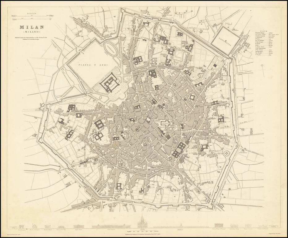
A detailed town plan of Milan, showing the fortified walls, city gates, inner ring, important public buildings, squares, and much more. Across the bottom lies a comparison of twelve of the most important public buildings in Milan, drawn to scale. This...
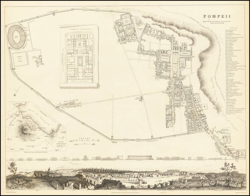
Fabulous town plan of Pompeii, with a large birdseye view of the town and profiles of 15 prominent buildings. Inset map of Mt. Vesuvius and a plan of the Domus Pansae. One of the best 19th Century English town plans to appear in a commercial atlas.
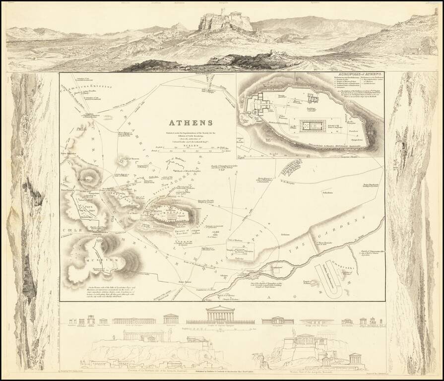
Highly detailed plan of Ancient Athens, surrounded by views of the ancient City. Includes views of ancient monuments and the restored Acropolis. One of the best published in a commercial atlas in the 19th Century. Marvelous ancient plan with vignettes.
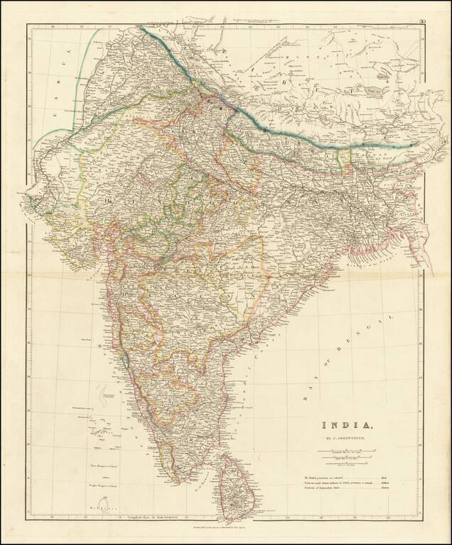
Striking example of Arrowsmith's map of India. The map appeared in Arrowsmith's London Atlas, one of the most popular English atlases of the mid-19th Century.
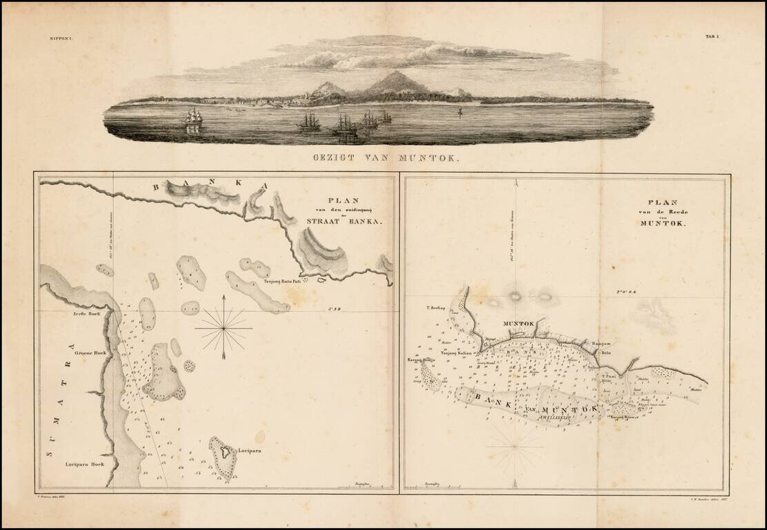
Fine panoramic view of Muntok in the top and two charts of Strait Bangka and offshore of Muntok on Bangka, drawn by Pistorius and I.W.Burslen. This group is of considerable historical importance as the first published maps focusing on Palembang,...
![Asiatic Archipelago [Early Singapore Inset]](/map/small/66879.jpg)
First State! Nice example of John Arrowsmith's map of the Asiatic Archipelago, including a large inset map of Singapore. Centered on the Philippines and Borneo, the map shows a number of different seasonal passages through the region to Hong Kong and...