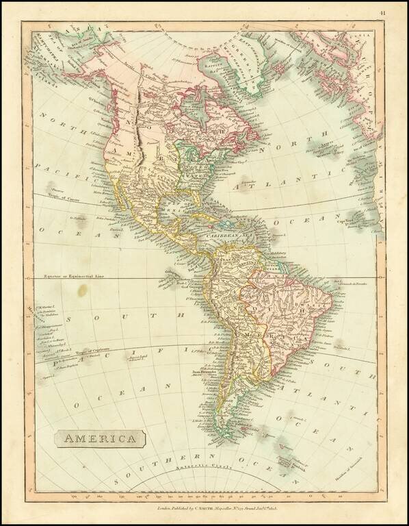
Detailed map of America, showing North America immediately prior to the discoveries of Lewis & Clark, and South America on the eve of its century of Revolution. The map is dated 1816 and includes an unknown region west of the Rocky Mountains,...
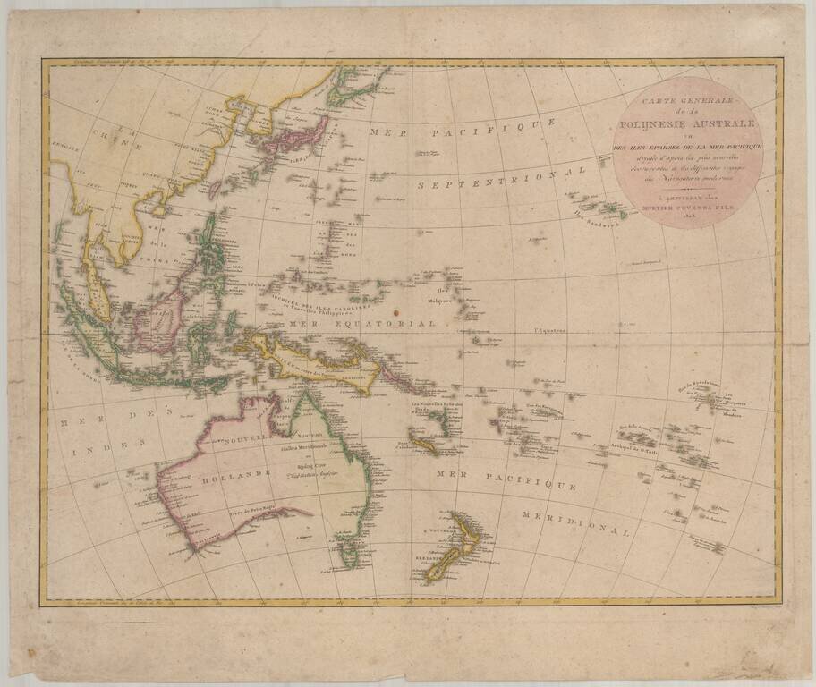
Scarce chart of the Western Pacific Ocean, published by Mortier, Covens & Fils. The map is based on Johann Matthias Christoph Reinecke's 1801 map of the region, which was the first German map to depict Tasmania as a separate island. The Mortier...
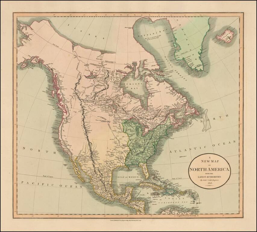
Fascinating map of North America, reflecting the knowledge of the American West on the eve of the publication of the first official account and map of Lewis & Clark's expedition from the Missouri River to the mouth of the Columbia River. Excellent...
Terrific transitional map of North America, issued shortly before Lewis & Clark's seminal report map of the Northwest. Alaska is labeled Russian Settlements and has a marvelous conjectural coastline north and east of Cape Mulgrave. The Pacific...
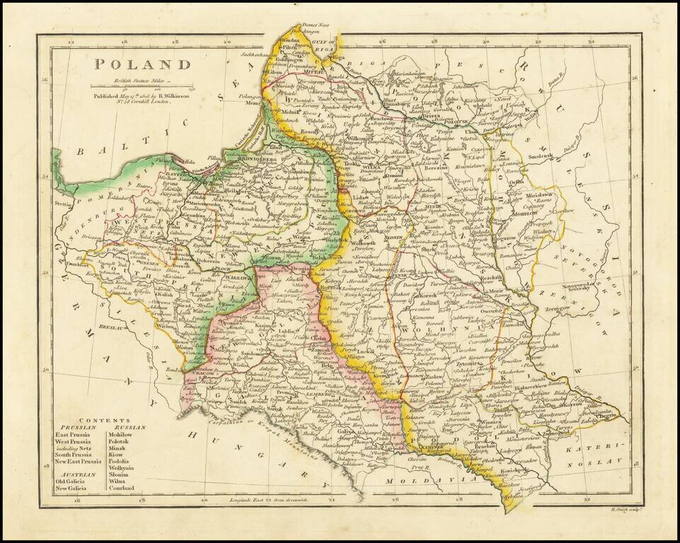
Detailed map of Poland, extending from Prussia in the west to Smolensk in the east. Highly detailed. Divided into the regions controlled by Prussia, Russia and Austria.
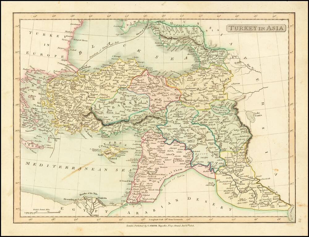
Detailed map of Asia Minor, Syria and Iraq. Excellent detail. Shows towns, rivers, mountains, islands, etc. From Smith's General Atlas. Nice topographical detail.
![Norway and Sweden with their Dependancies [Inset map of Iceland]](/map/small/70559.jpg)
Detailed map of Scandinavia, with a table listing the dependancies. Robert Wilkinson was active in London as a cartographic publisher from 1785 to 1825. He produced a number of nice works, including a General Atlas and a re-issuance of Bowen &...
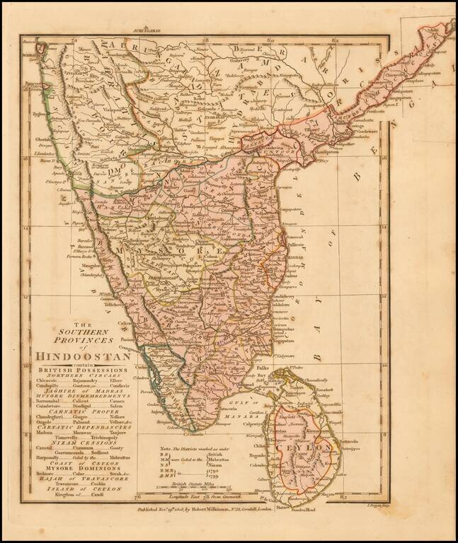
Delightful regional map of the Southern part of India and Ceylon, with nice details. Robert Wilkinson was active in London as a cartographic publisher from 1785 to 1825. He produced a number of nice works, including a General Atlas and a re-issuance...
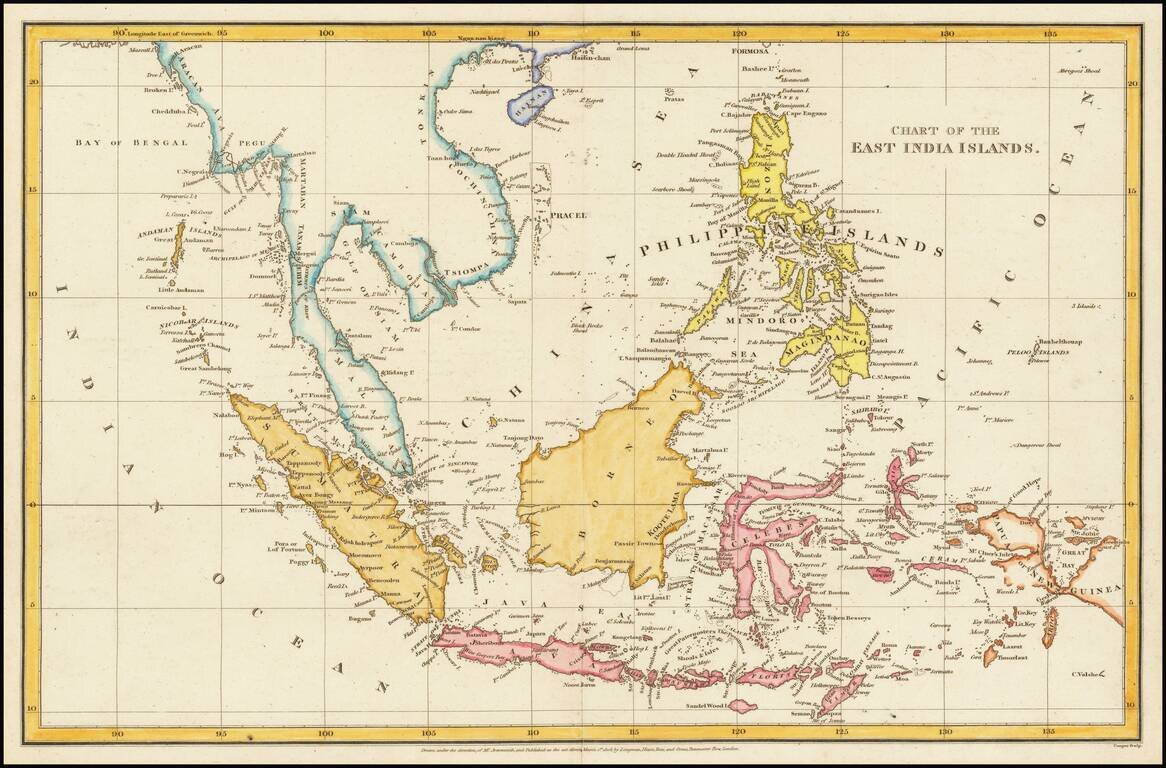
Detailed map of the Philippine Islands and Southeast Asia, published in London in 1805. The map is centered on the China Sea, with a fine detailed presentation of the Philippines. The Straits of Sincapore is noted, as is the Dutch Factory on the...
![[Manila] Baie de Manille par M. de Malespina](/map/small/61646.jpg)
A Diplomatic Exchange of Cartographic Information in the Far East Rare map of Manilla Bay, based upon the work of Alessandro Malapina, perhaps earliest example of Malaspina's mapping of Philippines to appear in print. The map is drawn from...
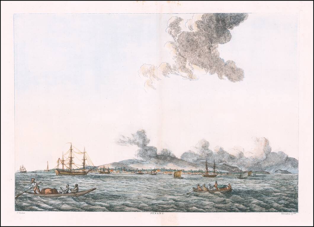
Rare view of Penang, from François Balthazar Solvyns' rare work. The Penang view appeared in the French edition of Solvyns work only. Rare colored example of Solvyns view. A native of Antwerp, Balthazar Solvyns set sail for India in 1790,...
![Turkey in Asia . . . [shows Cyprus]](/map/small/52736.jpg)
Delightful regional map of Asia Minor, Cyprus, Kurdistan, Turcomania, Karaman Amasia and Natolia, with nice details. Robert Wilkinson was active in London as a cartographic publisher from 1785 to 1825. He produced a number of nice works, including a...
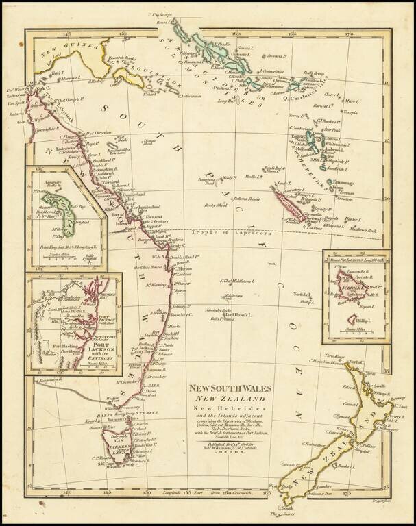
Interesting regional map of Eastern Australia and New Zealand, published by Robert Wilkinson. The map extends from the Solomon and Queen Charlotte Island in the North to New South Wales and New Zealand. Includes large insets of L. Howes and Norfolk...
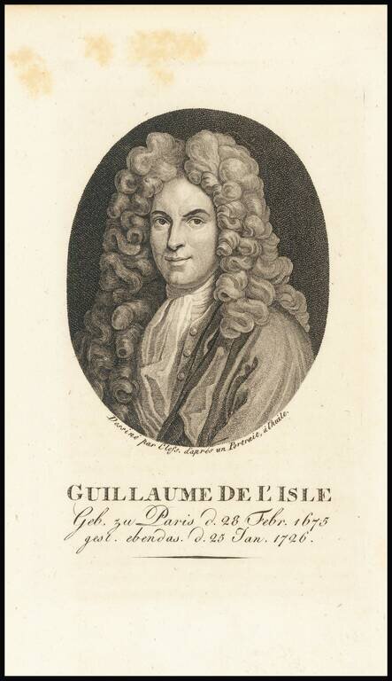
Finely engraved portrait of Guillaume de L'Isle (1675-1726), a cartographic prodigy who drew his first map aged nine. De L'Isle was elected to the French Academie Royale des Sciences at 27 and at 38 he became the first "Premier Geographe du Roi",...