Map size in jpg-format: 11.4065MiB
Click to open in high resolution (open in new tab).
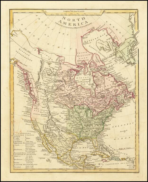
Terrific transitional map of North America, issued shortly before Lewis & Clark's seminal report map of the Northwest.
Alaska is labeled Russian Settlements and has a marvelous conjectural coastline north and east of Cape Mulgrave. The Pacific Northwest is identified as Vancouver's Surveys and shows nice detail, albeit limited to the coastline. The Rocky Mountains are shown in a pre-Lewis & Clark, pre-Humboldt/Pike configuration, primarily a long narrow chain of mountains, with over a dozen conjectural rivers flowing east and west from this mountainous source.
The Columbia and Frasier Rivers are shown, but purely as conjecture. The Upper Missouri is similarly conjecture.
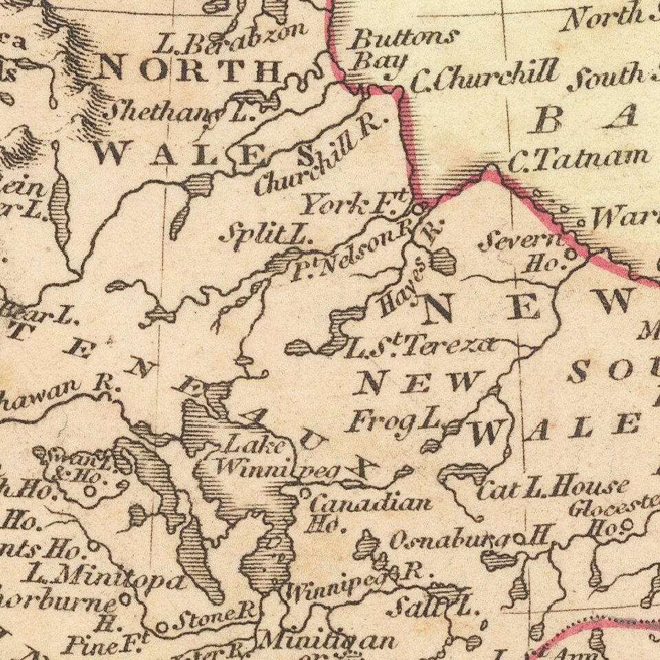
To the North, the better information furnished by the Hudson's Bay company is in evidence. In the Southwest, the many tributaries of the Colorado River are pure fiction and the Gila River is missing. The Missions of Upper California are shown, along with some mythical lakes and rivers. In all, a terrific early pre-Lewis & Clark map of the Transmississippi West.
The map is apparently much revised from Wilkinson's map of 1794, described by Wheat. An excellent Lewis & Clark era map.
If you are a student, write to us in telegram: @antiquemaps and indicate what material you need and for what work you need a map in high detail. We are ready to provide material on special terms. For students only!


![[Signed Political Satire Artwork] Vietnam ... Vietnam ... Vietnam ...](/map/small/68726.jpg)