![Карта Шара Земнаго Солиненная по Астрономическимъ Наблю-денїямъ. Жанверомъ. [Globular Map of the Earth Compiled from Astronomical Observations. Janvier]](/map/small/65900.jpg)
Rare 1793 Russian-language edition of Jean Janvier's double hemispheric world map "Mappe-Monde ou Description Du Globe Terrestre", originally published in 1762. The map appeared in the Saint Petersburg-published atlas: Новый атлас, или...
![[Manuscript World Map] Weltkarte oder Europa, Asia . . .](/map/small/68619.jpg)
Striking Eighteenth-Century German Student World Map Colorful double-hemisphere world map completed as a student project by Joan Baptista de Schmid in grade one. The geography on the map is eclectic and charming, the result of a young person’s...
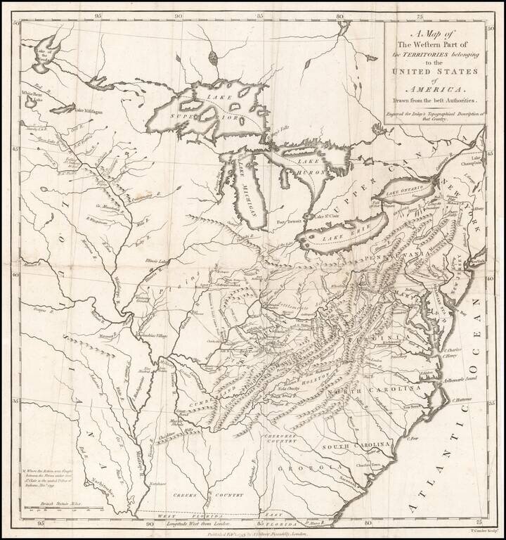
Nice example of this scarce regional map of the United States, which appeared in A Topographical Description of the Western Territory of North America ... by Gilbert Imlay. The map covers the region from the Great Lakes through Georgia and from the...
![The United States of North America with the British Territories And Those of Spain, according to the Treaty of 1784 . . . 1793 [shows Franklinia!]](/map/small/64978.jpg)
Rare First State of Franklin's United States Showing The State of Franklin! Scarce map of the United States, which includes the State of Franklinia in Western North Carolina. One of the first and finest English maps to display the boundaries of the...
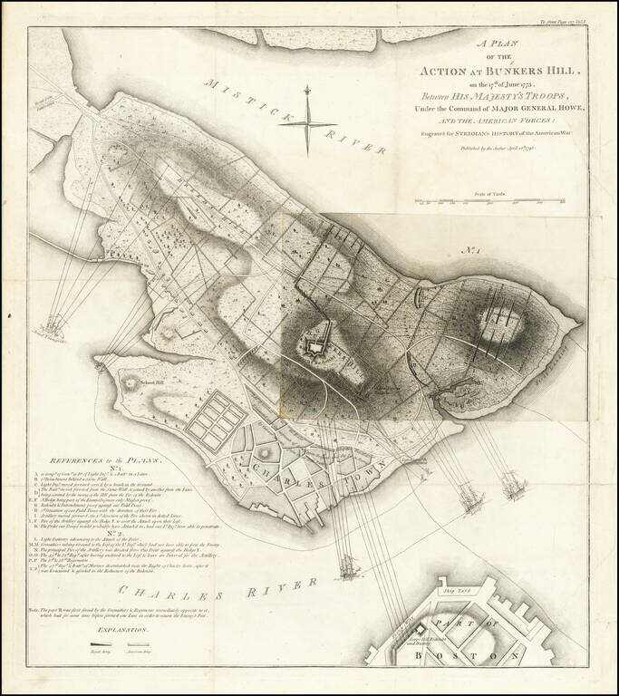
Fine Plan of the Battle of Bunker Hill—Illustrating Two Phases of the Action Nice example of William Faden's important Revolutionary War battle plan of the Battle of Bunker Hill, as issued by William Stedman. The present example has a single fold...

Nice example of the single sheet version of the seminal Fry-Jefferson map of Virginia and Maryland, engraved by Elisabeth Haussard and published in Paris by Robert De Vaugondy for the Atlas Universel. A well executed reduction of Joshua Fry and Peter...
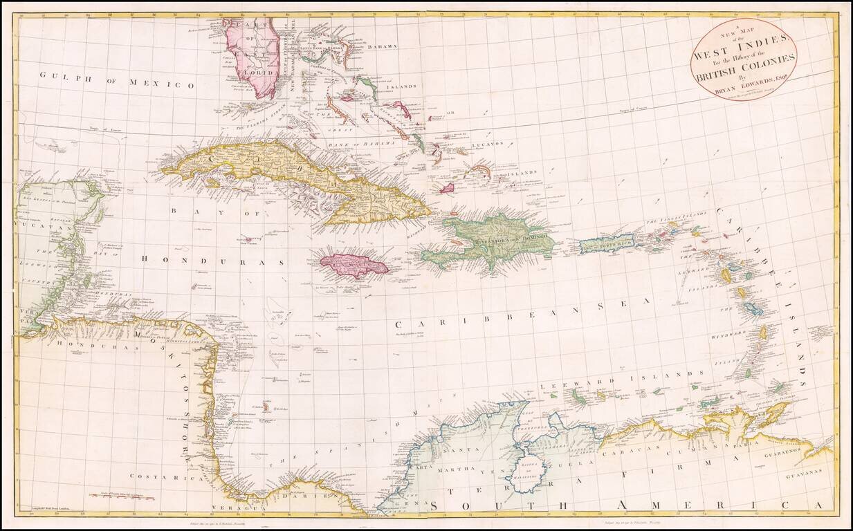
Fine large map of the South Florida and the Caribbean, published shortly after the American Revolution. The map extends from South Florida and the Florida (Gulf) Stream and the Bahamas in the north to the Yucatan, Mosquito Coast, Windward Islands and...
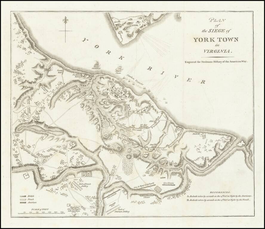
Important battle plan of the Siege of Yorktown This is the second appearance of this plan of Yorktown, which first appeared in Banastre Tarleton's A History of the Campaigns of 1780 & 1781 .... This is the second issue of the map, re-engraved for...
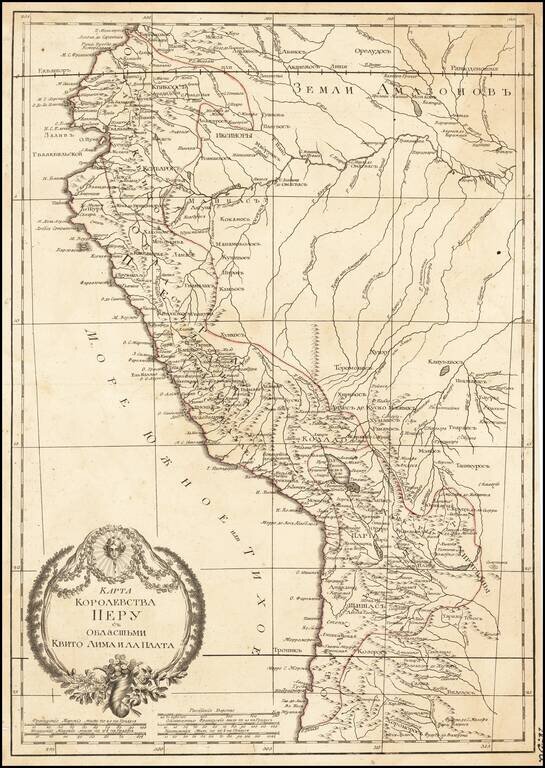
Russian-language antique map of the "Kingdom of Peru" from Ecuador to Chile on the western coast of South America. The map was created by Alexander Wilbrecht in Saint Petersburg in 1793, and was based on Janvier's Carte Du Perou ou se trouvent les...
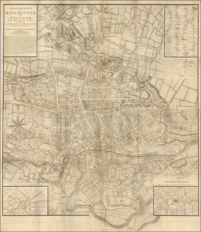
Rare early plan of Manchester by C. Laurent, first published in 1793. The map plates would later by acquired by John Stockdale in London. Important plan of Manchester, marking the planned developments in the northeastern part of the city. The map...
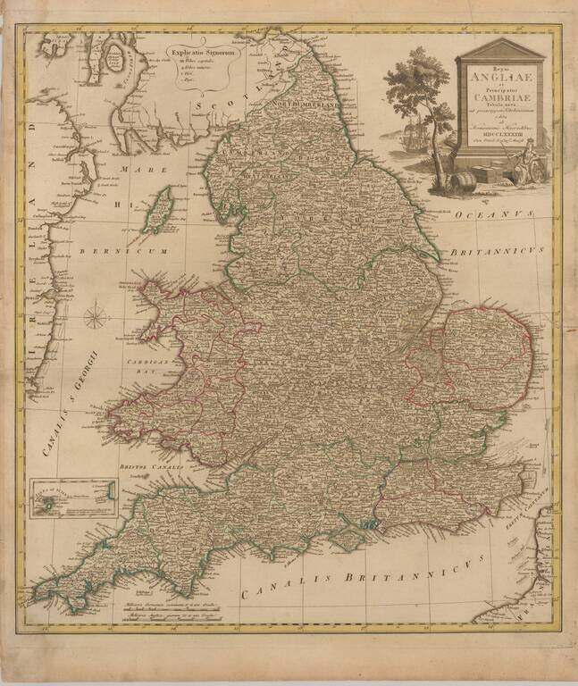
Decorative map of England and Wales, published in Nuremberg. The map is partially colored by counties and is based upon the map of Thomas Kitchin.
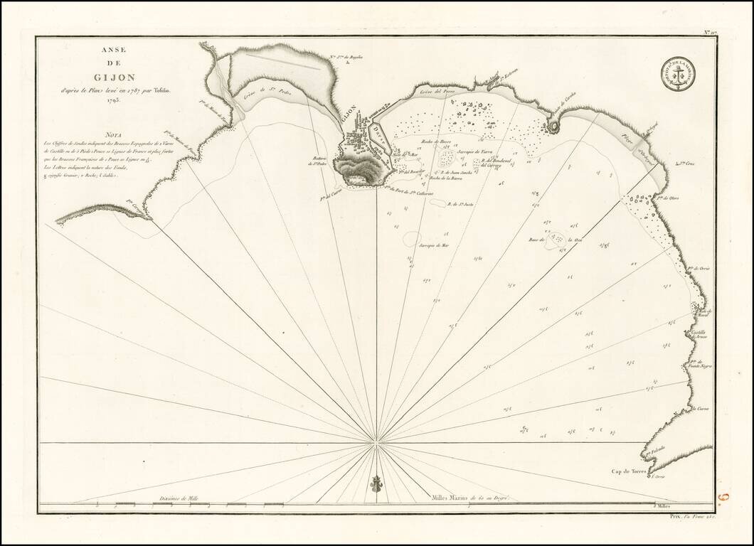
Detailed plan of the harbor and environs of Gijon, extending from Cap de Torres to Pointe Cervigon. The map is oriented with south at the top and includes extensive soundings, anchorages, coastal and harbor details and sailing directions. Based upon...
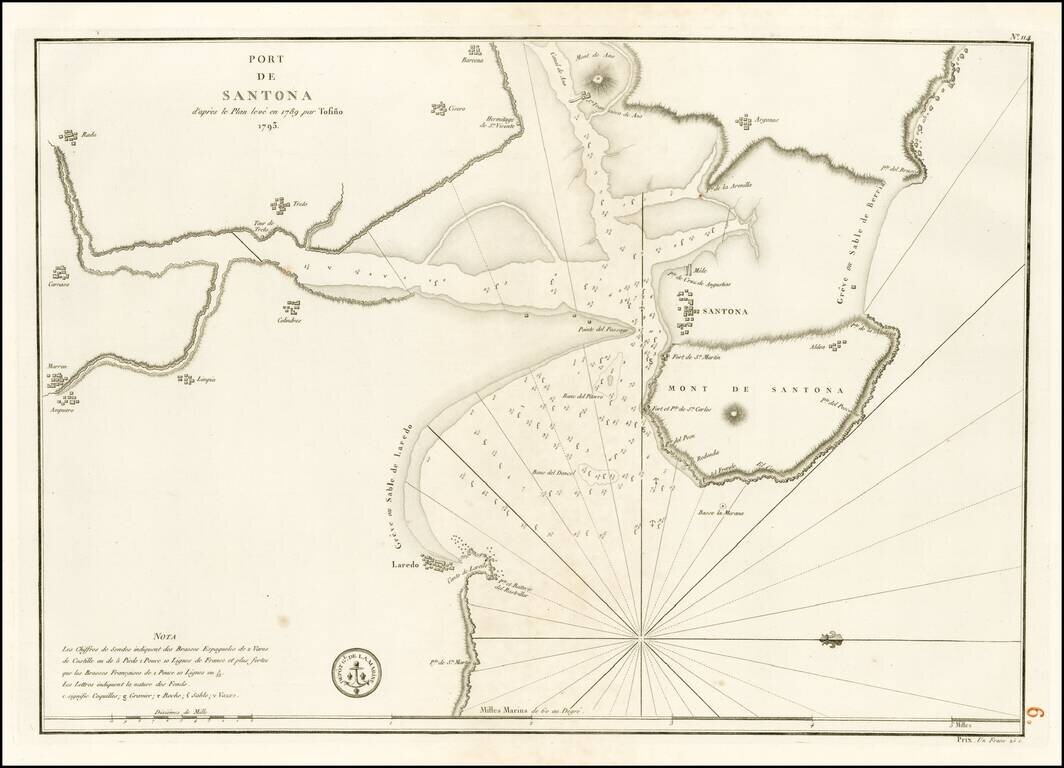
Detailed plan of the harbor and environs of Santona, from Laredo to Barcena. The map is oriented with west at the top and includes extensive soundings, anchorages, coastal and harbor details and sailing directions. Based upon an early plan by Don...
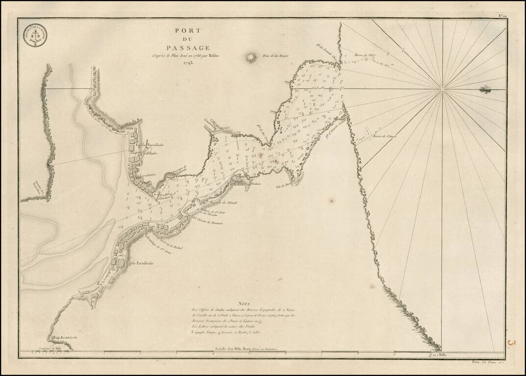
Detailed plan of the harbor and environs of Pasaia, Spain, extending from the mouth of the Harbor to Bordalaborda, with a number of forts, churches and other structures located along the coastline. The map is oriented with west at the top and includes...
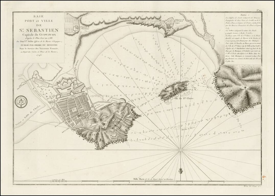
Detailed plan of the harbor and environs of St. Sebastian. The map is oriented with south at the top and includes extensive soundings, anchorages, coastal and harbor details and sailing directions. Based upon an early plan by Don Vincente Tofino de...