logo

1793. A Topographical Plan of Manchester and Salford with the Adjacent Parts; shewing also the Different Allotments of Land proposed to be built on, As communicated to the Surveyor by the respective Proprietors. . . . 1793

  • A Topographical Plan of Manchester and Salford with the Adjacent Parts; shewing also the Different Allotments of Land proposed to be built on, As communicated to the Surveyor by the respective Proprietors. . . . 1793

A Topographical Plan of Manchester and Salford with the Adjacent Parts; shewing also the Different Allotments of Land proposed to be built on, As communicated to the Surveyor by the respective Proprietors. . . . 1793 information:

Year of creation: 
Resolution size (pixels): 
 11207x12895 px
Disk Size: 
 49.9264MiB
Number of pages: 
 1
Place: 
 Manchester
Author: 

Print information. Print size (Width x height in inches):
Printing at 72 dpi 
  155.65 х 179.1
Printing at 150 dpi 
 74.71 х 85.97
Printing at 300 dpi 
 37.36 х 42.98

An example of detailing the file of this map of in a printable high-resolution:

Click to open in high resolution (open in new tab).
Attention! this is just the central piece (central area 960x960 px) of the map file!
This is an example, so that you can see and study the level of detail of a given map. The entire Map will be fully available after payment!

A Topographical Plan of Manchester and Salford with the Adjacent Parts; shewing also the Different Allotments of Land proposed to be built on, As communicated to the Surveyor by the respective Proprietors. . . . 1793

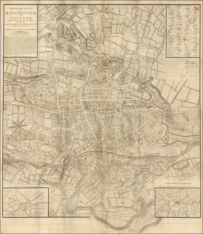
Rare early plan of Manchester by C. Laurent, first published in 1793. The map plates would later by acquired by John Stockdale in London.

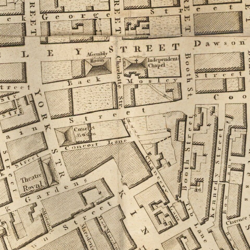
Important plan of Manchester, marking the planned developments in the northeastern part of the city.

The map includes an inset plan of the city, circa 1650, and the route from London to Manchester and the environs of Manchester.

The map is a modified version of the first large-scale mapping of Manchester, which was carried out by William Greene between 1787 and 1794. Charles Laurent managed to get access to Green's survey, and issued a smaller scale map of Manchester before Green was able to publish his large-scale map, with the benefit of subscribers.

Originally published by Laurent in 1793, Stockdale saw the potential market for this map and bought the plates the same year, using them to illustrate Aikin's Description of the Country from Thirty to Forty Miles Round Manchester.


Special conditions for students!

If you are a student, write to us in telegram: @antiquemaps and indicate what material you need and for what work you need a map in high detail. We are ready to provide material on special terms. For students only!

Item information:

Year of creation:
Size:
11207x12895 px
Disk:
49.9264MiB
Number of pages:
1
Place:
Manchester
Author:
Charles Laurent.
$14.99

Related item