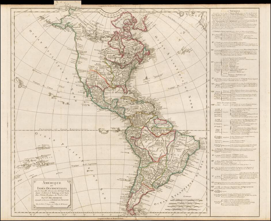
Scarce third state of De Vaugondy's map of America, updated to include the details of all three of Cook's voyages. The Northwest Coast of America is still mapped with part information and part conjecture. The Spanish contacts with the region are...
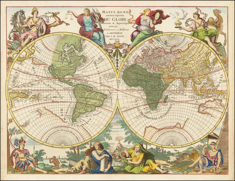
Hubert Jaillot's World Map Re-Issued At the End of the 18th Century Scarce Dutch decorative double hemisphere map of the World one of the most unique and decorative world maps of the period. By the end of the 17th Century, Paris was supplanting...
![[Franklinia] A Map of the States of Virginia, North Carolina, South Carolina and Georgia; Comprehending the Spanish Provinces of East and West Florida: Exhibiting the Boundaries as fixed by the late Treaty of Peace . . .](/map/small/67980.jpg)
One of the Earliest Appearances of the State of Franklin (Franklinia) Nice example of Purcell's map of the Southern States (and Midwest), which includes an early reference to the New State of Franklin in the center part of North Carolina. This map...
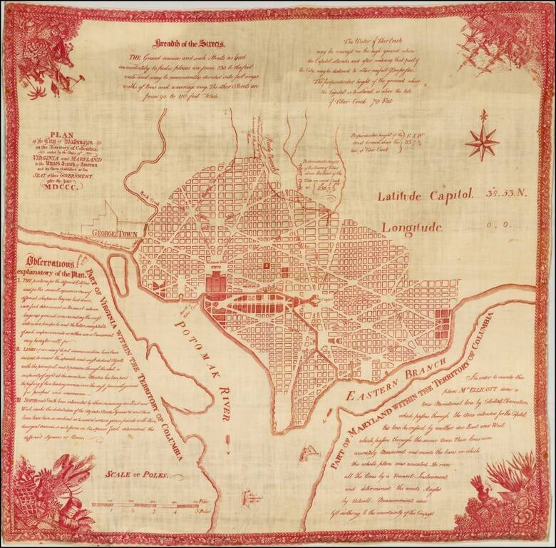
Near flawless example of the souvenir edition Hill's Plan of Washington, printed in red on linen. Hill's Plan of Washington is the earliest official map of the City of Washington, pre-dated only by the pirated miniature magazine edition of the Hill...

Striking full color example of scarce 1792 edition of Thomas Jefferys' map of the Gulf Coast, from Jeffreys' West India Atlas. Jeffery's map is one of the earliest obtainable large format map to treat the Gulf Coast region with such remarkable detail,...
![[Eastern Siberia and Alaska]. ‘Vostochnaya Chast Irtkutskoi Gubernii s prilezhashhimi ostrovami i zapadnom beregom Ameriki’ (‘The Eastern Part of the Irkutsk Province with the adjacent islands and the West Coast of America’).](/map/small/38895.jpg)
Fine example of this rare Russian map of the northwest coast of America and northeastern parts of Russia, published by Wilbrecht in his rare 1792 atlas entitled Ross'iiskoi Atlas iz soroka chetyrekh kart sostaiashch'ii I na sorok na dva...
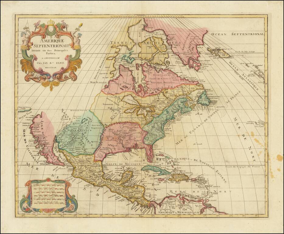
Interesting map of North America by Jan Elwe, printed in Amsterdam. The map is a scarce derivative of Sanson's 1656 and Jaillot's 1676 maps. California is now a peninsula. The Great Lakes are closed at the western ends, unlike the earlier versions of...
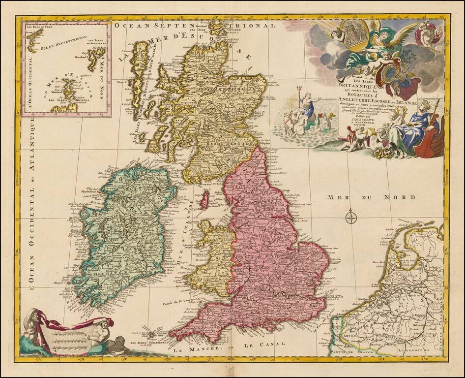
Scarce map of the British Isles, embellished with a large cartouche and coat of arms.
![[Map of the Kiev Region] КАРТА КІЕВСКАГО НАМѢСТНИЧЕСТВА](/map/small/57871.jpg)
19th-century photo-lithographed facsimile of a map of the Kiev region from Alexander Wilbrecht's famous 1792 Atlas of the Russian Empire (Российский атлас). Pale of Settlement The map is interesting for many reasons, not least of which...
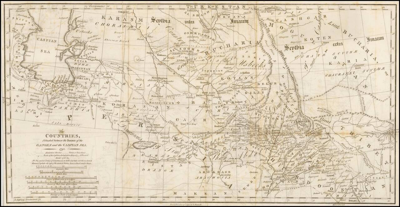
Interesting overview of the region east of the Caspian Sea to Bukara and Tibet, published by Rennell. Shows a wealth of cities, towns, tribes, river systems and general topography. Notably the ancient place names are shown in Italic Capitals while...
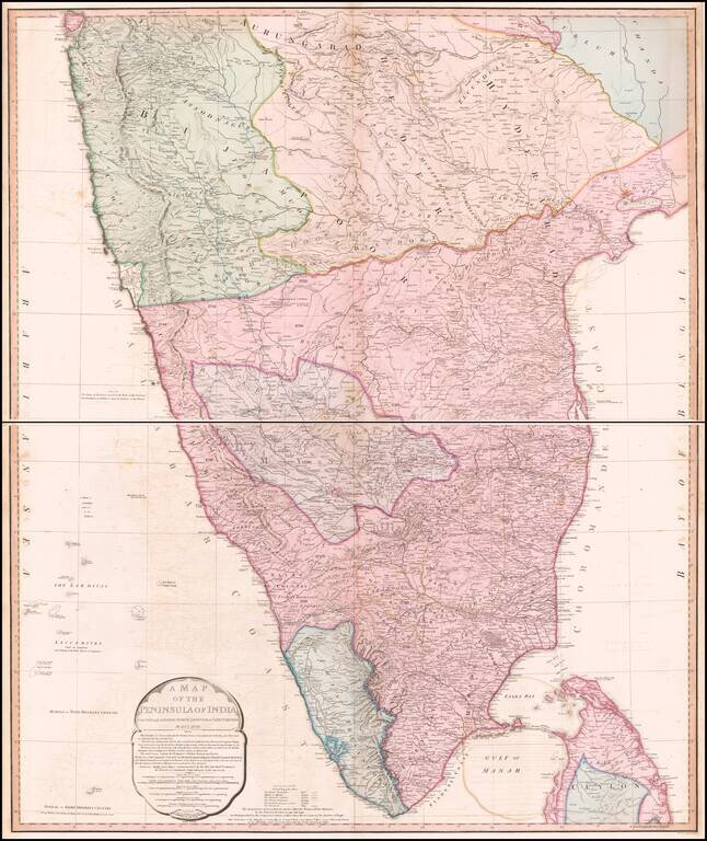
Striking Map of British India This highly detailed two-page map depicts the southern portion of India as it was known at the turn of the nineteenth century. It includes thorough information about the extent of British rule in India at the time. The...
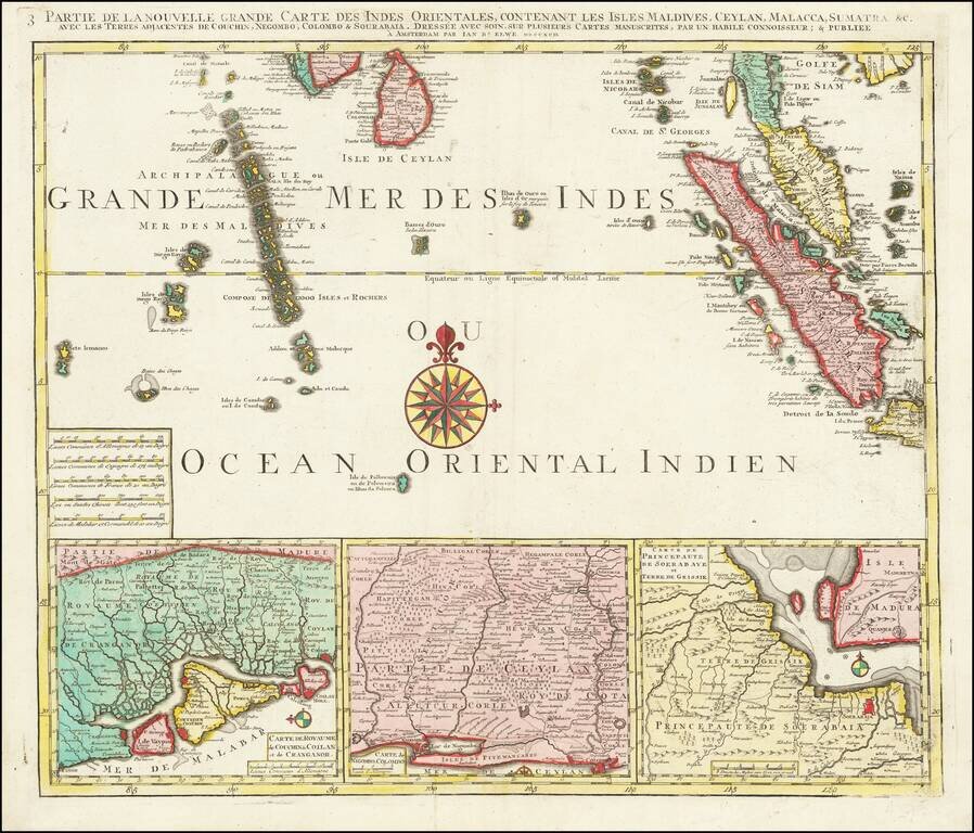
Finely detailed regional map depicting Singapore, Ceylon, the Maldive Islands, Sumatra, Southern Malaysia, etc. Remarkably detailed this map is highly decorative as well.
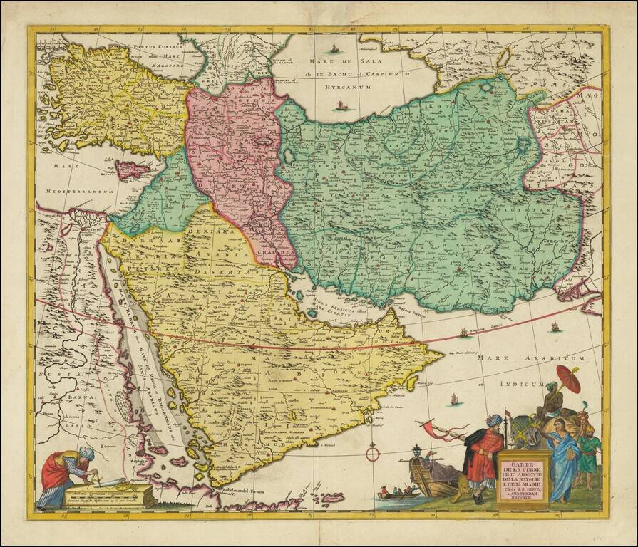
Scarce decorative map of the region bounded by the Saudi Peninsula, Red Sea, Nile River, Cyprus, Asia Minor, the Gulf of Aden, Indian Ocean, Armenia, the Caspian Sea, Afghanistan and the Indian Ocean, centered on the Persian Gulf. Includes two...
![Carta de la Tierra de Chanaam y de Promission Ofrecida A Abraam y a su posteridad y la tierra de Pharan... [bound in:] Historia Cronologica del Pueblo de Dios...](/map/small/66627.jpg)
Scarce 18th-century Spanish-language map of the Holy Land published in Alcalá in 1792. The engraved map includes a plan of Jerusalem, the family trees of Adam and Noah, a plan of the camp of the Israelites in the desert, and a map of their...
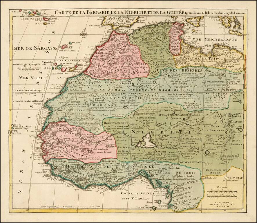
Detailed map of North and West Africa, by Jan Elwe, based upon the earlier maps of De L'Isle. Richly annotated throughout and with excellent regional detail.