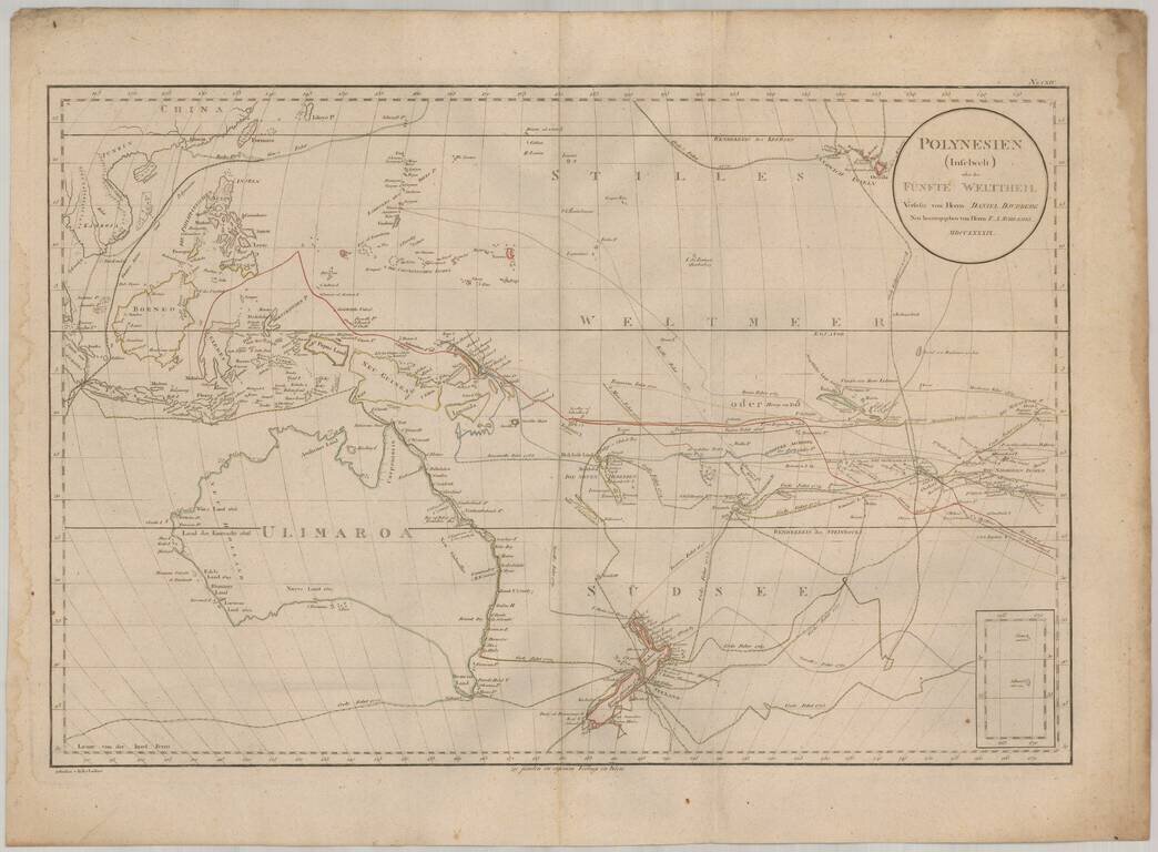
Rare map of the South Pacific, from Australia (Ulimaroa) to Hawaii. The map is one of the only maps to refer to Australia by its native name (Ulimaroa) and is also noteworthy for its fine treatment of New Zealand and extensive depiction of the routes...
![The English Pilot. Describing the West-India Navigation, from Hudson's Bay to the River Amazones. [Fourth Book]](/map/small/71190.jpg)
"The First Significant Collection of Charts Exclusively of the American Coasts to be Published in England" - Cumming An attractive example of the largest edition of the definitive 18th-century English chartbook of North America. This is a rare late...
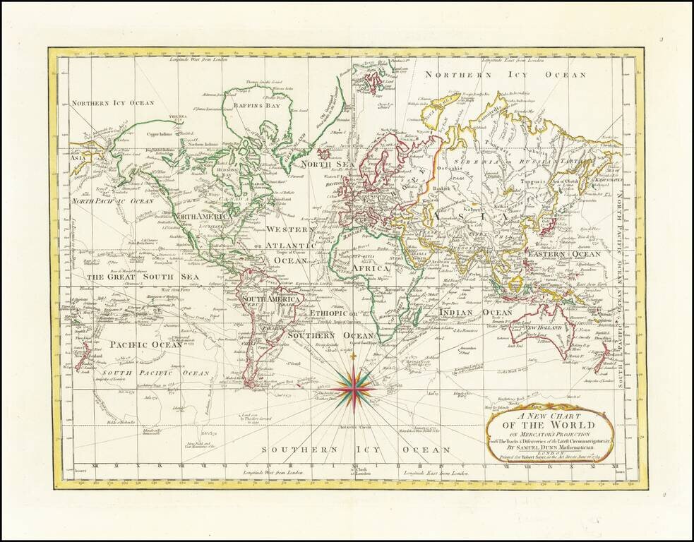
18th Century English Antique Map of the World Detailed map of the world, illustrating the tracks of the latest explorers to circumnavigate the world. The tracks shown includes the three Cook voyages, and those of Byron, Bougainville, Bouvet, etc....
![Plan Du Fort Carillon . . . 1758 [French & Indian War Battle Plan--Fort Carillon/Ticonderoga]](/map/small/58985.jpg)
Rare French & Indian War Battle Plan, showing the fortifications and battles fought at Fort Carillon between Lake Champlain and Lake George. The map shows the English Assault on Fort Carillon under the direction of General James Abercromby. The...
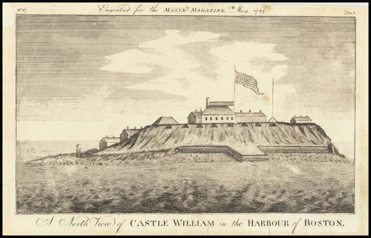
Rare Early American View Early American view of Castle William in Boston Harbor. Castle William's history dates to 1634 when cannons were first deployed to defend Boston Harbor. British officials used the fort as a refuge in the year prior to the...
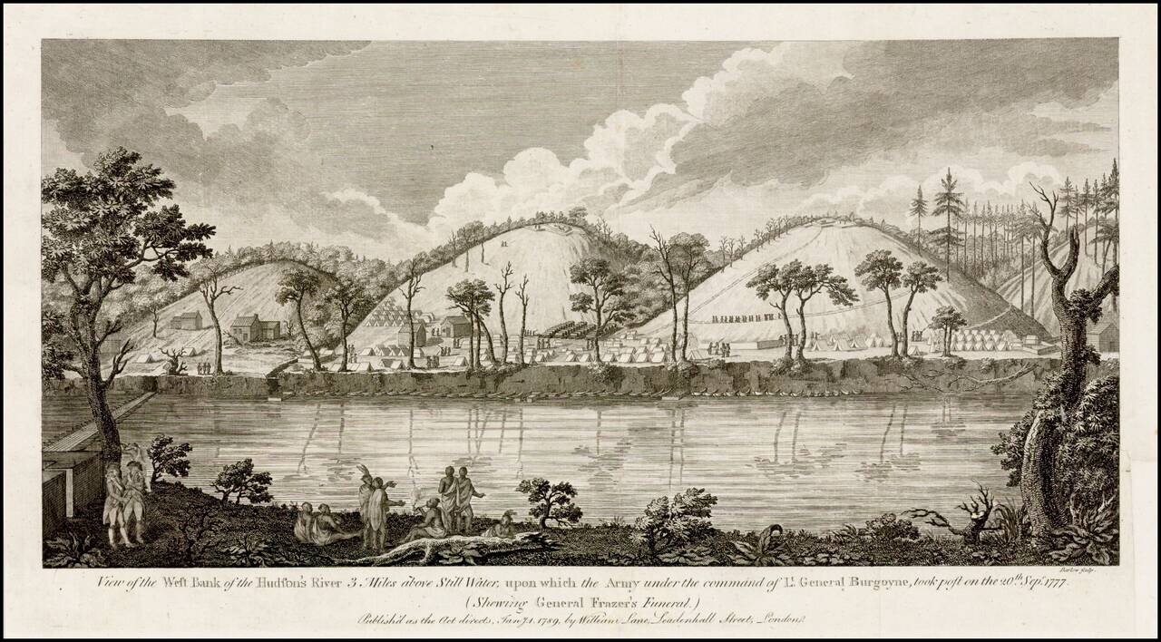
Fine view of Burgoyne's encampment along the Hudson River, published shortly after the end of the American Revolution. Burgoyne's campaign to defeat the revolutionary forces by advancing from Canada and meeting another British army from New York City...
![Attaques Des Forts De Chouaguen en Amerique. . . . 1756… [French & Indian War Battle Plan--Fort Oswego, Fort Ontario and Fort George]](/map/small/57191.jpg)
Rare French & Indian War Battle Plan, showing the fortifications and battles fought at the mouth of the Chouaguen (Oswego) River in 1756. The key at the bottom of the battle plan explains the various activities of the French, English and Indians,...
![Attaques Du Fort William-Henri…1757 [French & Indian War Battle Plan--Fort William Henry]](/map/small/57193.jpg)
Rare French & Indian War Battle Plan, showing the fortifications and battles fought at Fort William Henry on Lake George. The key at the bottom of the battle plan explains the various activities of the French, English and Indians, including...
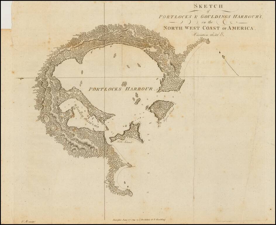
Rare early sketch map of Portock Harbor and Goudling Harbor, north of Sitka and west of Juneau Alaska, from Geroge Dixon's Voyage round the World; but More Particularly to the North-West Coast of America: Performed in 1785, 1786, 1787, and 1788, in the...
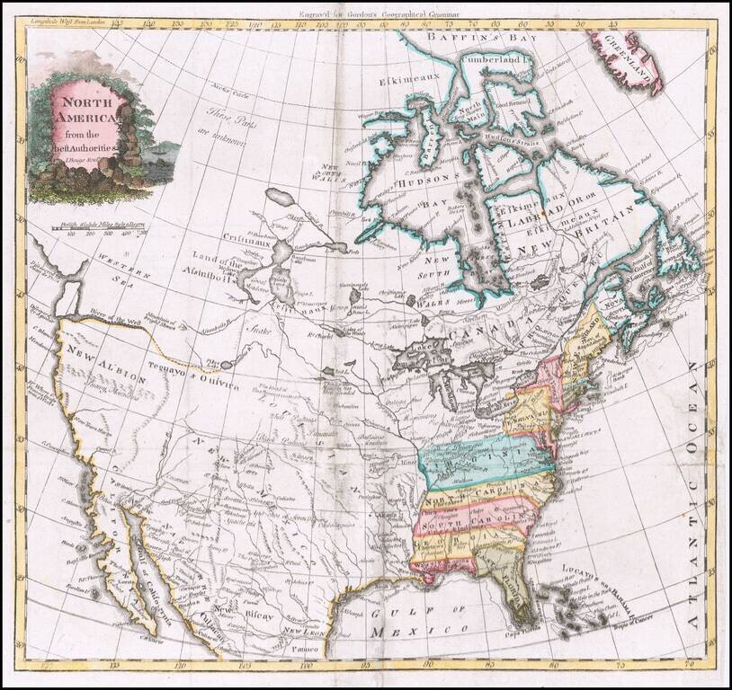
North America Signed by a Rarely Seen Map Engraver Rare mid-18th Century map of North America, engraved by I Buego in Edinburgh. The map shows the British Colonies extending from the Atlantic to the Rocky Mountains. East and West Florida are shown,...
![Plan De Louisbourg... [French & Indian War Battle Plan--Louisbourg]](/map/small/57192.jpg)
Rare French & Indian War Battle Plan, showing the fortifications and battles fought at Louisbourg. The key at the bottom of the battle plan explains the various places on the plan. The plans were issued in Les plans de la guerre de sept ans...

The Return of the First Fleet -- Fundamental Map for Australian Collectors A highly important map in the history of settling Australia, with the present example including annotations in pencil noting a ship wreck and other details. The track of the...
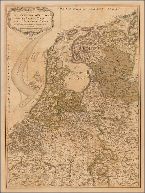
First edition of Faden's large and detailed map of Holland, originally issued 1789. The 'Generality Lands' were parts of Catholic Flanders captured and controlled by the United Provinces.
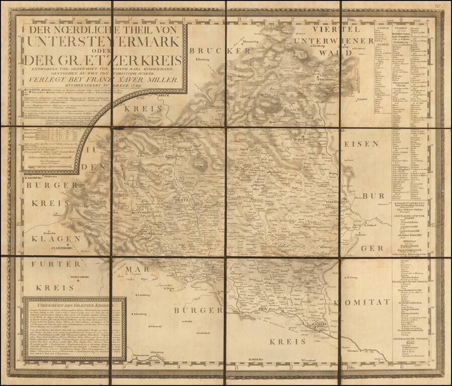
Rare Separately Published Map from Kindermann's Important Atlas of Inner Austria Rare late 18th Century map of the Graz region in Southwestern Austraia, which was one of 12 maps, typically referred to as the Atlas von Inner Osterreich (Atlas of Inner...
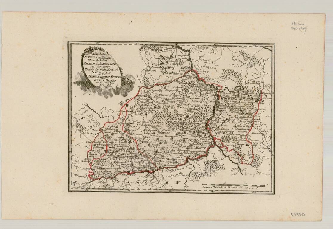
Very scarce regional map of Poland and the Ukraine, showing the region traversed by the Bug River and centered on Braclaw. Shows rivers, roads, towns, castles, forests, lakes and a host of other details. Quite possibly the most detailed map of this...
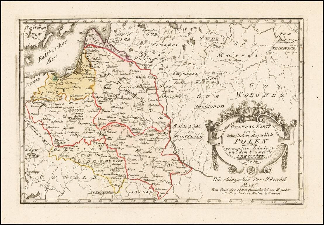
Scarce map of Poland, published by Von Reilly. The map was published during the period when Stanislaw II was attempting to reform Poland and implement a set of modern laws in tune with the Enlightenment. The Great Sejm convened by Stanislaw II August...