![[Belize] A Map of A Part of Yucatan or of that Part of the Eastern Shore within the Bay of Honduras Allotted to Great Britain for the Cutting of Logwood, in consequence of the Convention Signed with Spain on the 14th July 1786. By a Bay-Man . . . 1787 [](/map/small/60976.jpg)
First Modern Map of Northern Belize, with Text from the Logwood Treaties between Britain and Spain Rare, separately published 1787 logwood map of Honduras and modern-day Belize printed by William Faden, Geographer to the King. This is the first...
![[Virgin Islands, etc] Supplément pour les Isles Antilles, extrait des cartes Angloises](/map/small/69592.jpg)
Interesting hand-colored engraved map of the Virgin Islands, with insets of Barbuda, St. Kits, Antigua, Dominica, St. Lucia, Barbados, St. Vincent, Grenada, and Tobago. The main map covers the region from St. Thomas and St. Croix to St. Martin and...
![[Virgin Islands] Cartes De Supplement Pour Les Isles Antilles](/map/small/70820.jpg)
Excellent map of the Virgin Islands from Puerto Rico to Barbuda, centered on the American and British V.I., extending from Crab Island, St. Thomas and St. Croix to Sable Island, Sombrero Island, St. Barts, St. Martin and Anguilla. Includes 8 large...
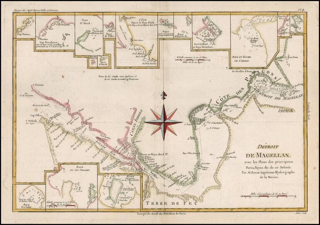
Detailed map of the Straits of Magellan from Bonne's Atlas Supplement. Shows the direction of the currents, bays, points, soundings, harbors, islands, shoals, etc. Includes the best route through the straits as known at the end of 18th century....
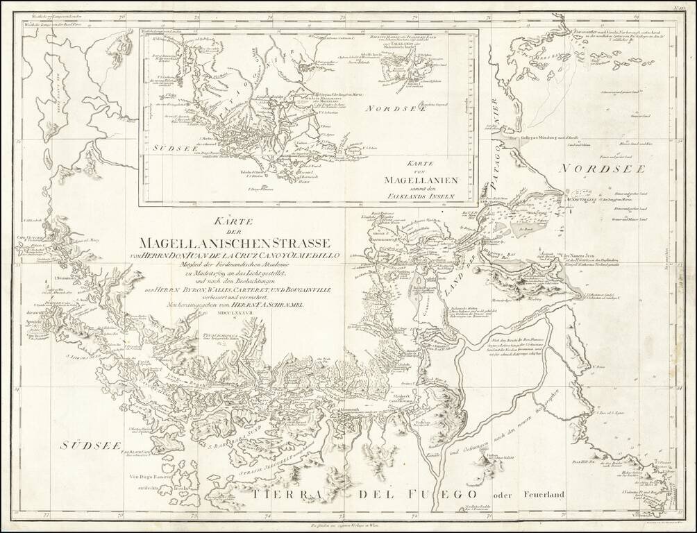
Navigating Magellan's Strait at the End of the Eighteenth Century Sharply-detailed map of the Strait of Magellan, published in Vienna by F.A. Schraembl. The map provides a fine depiction of the Strait, with a large inset showing the wider region of...
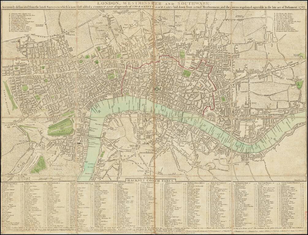
Detailed early plan of London, published in 1787. The map extends from Islington to Newington Butts and from east to west from Stepney to Hyde Park. Includes a list of important buildings with references at the top left and right and an extensive...
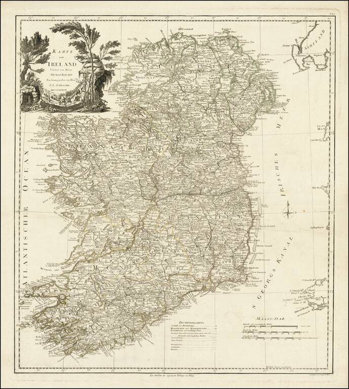
Fine large format map of Ireland, based upon the maps of Thomas Kitchin and John Rocque, published by Schraembl in Vienna in 1787.
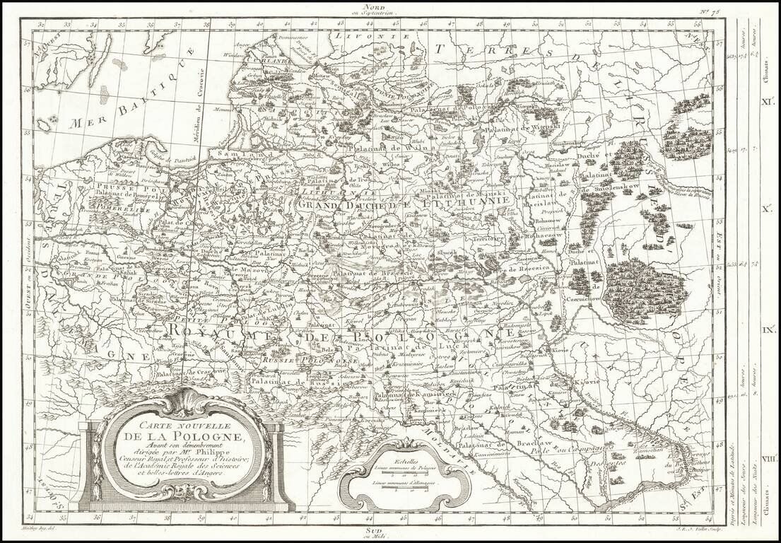
Rare map of Poland, depicting the dismemberment, published in Paris by Moithey and engraved by J.E.J. Vallet. The map is filled with information on the rivers, mountains, cities and villages.
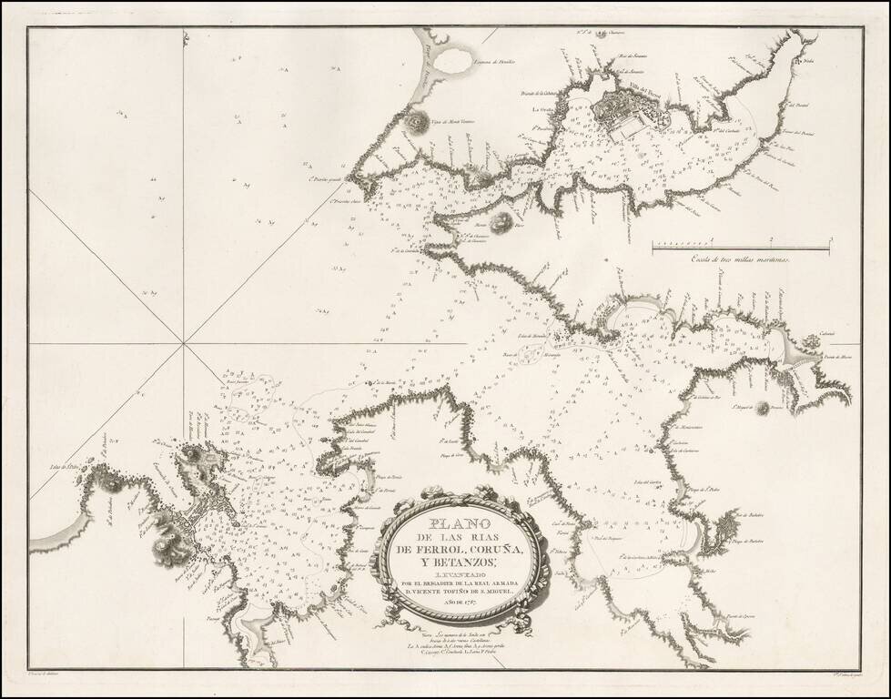
Detailed sea chart of a part of Galicia, showing the harbors at the mouths of the Rivers Ferrol, Coruña and Betanzos, published for the Spanish Hydrographical Society in 1787. This chart was one of the most important early modern surveys of the...
Scarce blue back chart of the Western Mediterranean, published under the direction of the Spanish Hydrographical Department.
![[Catalan Portolan Sea Chart] Descripcion de la Costa de España Portugal y Parte de la Barbaria contiene la sonda con la calidad de Fondo segun se a Podida y moestiear Advartencia . . . Sacado de su original en la Havana 1776](/map/small/50534.jpg)
18th Century Portolan Sea Chart of the Southern Iberian Coastline -- Escuela Nautica de Mataro (Catalonia) Finely executed 18th Century Manuscript Sea Chart of the southern coast of Spain & Portugal, extending from the Algarve region to Marbella,...
![Plan du Typa ou de Macao [with] Plan De La Baye D'Awatwska…Du Kamtschatka [with] Parti Du Japon ou Nipon](/map/small/36150.jpg)
Detailed maps of Macao, Awatska Island and part of Japan (Nihon), which appeared in the French edition of the Official Account of Cook's Voyages. Includes soundings and other details of each of the Bays.
Detailed map showing the Cape Verde islands, with a large inset of La Rade De La Praya. Shows towns, rivers, mountains, lakes, etc. Detailed map of the region from this classic 18th Century French atlas.
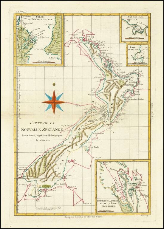
Marvelous detailed map of New Zealand showing cook's daily tracks around the Island, with 4 insets showing Mercure Bay, Cooks' Strait, Baye des Isles and Baye de Tolaga. Full color example of the fine detail appearing in Bonne's Atlas Supplement,...