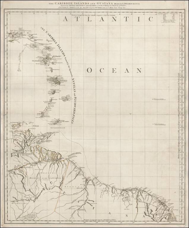
Scarce map of the Eastern Caribbean and Northeastern Coast of South America, published by Thomas Jefferys. The map extending from the Virgin Islands to Margarita and Trinidad Islands to Cayenne and Lake Parima, including a nice treatment of the...
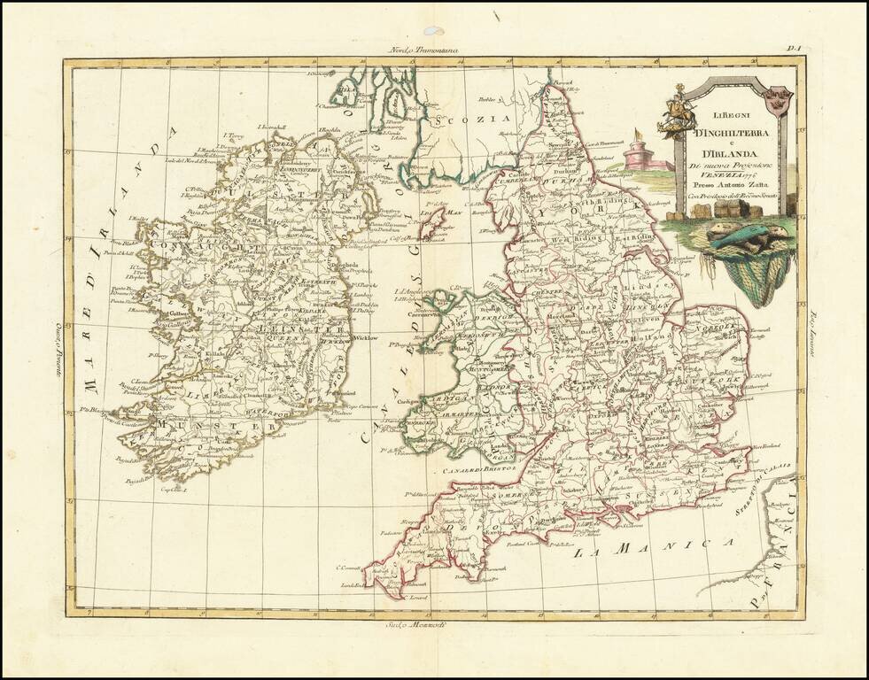
Detailed map of Great Britain, published in Venice by Zatta. Includes a decorative cartouche.
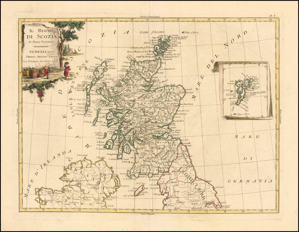
Decorative Italian map of Scotland, with an attractive inset of the Shetland Islands. The map appeared in Antonio Zatta's 4 volume 'Atlante Novissimo". Zatta was a major Italian cartographer of the time, and his works are increasingly popular with...
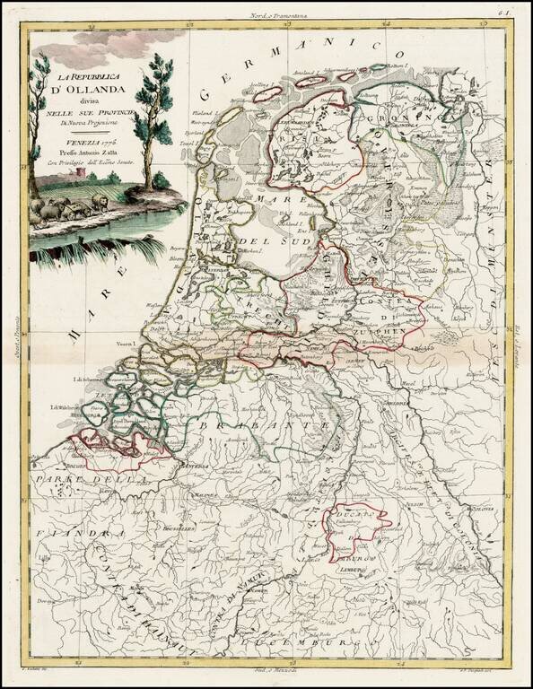
Decorative map of the Low Countries from Zatta's Atlante Novissimo.
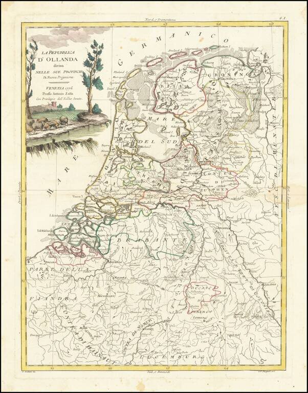
Decorative map of the Low Countries from Zatta's Atlante Novissimo.

Striking map of France, divided by Governments (pre-dating the Department system). Decorative title cartouche. From Zatta's monumental Altante Novissimo, one of the last great decorative atlases of the 18th Century.
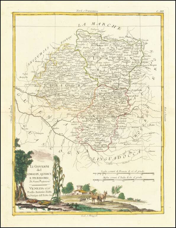
Decorative map of Southern France. Includes Limoges, Perigueux, Bergerac, Cahors, Montauban, Castillon-la-Bataille, etc. Includes a large decorative title cartouche. The map was issued in Zatta's Atlante Novissimo, a monumental 4 volume work and one...
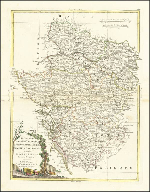
Attractive antique map of Southwestern France, including Bordeaux and the Basque region. Includes a large decorative title cartouche, surrounded by emblems of winemaking which made the region famous. The cartouche includes vines of wine grapes and...
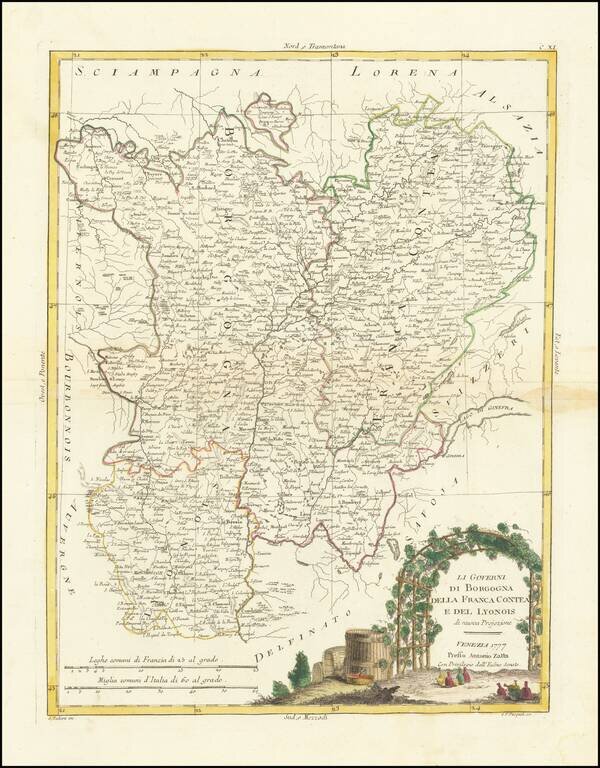
Decorative map of the Burgundy, Franche Comte and Lyon regions. Includes a large decorative title cartouche. The map was issued in Zatta's Atlante Novissimo, a monumental 4 volume work and one of the last great decorative atlases.
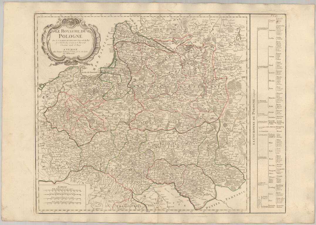
Detailed map of Poland, published by Santini in Venice. Santini credits Robert De Vaugondy as the source of this map. The table provides a breakdown of the sub-regions of the Kindgom of Poland.
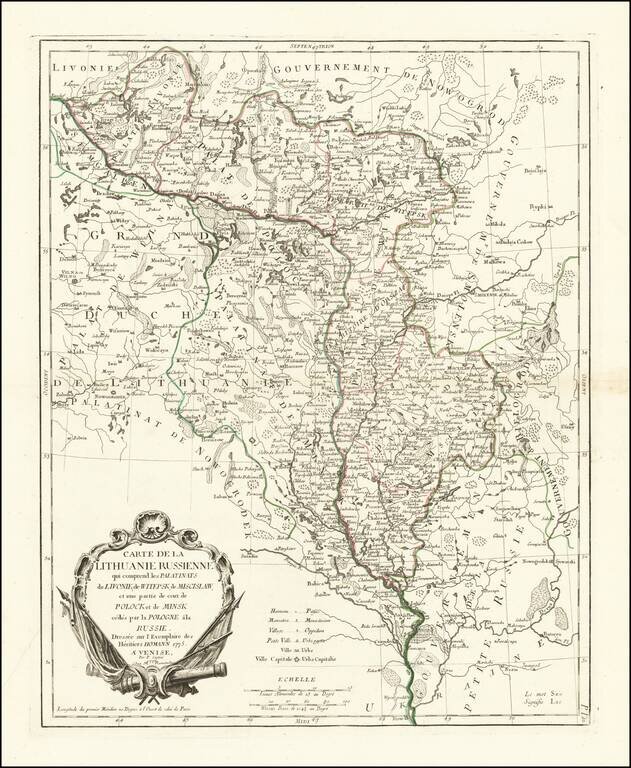
Fine and highly detailed map of Belarus, Latvia, with the Dnieper River. The map includes the towns of Smolensk, Orsa, Minsk, etc. Santini gives credit to Homann Heirs in the cartouche.
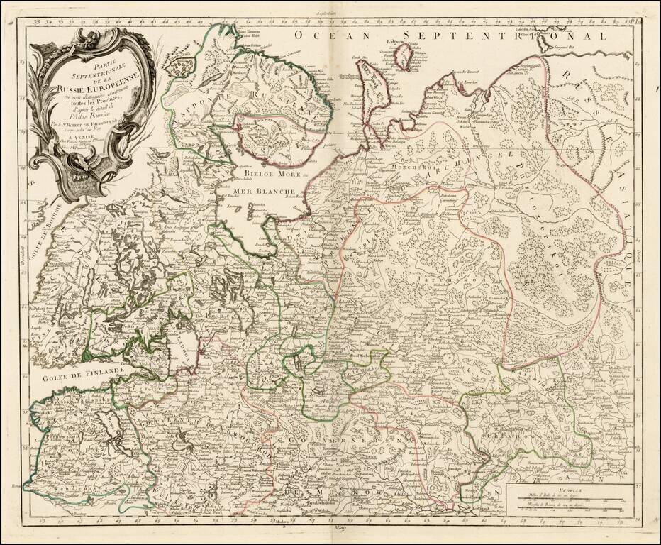
Highly detailed map of the Northwestern part of Russia, from the Gulf of Finland and Poland, to the western part of Asian Russia. Decorative cartouche.
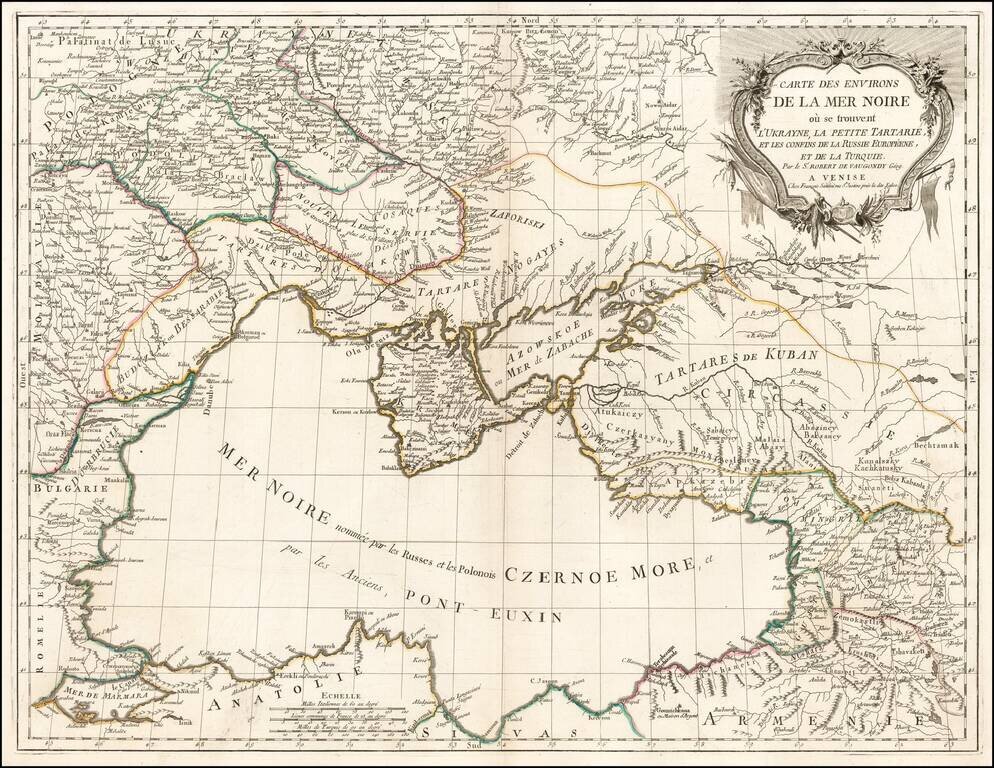
Scarce regional map centered on the Black Sea, published in Venice by Francois Santini. One of the most detailed maps of the region published in the mid-18th century.
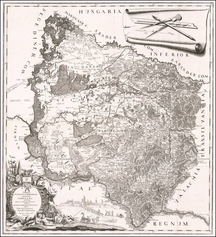
A Map of the Banat of Timisoara by One of its Most Important Historians Rare separately published map of the Banat of Timișoara, created by Francesco Griselini, following his travels to Timișoara with Count Giuseppe Brigido in 1774 and published in...
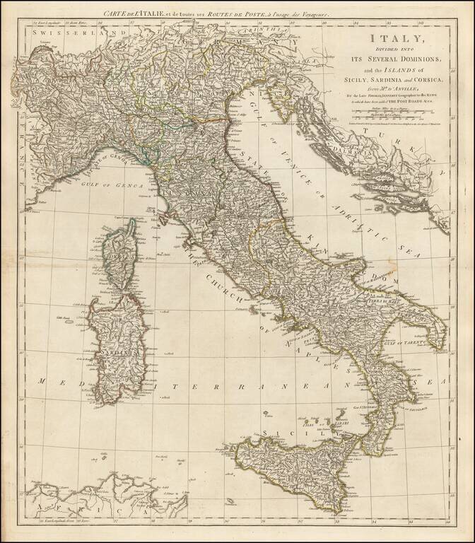
Detailed late 18th Century Postal map of Italy, Sicily, Corsica and Sardinia, with contiguous regions. Title also given in French.
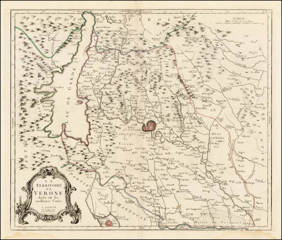
Scarce regional map of the Territory of Verona and environs, published in Venice by Francois Santini. Unlike many of the maps in Santini's atlas, this regional map of Italy is not drawn from De Vaugondy and is based upon Italian sources. One of the...