Map size in jpg-format: 12.8847MiB
Click to open in high resolution (open in new tab).
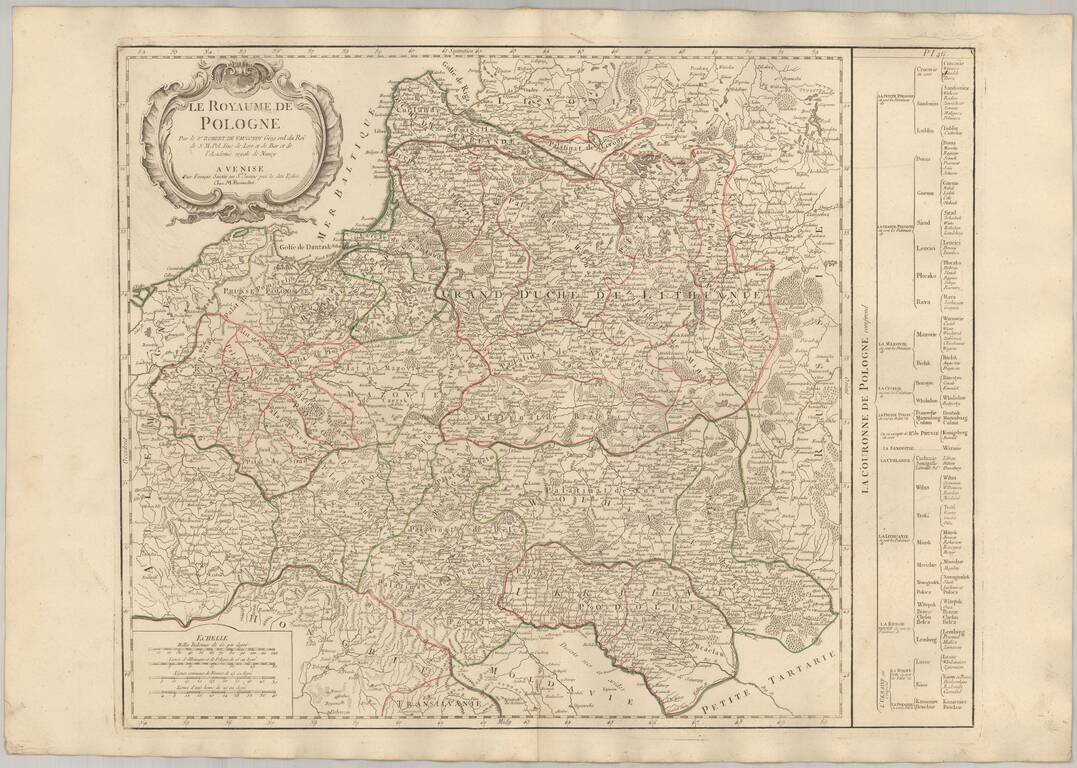
Detailed map of Poland, published by Santini in Venice.
Santini credits Robert De Vaugondy as the source of this map. The table provides a breakdown of the sub-regions of the Kindgom of Poland.
Paolo Santini (1729-1793) was an Venetian engraver known especially for his religious prints and fine cartographic engravings. He published in Venice and may have a been a member of the clergy. In his maps, he largely adopted and adapted the work of his French counterparts, especially the brothers de Vaugondy.
If you are a student, write to us in telegram: @antiquemaps and indicate what material you need and for what work you need a map in high detail. We are ready to provide material on special terms. For students only!


![[Hand Drawn Prussian Military Encampment at Opole, Poland] Special Grund-Riss Des Kaeyserl Feldl Lagers bey Oppeln in Ober Schlesien](/map/small/59726.jpg)