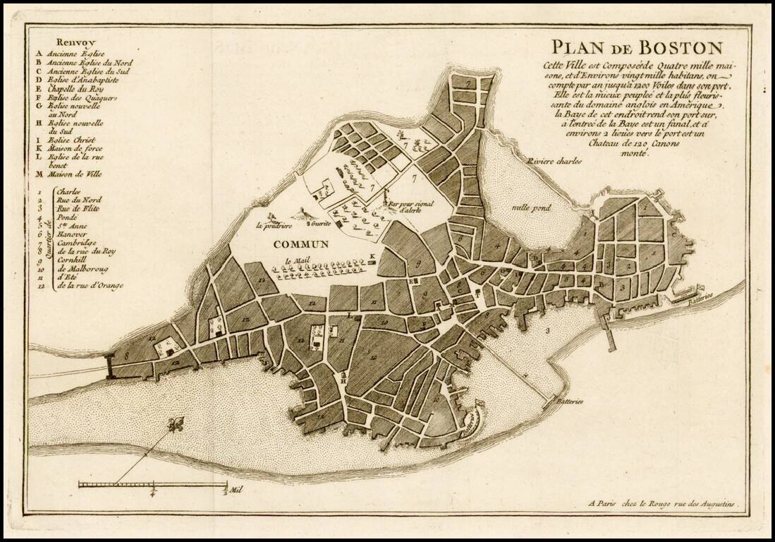
Fine example of Le Rouge's plan of Boston, issued at the beginning of at the outset of the French & Indian War in his Recueil des plans de l'Amerique septentrionale. Le Rouge's plan has been reduced French from John Bonner's New Plan of ye Great...
![[Massachusetts Bay, with Boston and Part of Cape Cod]](/map/small/59282.jpg)
Exceptional Revolutionary War Era Chart of Massachusetts Bay. One of the better charts from Des Barres' Atlantic Neptune, extending from Cape Ann in the north, through Boston, to Plymouth in the south, and showing Cape Cod from Wellfleet north. This...
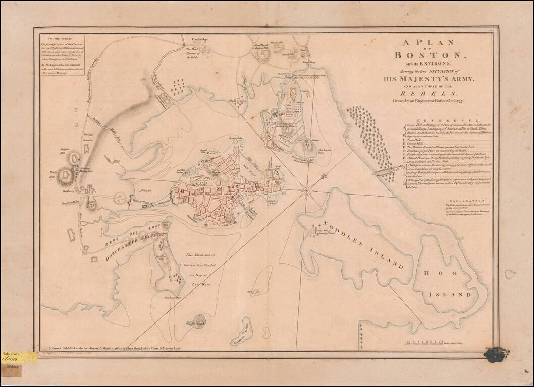
An Early Revolutionary War Battle Plan From An German Archive Nice example of perhaps the finest contemporary plan of the Siege of Boston at the outset of the American Revolution, drawn by Lieutenant Richard Williams. Williams' remarkable...
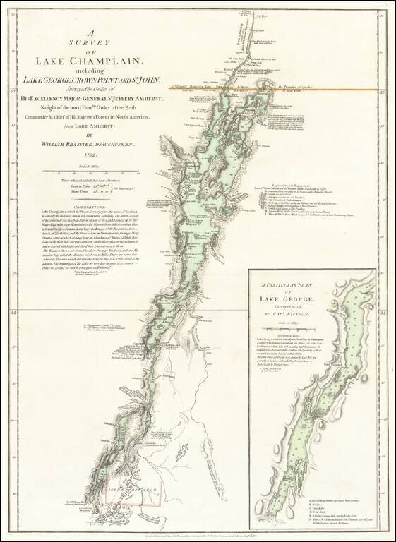
An Important Revolutionary War Period map of Lake Champlain & Lake George, based upon William Brassier's survey of the region during the French & Indian War. Sayer & Bennett's map is the first separately published map to focus on Lake...
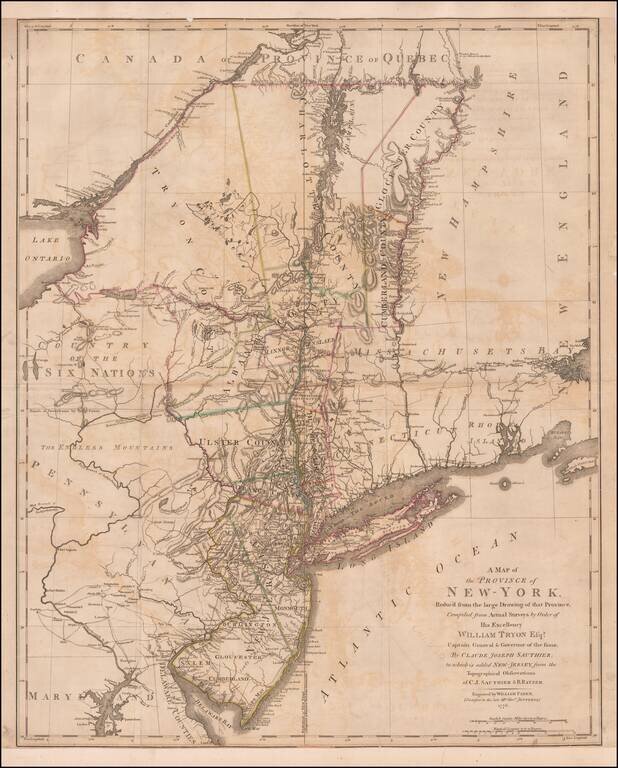
Important early Revolutionary War map, published by William Faden shortly after the signing on the Declaration of Independence. This remarkable map is a combination of two of the most important colonial surveys conducted on the eve of the Revolution,...
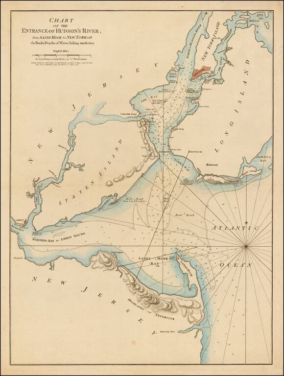
First state of this rare sailing chart of the area around New York Harbor and Long Island, which was issued separately and in the first edition of Sayer & Bennett's North American Pilot. This finely detailed chart is centered on Staten Island,...
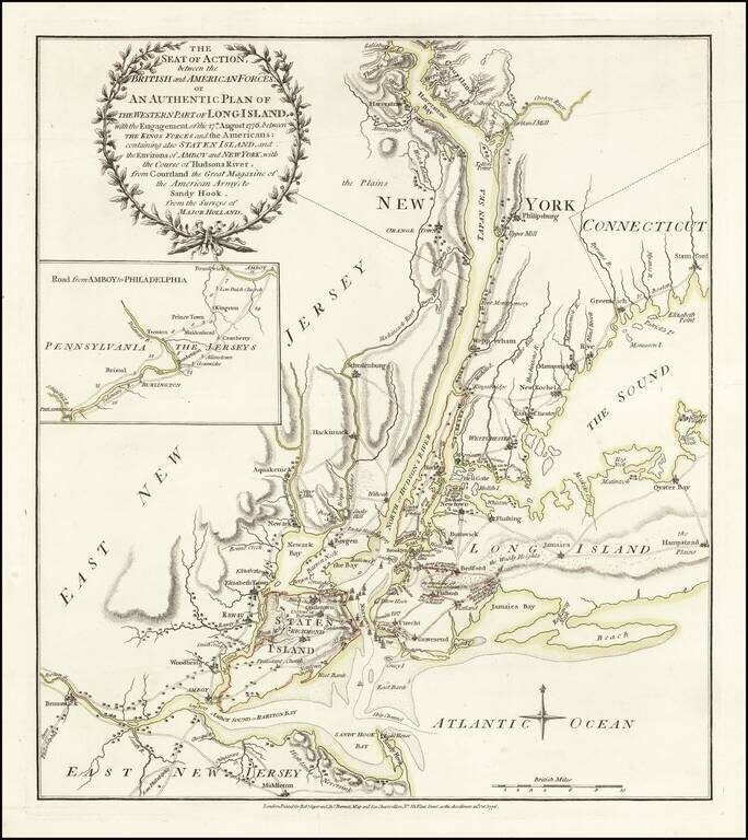
One of the Best Revolutionary War Battle Plans of New York City. Fine old color example of Sayer & Bennett's rare battle plan of the area around New York City, depicting one of the most important early battles of the American Revolution....
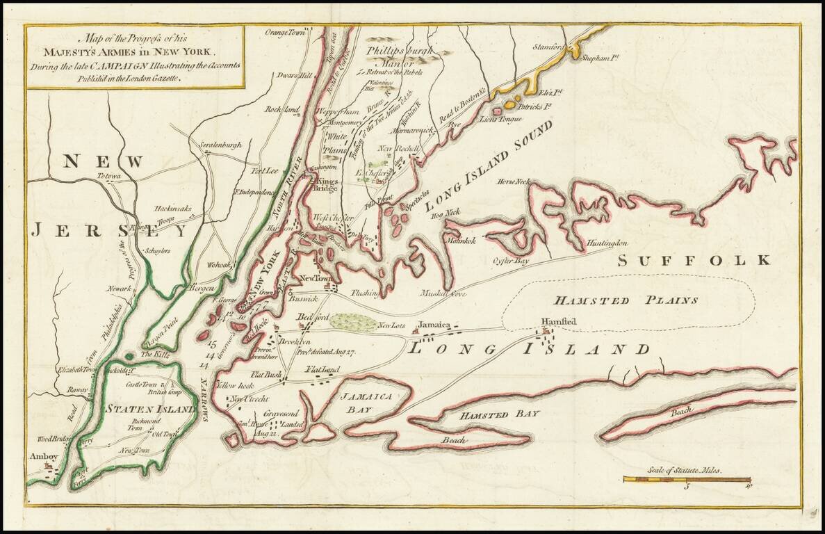
Revolutionary War Battle Map for New York City &c. Detailed early Revolutionary War battle plan of the area around New York City, depicting the battles of Long Island and White Plains in 1776. The map shows battle details of General George...
![[Long Island & Vicinity] Der Teufels Belt gemeiniglich genannt der Lange Insels Sund](/map/small/37902.jpg)
Extremely rare separately printed map of Long Island, New York City and the area north of the City and Long Island. Includes the contiguous Connecticut Coastline to just beyond Stonington Bay and Fisher's Island and to just north of Tappen Zee and...
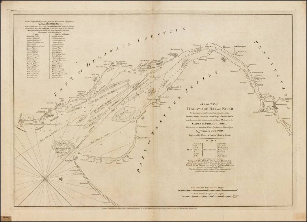
Fine example of William Faden's important early chart of the Delaware River, prepared on the eve of the American Revolutionary War. Fadens chart is the earliest obtainable derivative of Joshua Fisher's virtually unobtainable map, which has been...
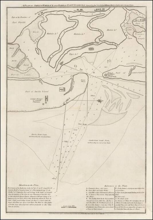
A Revolutionary War Florida Rarity. Fine wide margined example of Sayer & Bennett's chart of Amelia Harbor and Bar, based upon a survey conducted under the direction of Jacob Blamey in January 1775. The map is oriented with west at the top. On...
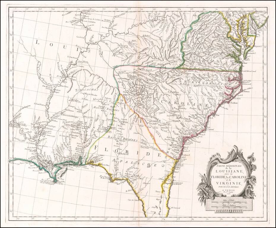
Scarce Italian Map of the Southern Colonies in Colonial America at the Outset of the American Revolution A marvelous map the Southern part of Colonial America, published by Paolo Santini in Venice. The map covers most of Florida, then extending west...
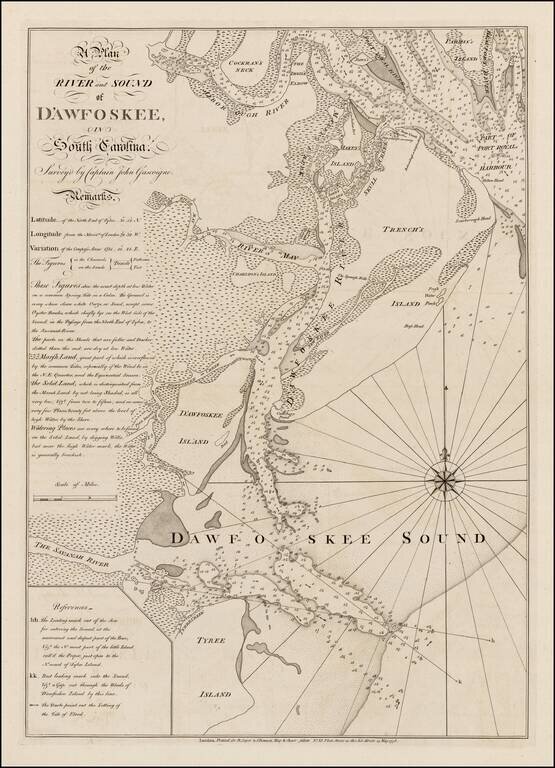
Highly detailed sea chart of the area around Hilton Head, South Carolina, based upon a survey by Captain John Gascoigne. Gascoigne's finely engraved chart was produced at the beginning of the American Revolution, at a time when the outcome among the...
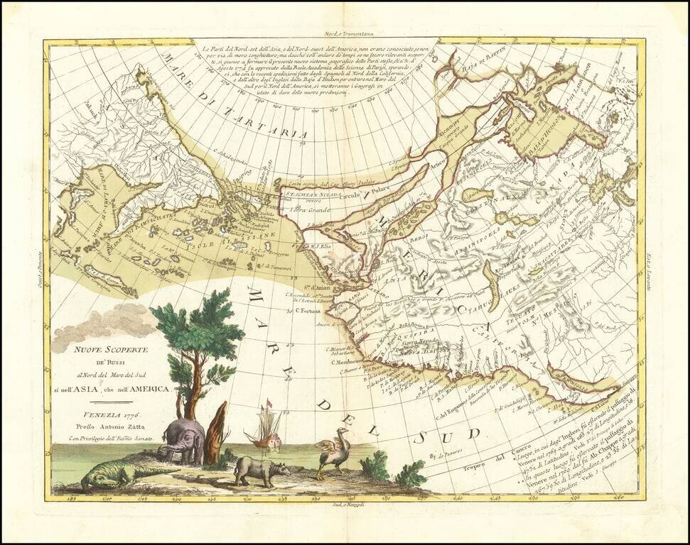
An Ostrich, An Elephant and the Northwest Passage! Striking example of Zatta's map of the northern Pacific Coastal regions and one of the best illustrations of a late rendition of the Northwest Passage, here illustrating two wide passages from the...
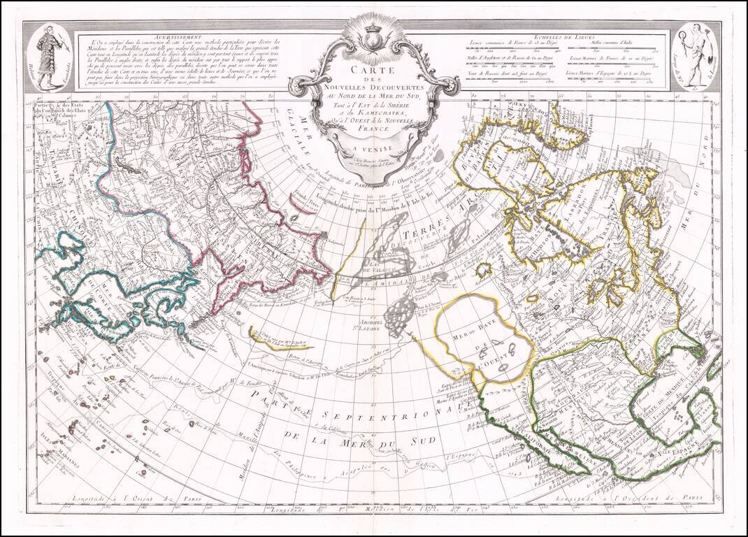
Santini's edition of Joseph De L'Isle's map of the Northern Pacific Ocean, North America and Asia. De L'Isle's map was a cartographic landmark, representing the most important advances in the mapping of this region prior to Cook. The map reported the...
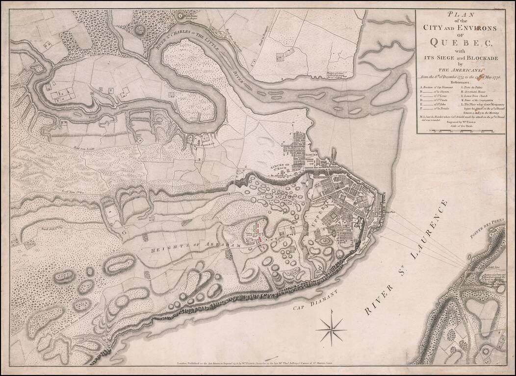
Fine, Detailed, Separately-Issued Plan of the Siege of Quebec (1775-6) Rare, separately-published plan of the Siege of Quebec, published by William Faden in London. The plan shows a pivotal early moment in the American Revolution and highlights the...