![Carte des parties Nord et Est de L'Asie qui comprend Les Costes De Russie Asiatique Le Kamschatka, Le Iesso et Les Isles Japon…[insets of Alaska, West, AZ and Conibas]](/map/small/70673rd.jpg)
Marvelous depiction of the Northeast Passage, from Norway and Spitsberg Island to the Straits of Anian and Cape Schalaginskoy north of Kamschatka, covering the NE Coast of Asia to south of Japan and Korea. The primary focus of the map is Asiatic...
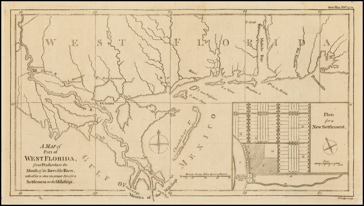
Nice detailed map of the Gulf Coast from Pensacola to the mouth of the Mississippi River, from the February 1772 edition of Gentleman's Magazine, with a nice inset plan for a New Settlement. Extends to west of New Orleans to include Plantations along...
![[The 5 Californias] Carte De La Californie Suivant 1. La Carte manuscrite de l'Americque de Mathieu Neron Pecci olen dressee a Florence en 1604, 2. Sanson 1656 . . .](/map/small/67157.jpg)
Survey of the Fine Early Maps of California A historically important depiction of the 5 most influential cartographic depictions of California, showing the evolution of how California was mapped between 1604 and 1767. The earliest map is (upper...
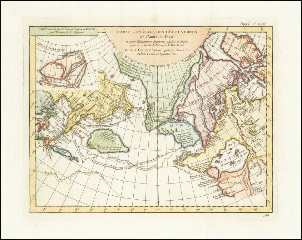
A fascinating map of the Northwest Coast, showing De L'Isle's conjectural northwest coast, based upon De Font and Russian Discoverers, including the Bay of the West. The map is part of the great mid-18th Century debate, spurred by the reports of...
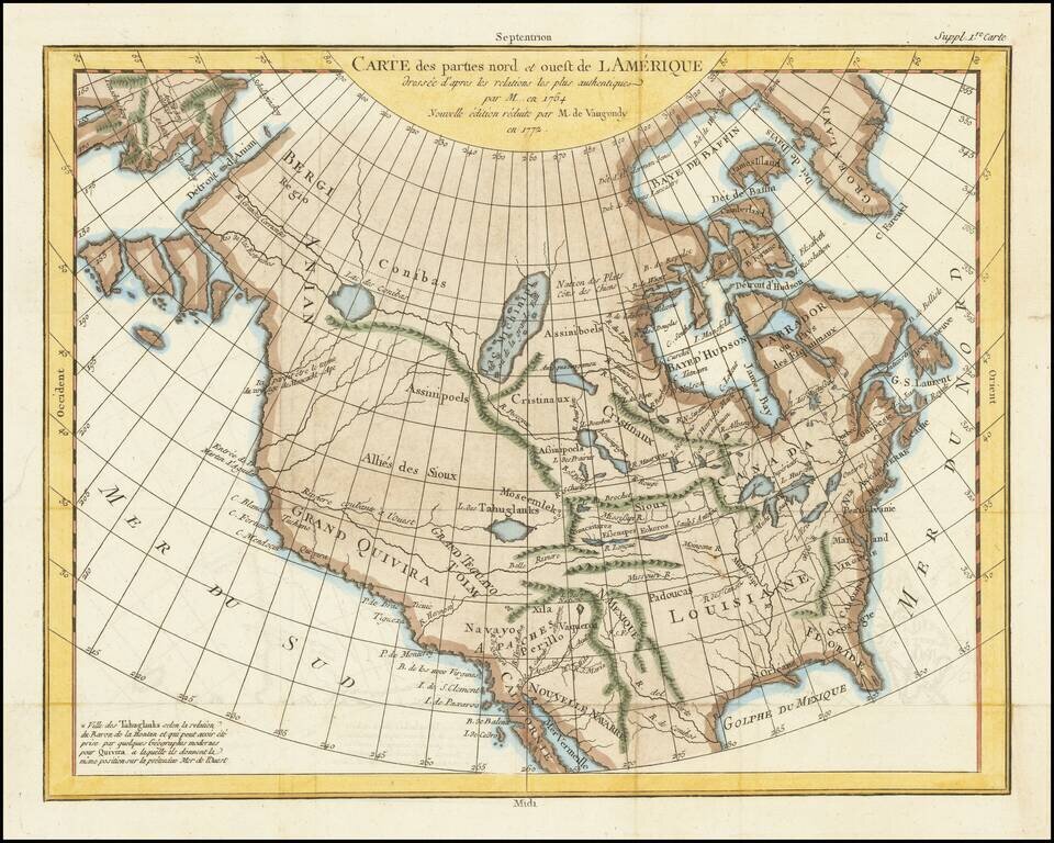
A fascinating map of North America, based upon a map by Thomas Engel. Engel's map of North America was issued in his Memoires Observations Geographiques in 1765, and provides a fascinating look at the watercourses across North America, with no less...
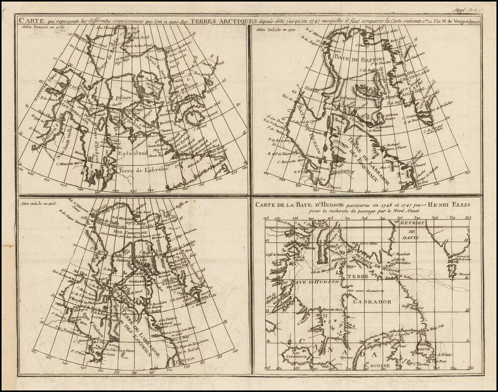
Marvelous set of four maps of the Hudson, Button and Baffin Bay regions, Davis Straits, and the Coast Labrador, as developed and explored between 1650 and 1750. This map was one of ten maps in Diderot's important 10 volume encyclopedia, one of the...
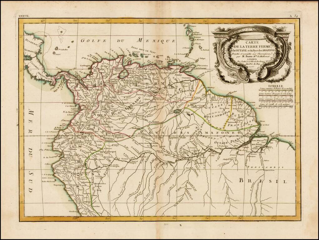
Striking 18th Century map of the northern portion of South America, including, Columbia, Venezuela, Ecuador, Guyana and the northen part of Brazil, on the eve of their independence from Spain. The map is divded into Spanish intendencies, with the...

A Rare Separately Published Example From A Storied English Country Mansion. Striking two-sheet, engraved map of South America below the Rio de La Plata, produced by Thomas Kitchin in London in 1772. Attractively-engraved by Kitchin, the map features...
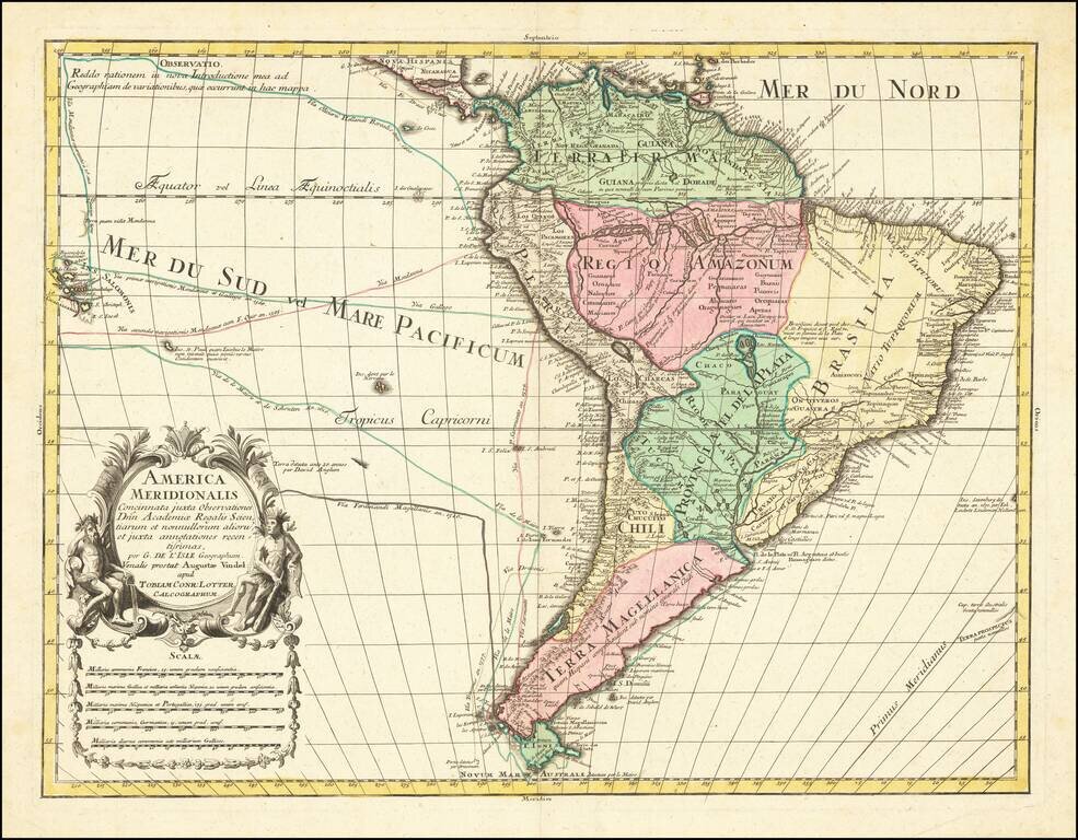
Decorative map of South America, by Conrad Lotter. The map shows the routes of Magellan (1520), Drake (1577), le Maire & Schouten (1616), and Sarmineto (1570). Various other dated discoveries are noted throughout. Interesting river systems and...
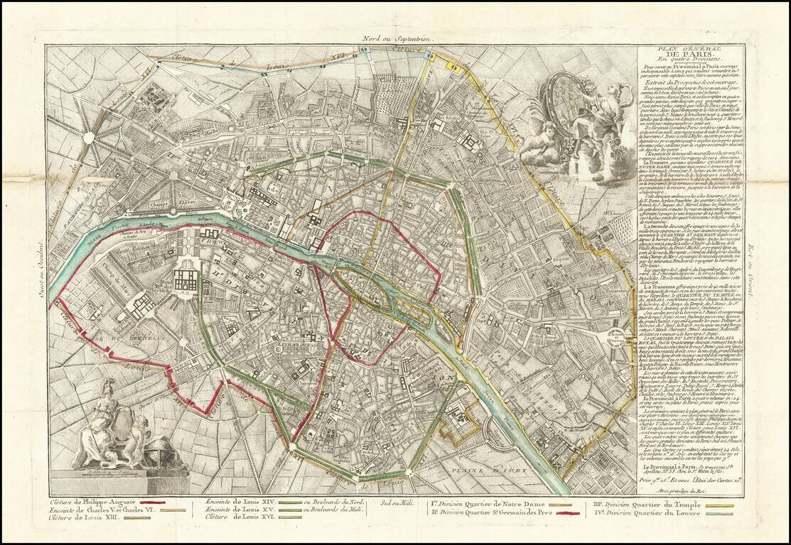
Rare map of Paris, illustrating the expansion of Paris's outer walls over the centuries and its 4 quarters. Paris is divided into four districts: Notre-Dame district (South-East) Saint-Germain-des-Prés district (South-West) Temple or Marais...
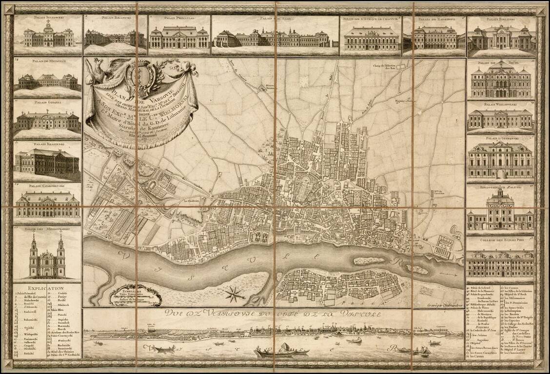
Fine example of the earliest obtainable city plan of Warsaw, engraved by Chalmandrier for Giovanni Antonio Rizzi Zannoni in 1772. Rizzi Zannoni's plan is based upon the 4-sheet plan of Warsaw by Pierre Ricaud de Tirregaille, entitled Plan de la ville...
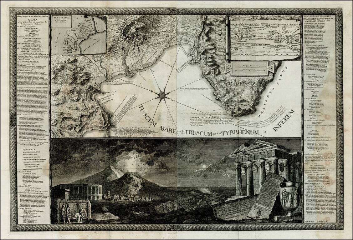
Rare map of the Gulf of Naples, which includes a spectacular view of the eruption of Mt. Vesuvius, but Filippo Morghen, Antonio Cardon & Giuseppe Bracci. Extremely rare and highly detailed map of the Gulf of Naples, by Filippo Morghen. The map...
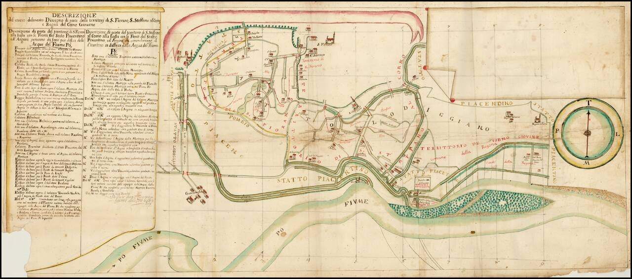
Fascinating map showing Piacenza on the Po River, with a number of canals, roads, public buildings, churches and other places of interest. The map is apparently oriented with south at the top. We have not learned much about the map--it is probably...
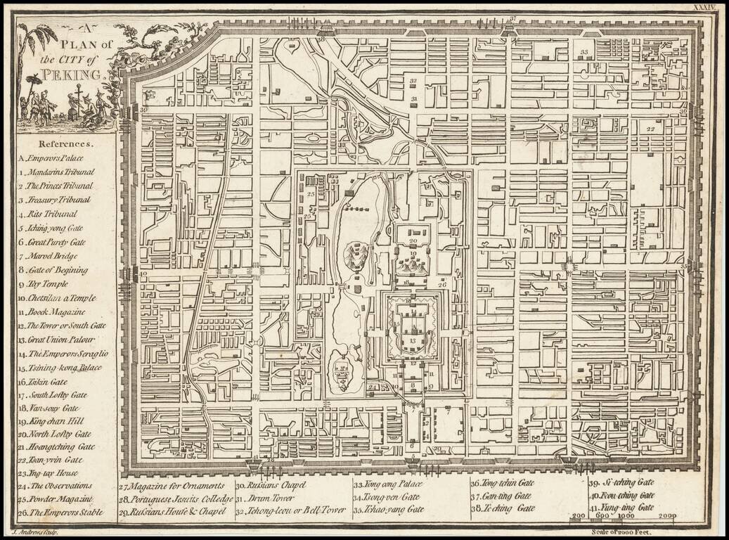
Scarce plan of the City of Beijing, published in London by John Andrews.
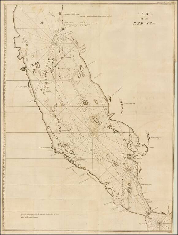
Finely executed map of the southern part of the Red Sea, which was published in A Letter to the Rev. Mr. Maskelyne, Astronomer Royal, F. R. S. Accompanying a New Chart of the Red Sea, with Two Draughts of the Roads of Mocha and Judda, and Several...