Map size in jpg-format: 115.278MiB
Click to open in high resolution (open in new tab).
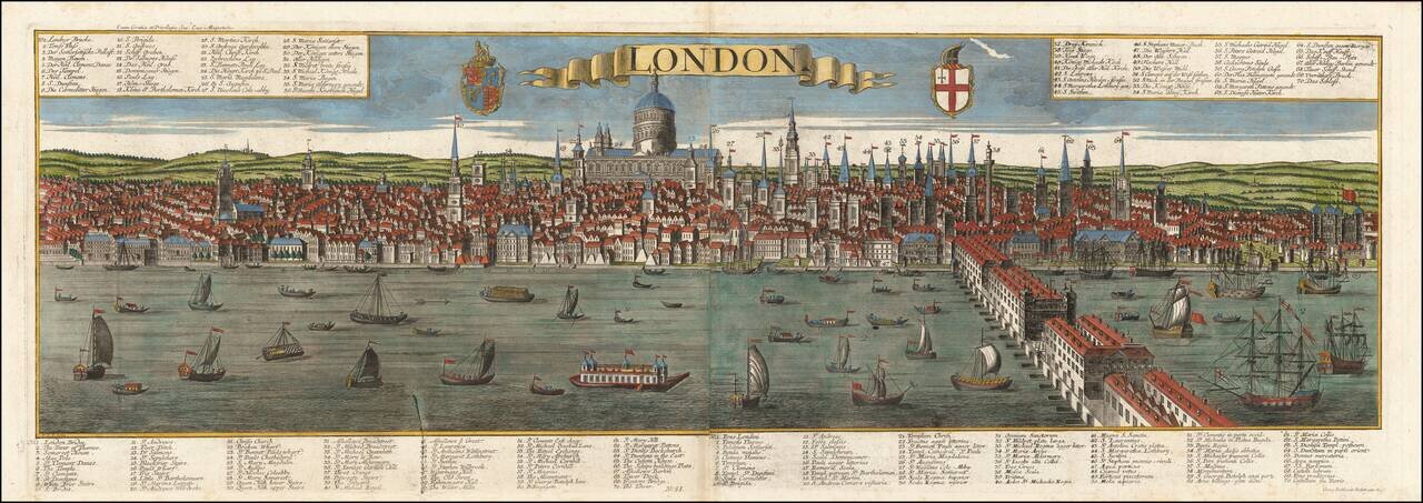
Striking panoramic view of London, published in Augsburg by the Probst family.
Highly detailed 18th century post-fire panorama of London as seen from the south bank of the Thames River, looking toward the St. Paul’s Cathedral, engraved by Friedrich Bernard Werner and initially published ca 1730 by Georg’s father, Johann Friedrich Probst.
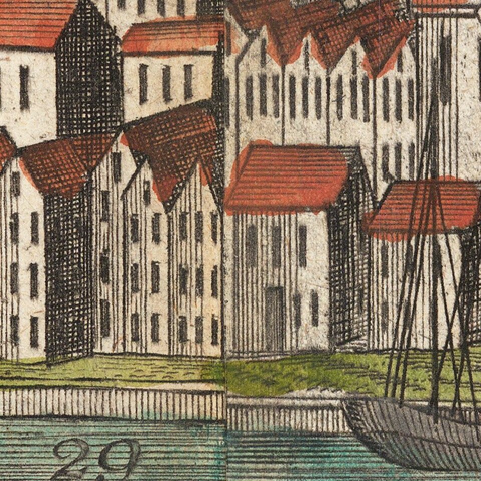
The view illustrates central London, with the old London Bridge at the far right and a very busy Thames with a variety of sailing ships and barges, stretching from Somerset House in the west to the Tower in the east. The Bridge itself is covered with houses; however it is not clear whether the view represents the bridge burnt down in 1725 or its replacement. The houses were finally cleared in 1756. Above the view is the title on a banner and the Royal Arms and the City Crest.
In 1711, an act was passed calling for the creation of fifty new churches to replace those lost in the Great Fire: nearly forty churches are named here. Also shown is the Monument to the Fire built by Christopher Wren 1671-77, for many years the highest isolated column in the world at 202 feet, with a staircase of 345 steps.
On the Thames are examples of the various boats using the river, with London Bridge dividing the river craft from the ocean-going vessels.
Includes a key locating 70 important placenames in English, Latin and German.
If you are a student, write to us in telegram: @antiquemaps and indicate what material you need and for what work you need a map in high detail. We are ready to provide material on special terms. For students only!