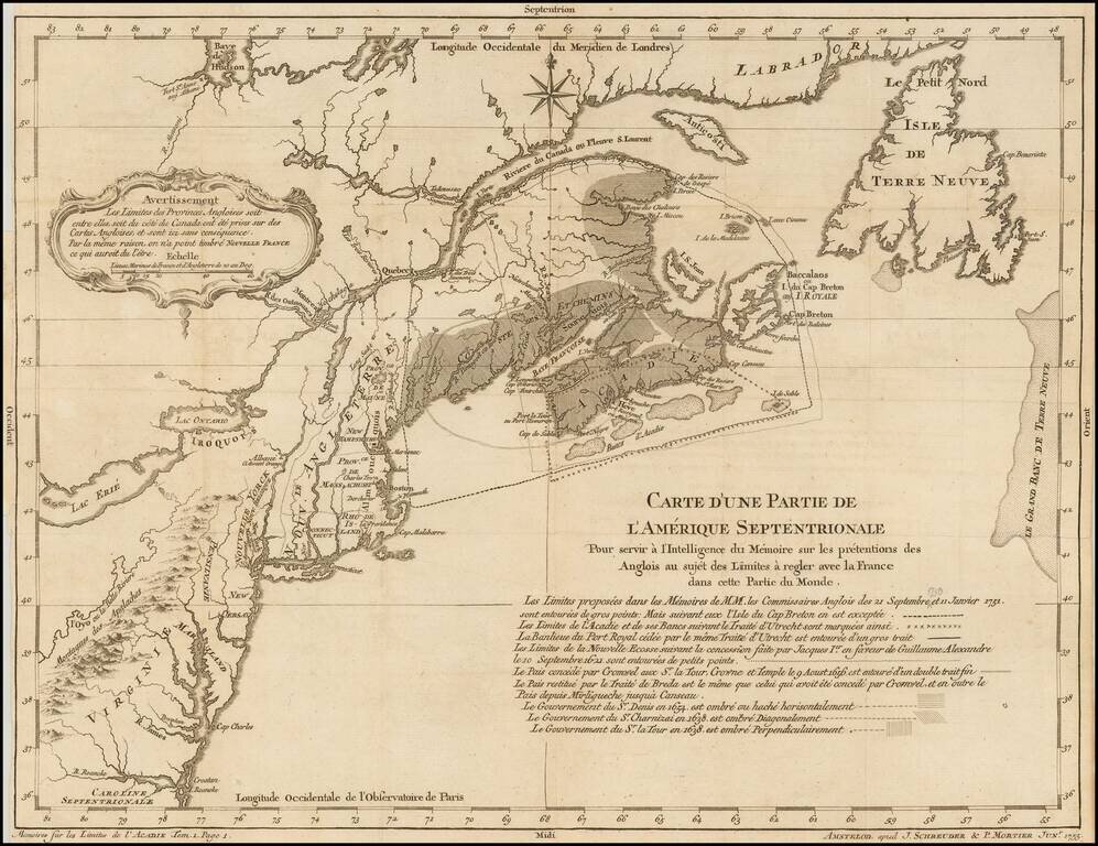
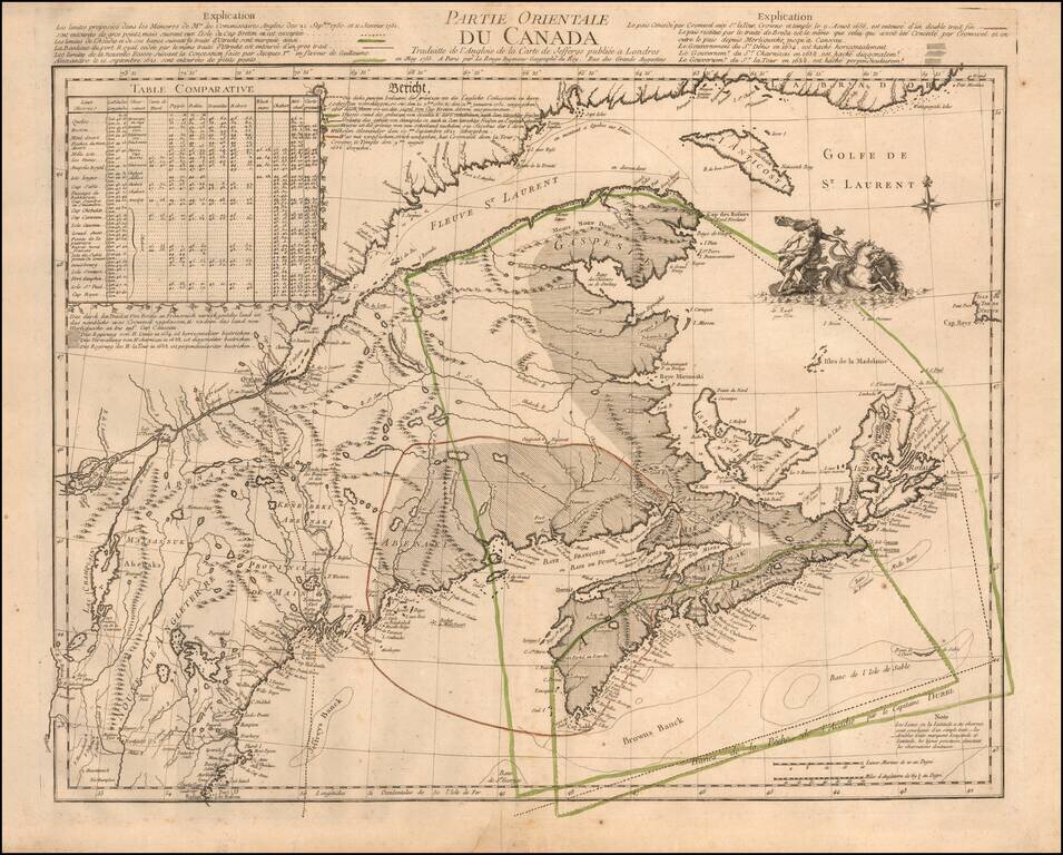
Rare Dutch Edition of Bellin's Controversial and Highly Important Map Illustrating the French and British Historical Claims to the Canadian Maritimes and Maine, published in Paris on the Eve of the Seven Years' War (1756-63) Rare Amsterdam imprint...
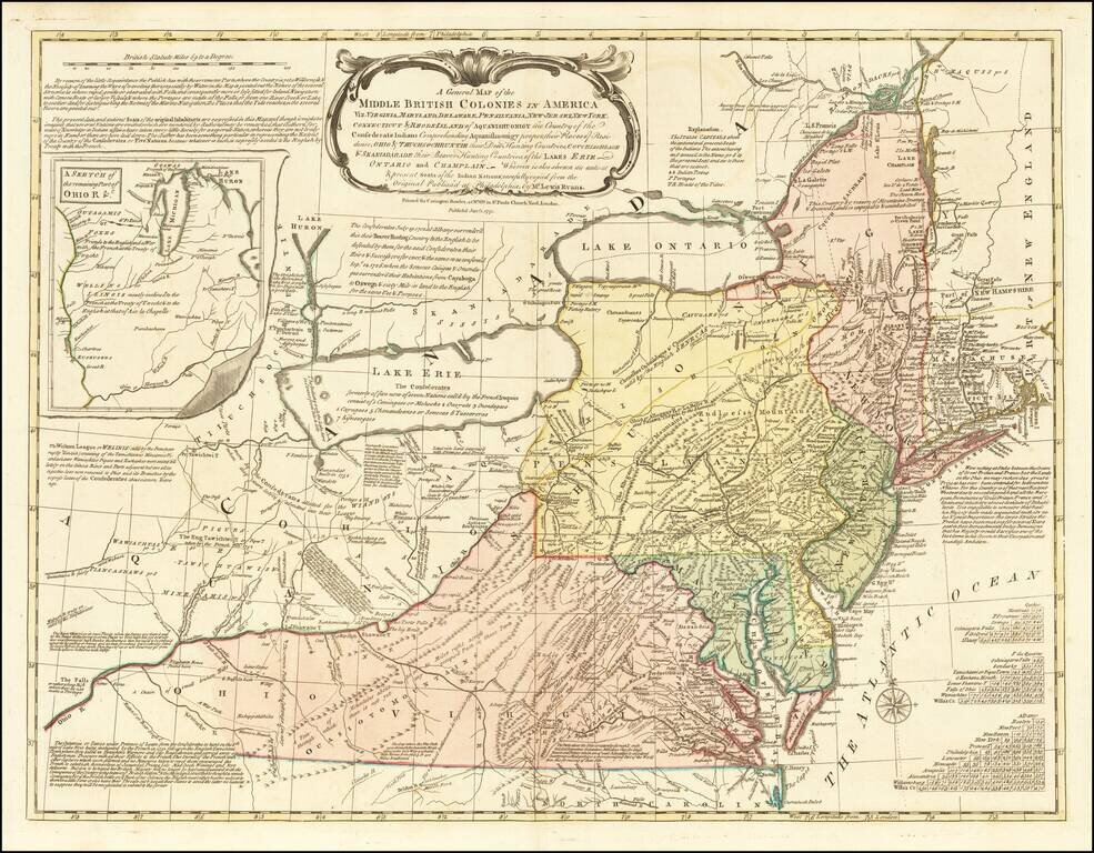
One of the Most Influential 18th Century Maps of America Fine example the Carrington Bowle's edition of Lewis Evans' seminal map of the British Colonies in North America. Along with the maps of Henry Popple and John Mitchell, Lewis Evans' map is...
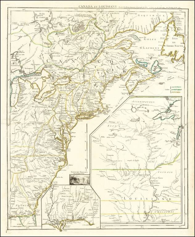
France Claims on the Eve of the French & Indian War Rare French & Indian War map of the British and French Colonies in North America, published by Le Rouge. Fine example of this highly detailed set of maps illustrating the French &...
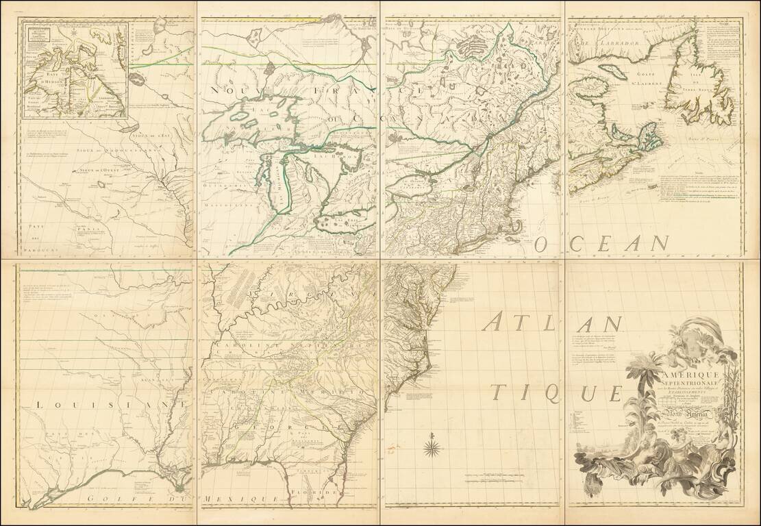
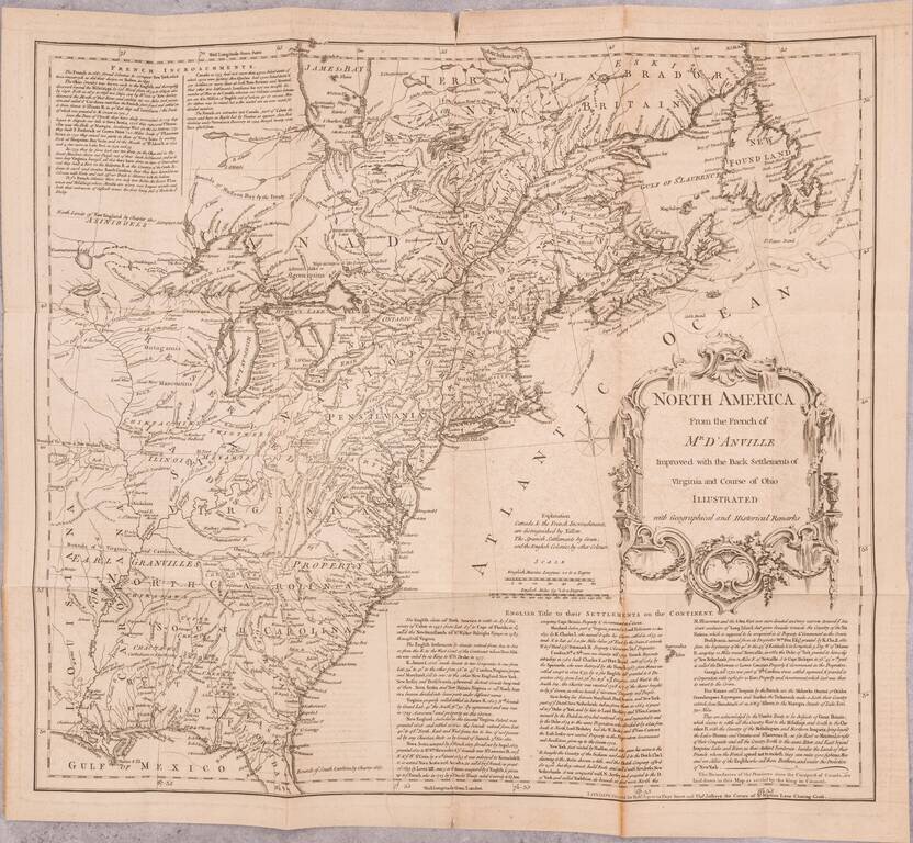
The Most Important American Map of the 18th Century Fine example of the French edition of Mitchell's seminal map of the Eastern part of North America. Mitchell's is regarded as perhaps the single most important American map of the 18th Century, and...
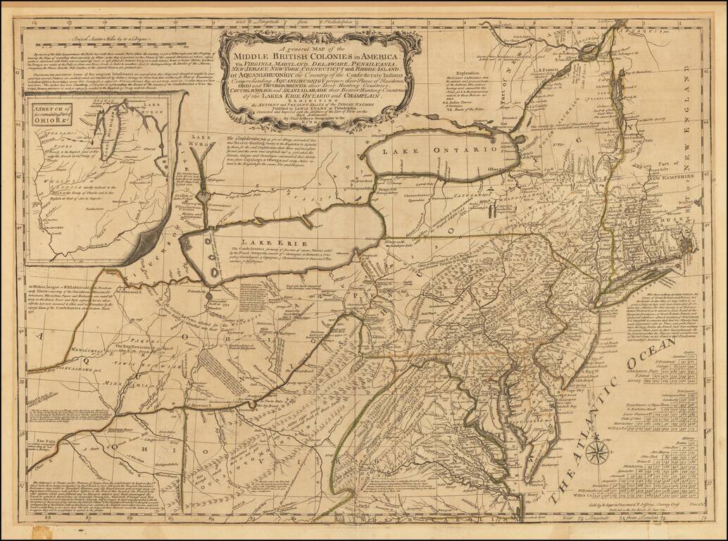
A nice example of the Sayer-Jefferys London issue of Lewis Evans' seminal map of the British Colonies in North America. Along with the maps of Henry Popple and John Mitchell, Lewis Evans' map is considered among the most important and influential...
"The Best Collection of Facts in General, for a Future Historian, that Was Ever Made or Published" -- John Huskey, 1755 This is a fascinating and important Boston-published work from the late-Colonial period, a year into the French and Indian War....
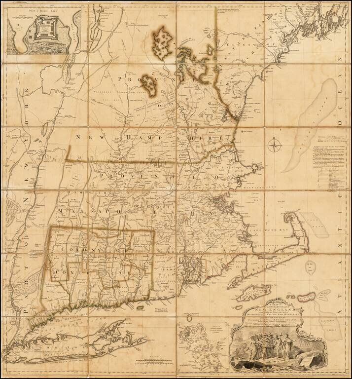
Rare separately issued example of the first edition, second state of Bradock Mead's remarkable large format map of New England & Long Island, the most important general map of the region issued during the French & Indian War. Bradock Mead's...
First state of Jeffery's map of New England and Nova Scotia, published by Thomas Jefferys in London. A finely executed map, extending south to Massachusetts and west to Montreal and Lake Champlain. The map incorporates information from other...
One of the earliest printed maps of the British Colonies to appear in a British Periodical. Detailed early map of the British & French Colonies in North America, extending from Long Island and the Hudson River to the St. Lawrence, Newfoundland...
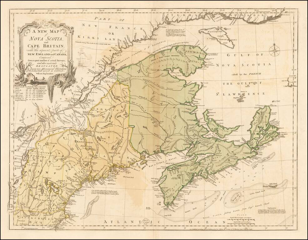
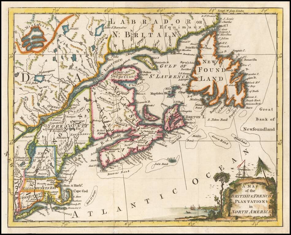
The French and British Historical Claims to Territory in the Canadian Maritimes and Maine, published in Paris on the eve of the Seven Years' War (1756-63). This truly fascinating and historically important map details the Acadia Boundary Dispute...
![Partie De L'Amerique Septent? Qui comprend La Nouvelle France ou Le Canada . . . [Large Great Lakes Inset]](/map/small/57758.jpg)
Decorative and highly detailed map of New England and Part of Canada, extending east to Newfoundland, with a large inset map of the Great Lakes. The large inset of the Great Lakes is based upon Bellin's map, and provides one of the best large format...
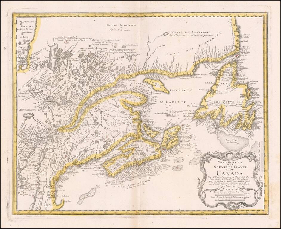
Nice example of the Homann Heirs edition of Bellin's map of New England and Eastern Canada. The map extends from Lake Ontario, the St. Lawrence River and Cape Cod in the South to Hudson Bay, Cape Rond and Newfoundland in the Northeast. A highly...
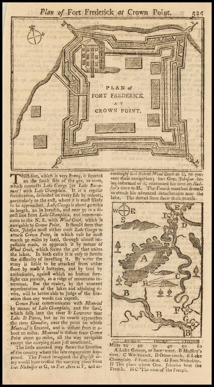
Detailed contemporary plan of Fort Frederick, issued at the outset of the French & Indian War. The map appeared in the November 1755 edition of the Gentleman's Magazine. The text describes the fort and the surrounding area, with a smaller map...

Detailed map of the Ohio Valley and regions to the East Nice example of Robert de Vaugondy's map of the Northern British Colonies, French interests to the North of the Great Lakes, and contested "Back Settlements," including a fine detailed treatment...
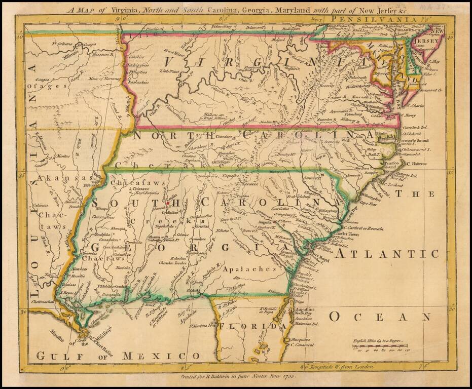
Scarce map of the Southeastern portion of the British Colonies, extending tothe Mississippi River and lower Missouri River, based upon John Mitchell's Map of the British Colonies, also issued in 1755. The map extends to West of the Mississippi River...
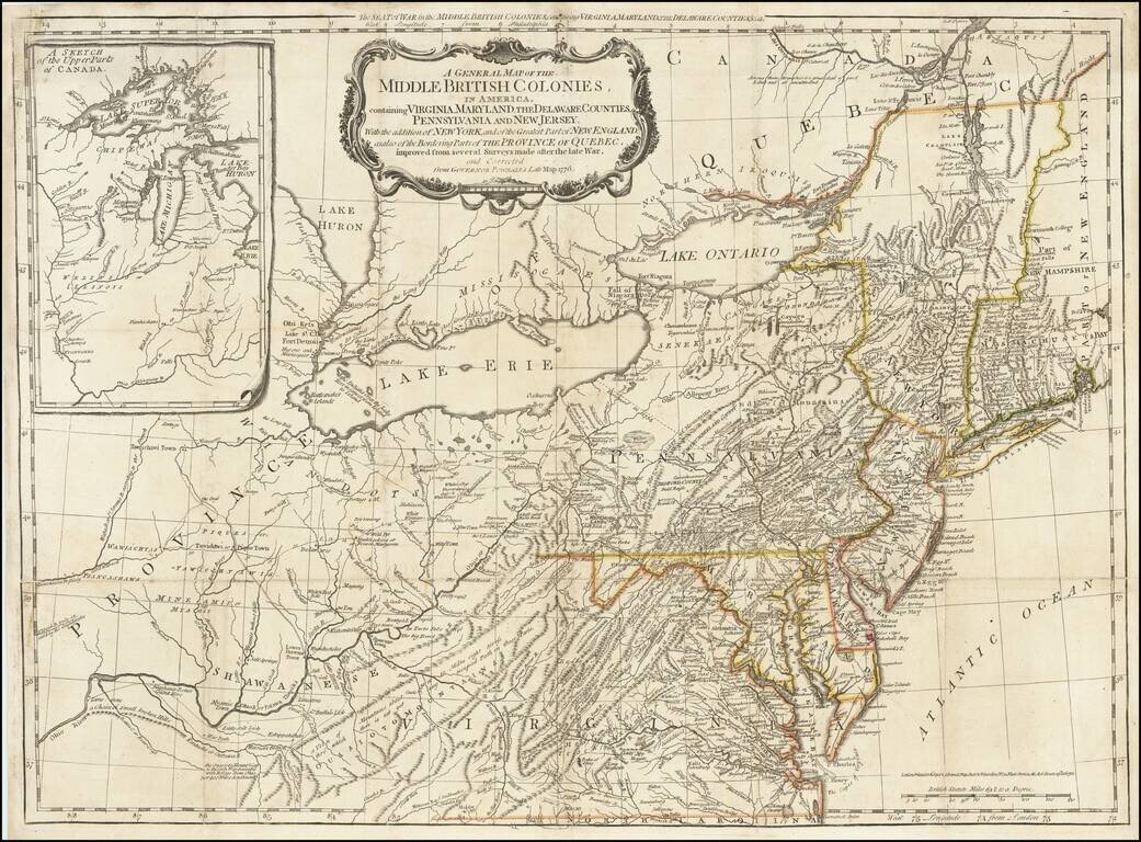
The scarce "Holster Atlas" edition of Lewis Evans' highly important map of the Middle British Colonies, at the start of the American Revolution. This edition of the map was prepared specifically for the American Military Pocket Atlas, an atlas...