Map size in jpg-format: 38.7115MiB
Click to open in high resolution (open in new tab).
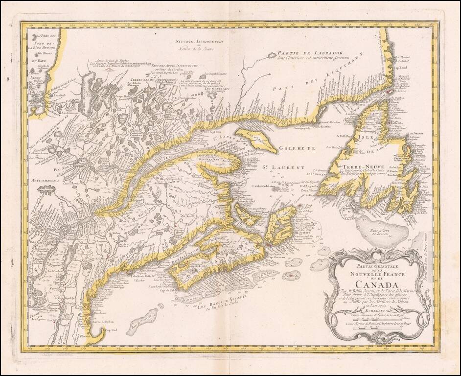
Nice example of the Homann Heirs edition of Bellin's map of New England and Eastern Canada.
The map extends from Lake Ontario, the St. Lawrence River and Cape Cod in the South to Hudson Bay, Cape Rond and Newfoundland in the Northeast.
A highly detailed and influential map, based upon primary sources.
Homann Heirs was a German publishing firm that enjoyed a major place in the European map market throughout the eighteenth century. Founded in 1702 by Johann Baptist Homann, the business passed to his son, Christoph, upon Johann’s death in 1724. Christoph died in 1730, aged only 27, and the firm was inherited by subsequent Homann heirs. This altered the name of the company, which was known as Homann Erben, or Homann heirs. The firm continued in business until 1848.
If you are a student, write to us in telegram: @antiquemaps and indicate what material you need and for what work you need a map in high detail. We are ready to provide material on special terms. For students only!
![[The First Maps in a la poupée Printed Color] Cartes en Couleur des Lieux Sujets aux tremblements de Terre Dans toutes les parties du Monde Selon le Sisteme de l’impulsion Solaire](/map/small/52293op.jpg)

