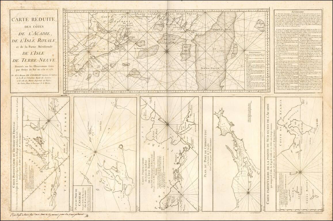
Large engraved mapsheet, comprising six inset maps related to the coast of Acadia and Ile Royale, published by Depot de la Marine in the mid-1750s. The maps are all credited to Mr. le Marquis de Chambert Capitaine des Vaisseaux.
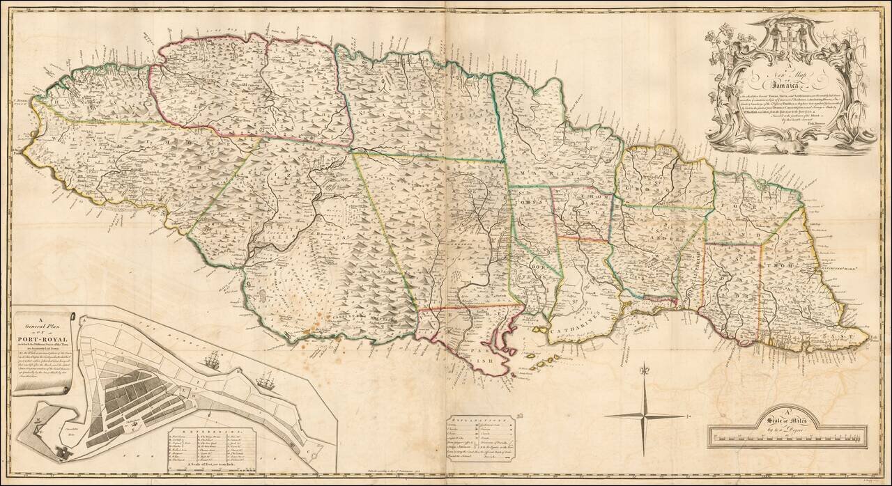
The true first state of the first large format Map of Jamaica. Fine 2-sheet map of Jamaica, published in London in 1755, engraved by J. Bayly. The present example is the first state of the "The first large-scale map of Jamaica." This large, dramatic...
![[Bermuda]](/map/small/62893.jpg)
Scarce map of Bermuda from the English Pilot, Fourth Book. Shows islands, bays and inlets, forts, navigational hazards, and a "Flemish Wreck." Includes wonderful text in English on the front and back, which includes a description of Bermudas or the...
![[London] Redriffe and Part of St. Mary Magdalens Parish Southwark Taken from ye Latest Survey with Corrections](/map/small/70290.jpg)
Decorative map of the Rotherhithe and Bermondsey sections of what is now greater London. Fine example of this map of a portion of London, from John Strype's re-issue of John Stow's Survey of London, originally, was published in 1598. Strype expanded...
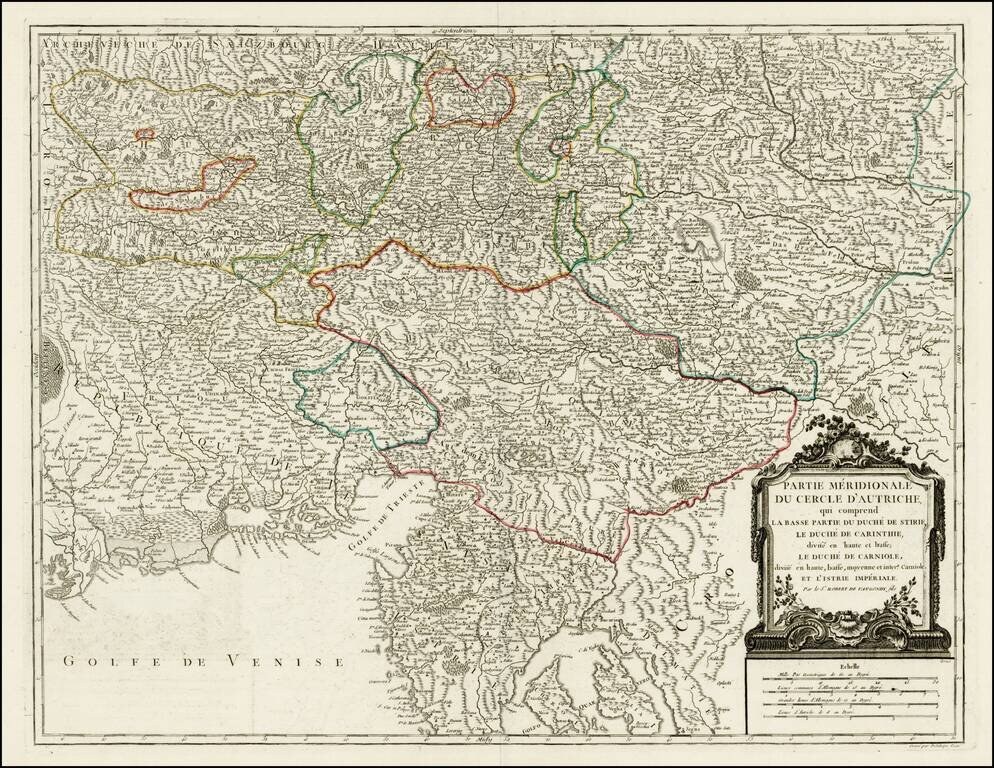
Detailed regional map of the region north of the Gulf of Venice, Istria, etc.. Shows the Southern portion of the Austrian Empire, from the Republic of Venice and the Gulf of Venice in the west to the Croatian Border. Shows Salzburg, Graz, Rijeka,...
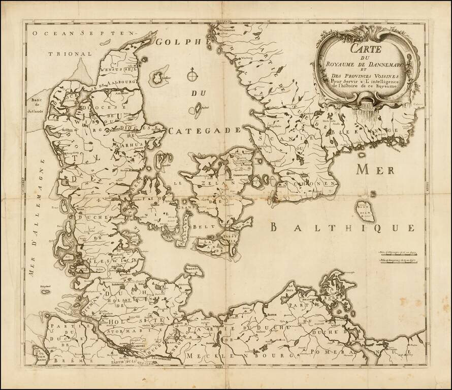
Scarce map of Denmark, published by O.H. de Lode in Copenhagen.
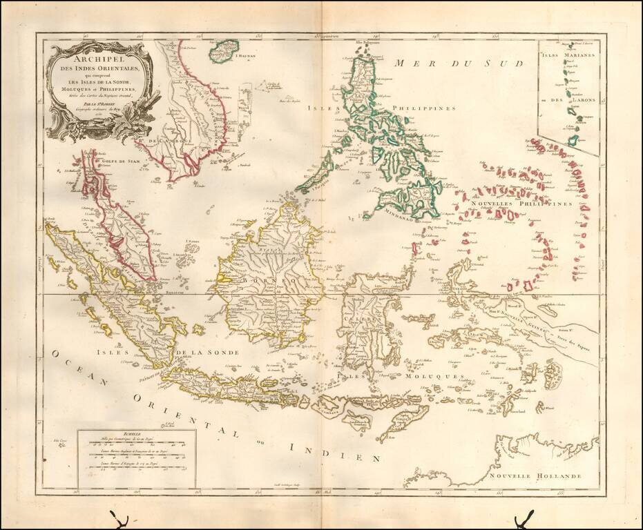
Striking and highly detailed map of the region from Sumatra and Malacca and Southern China to the Philippines, New Guinea and Northern Australia, centered on Borneo. Includes a large inset of the Marianas. Wonderful early detail, derived from the...
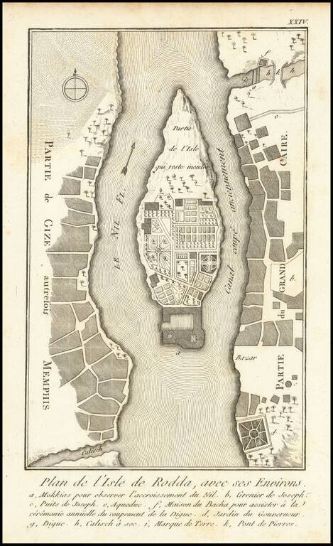
Antique engraved map of Roda Island in Cairo, Egypt. This map comes from the 1755 Copenhagen edition of Frederic Louis Norden's Voyage D'Egypte et de Nubie, in which it was plate 25. There are other editions of the map with different text settings...