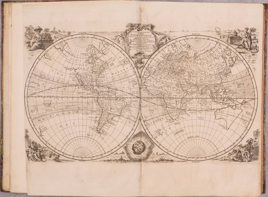
A wonderful example of this mid-18th century English atlas featuring a wide range of maps by Emanuel Bowen, published by him in London in 1752. Most of the maps feature Bowen's characteristic English Rococo cartouches and careful engraving. Perhaps...
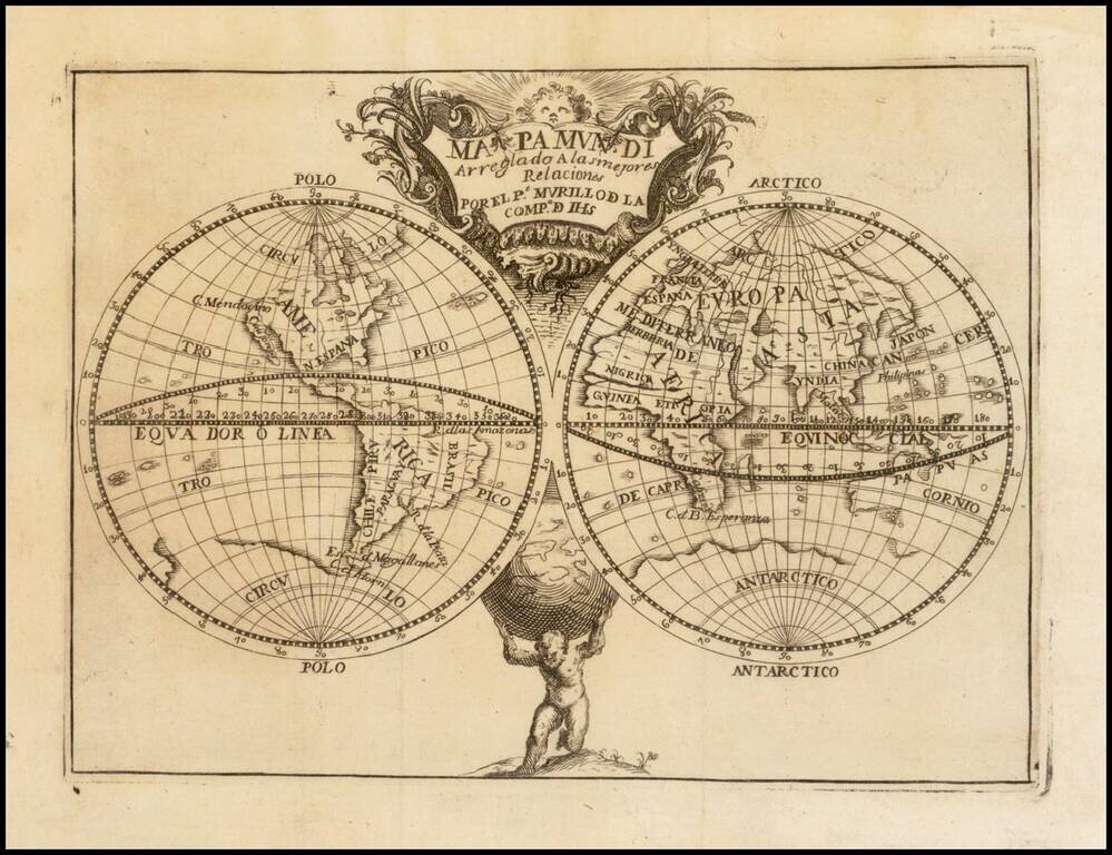
A Map of the World Naming the Philippines, by Murillo Velarde, the Greatest Mapmaker in Philippines History. Engraved map of the world by Murillo Velarde, issued as the world map in his magnum opus on historical geography: Geographia Historica......
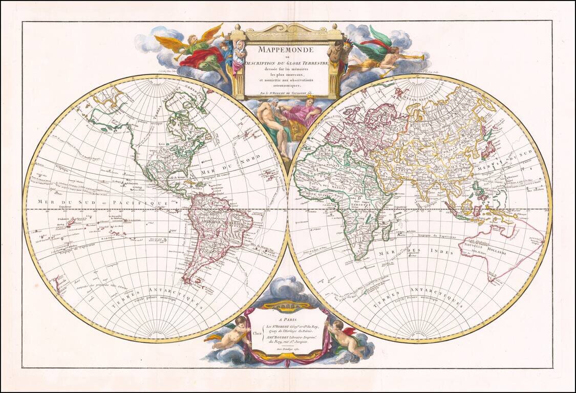
Striking Double Hemisphere Map of the World Showing the Latest Discoveries in the 1740s Fine large double hemisphere map of the world by renowned French mapmaker Gilles Robert de Vaugondy in 1752, first published in 1752. It shows the Anson...
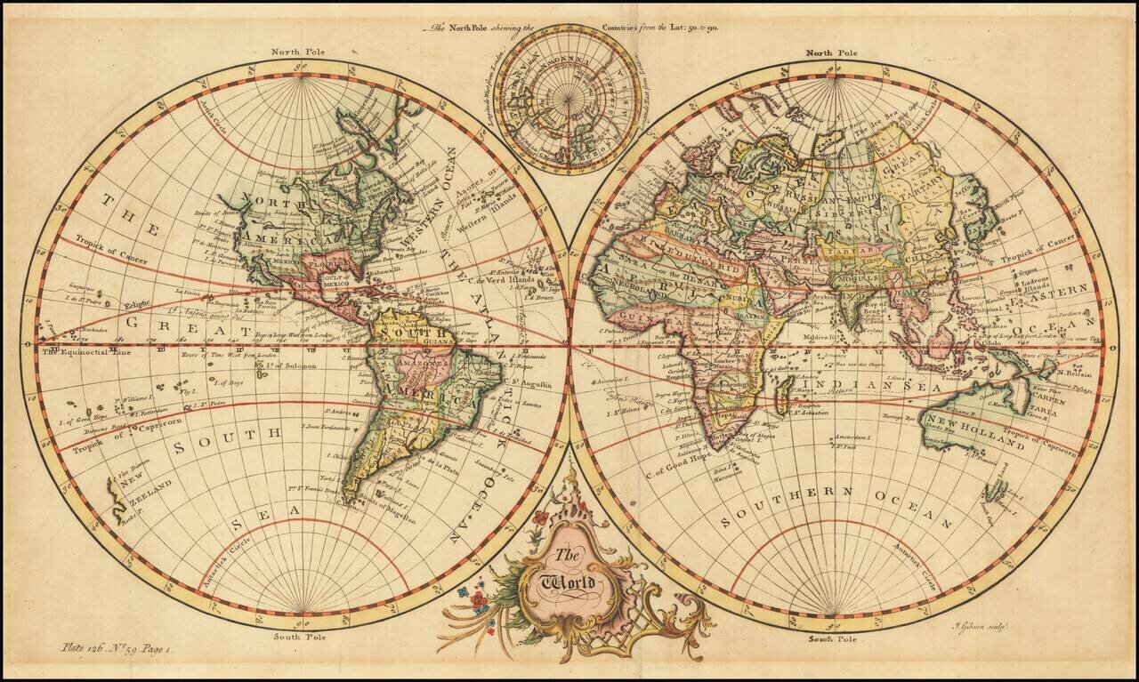
Fine Double-Hemisphere World Map Elegant world map, from Thomas Salmon’s Universall Traveller, and showing Anson’s circumnavigation track. The two hemispheres are set in a plain background. At bottom is a Baroque title cartouche. At top, nestled...
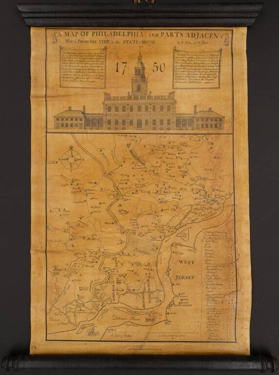
An Interesting Mid-Century Lithographic Edition of the Scull & Heap Philadelphia Interesting Wagner & McGuigan edition of Scull & Heap's seminal Philadelphia map. When first issued in 1752, the famous Scull and Heap plan was intended to...
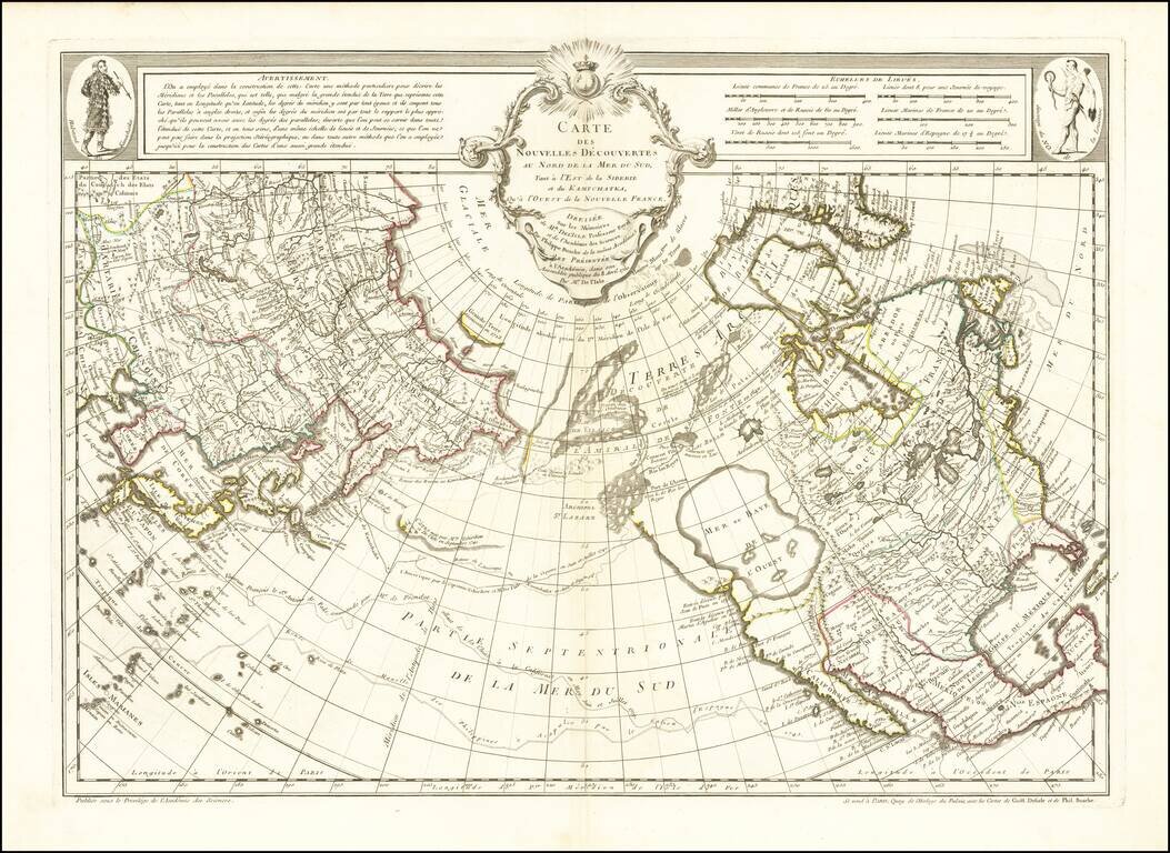
A Cartographic Landmark - The Most Complete Map of the North Pacific to Date and the Beginning of the Scientific Debate of the Sea of the West and Northwest Passage This is a fine example of a first edition of the landmark De L'Isle-Buache map of the...
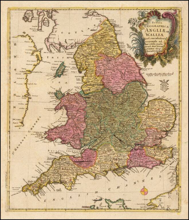
A nice example of this scarce map of England and Wales, published by the famous mathematician Leonard Von Euler. Decorative cartouce and privilege stamp below the cartouche. The map is quite scarce on the market.
![Italia in suos Status divisa et ex prototypo del Isliano desumta . . . [shows Sicily]](/map/small/69246.jpg)
Detailed map of Italy, Sicily, Corsica, Sardinia, etc., extending south to Malta and showing the Gulf of Venice and the contiguous Balkans. Includes a decorative cartouche.
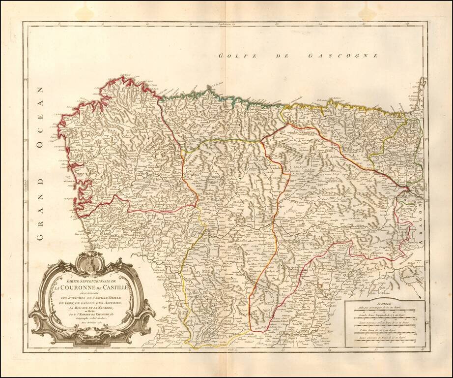
Decorative and highly detailed map of Northwestern Spain, including Biscaya, Gallicia, Leon, Asturias, Old Castille, and New Castille. A finely detailed map, with decorative cartouche.
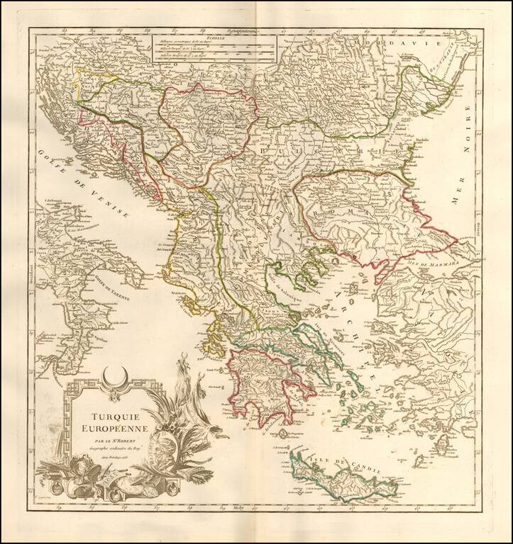
Detailed map of Greece, Romania and the neighboring regions, during the period when the region was still a port of the Ottoman Empire. Includes an elaborate title cartouche. From an early edition of De Vaugondy's Atlas Universel, one of the most...
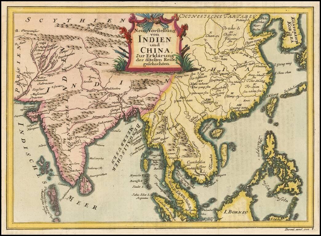
Rare regional map, extending from Korea and the Philippines to India and the Maldives. The map is apparently quite rare, as we can find no records for the map or its maker.
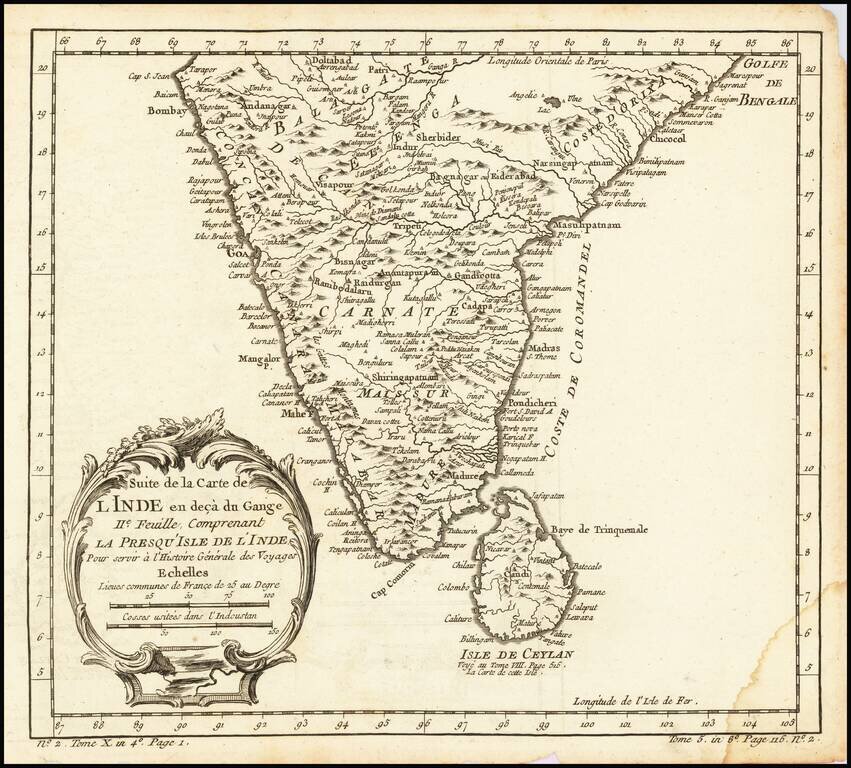
Interesting regional map of Southern India and Ceylon (Sri Lanka). A wonderfully detailed map. Includes a large decorative title cartouche. One of the maps produced by Nichlas Bellin for Prevost d'Exiles influential travel book, L'Histoire Generale...
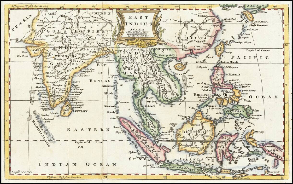
Excellent map of the region bounded by China in the northeast, the Timors and New Guinea in the Southeast, India, and the Maldives in the Southwest and Tibet and the Moguls Empire in the Northwest. Full of mid 18th Century regional names, and...