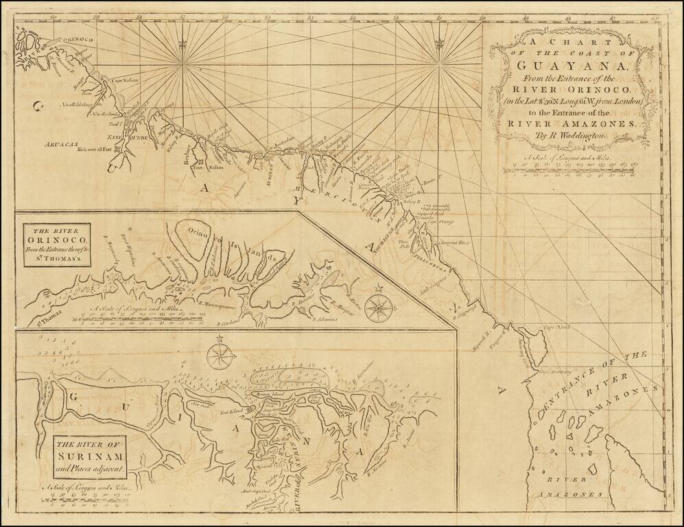
Scarce early English sea chart showing the coast of Guyana, with insets of the River Orinoco, published in London by Mount & Page. The map extends from the entrance thereof to St. Thomas, and the River of Surinam and places adjacent.
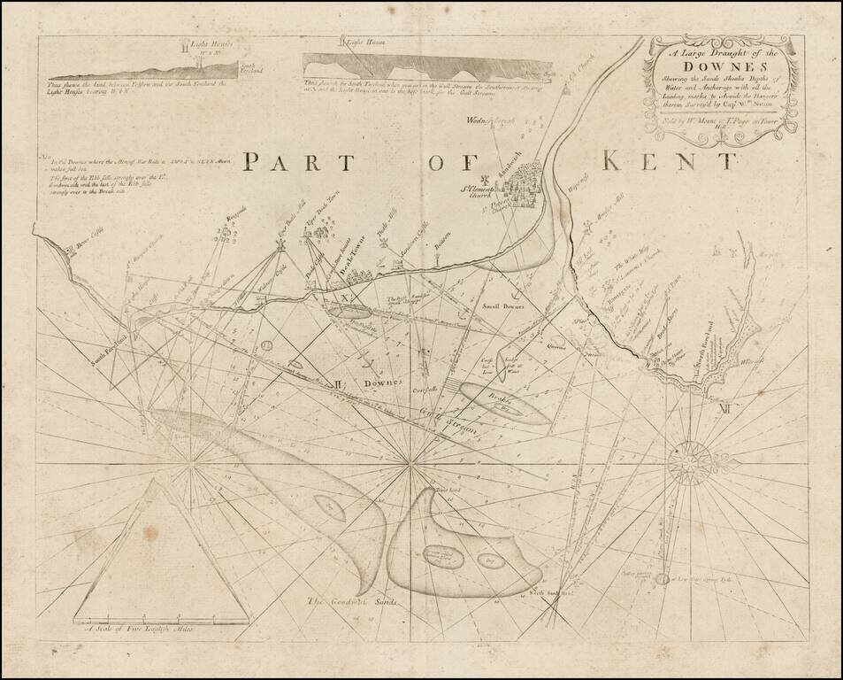
Detailed sea chart showing a portion of the Coast of Kent, from Dover Castle to North Foreland, published by Mount & Page. The chart shows leading marks to Sandwich, Deal and Ramsgate. It contains two coastal elevations and pictorial...
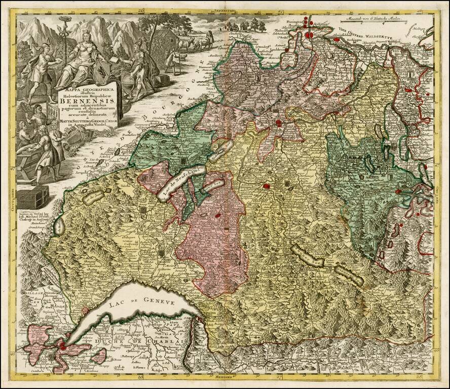
Decorative map of the Kanton of Bern and environs, extending to Geneva, Lucerne and Basel. Includes a decorative cartouche and a number of coat of arms within the map.
![[Untitled Map of Part of Switzerland in the area of Canton Berne and Terre de Saint Claude]](/map/small/29668.jpg)
One sheet of a larger map of part of Switzerland, probably covering the region south of the Canton of Berne. The map is centered on Terre De Saint Claude and shows the Bailliages' of Pontarlier, Salins, Quingey, Poligny, Arbois, Gex, Bugy, Saunier and...
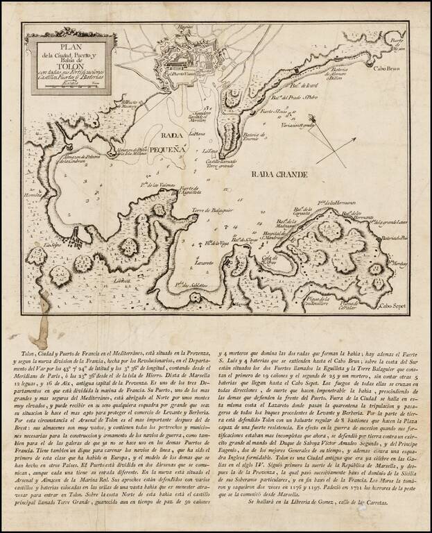
Rare Spanish broadside plan of the harbor, environs and military fortifications of Toulon, published by during the Siege of Toulon in 1793. This rare Spanish broadside depicts the Bay and Port of Toulon, one of the 3 major military ports of France. In...
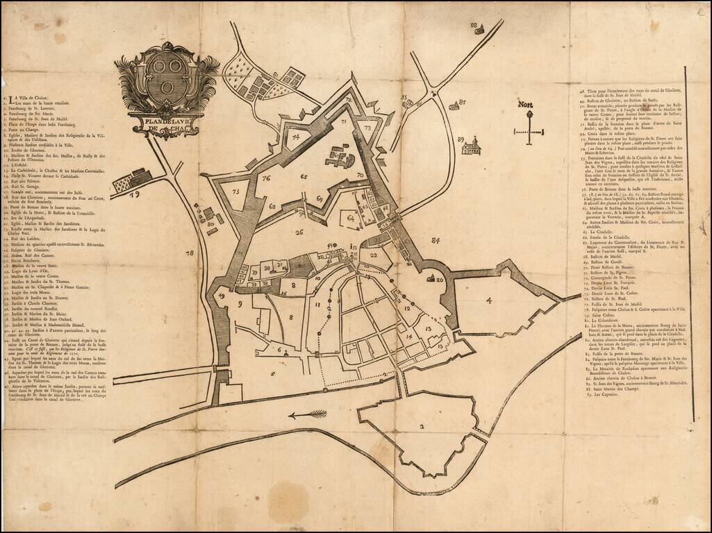
Fine early map of Chalone-sur-Saone, likely one of the earliest printed maps of the city. The map is surmounted by a large coat of arms above the title. Item #17 is Grande rue, anciennement rue des Juifs (Great street, formerly street of the Jews)....

Highly detailed map of the Alsace region, tracking the course of the Rhein from the Strassbourg area to just east of Landau. Large decorative cartouche.
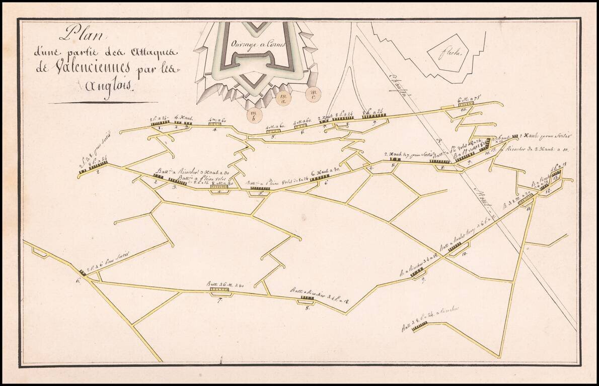
Finely illustrated manuscript plan illustrating the defenses and batteries around Valenciennes.
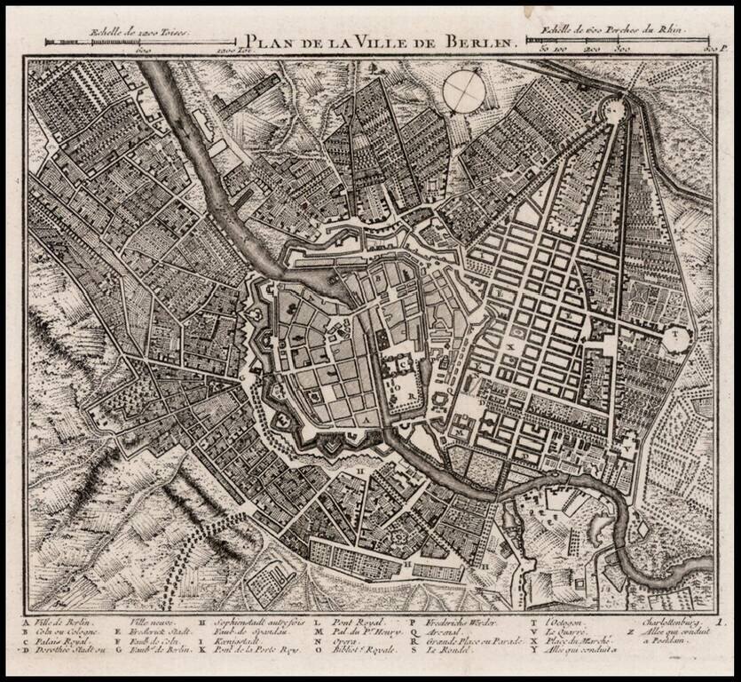
Detailed map of Berlin, with a key at the bottom showing approximately 25 place names.
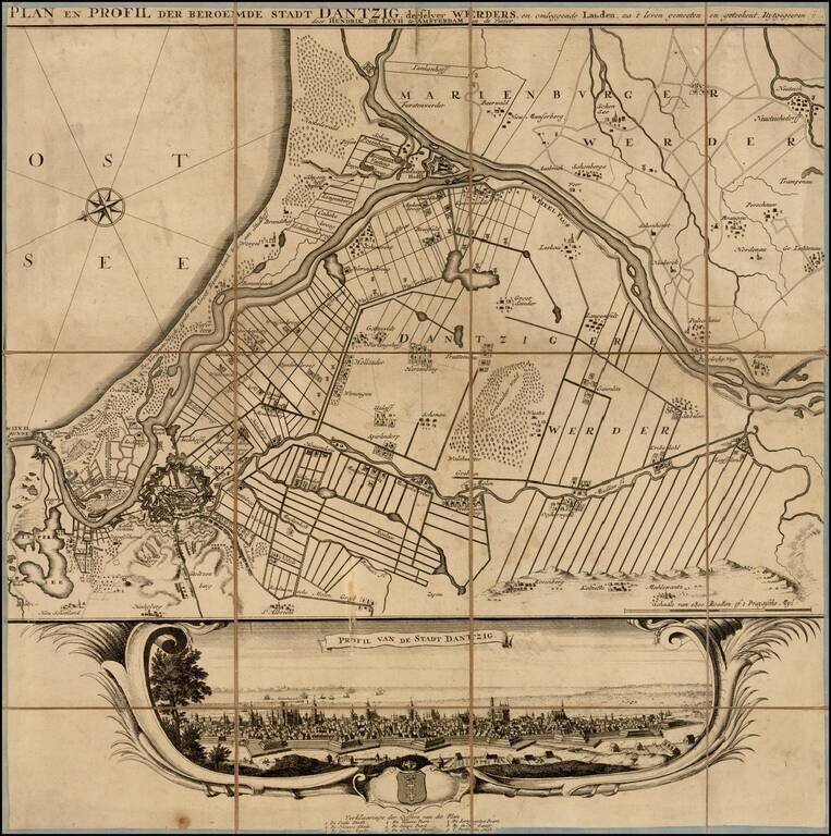
Rare plan and view of Dantzig (Gdansk) and neighboring regions, published in Amsterdam by Hendrik de Leth. Provides a final image of the town, including a coat of arms and key locating 9 places on the view. The view is quite rare, this being the...
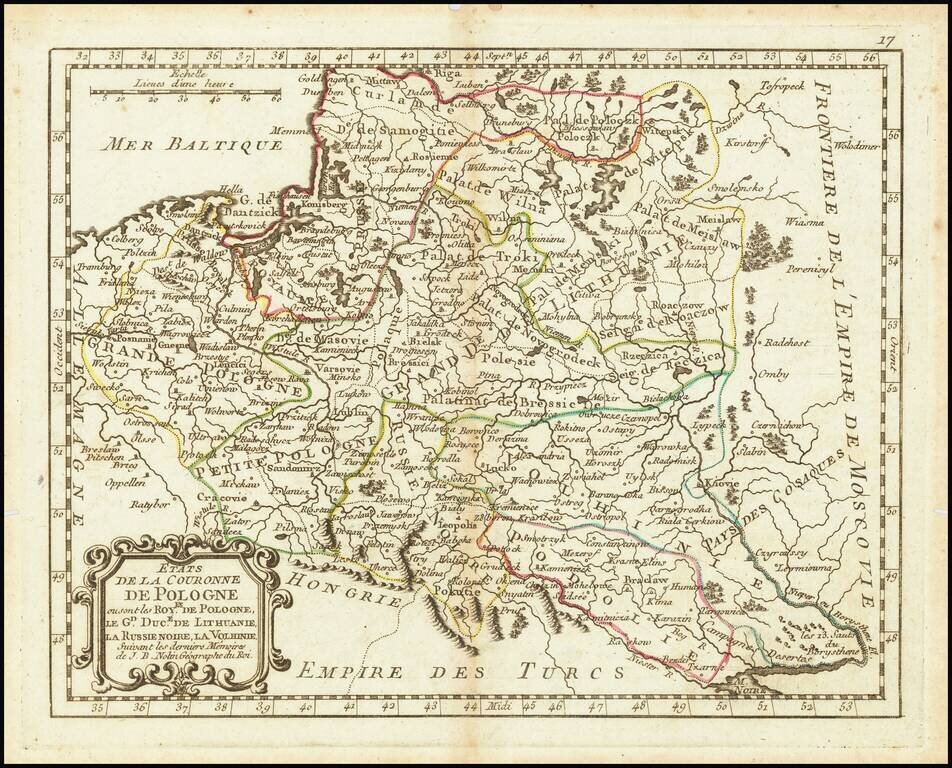
An attractive antique map of Poland showing the cities, rivers, lakes, and forests of the region during the commonwealth with the Grand Duchy of Lithuania. The various regions are demarcated and named, including Black Russia, Podolia, Volhynia, Greater...
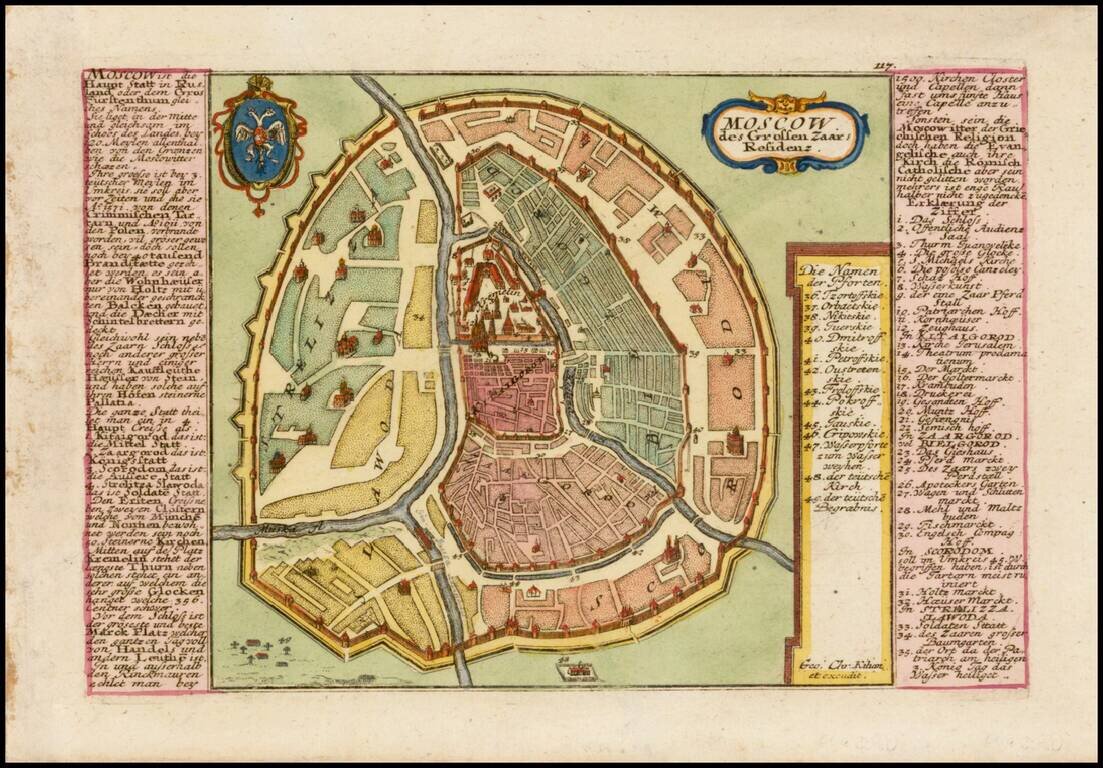
Finely detailed plan of Moscow, with extensive keys on either side of the map, identifying important places. Includes title cartouche and coat of arms.
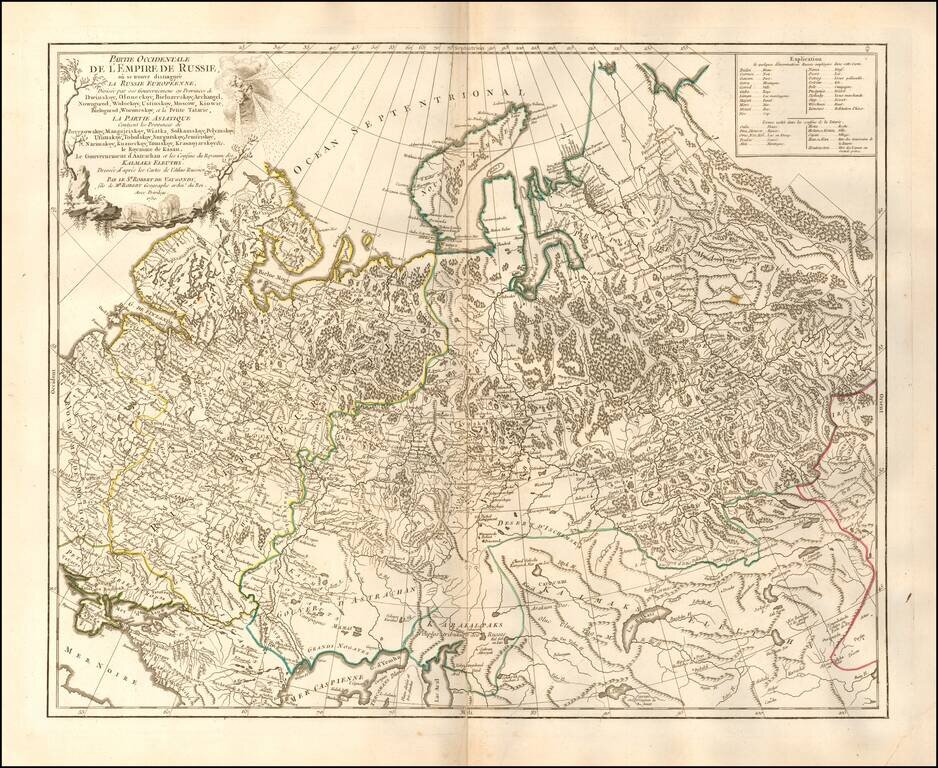
Highly detailed map of the Western Part of Russia, extending South to the Caspian and East to Irkurkoy and Ilimskoy.
![Plan Des [Ersten?] und Lezten Theil Der Affeire Des Feldmarschal Konigseg in Tyrol](/map/small/51959.jpg)
Attractive 18th-century manuscript map in ink and watercolor. The map proclaims to show the first and last parts of the action of "Fieldmarschal Konigseg" in Tyrol. That being said, the map seems largely imaginary. The Brenta River is certainly real,...
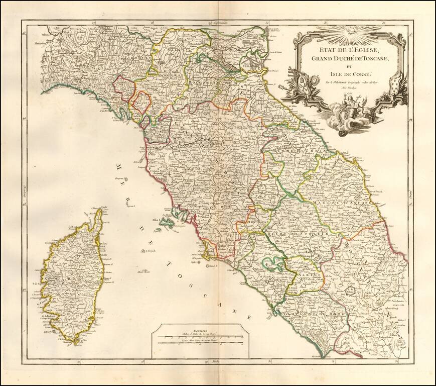
Interesting regional map of Central Italy, Tuscany and Corsica, from an early edition of DeVaugondy's Atlas Universel. Includes towns, mountains, rivers, lakes and a host of other details. De Vaugondy's Atlas Universel was one of the most...
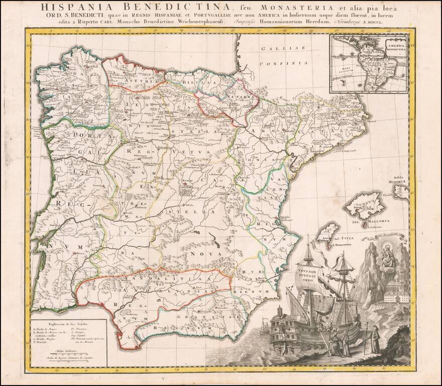
Interesting and highly decorative map of Spain and Portugal, with a large inset of Central and South America. The map illustrates the various Benedictine Monasteries on the Iberian Peninsula and in South America.