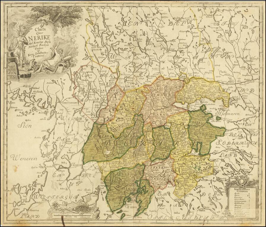
Antique engraved map of the historical Swedish province of Nerike, in central Sweden east of Lake Vanern. Wonderful allegorical cartouche featuring the arms of Nerike (or Nericia or Närke) on a rock. The internal boundaries of the province are...
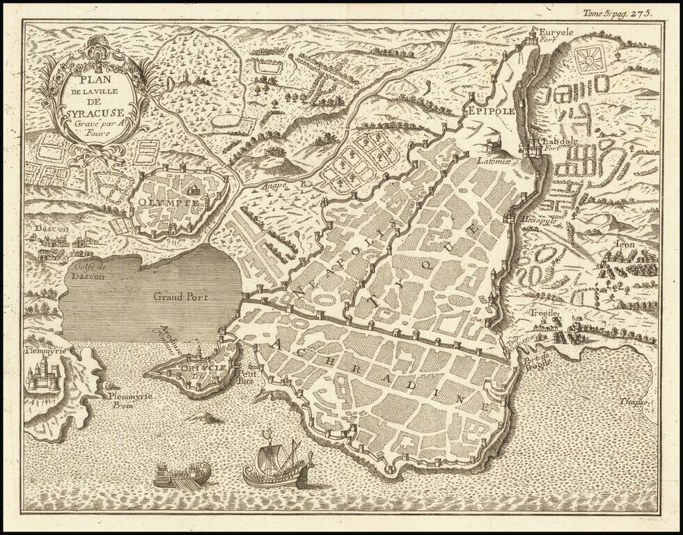
Interesting mid-18th Century plan of Syracuse in southeastern Sicily.
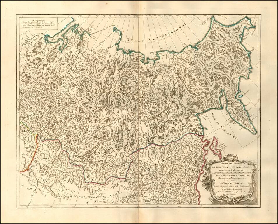
Fascinating and attractive map of the Northeastern portion of Asia, including Russia, China, the Gobi Desert, etc. Includes cities, villages, rivers, mountain ranges and various coastal islands.
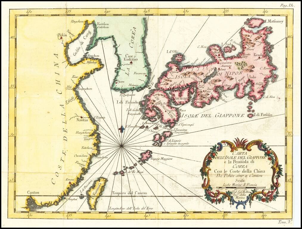
Italian edition of Bellin's regional map, showing Japan, the Korean Peninsula and China, including Canton and the Island of Formosa. Decorative cartouche and Rhumb lines.
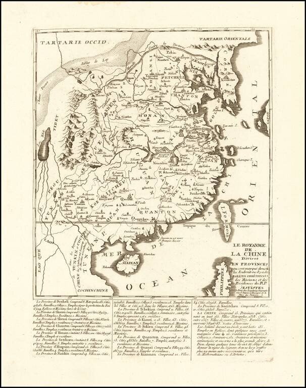
An Unrecorded Jesuit Map of China Rare Jesuit map of China, published in Paris by Longchamps. The map gives extensive details regarding China's provinces, major cities, families, colleges, temples, churches and Missions. The ending note discusses the...
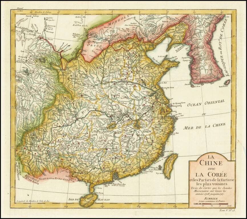
Detailed map of China and Korea, based upon the reports of Jesuit Missionaries between 1708 and 1717.
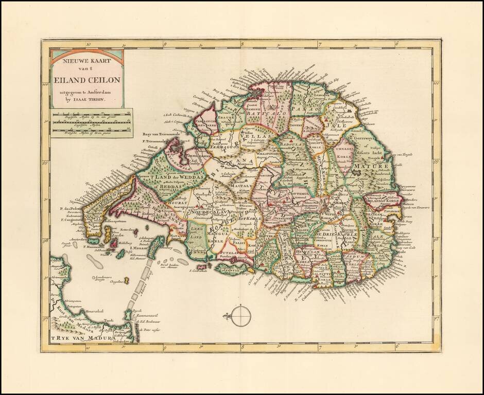
Striking example of Issak Tirion's map of Sri Lanka. Excellent and highly detailed map for the period.
![[Fort Gingee & The Great Mountain of Gingee]](/map/small/58792.jpg)
Detailed plan of "The Great Mountain of Gingee" and the small fort atop it, published by Thomas Kitchin. The explanatory note continues that 10 men were sufficient to defend the fort against assaults. The key locates a total of 12 places on the map....
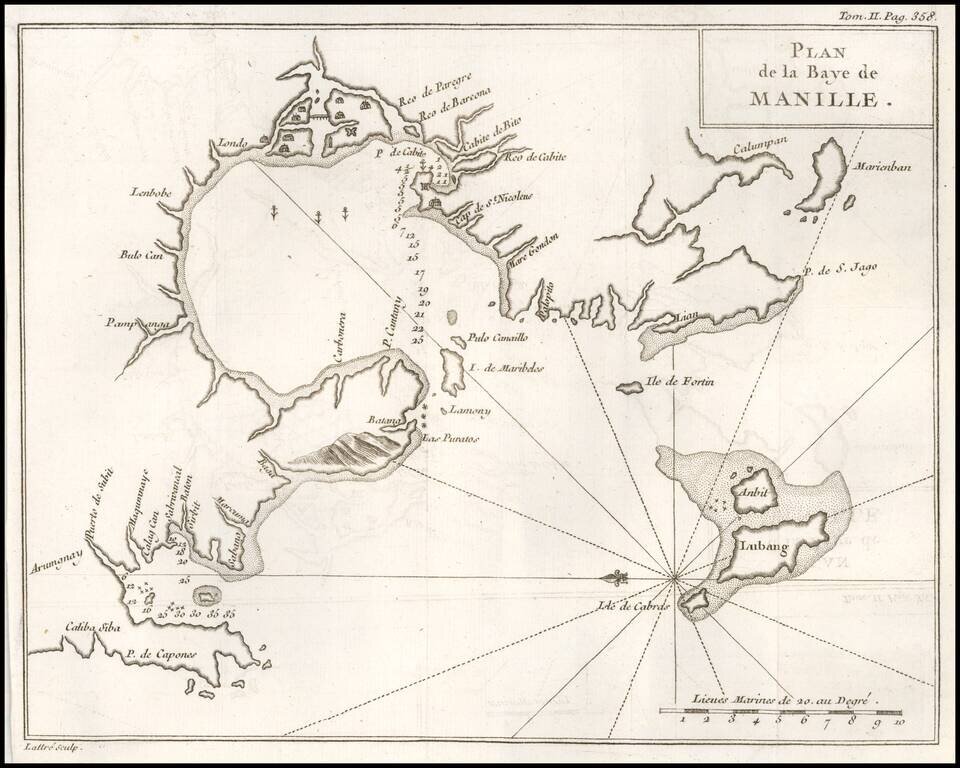
One of the Earliest Obtainable Plans of Manilla Bay. Detailed chart of Manilla Bay and environs, including placenames, soundings, etc. From a French edition of Anson's Voyages. One of the best maps of Manilla Bay from the period.
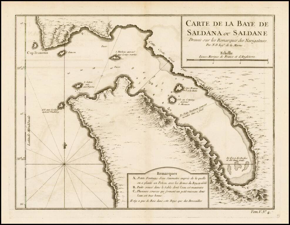
Detailed plan of Saldanha Bay, northwest of Cape Town In South Africa, published by Bellin, the Royal Hydrographer to the King of France.
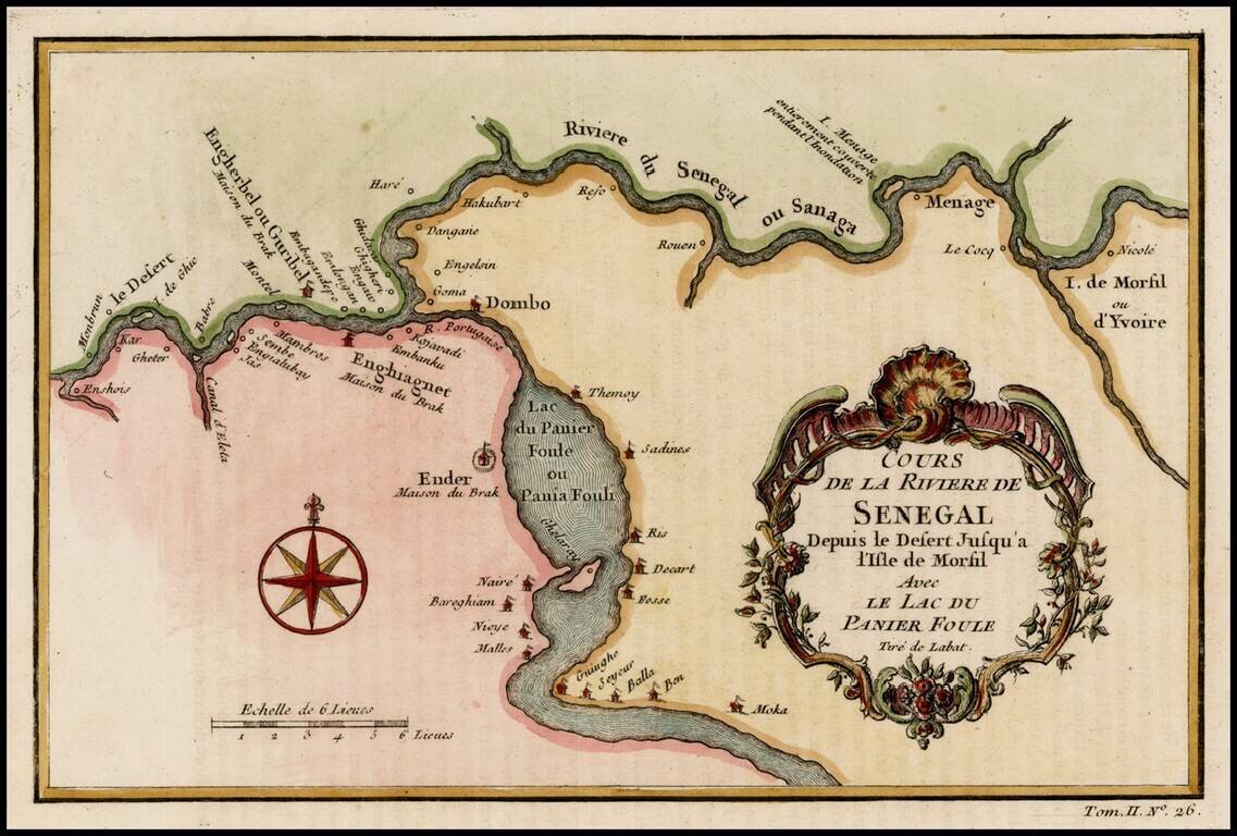
Detailed map of a part of the Senegal River, published by Bellin in Paris.
![[Hydra, Corvus and the Crater]](/map/small/43407.jpg)
Rare separately issued star chart of the Constellations Hydra, Corvus and the Crater, from John Bevis' Celestial Atlas. John Bevis was an Oxford trained physician and amateur astronomer, who is perhaps best known for his discovery of the Crab Nebula...
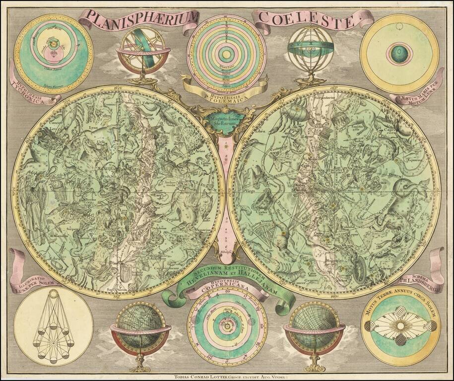
Striking Eighteenth-Century Map of the Stars Fine old-color example of Conrad Lotter's decorative double polar-hemisphere celestial chart. The large hemispheres show the constellations visible in the northern and southern hemispheres. Each circle is...
![[A Complete Set of the 12 Signs of the Zodiac]](/map/small/68796.jpg)
Complete Set of Bevis Star Charts of the Signs of the Zodiac in Early Color Quite possibly the only surviving separately published set of 12 star charts of the signs of the Zodiac, published by John Bevis. These extremely charts were compiled by...