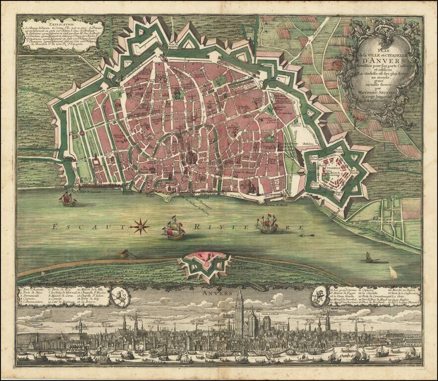
Fine old color example of Seutter's decorative and highly detailed plan of Antwerp, with a striking view of the City below. A fine dark impression.
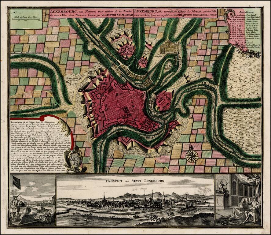
Fine old color example of Seutter's decorative and highly detailed plan of Luxemburg, with a striking view of the City below. The view below the map shows the city and two military views to the left and right of the main prospect of the City.
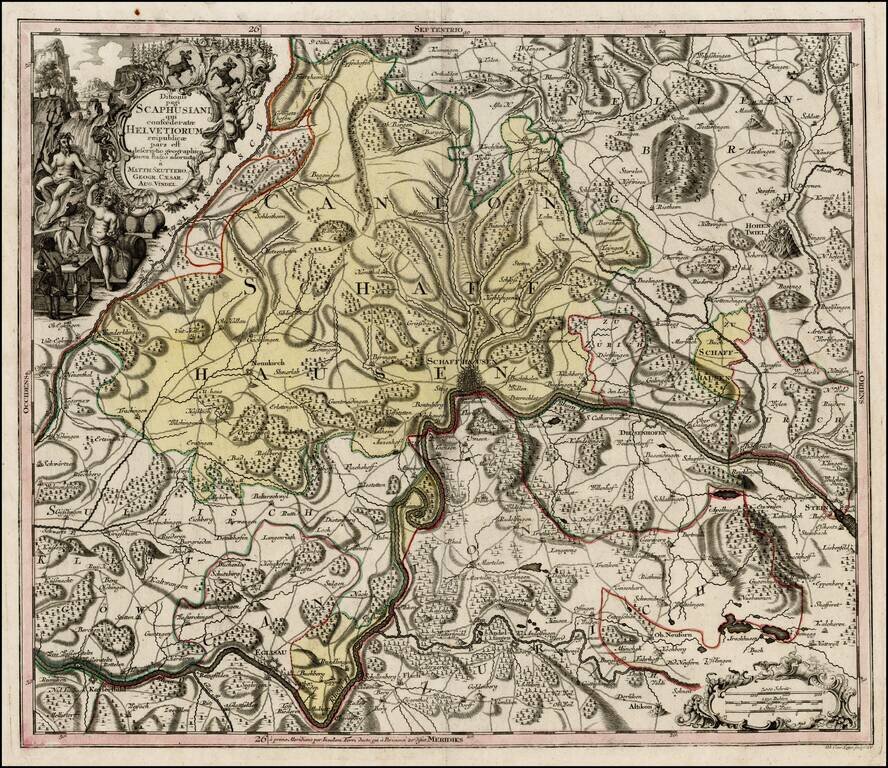
Nice example of Seutter's map of the area around Schffhausen on the Rhein River. One of a series of finely engraved regional maps of Switzerland produced by Seutter. Includes fine details, including towns, roads, rivers, mountains, castles, forests,...
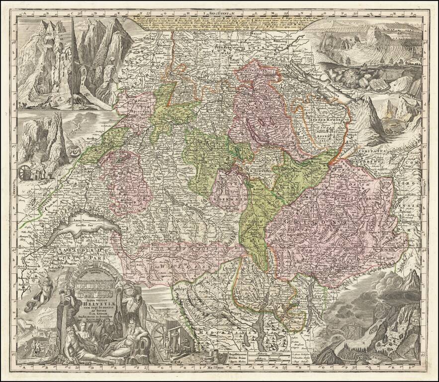
Striking and highly detailed map of Switzerland, with 8 elaborate vignettes and title cartouche. The vignettes show scenes of various mountains and rivers and other scenes, most notably a flying dragon. Includes the coats of arms of each of the...
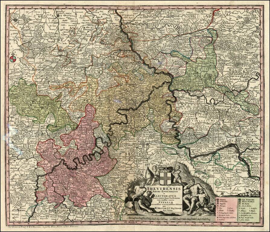
Decorative map of the Moselle & Rhine River Valleys. Includes a decorative cartouche.
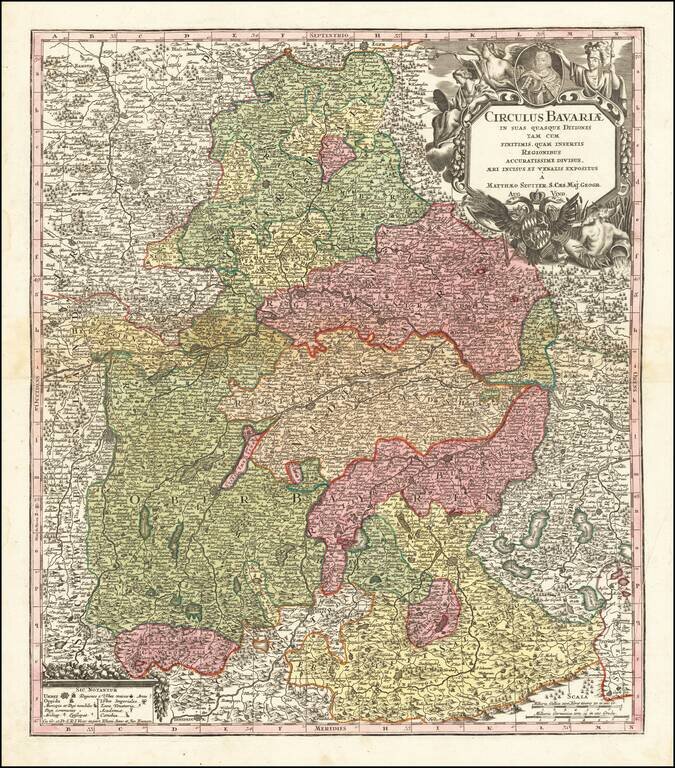
Detailed map of Bavaria, published in Augsburg by Seutter. The map extends from Obere Phaltz, Ober Bayern, Ertzstift Saltzburg, Burkhausen, Stift Passau, Freisingische Gr. Werdenfels, Hertzogt Neuberg, Pfalz Neuberg and a number of other German...
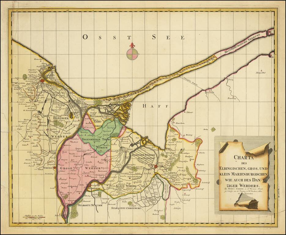
Scarce regional map of the area including Danzig, Elbang and Marienburg (Malbork), published in Amsterdam by Peter Schenk.
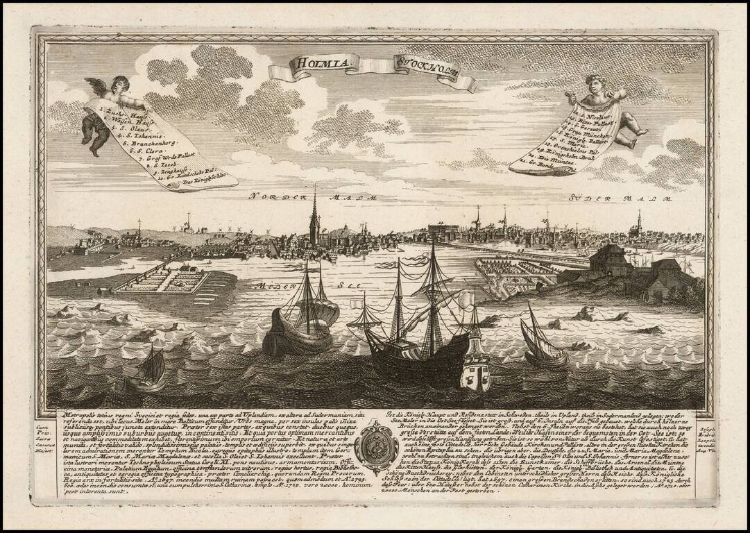
Rare view of Stockholm published by J.F. Leopold, in Augsburg, in 1730. The view includes a coat of arms and extensive description of the city in Latin and German. This is the first example we have offered in over 20 years.
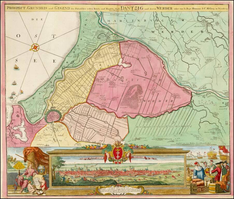
Striking example of Homann's map of Dantzig (Gdansk) and neighboring regions and striking birdseye view, major port to the Baltic Ocean, which for centuries was an important trading center for the Polish, Prussian, German and Baltic regions whose...
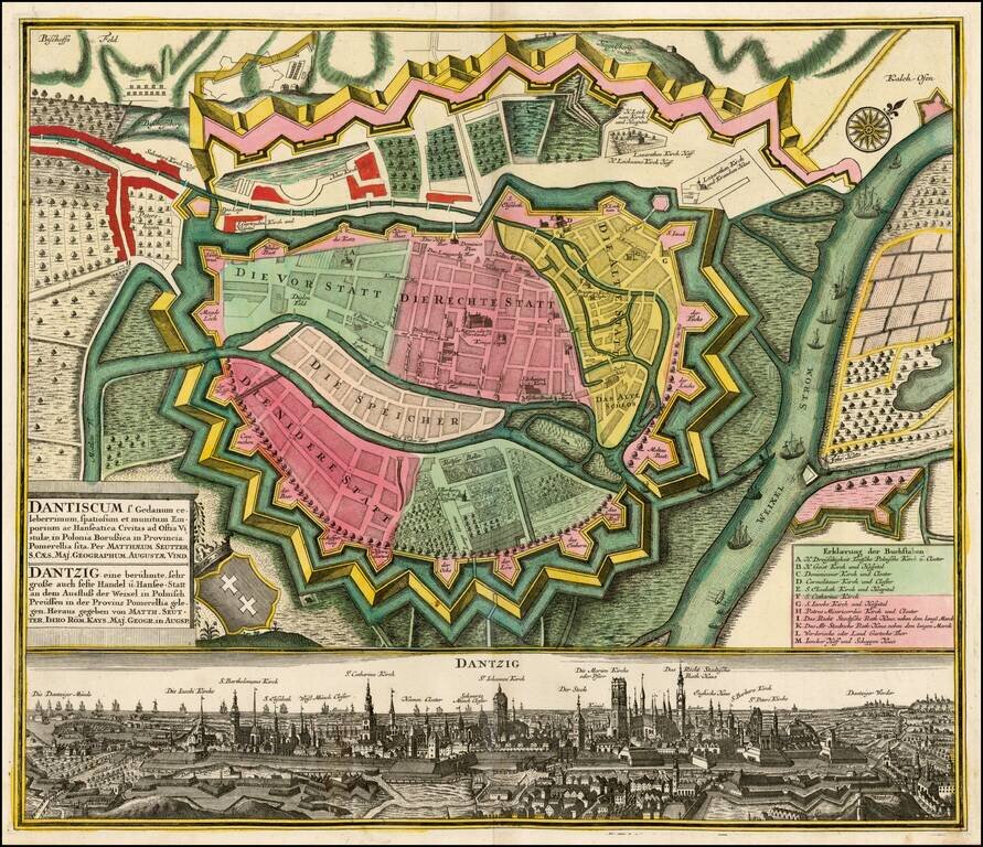
Fine example of Seutter's plan and birdseye view of Dantzig. The plan shows the fortifications of the town, streets, buildings and other points of interest. At the bottom is a fantastic view of the city.
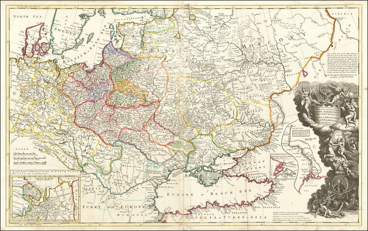
Striking large format map of Russia, Ukraine, Poland, Finland and the Baltic Countries and extending south to the Black Sea and the Balkans, with an ornate dedication cartouche to Peter the Great, including a portrait of the Czar near the bottom of the...
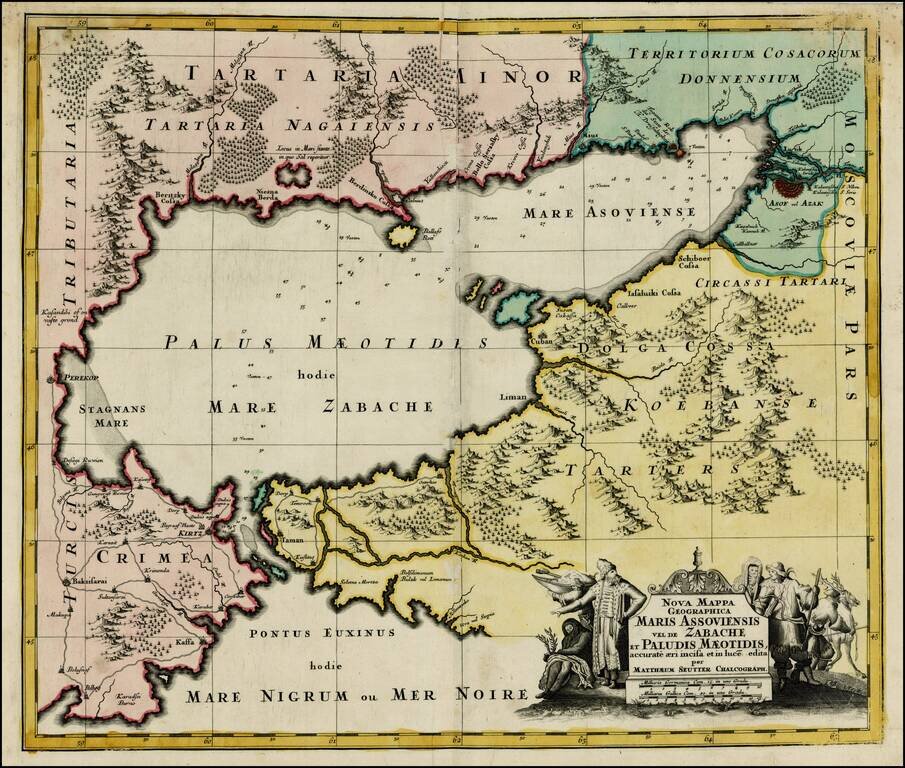
Striking map of the Sea of Azov and the surrounding regions, with a decorative allegorical cartouche, showing the costumes of the indigenous people of the region.
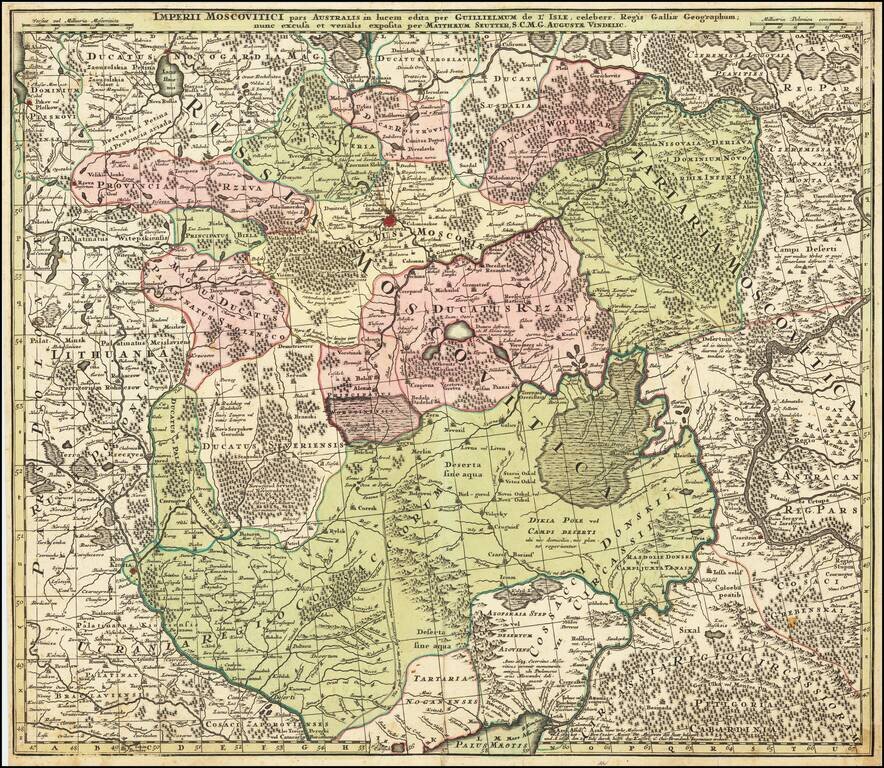
Centered on Moscow Detailed map of Southern Russia, including the Ukraine, Cosack Regions and the Southern part of Moscovie. Includes towns, roads, rivers, lakes, mountains, castles, forests and other details.
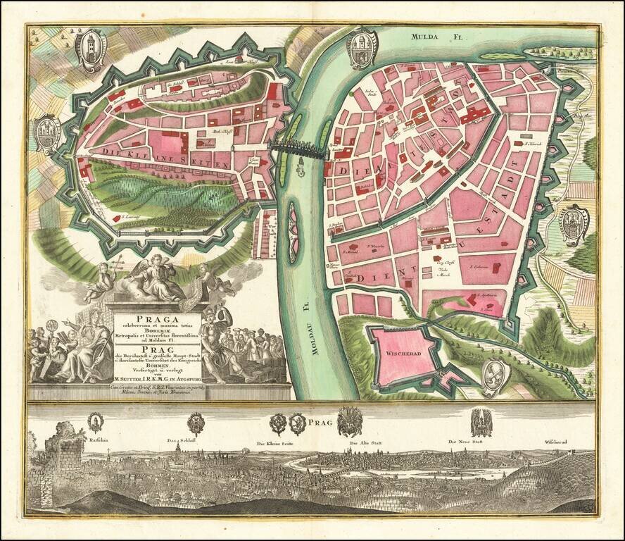
Fine example of Seutter's decorative and highly detailed plan of Prague, with a striking view of the city below. The map shows the city divided into three neighborhoods, the "small," "old," and "new" cities. Fields and Vysehard Cemetary surround the...
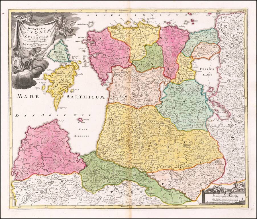
Early Map of Estonia and Latvia Nice example Homann's map of the northern Baltic region, published in Nuremberg. The cartouche shows Homann's "Cum Privilegio, S.C.M, placing the date of the map in or shortly after 1730 Fine dark impression.
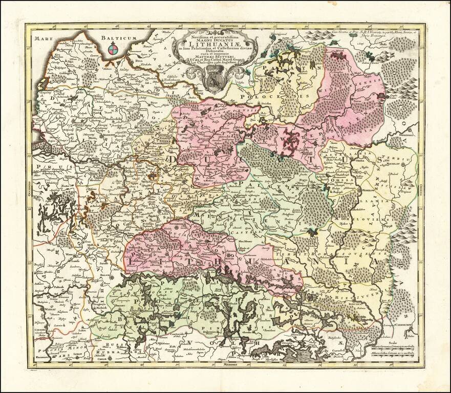
Second State of Seutter's map of Lithuania, extending from the Baltic (Riga) to Palatinat Polesia Bressicenis in the south. A highly detailed map of Lithuania, showing towns, castles, Palatinates, rivers, lakes, forests, etc. There are 3 states of...