Map size in jpg-format: 69.2217MiB
Click to open in high resolution (open in new tab).

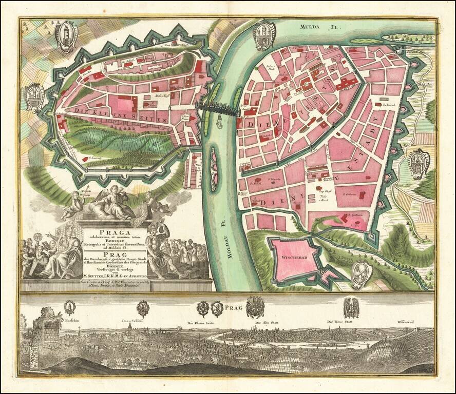
Fine example of Seutter's decorative and highly detailed plan of Prague, with a striking view of the city below. The map shows the city divided into three neighborhoods, the "small," "old," and "new" cities. Fields and Vysehard Cemetary surround the city. The Vltava is denoted by its German name of Moldau. Many other features are drawn and noted, including the Charles Bridge.
The panorama depicts the various neighborhoods and features noted above. Prague Castle and the Ratschin (castle district) are shown. The significance of the ruins in the foreground is unclear and may relate to something in the present day vicinity of Petrin Tower.
The map includes 5 coats of arms, the view includes 6 coats of arms. This includes the coat of arms of the city with three towers on a shield.
If you are a student, write to us in telegram: @antiquemaps and indicate what material you need and for what work you need a map in high detail. We are ready to provide material on special terms. For students only!