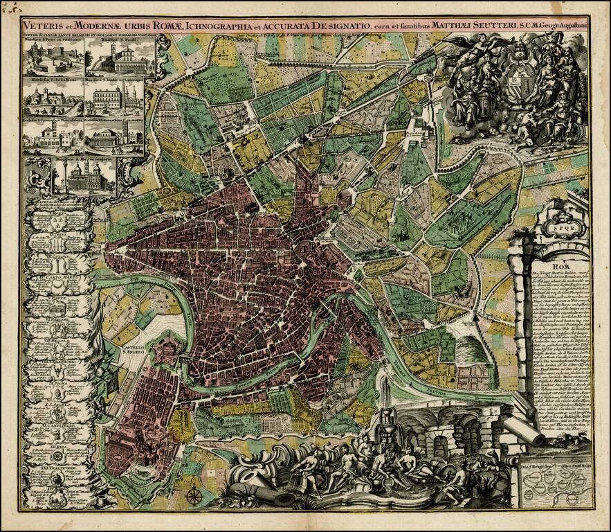
Decorative plan of Rome by Seutter, one of the most prolific printers of town plans in Germany during the 18th Century. The plan includes ichnographic representations of a number of the major buildings and structures of ancient and modern Rome, along...
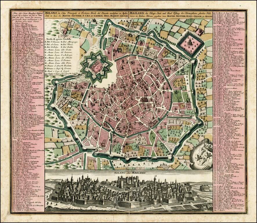
Fine old color example of Seutter's decorative and highly detailed plan of Milan, with a striking view of the City below. The view below the map shows the city atop a hill, with the fortifications in the foreground.
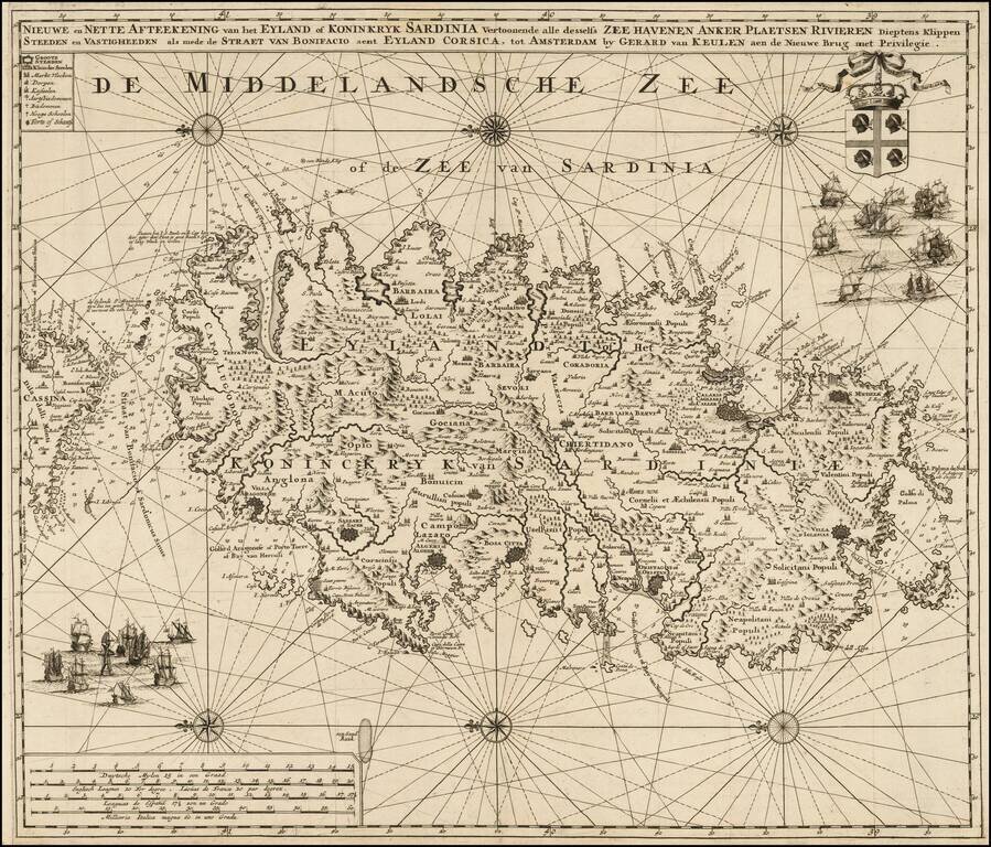
Highly detailed large format sea chart of Sardinia, including multiple sailing ships, compass roses, decorative cartouche, coat of arms, etc. Rare and decorative sea chart of Sardinia oriented to the East, which rarely appears on the market and even...
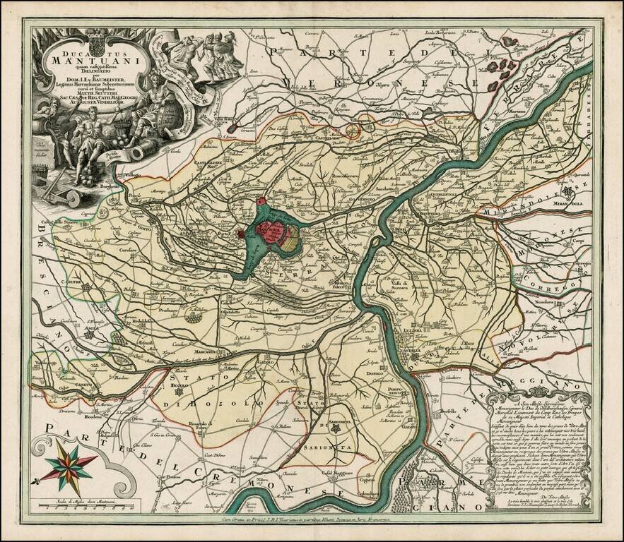
Fine full color example of this scarce decorative map, with Mantua at the center. Includes a decorative allegorical cartouche showing the history of the region, coat of arms and compass rose.
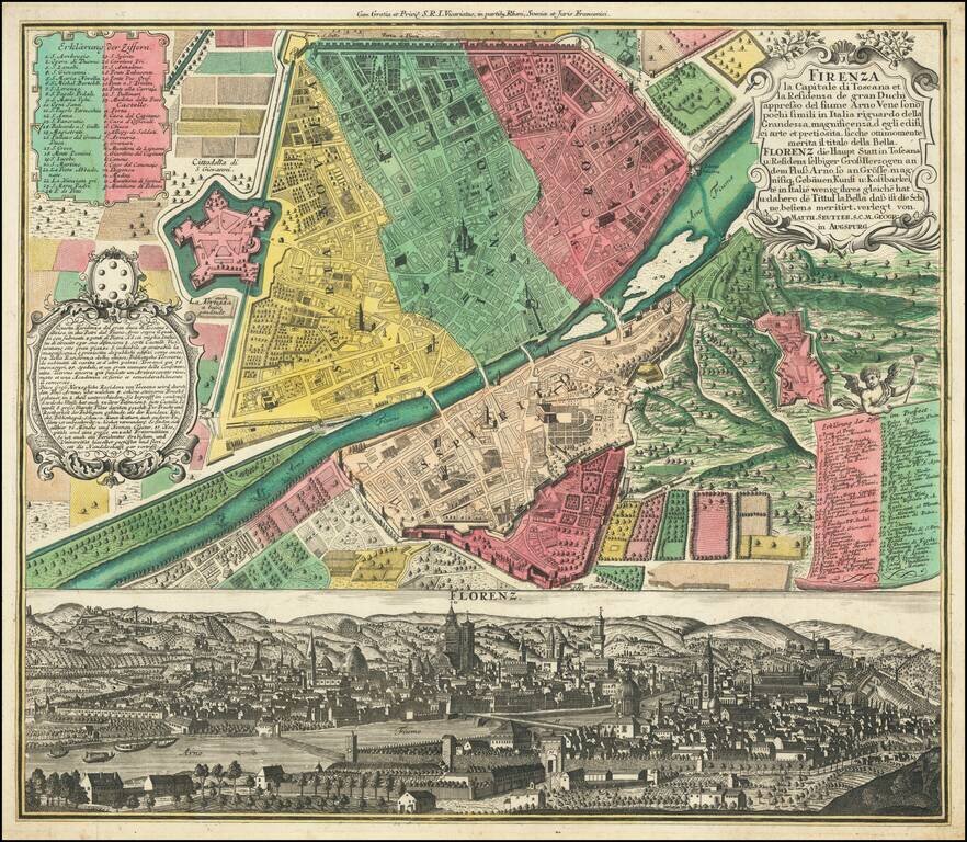
Fine old color example of Seutter's decorative and highly detailed plan of Florence, with a striking view of the City below. The view below the map shows the city from the far side of the Arno, with the Duomo in the center.
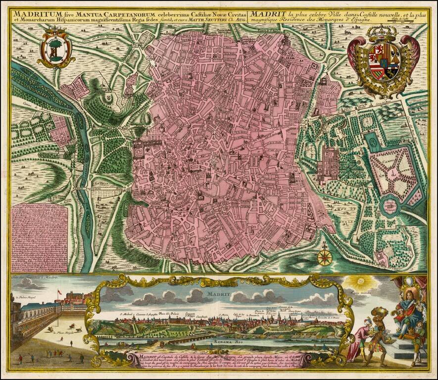
Fine old color example of Seutter's decorative and highly detailed plan of Madrid, with a striking view of the City below. The map includes 2 coats of arms, and a unique view of the City from across the Xarama River, set within a scene on the palace...
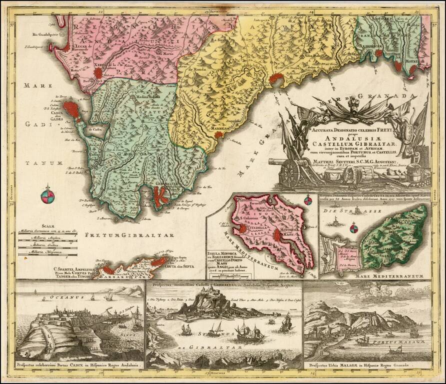
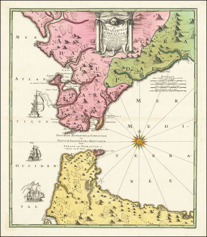
Decorative regional map of the southern parts of Spain, with large inset maps of Minorca, Ceuta, Cadiz, Gibralter and Malaga.
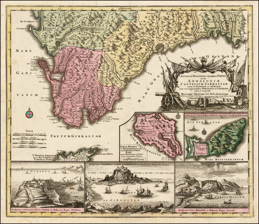
Decorative regional map of the southern parts of Spain, with large inset maps of Minorca, Ceuta, Cadiz, Gibralter and Malaga.
![[Barcelona] Barcino Metropolis Hispanici Principatus Cataloniae in littore Maris Mediterranei, perquam munita, et ab portus como ditatem celeberrimum Emporium cura Impensis . . .](/map/small/58971.jpg)
Fine old color map and view of Barcelona and environs, published by Seutter in Augsburg. At the top, a map-like view of the fortified town and harbor of Barcelona is shown, with a second set of walls on Montjuic (called Mont Juif on the map). Below...
Decorative Johann Baptist Homann engraved map of Strait of Gibraltar, including southern Spain and the northern tip of Morocco, showing Gibraltar, Cadiz, Malaga, Marbella, Algezira, Tetuan, Ceuta, Tangiers, Larache, etc. Highly detailed regional map,...
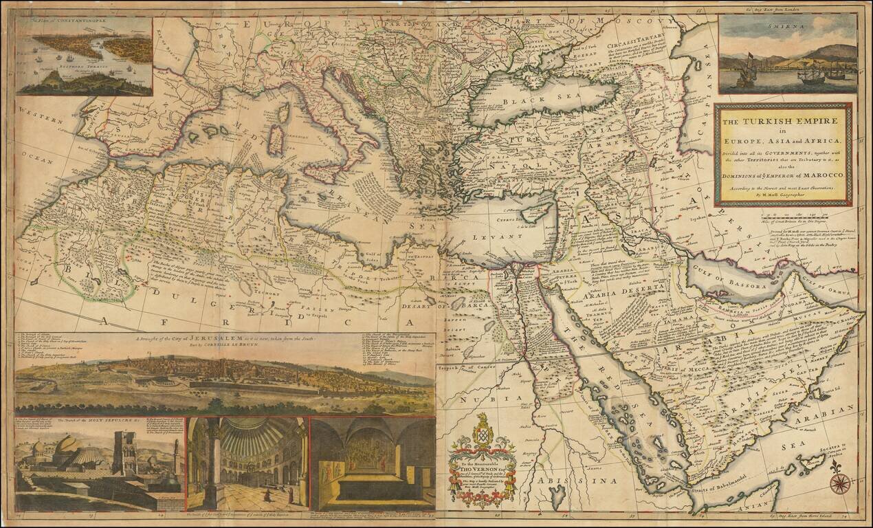
Dynamic Map of the Ottoman Empire with Rich Imagery of Jerusalem Striking large-format map of the Ottoman Empire by Herman Moll, one of England's leading map makers at the beginning of the eighteenth century. The map shows the sprawling Ottoman...
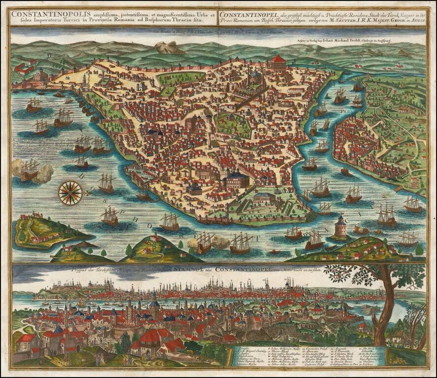
Striking plan of Istanbul, with the Bosphorus in the foreground.. The plan includes a large detailed view of the City at the bottom, with a key locating 30 landmarks. Fine old color example of Seutter's city plan and local views. Seutter engraved...
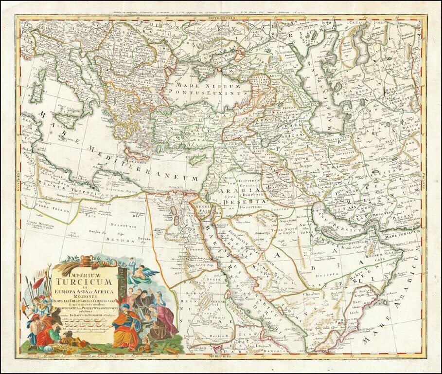
Gorgeous map of the Ottoman Empire, extending from the Persian Gulf and Red Sea to the Mediterranean and Caspian Seas, centered on Cyprus. Excellent detail and an attractive cartouche.
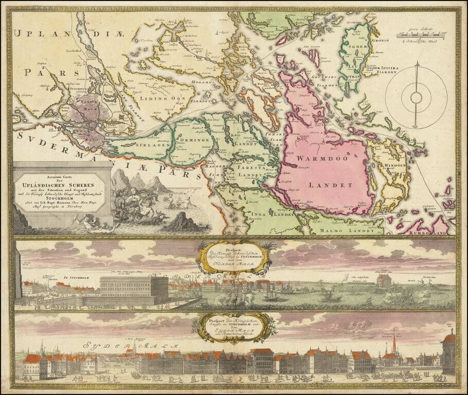
Decorative map and pair of views, focusing on Stockholm and its environs. The map shows Stockholm and the area around it, focusing on the approach from the sea. The two views below show the two major parts of Stockholm, Sydermalm and Nordermalm.

Detailed map of Denmark, published in London by Herman Moll.
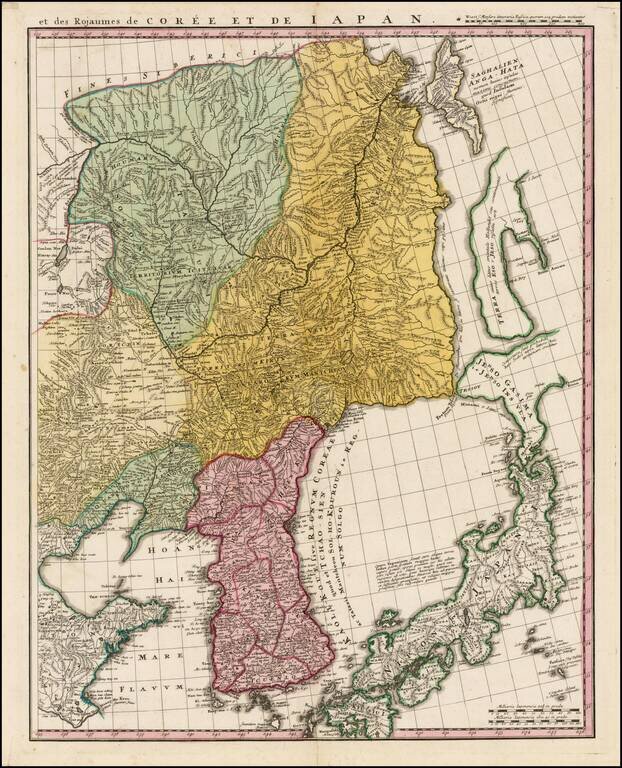
Fine example of the Homann Heir map of Korea, Japan, Manchuria and easternmost Russia, published in Nuremberg. The map is the eastern sheet of a pair of maps published by the Homann Heirs showing China, Korea, Tartaria, Japan, etc. The Kingdom of...