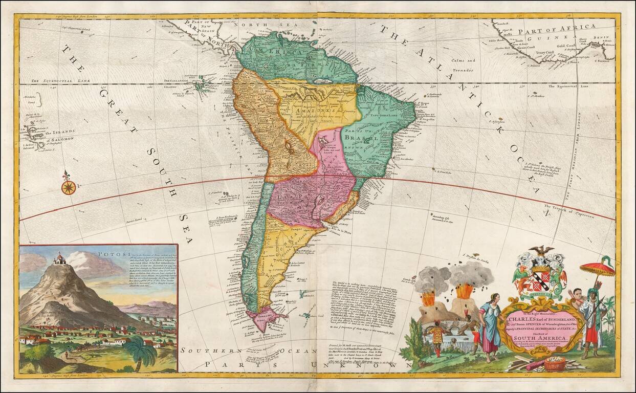
A Large English Map of Colonial South America Striking large format map of South America, published by Herman Moll, one of the leading English map makers in the first half of the 18th Century. The map includes a large inset of San Luis Potosi,...
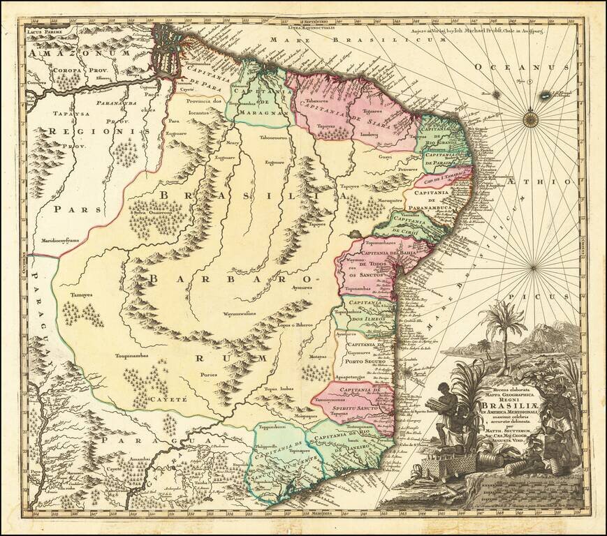
Gorgeous full color example of Seutter's scarce map of Brazil. The map covers Brazil from the mouth of the Amazon River to tSão Paulo and from the Paraguay River to the Atlantic. The map is based upon Joannes Blaeu's scarce Nova et Accurata Totius...
![Portugalliae et Algarbiae… [with large Regnum Brasiliae…inset]](/map/small/70149jd.jpg)
Portugal and Her Brazilian Colony Decorative map of Portugal with a large inset of Brazil, showing its 12 captaincies. The map is elaborately embellished, with several naval battles, a highly ornate cartouche and other details.
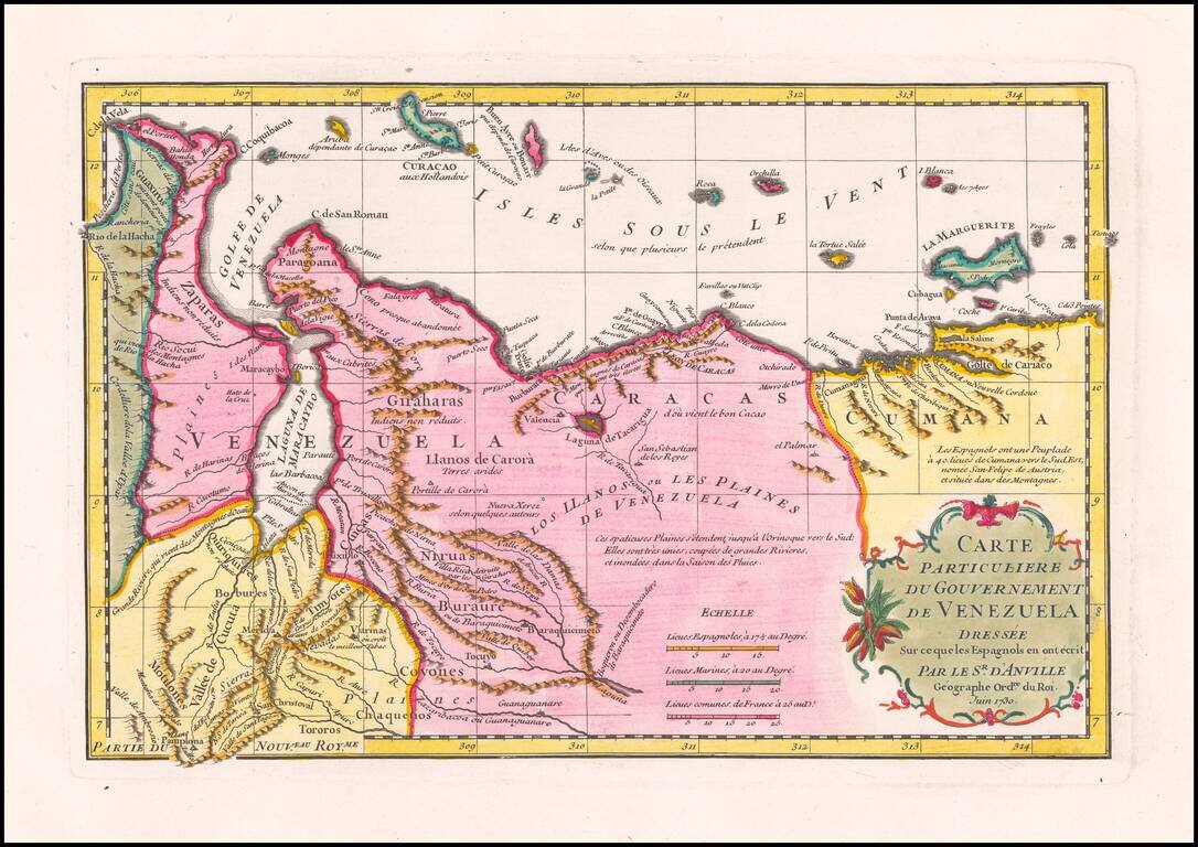
Striking D’Anville Map of Venezuela Fine example of D’Anville’s map of Venezuela, which features much of the northern part of what is today the country of Venezuela and the Leeward Antilles. The map shows the mountainous terrain in detail, with...

Rare chart of the Bay and Harbor at Gibraltar, based upon a contemporary survey by Captain Hendrik Lynslager, who held the title of Vice-Admiral van Holland en Vest-Friesland. The chart provides a detailed profile of Gibraltar and the surrounding...
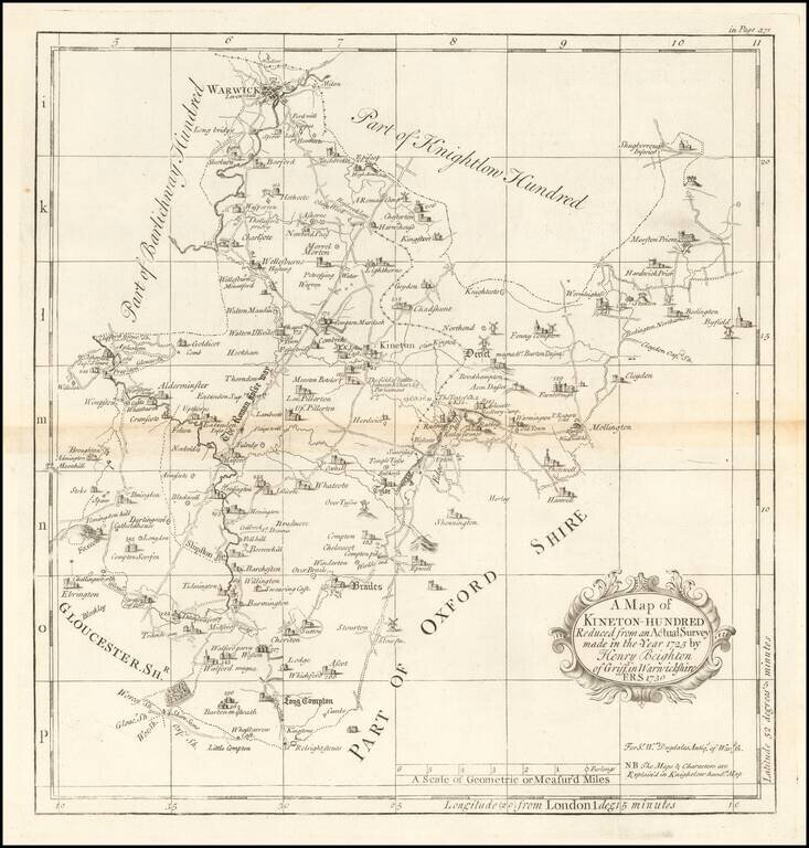
Engraved map of part of Warwickshire from William Dugdale's The antiquities of Warwickshire illustrated…beautified with maps, prospects and portraitures.
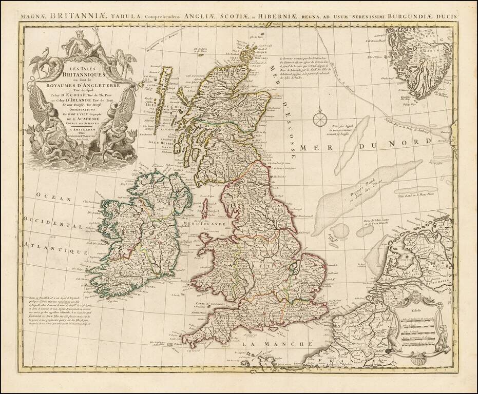
Covens and Mortier's attractive double-page engraved map of the British Isles, based on the 1702 De L'Isle map. This example has a pleasing contemporary outline hand color. The map features a large cartouche in the upper left comprised of numerous...
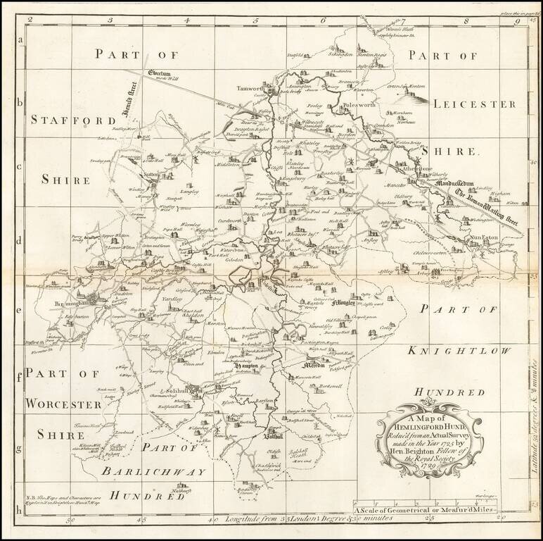
Engraved map of part of Warwickshire from William Dugdale's The antiquities of Warwickshire illustrated…beautified with maps, prospects and portraitures.
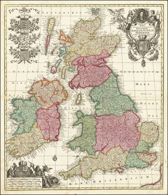
Gorgeous full color example of Seutter's map of the British Isles. Includes 5 large coats of arms, portrait and two large decorative allegorical cartouches.
![[Manuscript Map of Gibraltar]](/map/small/66061.jpg)
Original Early-18th Century Manuscript Map of Gibraltar. Pen, ink, and wash hand-drawn map of Gibraltar, probably done by a French or Spanish mapmaker around the time of the 1727 Spanish siege. The map is unusual in its configuration and does not...
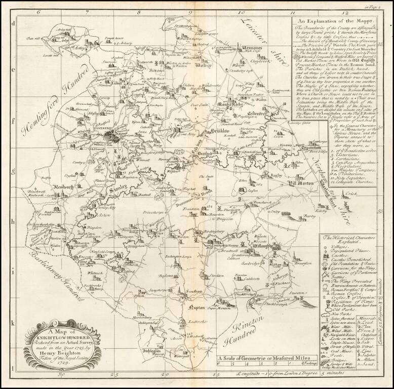
Engraved map of a part of Warwickshire from William Dugdale's The antiquities of Warwickshire illustrated…beautified with maps, prospects and portraitures. The map includes Coventry.
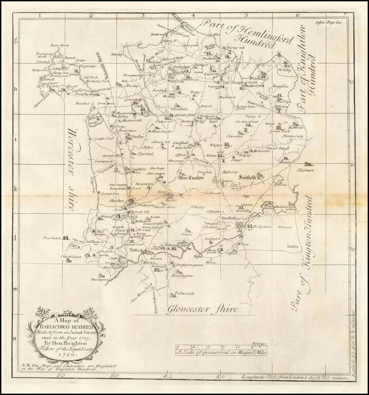
Engraved map of part of Warwickshire from William Dugdale's The antiquities of Warwickshire illustrated…beautified with maps, prospects and portraitures.
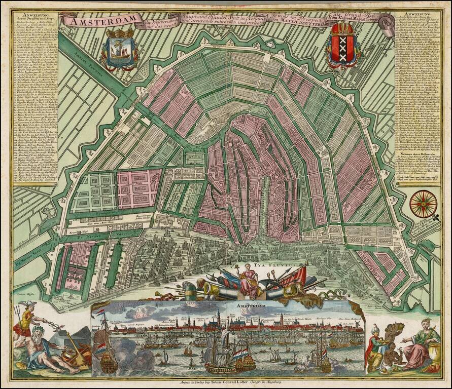
Nice full color example of Seutter's decorative and highly detailed plan of Amsterdam, with a striking view of the City and allegorical embellishments below. Includes 2 coats of arms and a key naming over 300 places on the map and view.
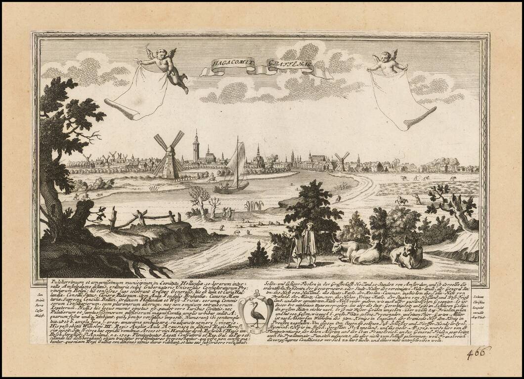
Rare view of Den Haag, published by J.F. Leopold, in Augsburg, in 1730. The view includes a coat of arms and extensive description of the city in Latin and German. This is the first example we have offered in over 20 years.
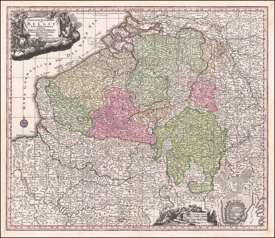
Decorative regional map of the Low Countries, published by Seutter.
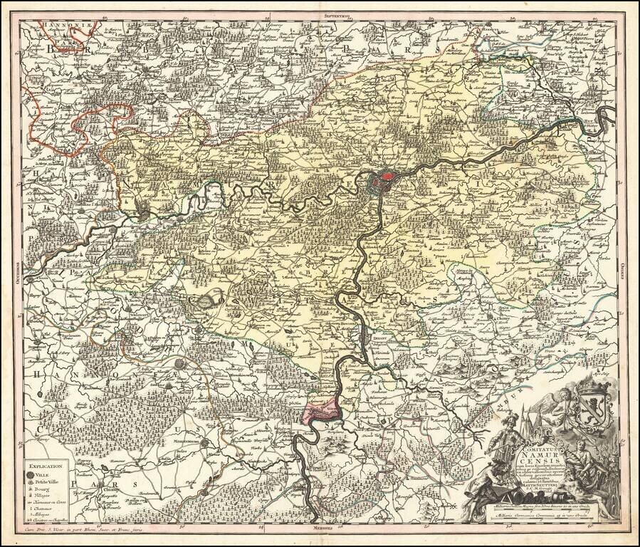
Decorative map of Namur, published in Augsburg by Seutter. Includes an elaborate allegorical cartouche and coat of arms.