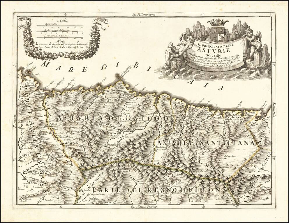
Finely engraved map of the Principality of Asturias on the northern Spanish coastline, based upon the work of Cantelli da Vignola and engraved by Aubrey Barbey, who apparently engraved a number of maps for Rossi. Divided into Asturia di Oviedo and...
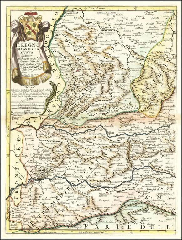
Antique engraved map of the Kingdom of New Castille. The map was published in Rome in 1696 by Giacomo Cantelli da Vignola and Giacomo Giovanni Rossi. The map is centered on The Tagus or Tajo River and includes Badajoz, Alcantara, Plancencia, and...
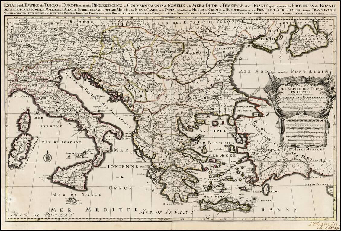
Scarce large format map of the Turkish Empire in Europe and the Eastern Mediterranean, published by Jaillot, based upon the earlier maps of Nicolas Sanson .
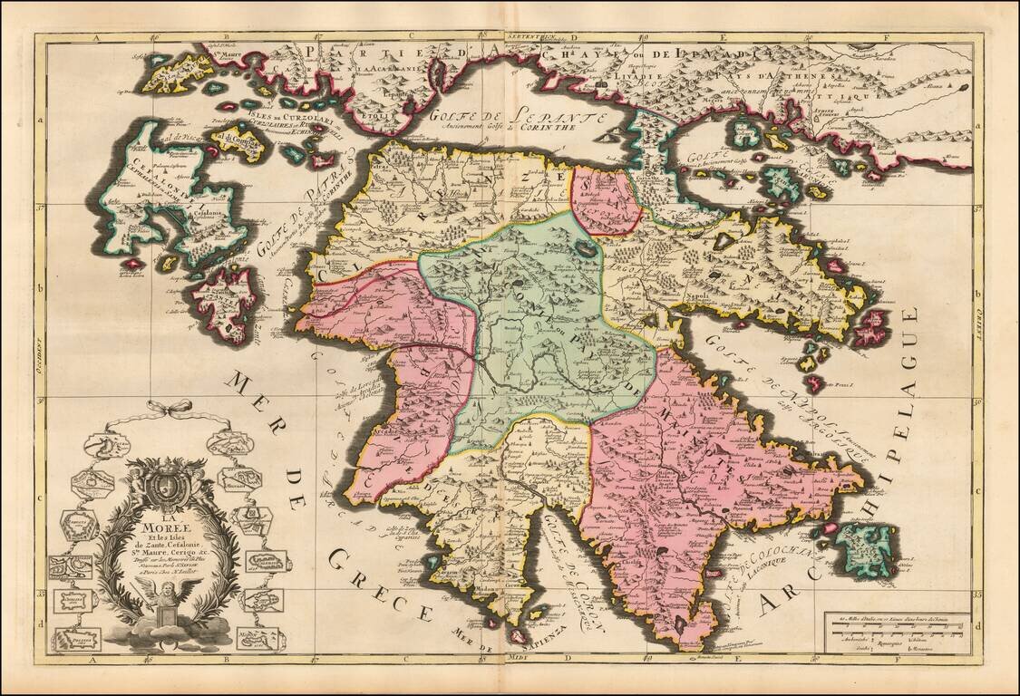
Striking large and highly detailed map of Morea and surrounding islands by Jaillot. Includes smaller plans of 12 other islands.
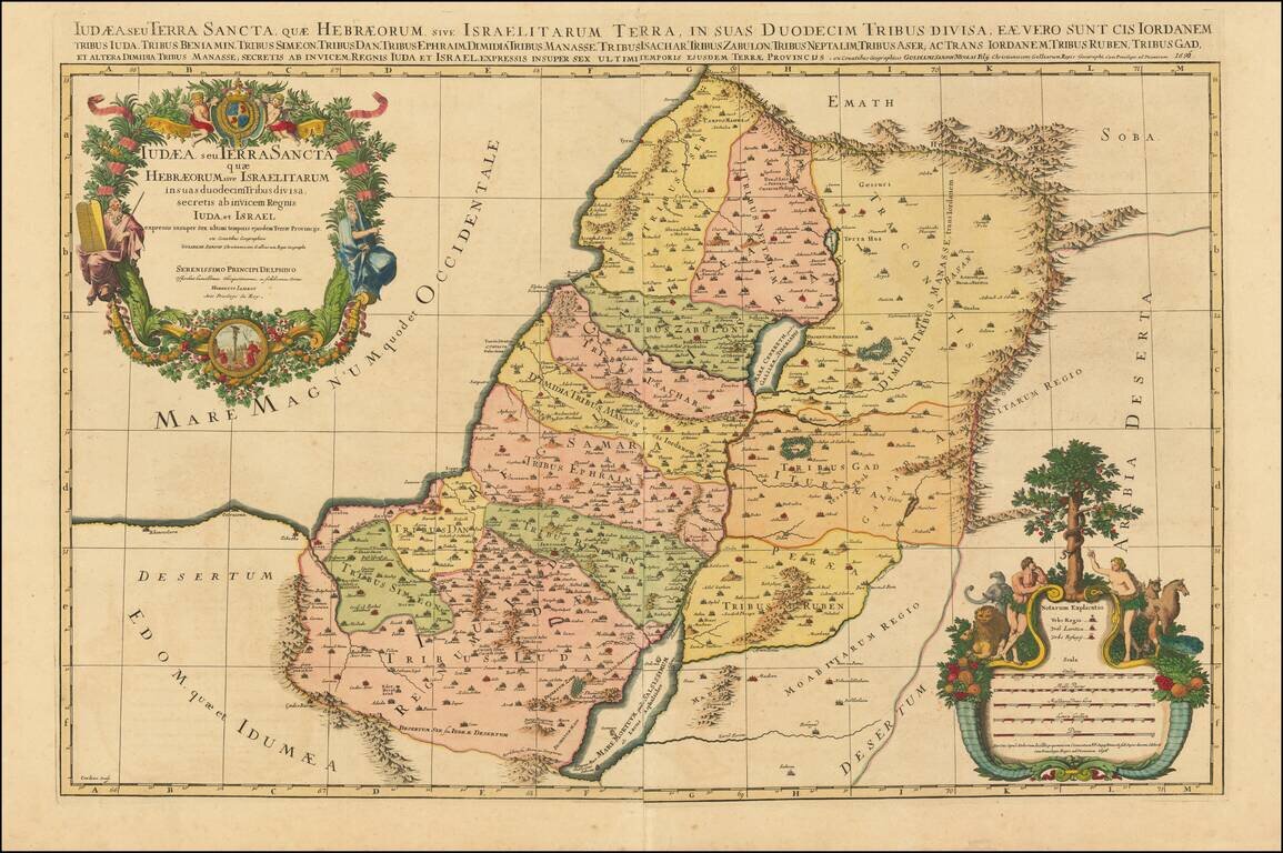
Striking large format map of the Holy Land, with tribal divisions and a wealth of place names and topographical detail, including the locations of royal and priestly cities, and sanctuaries. Decorated with two fine cartouches. The title cartouche...
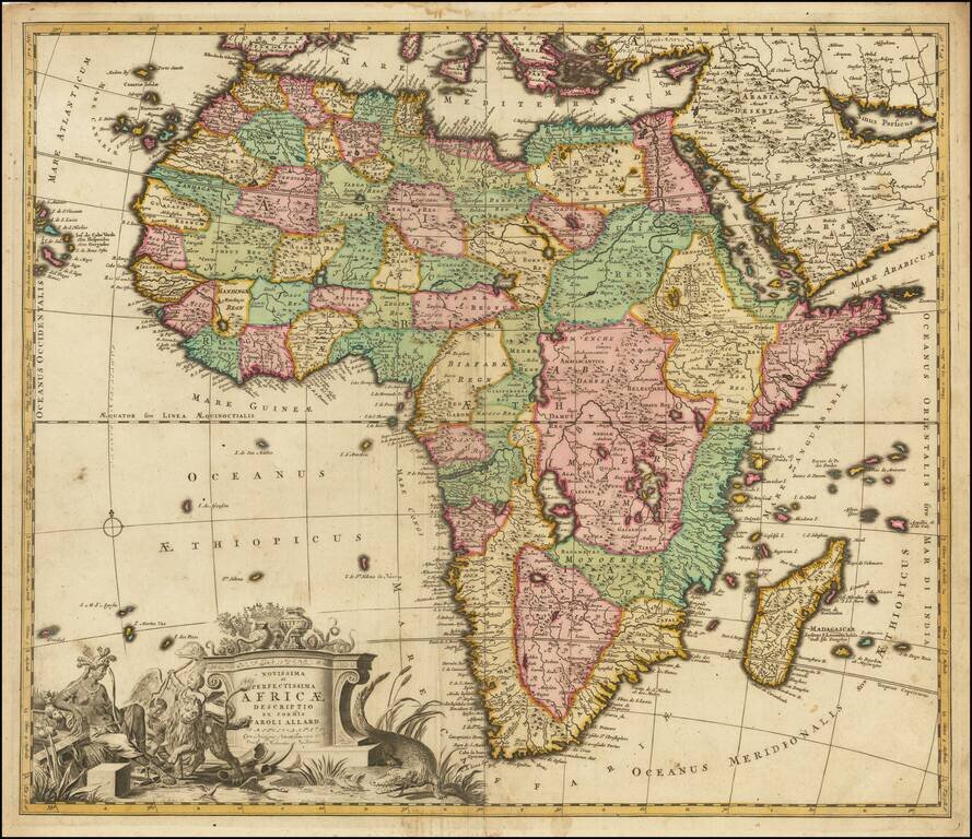
Nice example of this finely engraved map of Africa published by Carol Allard, based on De Wit's map of Africa c.1670. This map is similar to the De Wit's Africa in its later states and even uses some of De Wit's lettering within the surrounding...
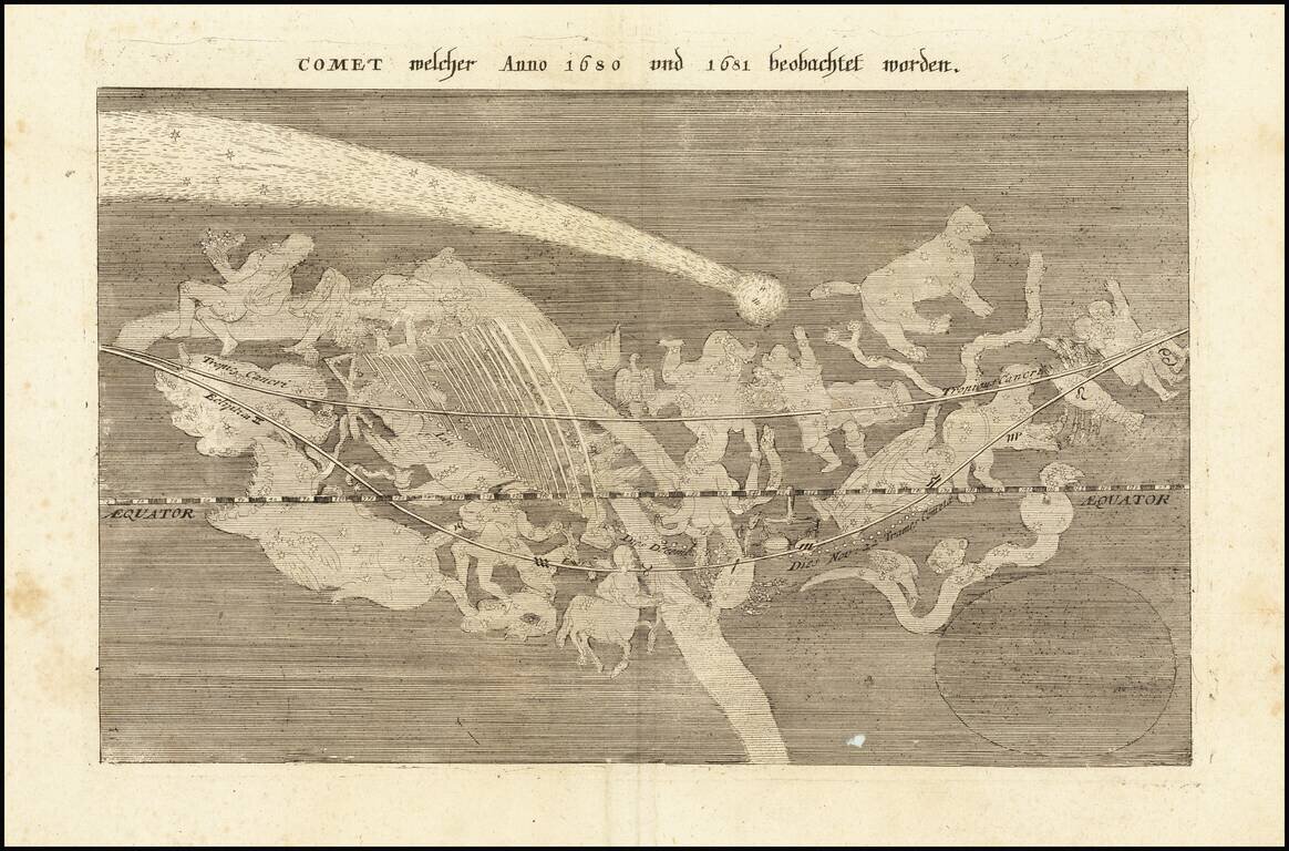
The Great Comet of 1680 Scarce map showing passage of the Great Comet of 1680, which appeared in Merian's Theatri Europaei, Zwölffter Theil. The map illustrates a comet seen by Sir Edmund Halley in 1680 and 1681, notably the year prior to his...