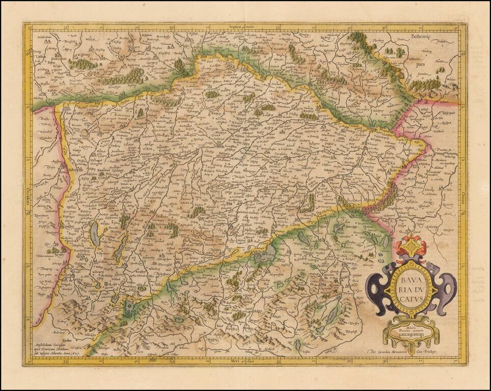
Nice old color example of Mercator's detailed regional map of Germany. The map map shows the course of the Danube in the north, flowing through Ingolstadt, Strassburg, and Passau and extending to the Alpine cities of Fussen, Partenkirchen, Innsburck...
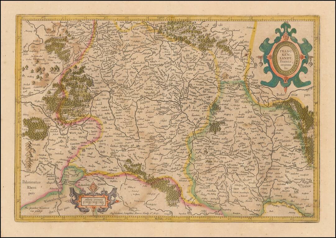
Mercator's double-page engraved German regional map, here in old hand. The map shows Frankfurt am Main, Heidelberg, Wurzburg and the course of the upper Main River, extending east to Regensburg and Eger in Bohemia.
Old color example of Mercator's regional map of a part of Germany from an early edition of the Mercator-Hondius Atas.
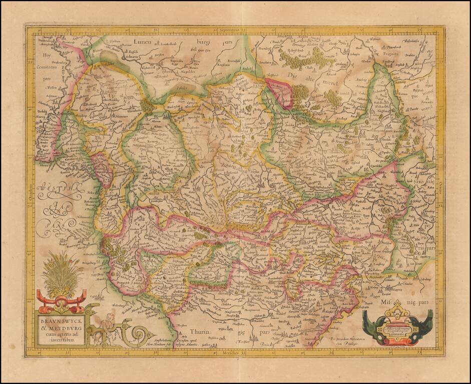
Nice old color example of Mercator's detailed regional map of a portion of Northwestern Germany. Includes Hamburg, Luneburg, etc.
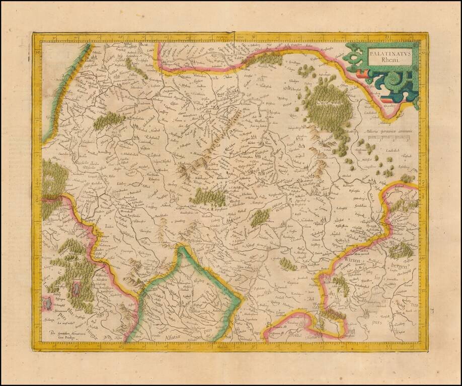
Nice example of Mercator's detailed regional map of Germany. The map extend north to Frankfurt, Bingen and Bachrach and south to the Alsace Region of France, following the Upper Rhine. Heidelberg is near the center of the map.

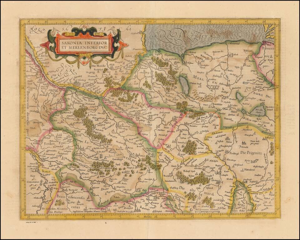
Detailed map of Holstein, extending south to include Hamburg and Lubeck. From an early edition of Mercator's Atlas.
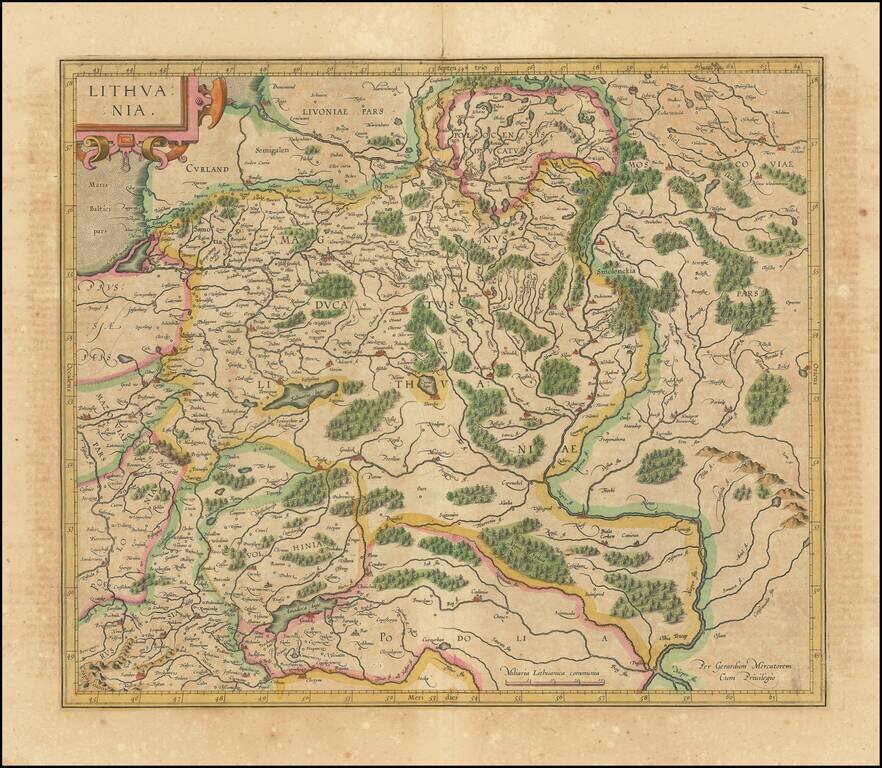
Nice old color map of Lithuania, with parts of Poland, Prussia, Ukraine and Belarus, published by Gerard Mercator. This is one of the maps which includes Gerhard Marcator's name as the map maker. Extends from the Baltic, including part of Prussia, to...
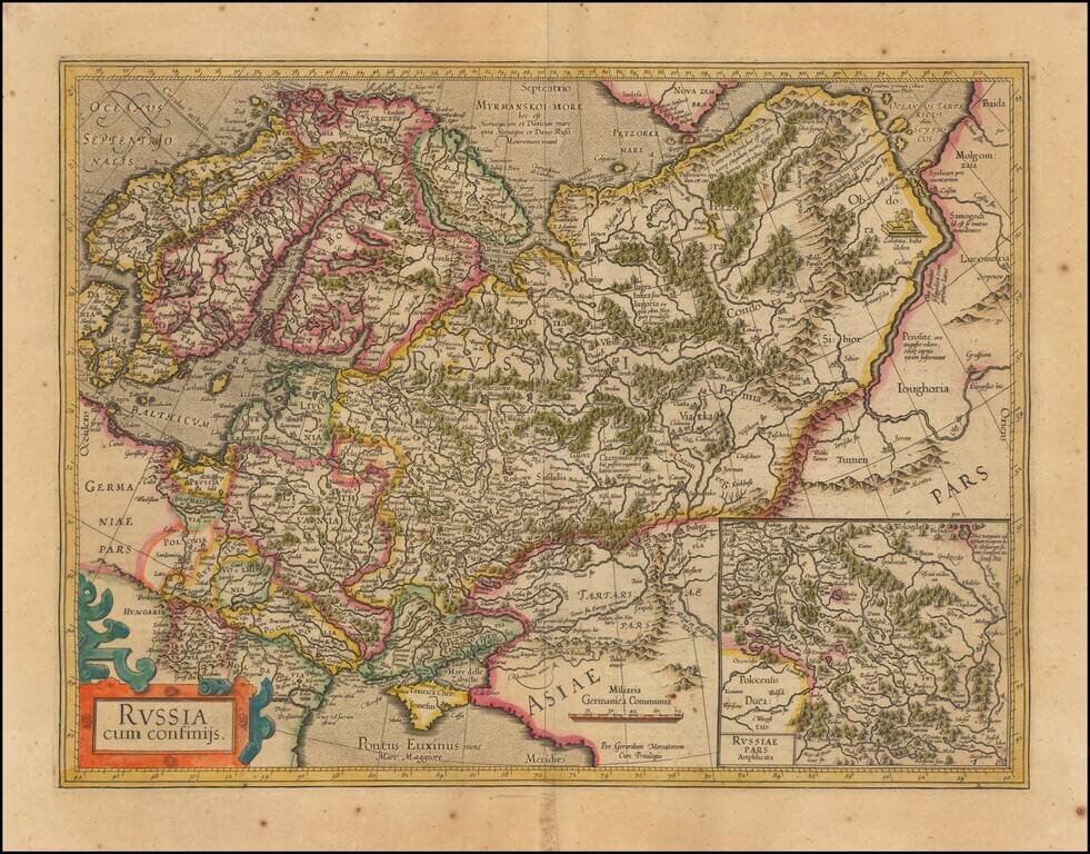
Nice outline color example of Mercator's first map of Russia. The map shows the region from Scandinavia to the Black Sea and the Oby River. Large inset of Russia Pars Amphisicata (Moscovia). Numerous Eastern European regions are shown, including:...
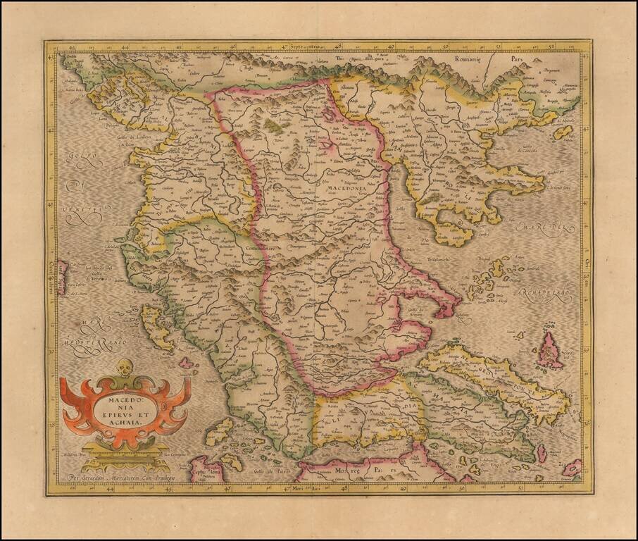
Nice old color example of Hondius's detailed regional map of Macedonia, with a decorative cartouche.
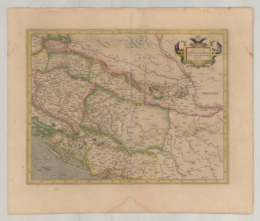
Decorative early map of the Balkans and the Gulf of Venice, with a large decorative cartouche. Finely engraved and highly detailed.
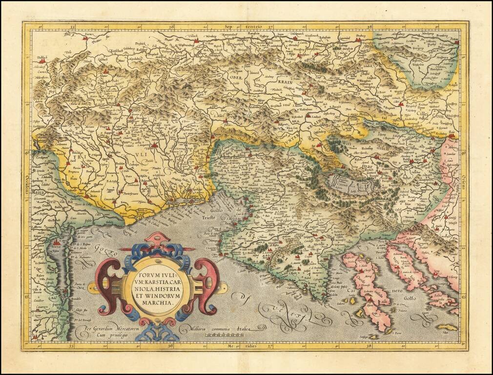
Detailed regional map of the Gulf of Venice and Gulf of Trieste regions, including Friuli and Istria. Includes Slovenia, northwestern Croatia and parts of Italy and Austria.
![Tarvisina Marchia et Triolis Comitatus [Venice & Lago Di Garda]](/map/small/47111.jpg)
Decorative regional map, extending from the Gulf of Venice to Tirolia, centered on Lago di Guardia and Verona. Shows Venice, Padua, Ferrara, Crema, etc. Nice full color example.
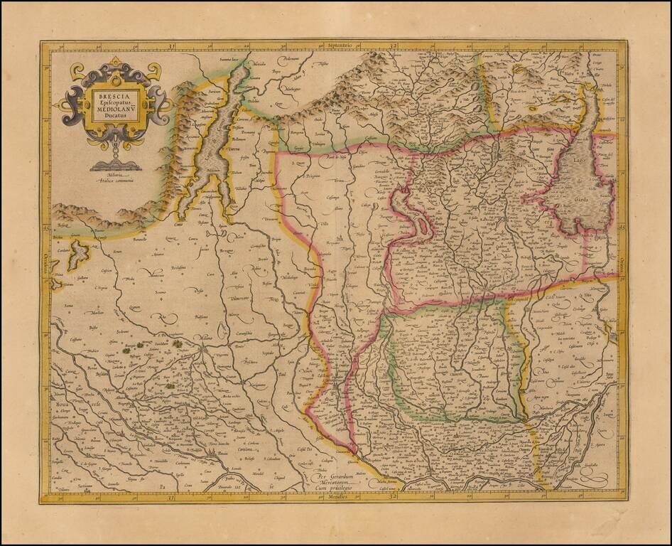
Striking map of Brescia, centered on Bergamo and including Milan, Cremona, Brescia, Lago De Garda, Lago Di Como, etc. Covers the region between Lago di Como and Lago Di Garda and extending south to the Po River region. Includes decorative title...
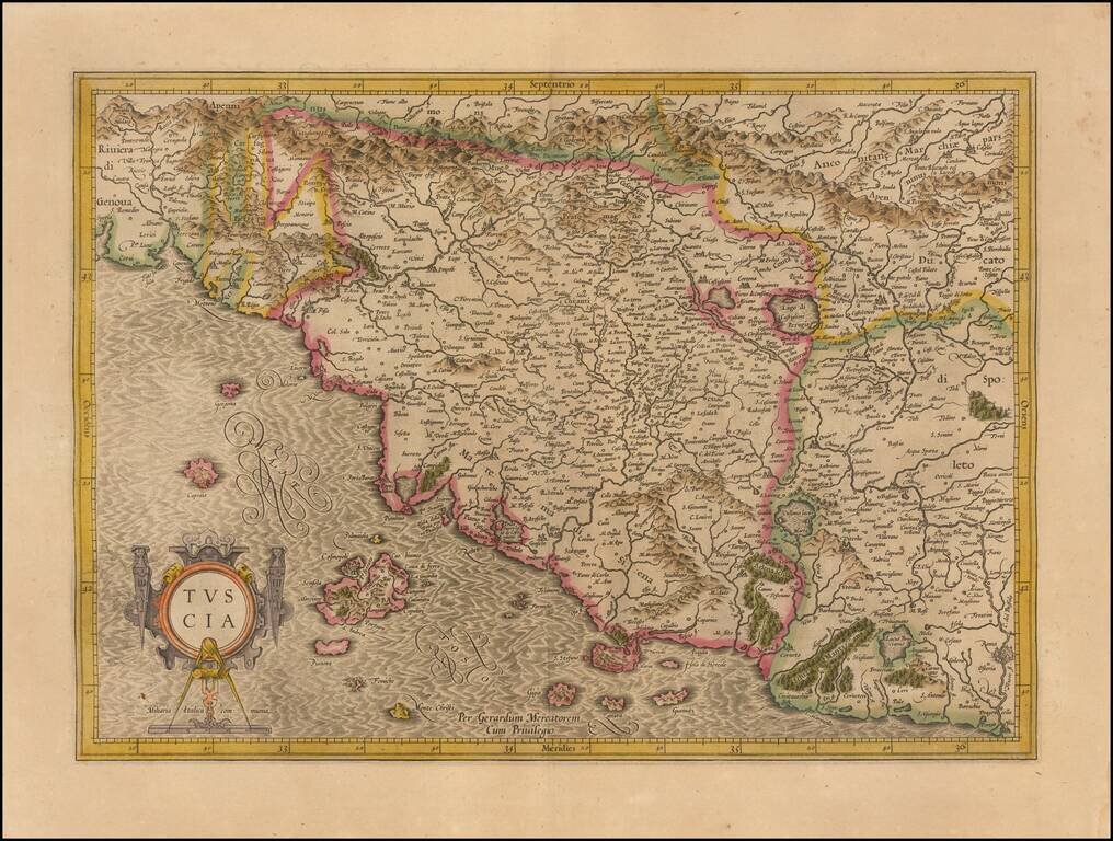
Striking map of Tuscany and surrounding regions, from an early edition of the Mercator-Hondius Atlas Sive Cosmographia. Drawn from contemporary Italian sources, this map is one of the most up to date modern maps of Tuscany printed in the early 17th...
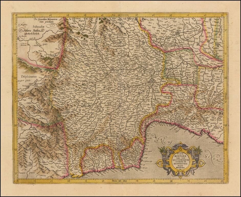
Striking regional map of Italy, centered on the Pedemont region of Italy and Genoa, published by Gerard Mercator and later by Hondius in the Atlas Sive Cosmographia. The map extends to the Milan region in the northeast, Cinque Terre in the southeast,...
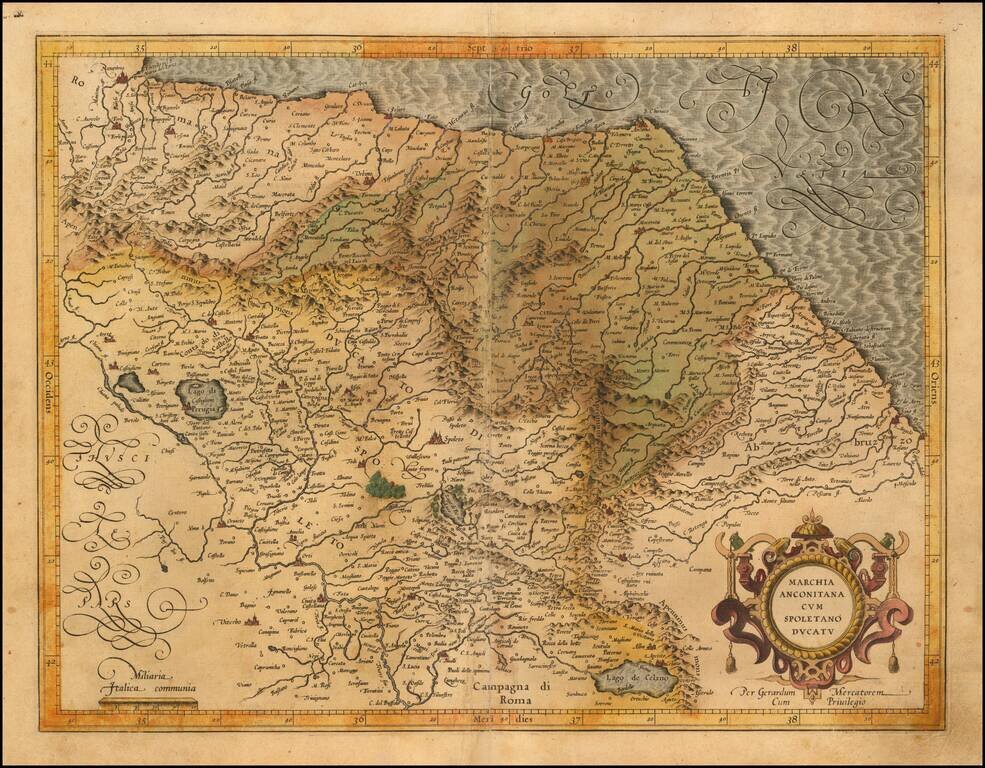
Finely engraved regional map Italy, published by Gerard Mecator in his Atlas Sive Cosmographia. The map extends from Ancona, Ravenna and San Angelo on the Adriatic Coast to Spoleto, Perugia, Tivoli and Lago di Celano