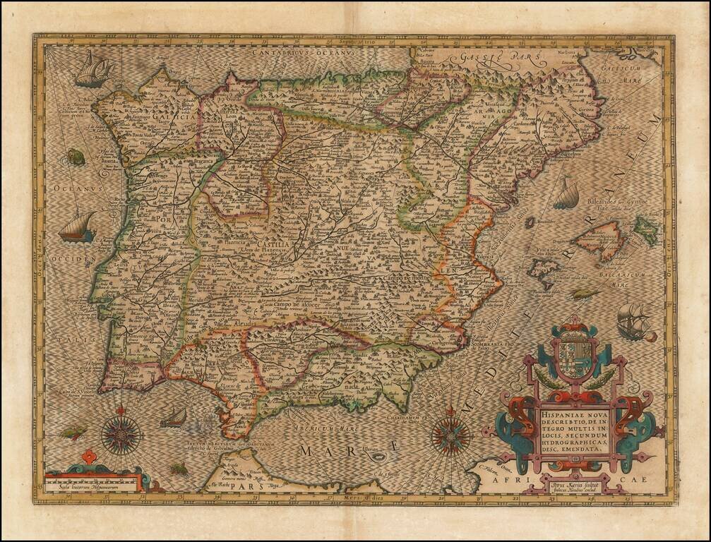
Striking example of the Kaerius-Hondius map of Spain and Portugal. The map includes a striking coat of arms, 2 compass roses, sailing ships and sea monsters, along with Hondius' unique style for engraving the ocean. A gorgeous dark impression of this...
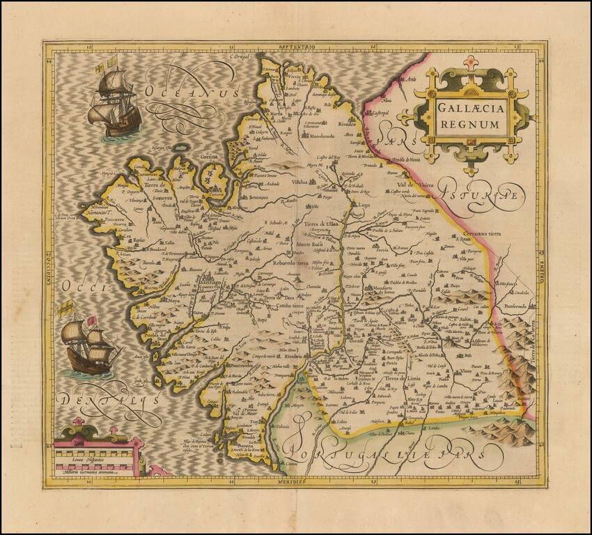
Old Color example of Mercator's map of Gallica. Beautiful map of the northwestern coast of Spain, extending from the Asturias de Oviedo region and Aviles in the northeast to Bayona and the Portuguese border on the south, centered on Santiago di...
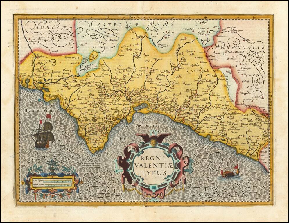
Fine old color example of Hondius' map of the Valencia, from his Atlas Sive Cosmographia. . . . Includes a decorative cartouche, scale of miles, sailing ship and sea monster.
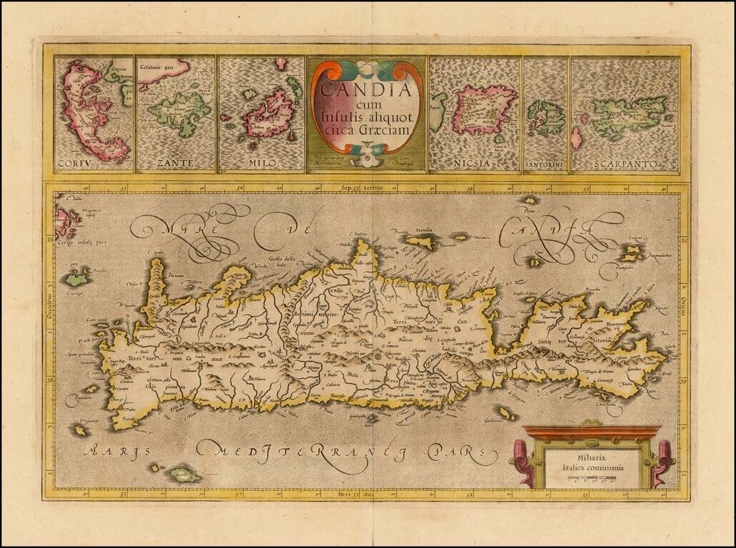
Nice old color example of the true first edition of Mercator's map of Crete and neighboring Greek Islands, from the first edition of Mercator's Atlas Sive Cosmographia. . . . Includes two large cartouches. Nice detail in the map of Crete and the large...
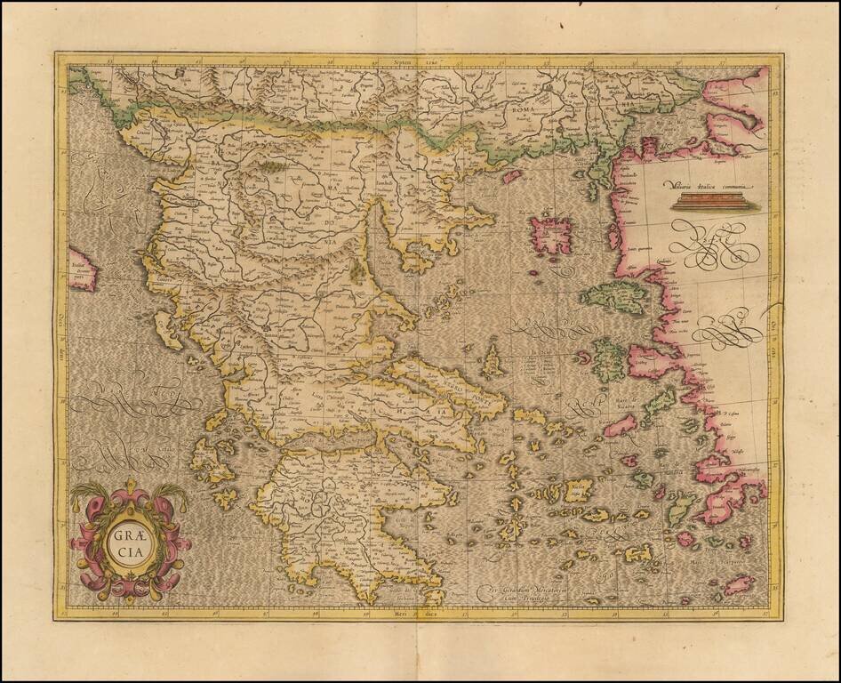
Fine example of Mercator's map of Greece, from an early edition of Mercator's Atlas Sive Cosmographia. The map bears the signature of "Gerardum Mecatorem," on the maps created by Mercator during his lifetime. The map is one of the earliest modern...
![Natoliae Sive Asia Minor [shows Cyprus]](/map/small/42928.jpg)
Old color example of Mercator's map of Turkey, Asia Minor and Cyprus. Includes a decorative cartouches, sailing ship, sea monster and finely stippled seas.
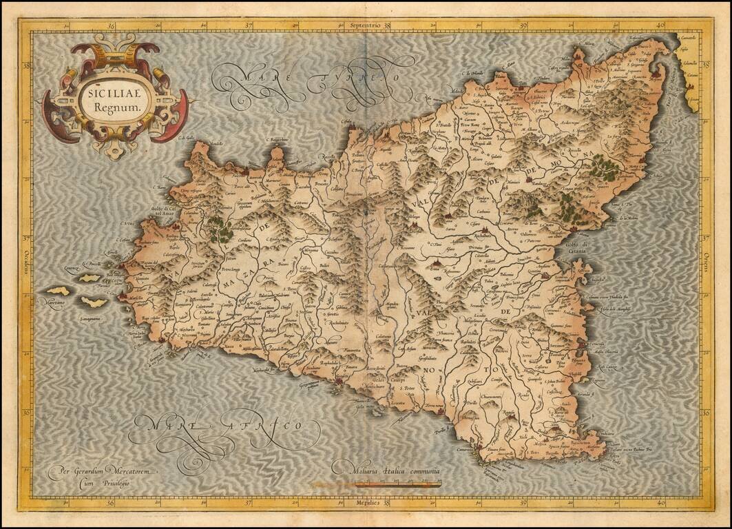
Nice old color example of the first state of Mercator's decorative map of Sicily. An example of the second state, with revised cartouche, can be seen here: /gallery/detail/31471sm
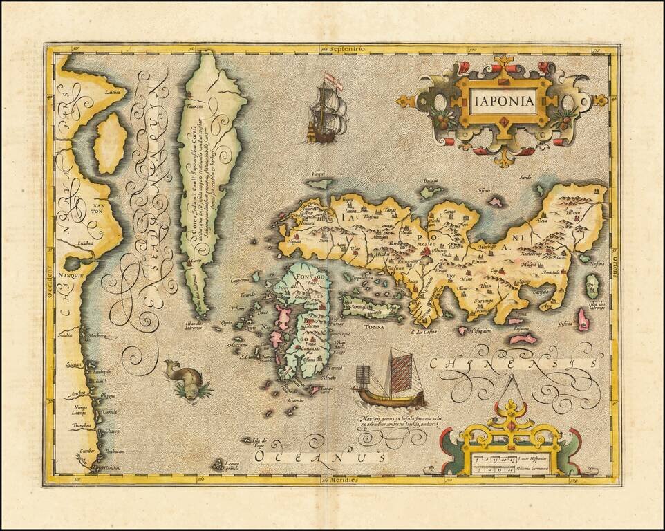
Fine full example of Hondius' map of Japan & Korea. One of the finest early Dutch maps of the region, first published in 1606 as one of the 37 new maps engraved for Jodocus Hondius' expanded Dutch edition of the Mercator Atlas. The map is based...
![[Manila - Luzon] Typus Freti Manilensis. Die Straet vande Manilles](/map/small/61346op.jpg)
One of the Earliest Obtainable Maps of Manila / Luzon / Northern Philippines Nice example of Joris van Spilbergen's rare regional map / sea chart of Southern Luzon, Mindoro and Samar Islands, published in Amsterdam in 1619. The map provides a...
![[Title Page] Italiae Sclavoniae, Et Graeciae tabula geographice, Per Gerardum Mercatorem . . .](/map/small/37176.jpg)
Finely colored example of this decorative title page from the first complete edition of Mercator's Atlas Sive Cosmographia . . .