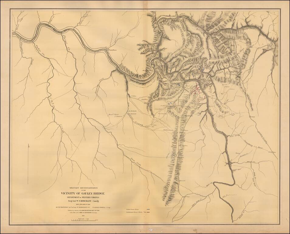
Color-lithographed map of the area near Gauley Bridge, (present-day) West Virginia. Gauley Bridge was the site of a minor battle during the Civil War, which resulted in a Union victory. "United States forces" are colored blue, and "Confederate forces...
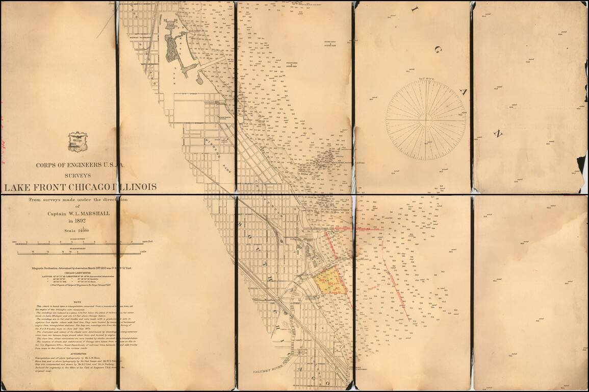
With Manuscript Annotations Showing Proposed Harbor Improvements Detailed map of part of the City of Chicago, from Jackson Park to the Colehour Yard area, prepared by the United States Corps of Topographical Engineers in 1892. The map is centered...
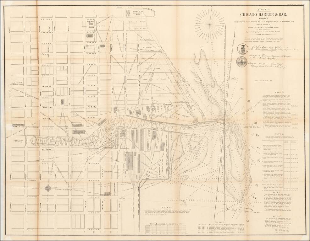
Detailed plan of Chicago, based upon the surveys conducted by the US Topographical Engineers, under the direction of Lieutenant Colonel J.D. Graham in 1857 and 1858. Centered on Downtown Chicago and the Loop, this large format map of Chicago Harbor...
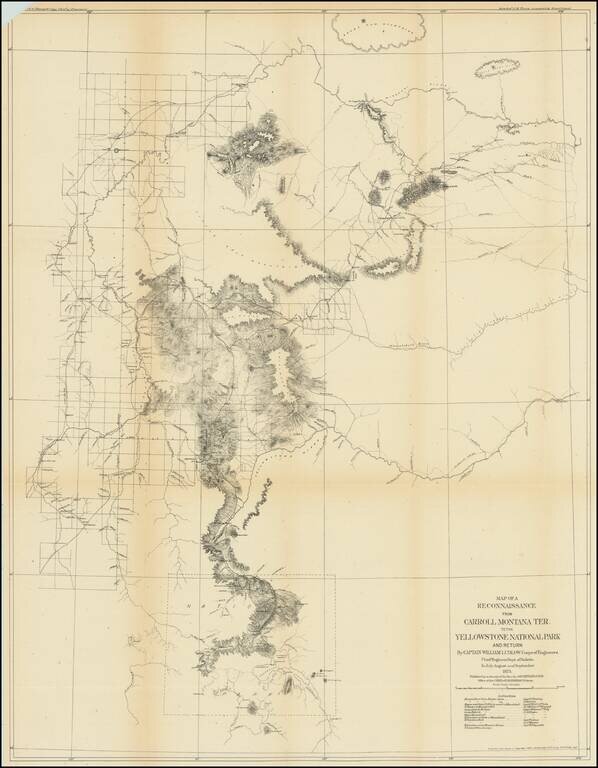
Captain William Ludlow's Expedition To Yellowstone From Montana in 1875 Important early exploration and survey of the route from Carroll, Montana to Yellowstone, undertaken by Captain William Ludlow in 1875. Carroll, Montana was described by Ludlow...
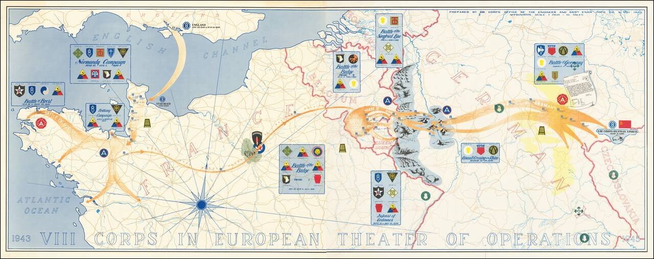
Superb map of the actions of VIII Corps, US Army, from 1943 to 1945. The map was prepared by VIII Corps Office of the Engineer and 665th Engr. Topo. Co. on the 9th of May 1945. The map, which stretches from Normandy to Czechoslovakia, lists the...