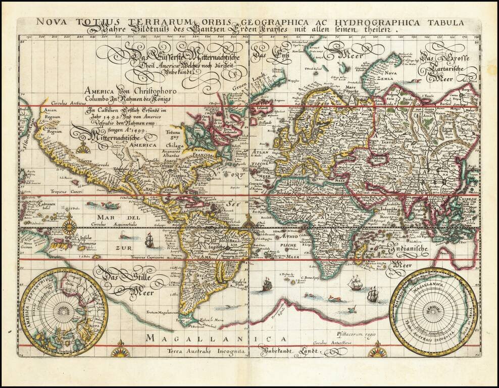
Rare old maps of the whole world. Secret knowledge, ancient worlds, ancient maps - discover the ancient world
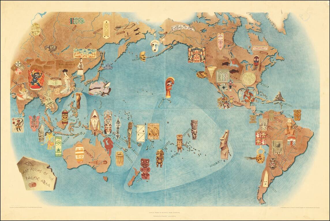
An attractive lithograph showing the art forms of the Pacific, after the eponymous mural by the talented Mexican intellectual Miguel Covarrubias. Many examples of traditional art forms are shown overlaid on a map that includes all of the Americas,...
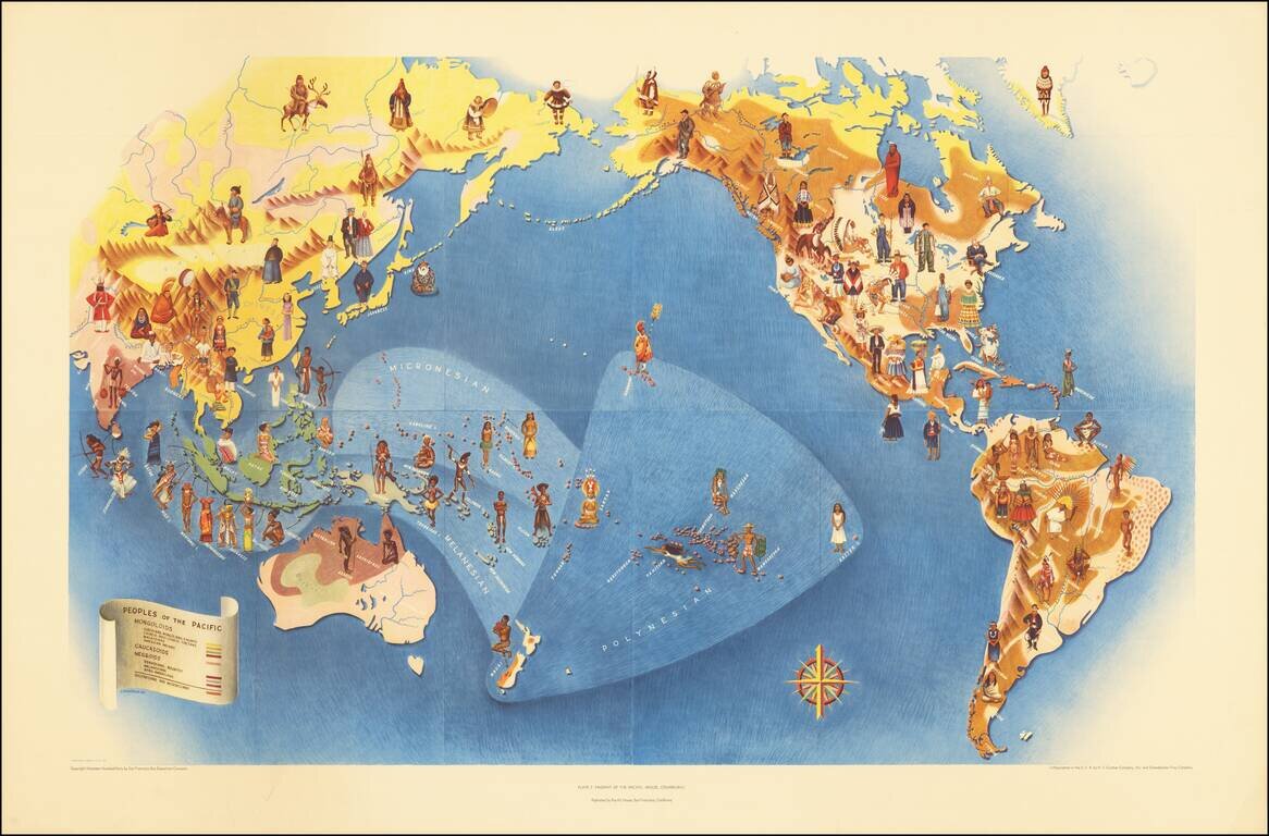
An attractive lithograph from 1940 showing the peoples of the Pacific, after the eponymous mural by the talented Mexican intellectual Miguel Covarrubias. The map shows the Pacific in its entirety and extends to all of the Americas, Oceania, and most of...
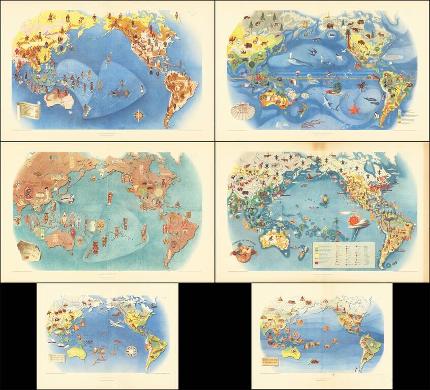
This is a series of six works, lithographed after Covarrubias's mural the Pageant of the Pacific, which was first displayed at the 1939 San Francisco Golden Gate International Exposition. Covarrubias was commissioned to create this mural that would be...

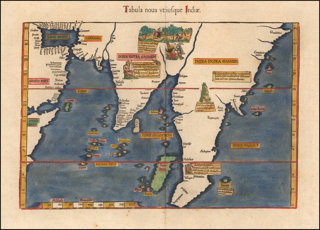
The Earliest Obtainable Map of Southeast Asia, India, etc. Important early map of the Indian Ocean and Southeast Asia, first published in the 1478 Rome edition of Ptolemy's Geography, Claudii Ptholomei Alexandrini. Cosmographia..., created under the...
![Undecima Asiae Tabula [India, Southeast Asia]](/map/small/29254.jpg)
First Two-Color Printed Map of Southeast Asia and Surrounding Areas From a Groundbreaking Edition of Ptolemy's Geographia Fine example of Bernardus Sylvanus’ map of Southeast Asia, China, India, and adjoining regions, from his Geographia published...

The Earliest Modern Map of India and Southeast Asia A striking example of Waldseemuller's modern map of the Indian Ocean, India, Southeast Asia and contiguous regions, from the 1513 edition of Waldseemuller's Geographia. Waldseemuller's modern map...
Nice full color example of the 1541 edition of Fries' map of India and Southeast Asia, focusing on Southeast Asia, India, and Sri Lanka and the Indian Ocean. Fries' map is a reduced size version of Waldeseemuller's 1513 map, the earliest modern map to...
![Tabula Asiae XII [Sri Lanka]](/map/small/59207.jpg)
Striking example of Gastaldi's important map of Sri Lanka, based upon Ptolemy. Giacomo Gastaldi's Atlas of 1548 has been called the most comprehensive atlas produced between Martin Waldseemüller's Geographiae of 1513, and the Abraham Ortelius...
The First Appearance of Formosa Island on a Printed Map. Finely colored example of Gerard De Jode's map of Asia, published in his Speculum Orbis Terrae, in 1593. The map has a fascinating depiction of the Philippine Islands. Singapore is "Sincapura"....

Gorgeous 16th-century map of the region centered on the Indian Ocean, from Linschoten's Itinerario. Linschoten's work was a significant advance in the mapping of India and the Middle East. As noted by Tibbetts, the surprising fact about the...
![[Rare English Edition!] Deliniantur in hac tabula, Orae maritimae Abexiae, freti Mecani: al. Maris Rubri: Arabiae Freti Mecani: al Maris Rubri: Arabiae, Ormi, Persiae, Supra Sindam usque . . . / The description of the coast of Abex, The Straights of Mec](/map/small/69450.jpg)
Rare 16th-century English map of the region centered on the Indian Ocean, which appeared in the rare English edition of Linschoten's Itinerario, Iohn Huighen van Linschoten. His discours of voyages . . . , published in London in 1598. Linschoten's...
![[Rare English Edition!] Delineatio Orarum Maritimarum, Terrae vulgo Indigetatae Terra do Natal, item Sofalae, Mozambicae, & Melindae . . . / The description or Caerd of the Coastes of the Countreys following called ~ Terra do Natal, all the Coast of S](/map/small/69464.jpg)
Rare English Edition -- Stunning Map of Eastern Africa Striking example of the rare English Edition of Linschoten's map of Eastern Africa, which appeared in the rare English edition of Linschoten's Itinerario, Iohn Huighen van Linschoten. His discours...
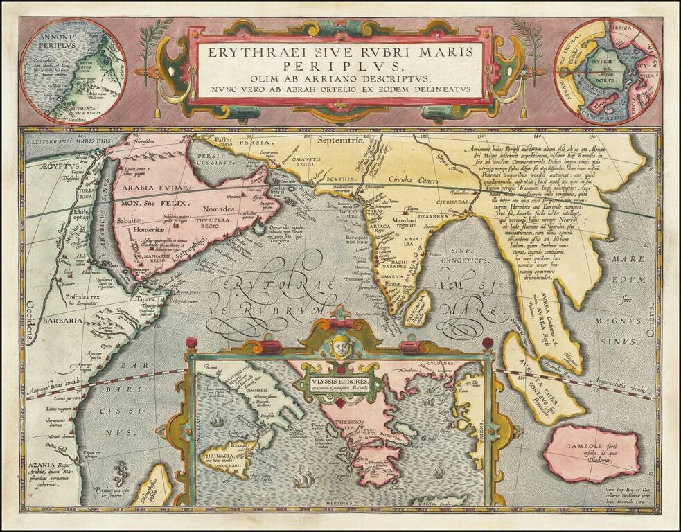
Fine Ortelius Map of the Indian Ocean Linking Mythical, Ancient, and Contemporary Exploration Striking historical map of the Indian Ocean and contiguous regions of the Middle East, India and Southeast Asia, published by Ortelius in his Parergon. This...
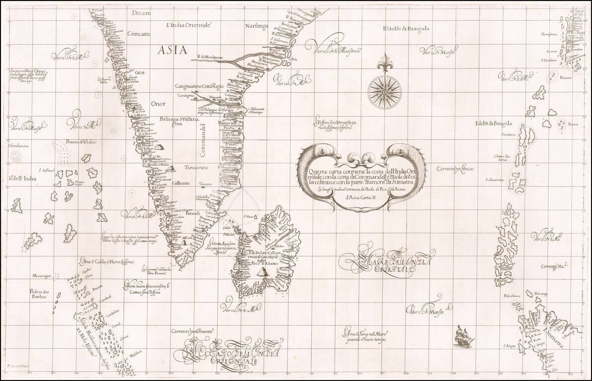
First state of Robert Dudley's rare sea chart of India, Sri Lanka, the Maldives, northwestern Sumatra, the Andaman Islands, the Nicobar Islands and a part of Pegu (Myanmar). The chart is an elegant engraving by Antonio Francesco Lucini, with a Baroque...
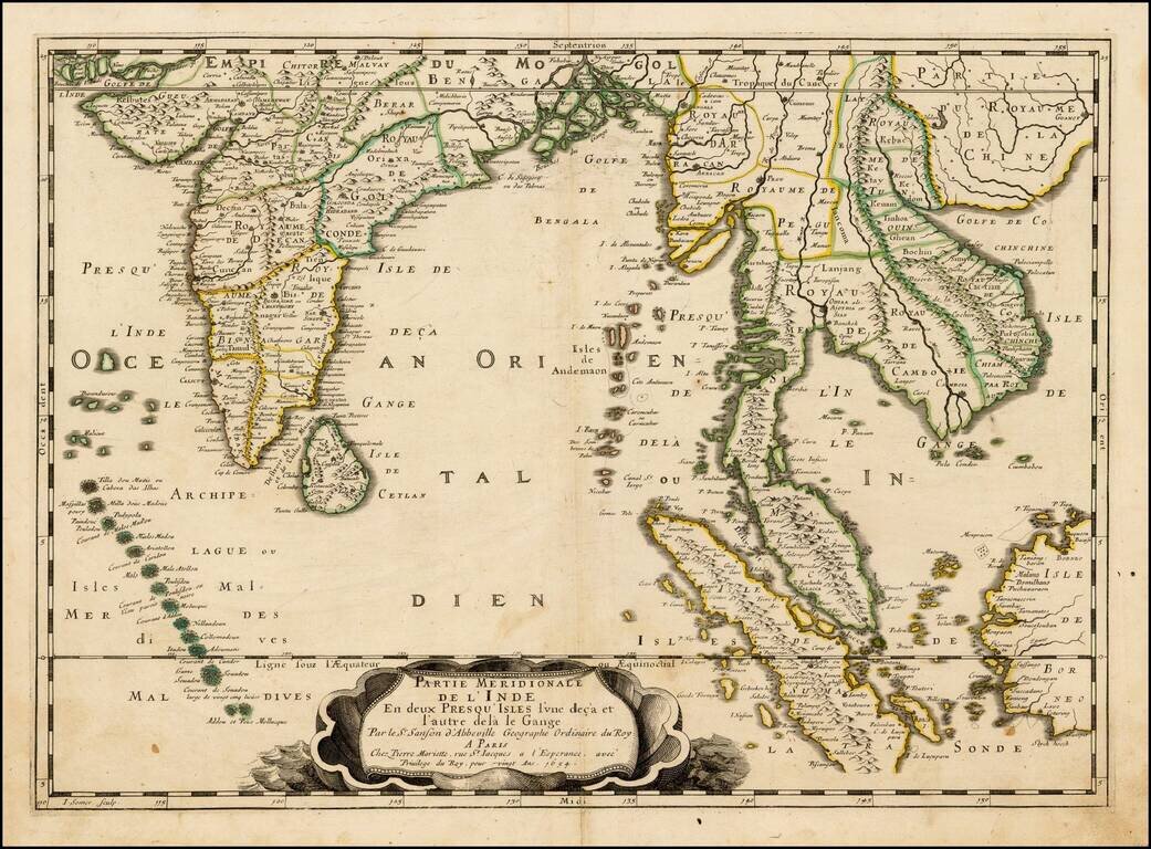
Nice example of this important early map of India and Southeast Asia from Pierre Du Val, the main rival to Nicolas Sanson among French mapmakers of the 17th century. First published in 1654 and issued separately, then included in Sanson's Atlas Les...
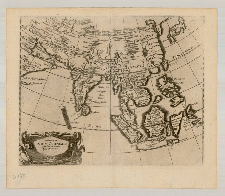
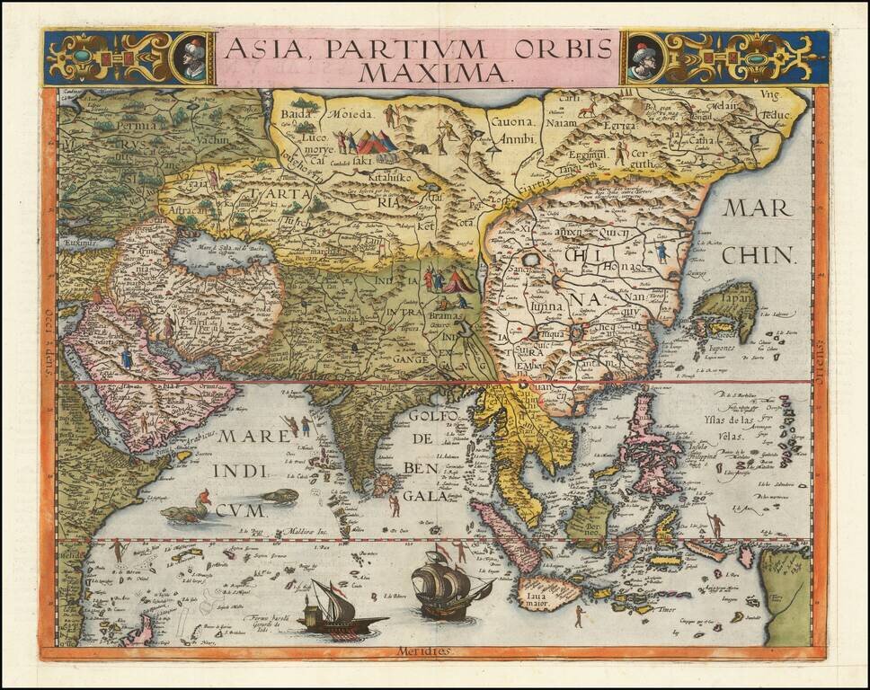
Scarce map of East Asia and the Indian Ocean, extending from Japan and Korea to the Caspian Sea and the Persian Gulf. The map is centered on the Indian Ocean.