
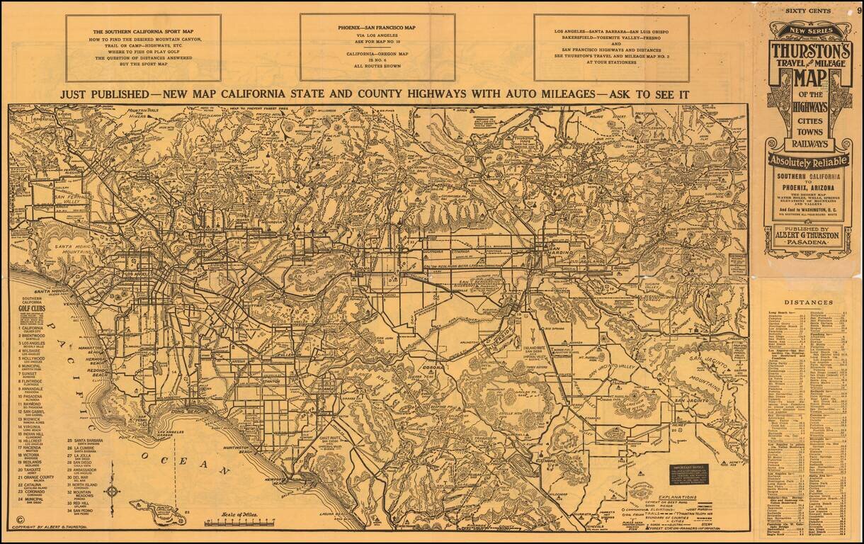
An Early Road Map of the Southwest Fantastic early automobile map of the Desert Regions between Southern California and Phoenix, published in 1915 by Albert G. Thurston and drawn by D.C. McClain. The desert map is quite extraordinary, providing a...
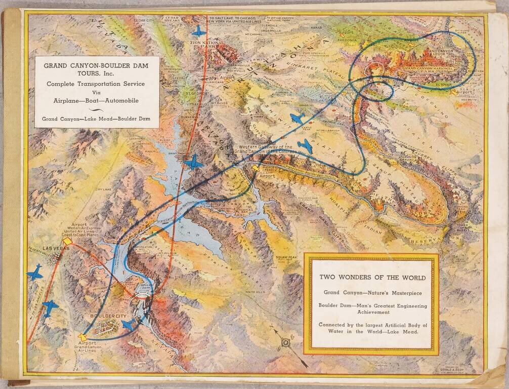
Pioneer Air Tours For The Grand Canyon July 1936 booklet outlining the services of the recently created Grand Canyon - Boulder Dam Tours Inc., with illustrated covers by famed pictorial map artist Gerald Eddy. The booklet outlines the tours offered...
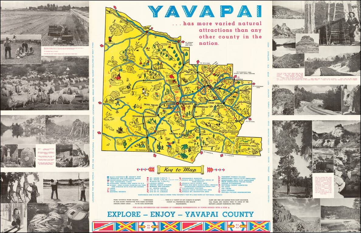
Lively promotional map of Yavapai County, Arizona, produced by the Yavapai Board of Supervisors. Centered on Prescott, Arizona, the map illustrates landmarks, tourist attractions, roads nd railroads, and is surrounded by photographs promoting the...
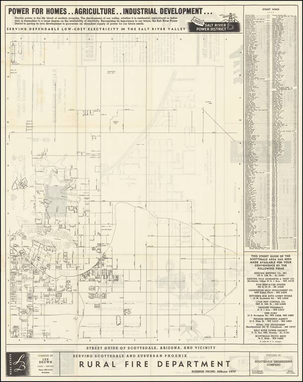
"The West's Most Western Town." Scarce promotional map of the area around Scottsdale, copyrighted by R.S. Knight in 1955. The Salt River Power District promotional text at the top of the map is especially insightful into the mindset of the region in...
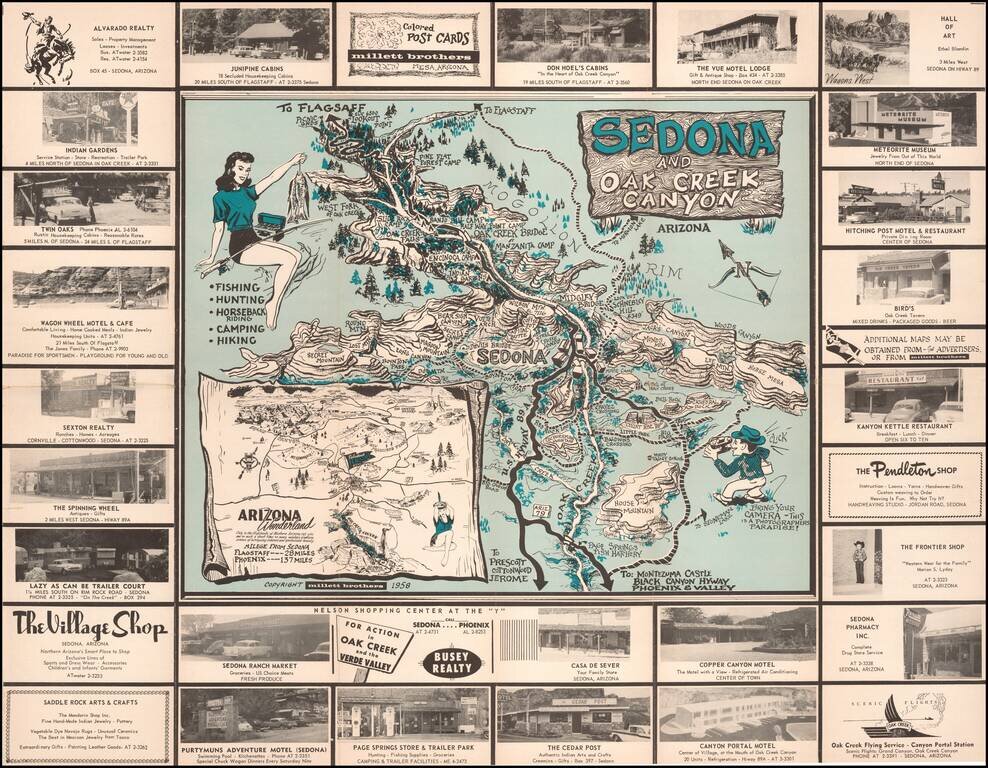
Bring Your Camera -- This is A Photographers Paradise! Rare pictorial promotional map, advertising Sedona and the Flagstaff area. The Sedona side provides a marvelous whimsical look at Sedona and Oak Creek Canyon, with its tourist attractions and...
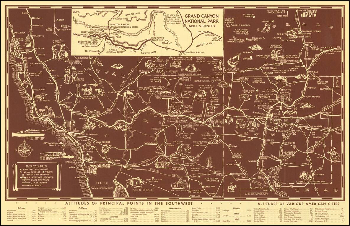
Scarce pictorial map of the American Southwest, published by Fred Harvey. The map provides a detailed pictorial image of the American Southwest, with an inset of the Grand Canyon. The verso includes a table of Indian Signs and Symbols, along with...
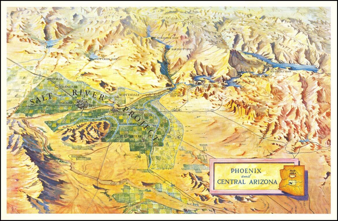
Scarce birdseye view style map of the area around Phoenix, highlighting the Salt River Project and the lands irrigated by the various canals in the area. The map shows a number of important early dams, including: Granite Reef Dam (built 1906-1908)...