
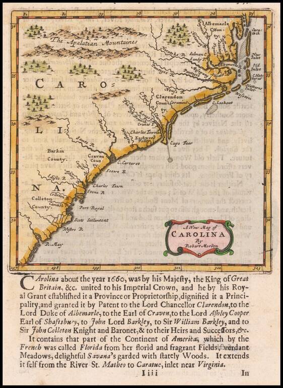
Nice example of Morden's map of the Carolinas, one of the earliest obtainable English maps of the Carolinas. Beginning in the 1670s, the English fortunes in North America took a dramatic turn upward, resulting in a booming interest in the British...
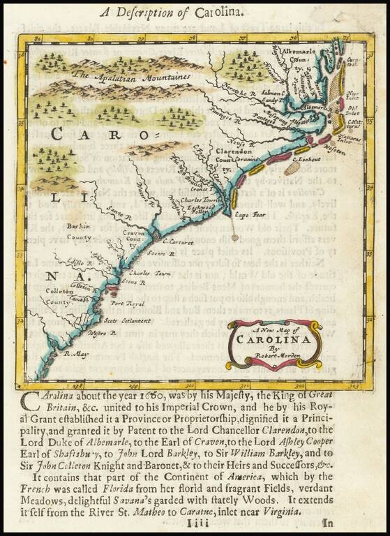
Nice example of Morden's map of the Carolinas, one of the earliest obtainable English maps of the Carolinas. Beginning in the 1670s, the English fortunes in North America took a dramatic turn upward, resulting in a booming interest in the British...

Nice example of this scarce late 17th Century map of the Southeast. Valk & Schenk's map is a rare re-issue and reworking of Jan Jansson's map of the region. Jansson's map of the Carolinas and Blaeu's map of the Carolinas are virtually...
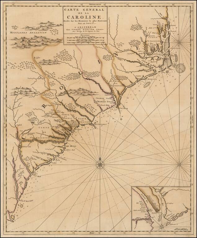
French Edition of An Important Early Map of the Carolinas First state of Mortier's map of the Carolinas, one of the most detailed and up to date maps of the period. Mortier's map is based upon Thornton, Morden & Lea's virtually unobtainable map...
![Carte Particuliere De La Caroline Dresse sur les Memoires le plus Nouveaux Par Le Sieur S[anson] . . .](/map/small/58997.jpg)
A good example of Mortier's highly detailed map of the area around Charleston, South Carolina (founded 1669), the earliest obtainable map of South Carolina printed outside of England. Covens & Mortier's map is based upon surveys and manuscript...
![[Indian Wars in Carolina] De gruwlyke aanvalle der Indiaanen op de Engelse in Carolina . . .](/map/small/69953.jpg)
A series of nine current event broadsides, most notably the image showing the English battling Indians in the Carolinas at the top left. The Carolina image shows a Dutch view of the Yamasee War. The full title, translated from the Dutch, reads "The...
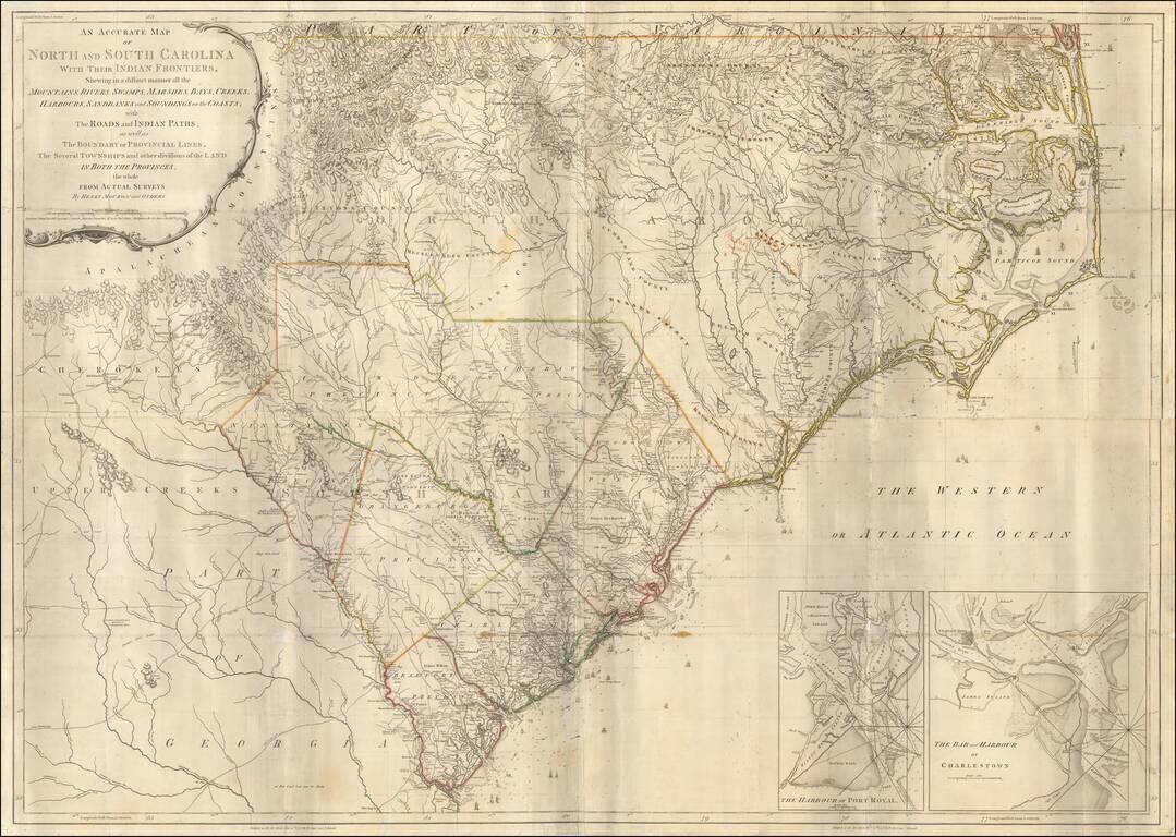
Second state of Henry Mouzon's landmark 4-sheet map of the Carolinas, the primary source for the geographical details of the Carolinas for the American, English and French armies during the American Revolution. Mouzon's map was unquestionably the most...
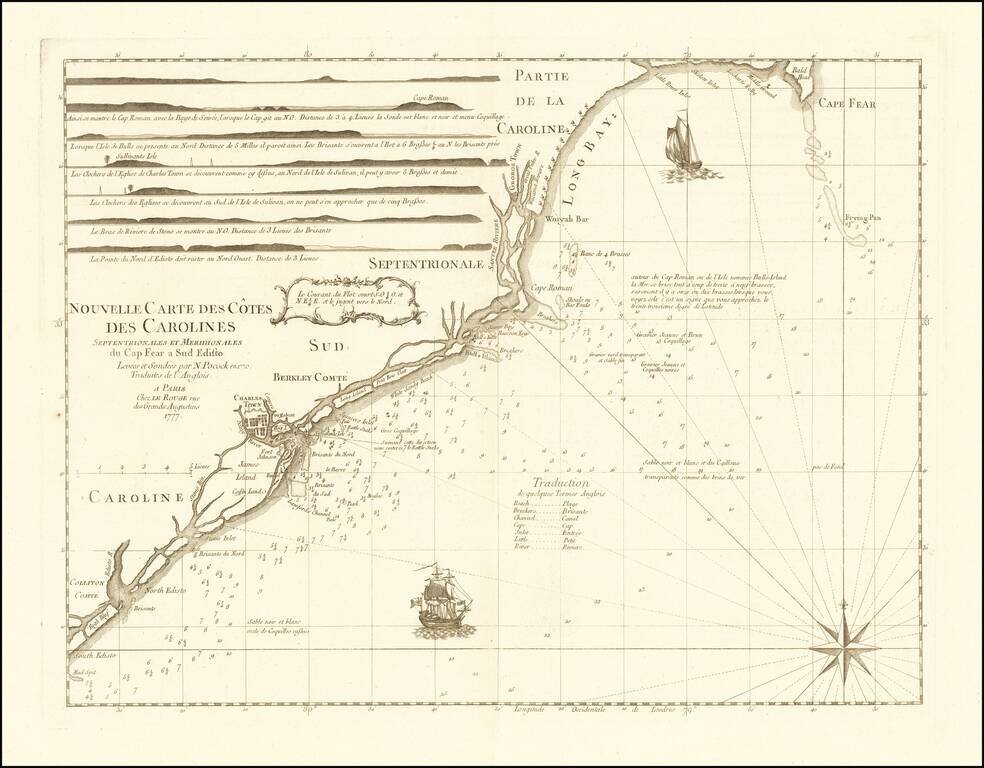
Rare chart of the Carolina coast, prepared by Le Rouge in connection with France's participation in the American Revolutionary War. This rare chart is one of a group of charts prepared by Georges Louis Le Rouge for use by the French Navy, which...
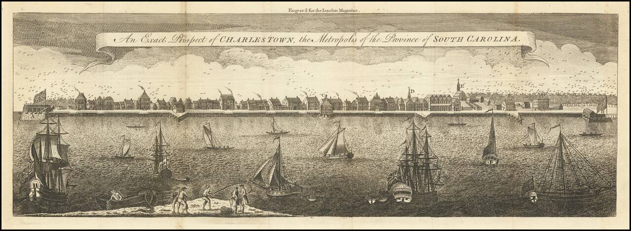
The Earliest Reasonably Obtainable View of Charleston Second edition of this large format view of Charleston is based upon a painting by Bishop Roberts in 1739, which was engraved by William Henry Toms for the London Magazine. There are two examples...
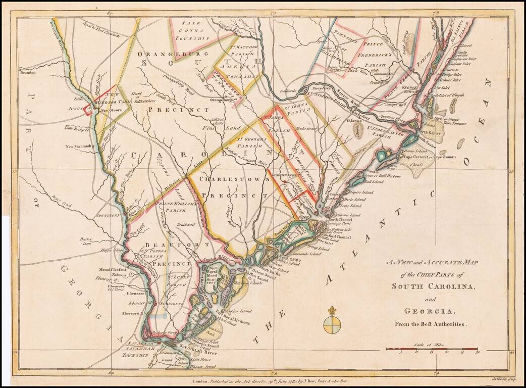
Fine early Revolutionary War map of South Carolina and part of Georgia, engraved by Jonathan Lodge for the Political Magazine of June 1780. The map shows early southern forts, counties, townships, parishes, precincts, towns, roads, rivers, and many...
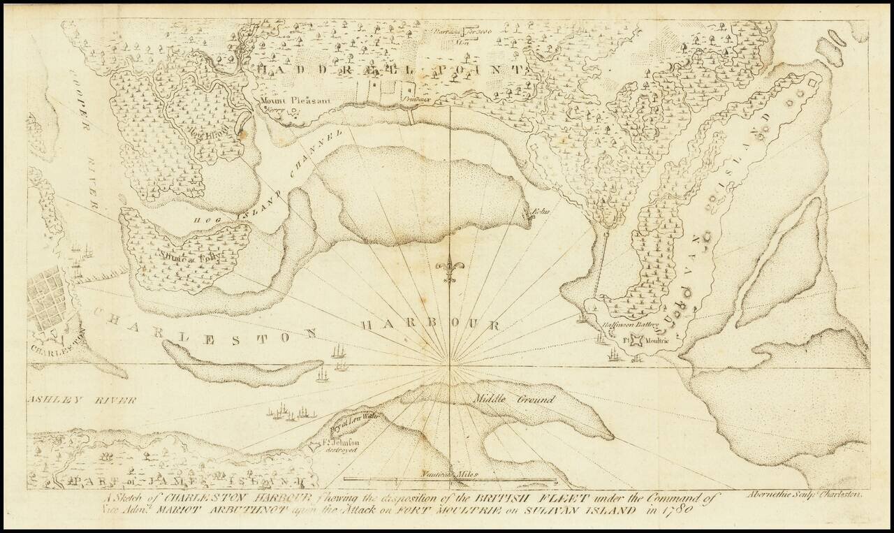
The Second Map Printed South of the Mason Dixon Line. Scarce and important Charleston and Fort Sullivan Battle Plan, issued in David Ramsay's History of the Revolution of South Carolina... . Thomas Abernethie was an early engraver in Charleston,...
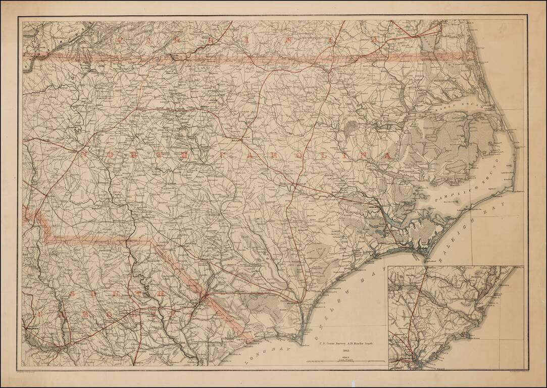
Rare printed color example of this extremely rare map of North Carolina, with the adjoining parts of Virginia and South Carolina, produced by Lindenkohl and lithographed by Krebs at the direction of the US War Department in 1865. During the Civil War,...
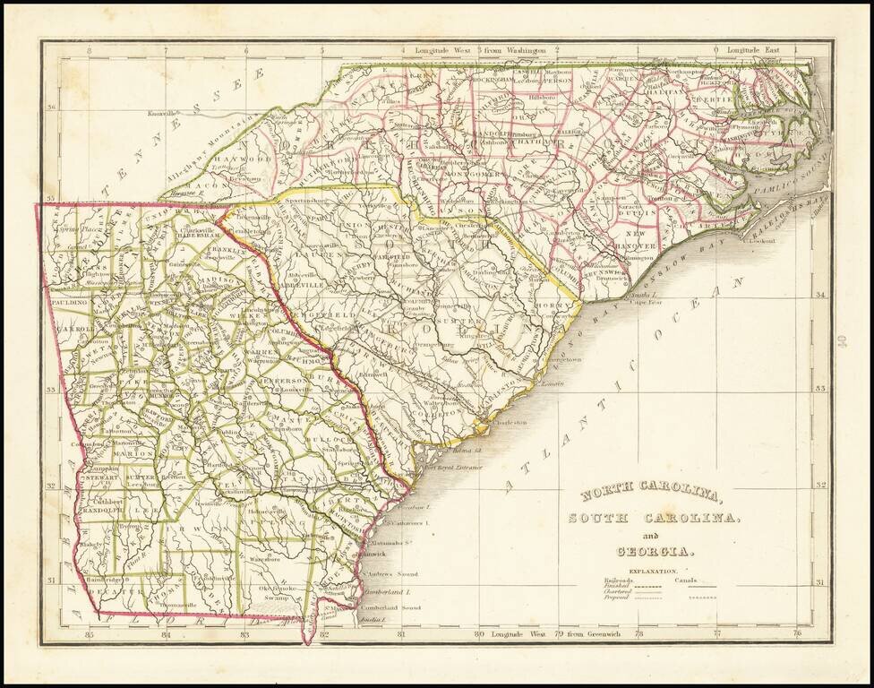
Scarce full original color map of Georgia and the Carolinas, from Bradford's Comprehensive Atlas. Shows counties, towns, rivers, and other details. Bradford's Comprehensive Atlas was one of the most successful commercial atlases of the 1830s, at a...
![[Defending The Southern Coast During the Spanish American War] Map of Sea Islands. Coast of Georgia. from St. Mary's River to Savannah River compiled from the best Authorities 1864 / Map of Sea Islands. Coast of Georgia. from St. Mary's River to Sav](/map/small/59563.jpg)
Defending the Southern Coastline Against Spanish Attacks From Cuba Finely executed manuscript map of the Sea Islands of Georgia and Sea Islands of South Carolina, created by Robert Deas Gignilliat during the Spanish-American war, 1898. The map is...
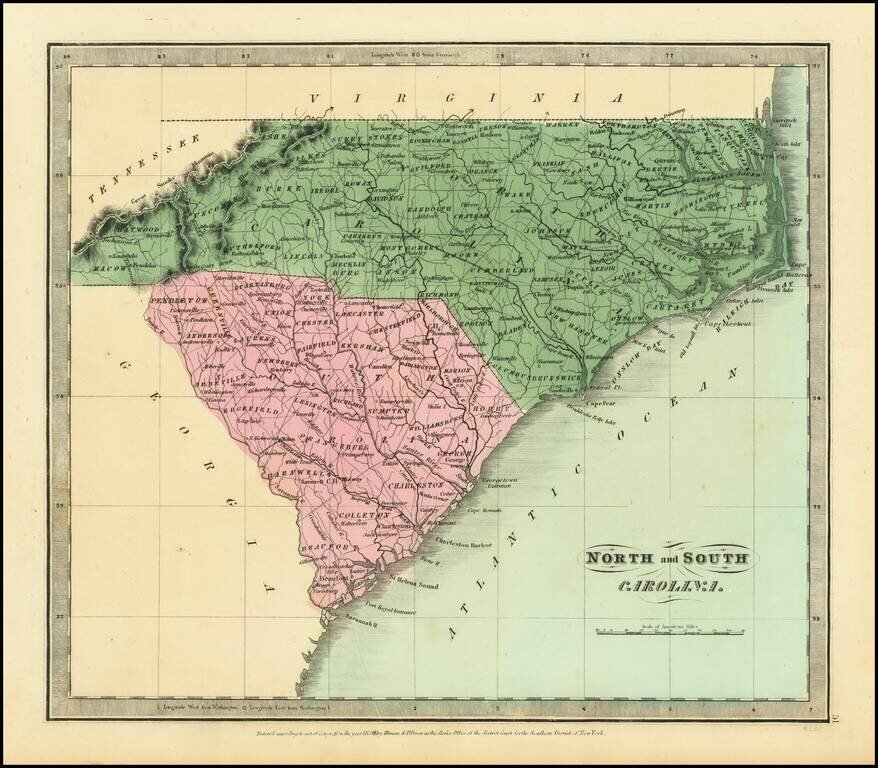
Nice example of the first edition of David Burr's map of the Carolinas, which appeared in his Universal Atlas, first issued in 1836. Shows counties, towns, rivers, roads, courthouses and other details. Burr's Atlas was perhaps the most elegant...
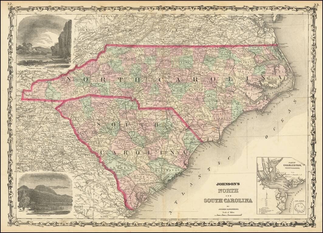
Attractive map of the Carolinas, published by Johnson & Browning. The map is colored by counties and showing towns, railroads, lakes, rivers, forts, swamps, islands, etc. Large inset plan of Charleston and Fort Sumter and large vignettes of Table...