
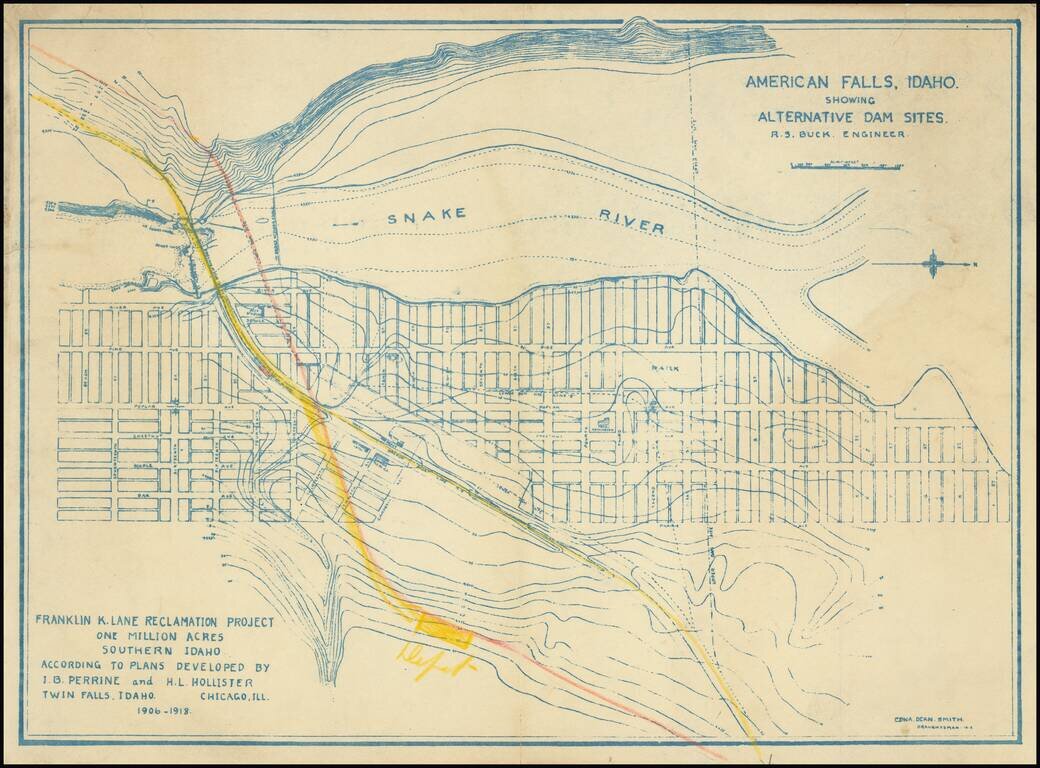
Relocating A Town To Construct the American Falls Dam Topographical plan of the area around American Falls, Idaho and the American Falls, Dam on the Snake River, drawn by Edna Dean Smith. The map was prepared in connection with the "Franklin K. Lane...
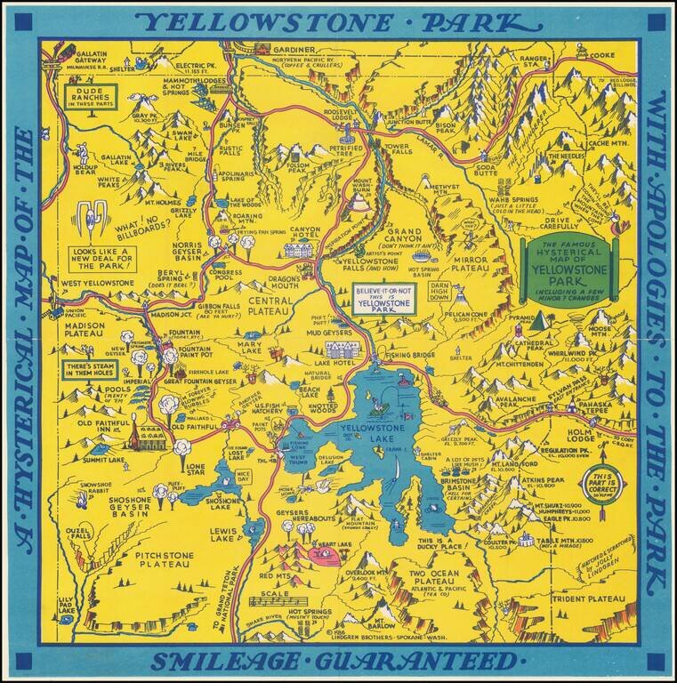
"Hatched & Scratched by Jolly Lindgren," this comic pictorial map is full of puns and comic vignettes related to Yellowstone and environs. The Lindgren Brothers issued a number of other silly whimsical maps of national parks and other parts of the...
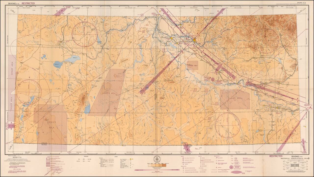
Restricted World War II Aviation Map Detailed aeronautical map of the Boise area. The chart is a font of information about civil and military aviation during WWII. It was intended for civil aviators flying by visual navigation and so includes data...
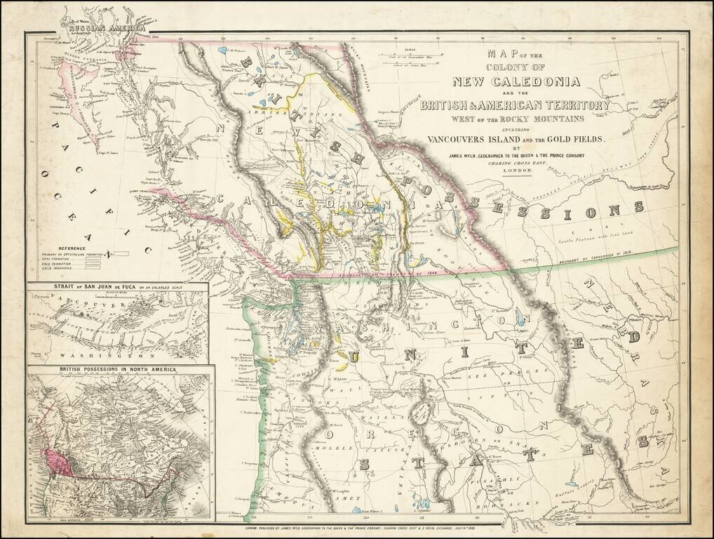
First State of this Exceptional Fraser Canyon Gold Rush Rarity One of the great early mappings of the Pacific Northwest, covering Oregon Territory, Washington Territory, and British Columbia (which was then still "New Caledonia") with information...
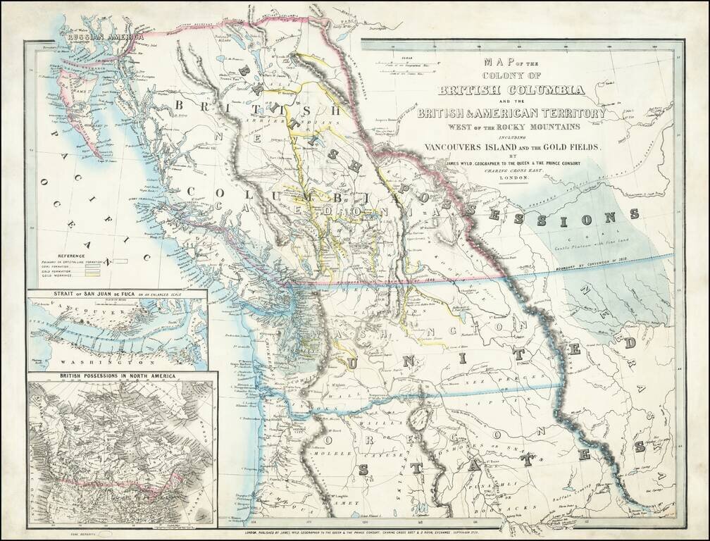
An Exceptional Fraser Canyon Gold Rush Rarity. One of the great early mappings of the Pacific Northwest, covering Oregon and Washington Territories, and British Columbia ("New Caledonia") with information derived from the Hudson Bay Company and Royal...