
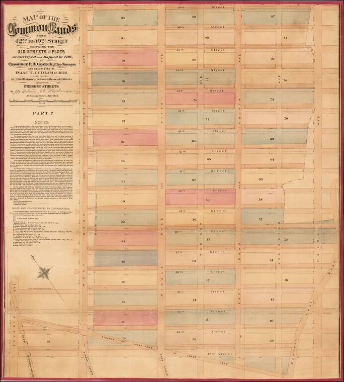
![[Upper East Side - Manhattan -- 79th Street to 93rd Street] Map of the Common Lands from 76th to 93rd Street Showing the Old Streets and Plots As Surveyed and Mapped in 1796, By Cassimer T. H. Goerck, City Surveyor and Resurveyed by Isaac T. Ludlam in 1](/map/small/61033.jpg)
Upper East Side - Manhattan (79th Street to 93rd Street) This is a John Bute Holmes 1874 cadastral map of the Upper East Side neighborhood of Manhattan - the only specific map of this area to appear in the 19th century. The map depicts the region...
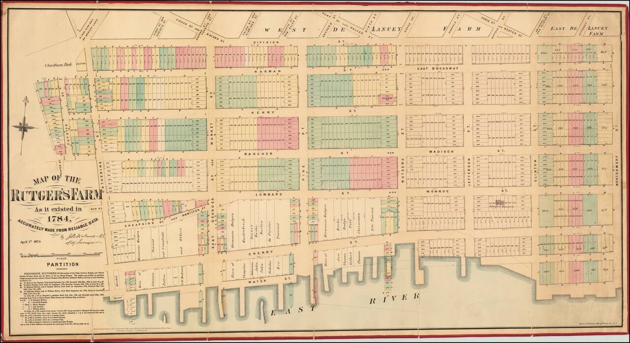
Excellent separately-issued 1874 map of the Lower East Side and Two Bridges neighborhoods of Manhattan. The map covers Oliver Street to Montgomery street and from Division to the East River. The Rutgers Farm The Rutgers Farm, which occupied the...
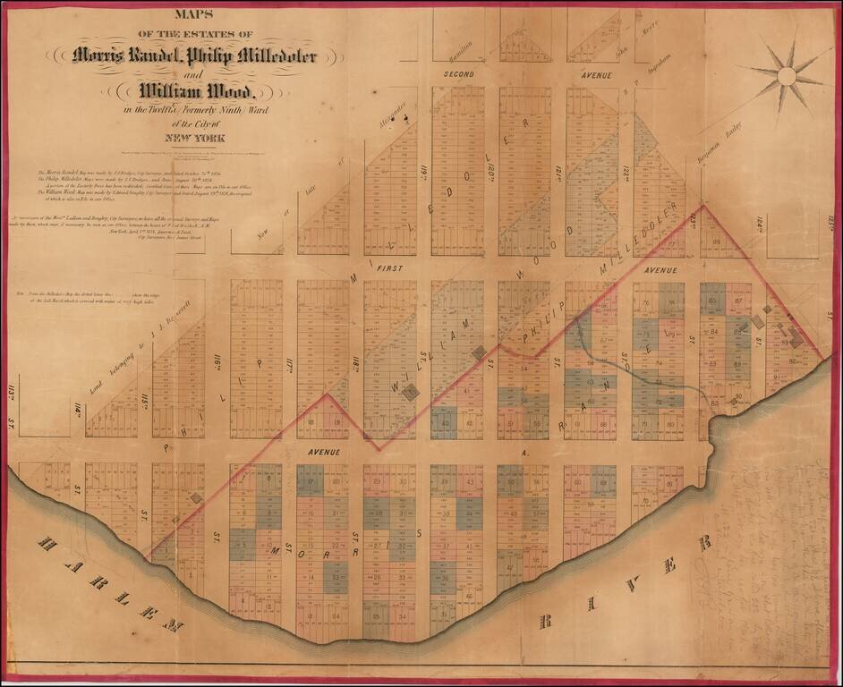
Rare cadastral map of New York City's Spanish Harlem. A rare cadastral or property map of northeastern Manhattan, New York City, between Second Avenue and the Harlem River, and from 113th to 125th Streets. This area is today generally considered part...
Fascinating map of the Upper East Side by one of New York's most eccentric mapmakers. Superb large format, separately issued map of part of the Fashion District in Manhattan, by one of New York's most fascinating mapmakers, John Bute Holmes. This...
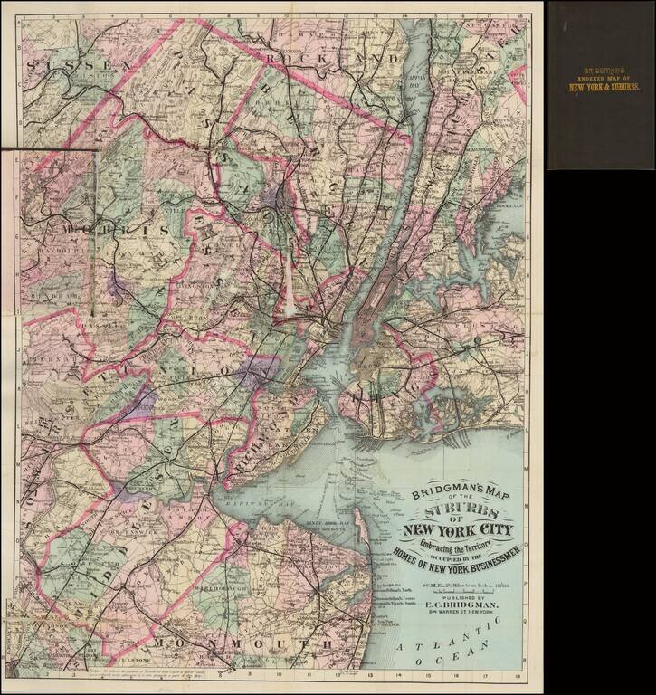
Very attractive hand-colored folding map of New York City and environs, showing the suburban towns of Long Island, New Jersey, and Westchester. Shows rail lines, including commuter rail. Hand-colored in outline by county, and in wash for townships. A...
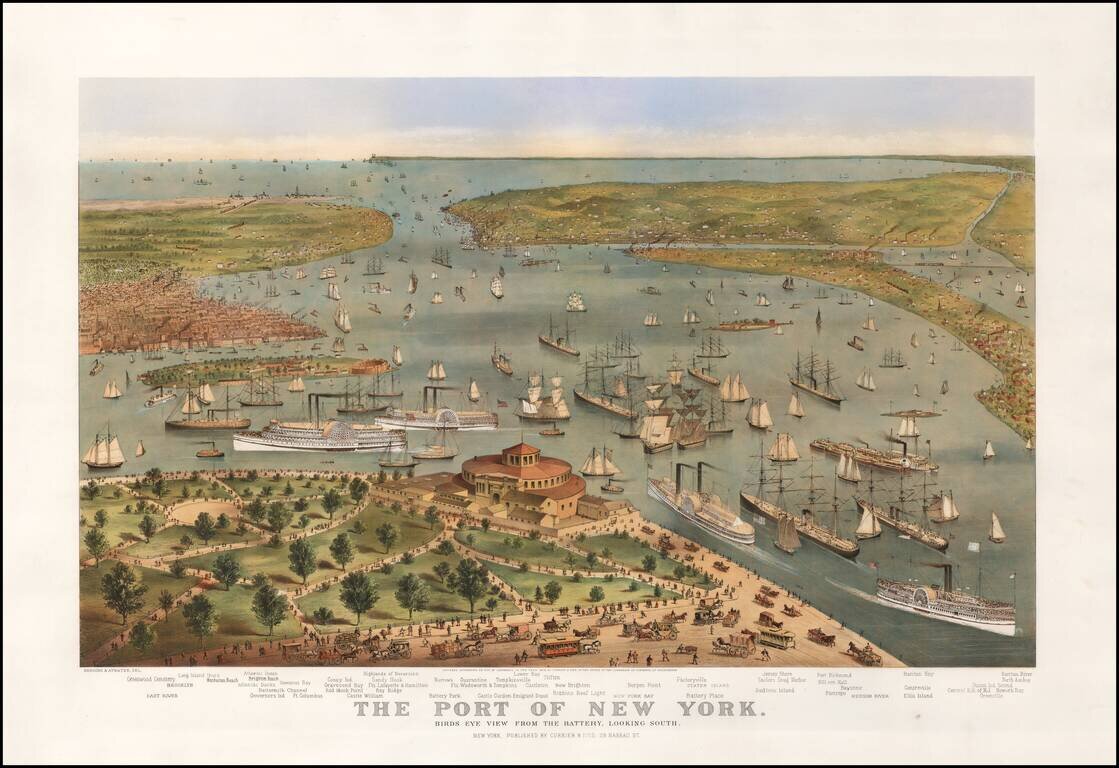
Currier & Ives' definitive 19th-century view of the bustling Harbor of New York. First state of Currier & Ive's striking view of New York Harbor, pre-dating the inclusion of the Statue of Liberty. In the foreground, a bustling Battery Park...
Rare Cadastral Map of Midtown West, Including Times Square and part of the Theater District. Antique, separately-issued John Bute Holmes hand-colored lithographed map, depicting the region from the Hudson River to Sixth Avenue and from 57th Street to...
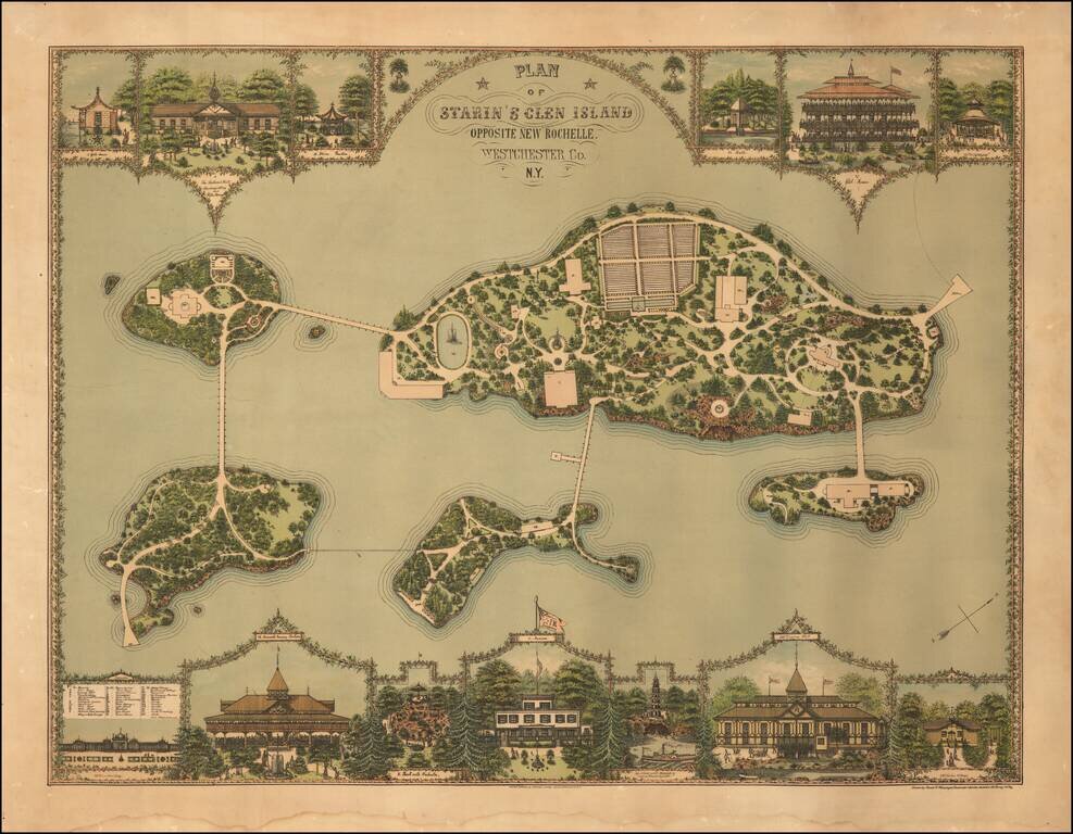
Gilded Age Landscape Design of "the First Theme Park in the Country". Superb chromolithograph landscape design map, showing the layout for Starin's Glen Island in Long Island Sound, off New Rochelle. The print is the work of Franz Xaver Heissinger, a...
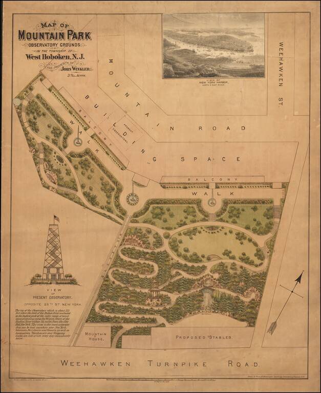
A Gilded Age Design for an Observatory Overlooking Manhattan. Unrecorded color-lithographed architectural plan for the grounds surrounding the Hoboken observatory overlooking Manhattan. The observatory in Hoboken echoed the Latting Observatory on a...
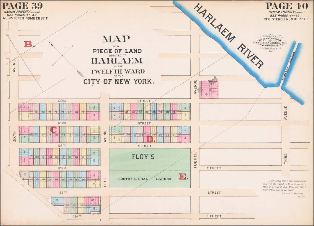
Hand-colored lithographed map of part of Harlem, New York City, published by Spielmann & Brush in their very rare atlas Certified Copies of Original Maps of Property in New York City (1881). The last copy of that atlas was on the market with a New...
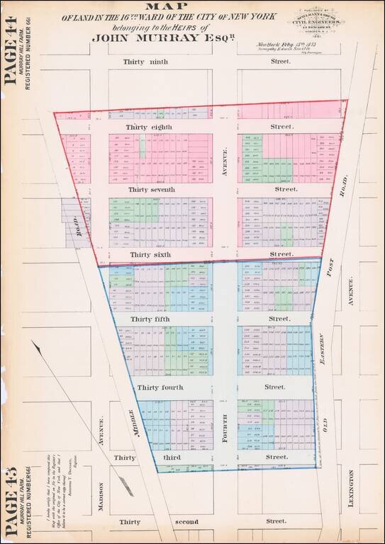
Hand-colored lithographed map of Murray Hill, New York City, published by Spielmann & Brush in their very rare atlas Certified Copies of Original Maps of Property in New York City (1881). The last copy of that atlas was on the market with a New...
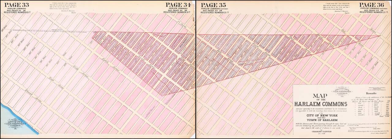
Hand-colored lithographed map of part of Harlem, New York City, published by Spielmann & Brush in their very rare atlas Certified Copies of Original Maps of Property in New York City (1881). The last copy of that atlas was on the market with a New...
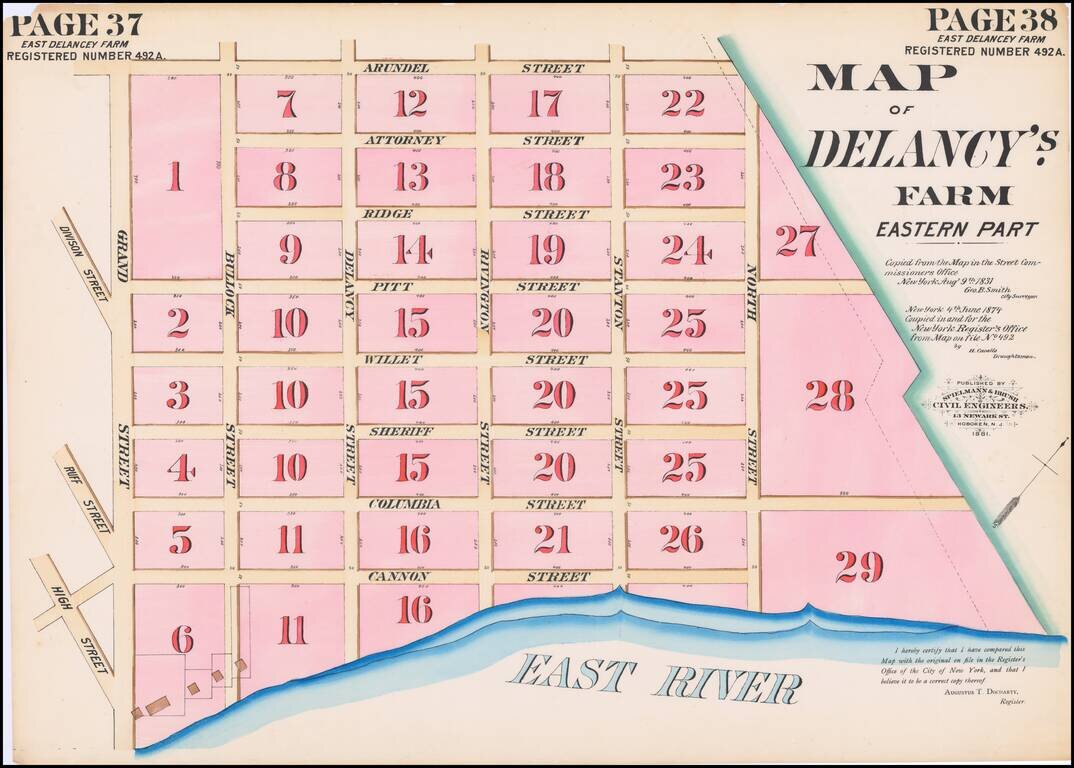
Hand-colored lithographed map of part of the Lower East Side, New York City, published by Spielmann & Brush in their very rare atlas Certified Copies of Original Maps of Property in New York City (1881). The last copy of that atlas was on the...
![[Lower East Side.]](/map/small/59559.jpg)
Hand-colored lithographed map of part of the Lower East Side, New York City, published by Spielmann & Brush in their very rare atlas Certified Copies of Original Maps of Property in New York City (1881). The last copy of that atlas was on the...
![[Chelsea, New York City] Map of Land in the Twelfth Ward of the City of New York Belonging to the Estate of George C. Schroepel Decd.](/map/small/59760.jpg)
Hand-colored lithographed antique map of the land that became present-day Penn South Houses, New York City, published by Spielmann & Brush in their very rare atlas Certified Copies of Original Maps of Property in New York City (1881). The last copy...
![[Hudson Yards, New York City] Map of Land in the Twelfth Ward of the City of New York Belonging to the Estate of George C. Schroepel Decd.](/map/small/60172.jpg)
Hand-colored lithographed map of the land that became present-day Hudson Yards, New York City, published by Spielmann & Brush in their very rare atlas Certified Copies of Original Maps of Property in New York City (1881). The last copy of that...