
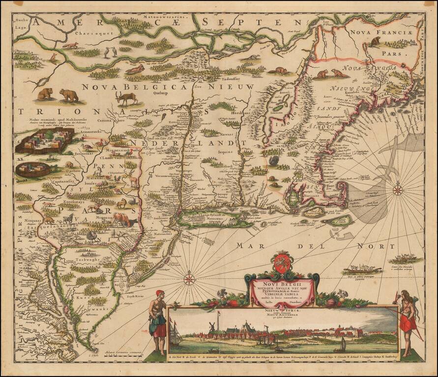
Danckerts Edition of Visscher's Landmark Map of the Northeast Second state of Justus Danckert's map of New Netherlands, including a view of New Amsterdam, now also called "Nieuw Yorck." A very attractive example from this famous and much sought...
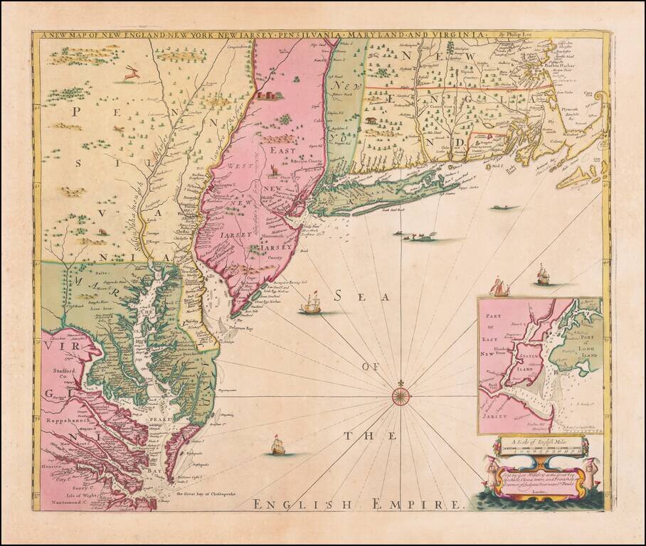
Spectacular Contemporary Color Example of An Important Map of the British Colonies with the First Printed Plan of New York Harbor Remarkable old color example of the final edition of Thornton, Morden & Lea's important map of the English Colonies...
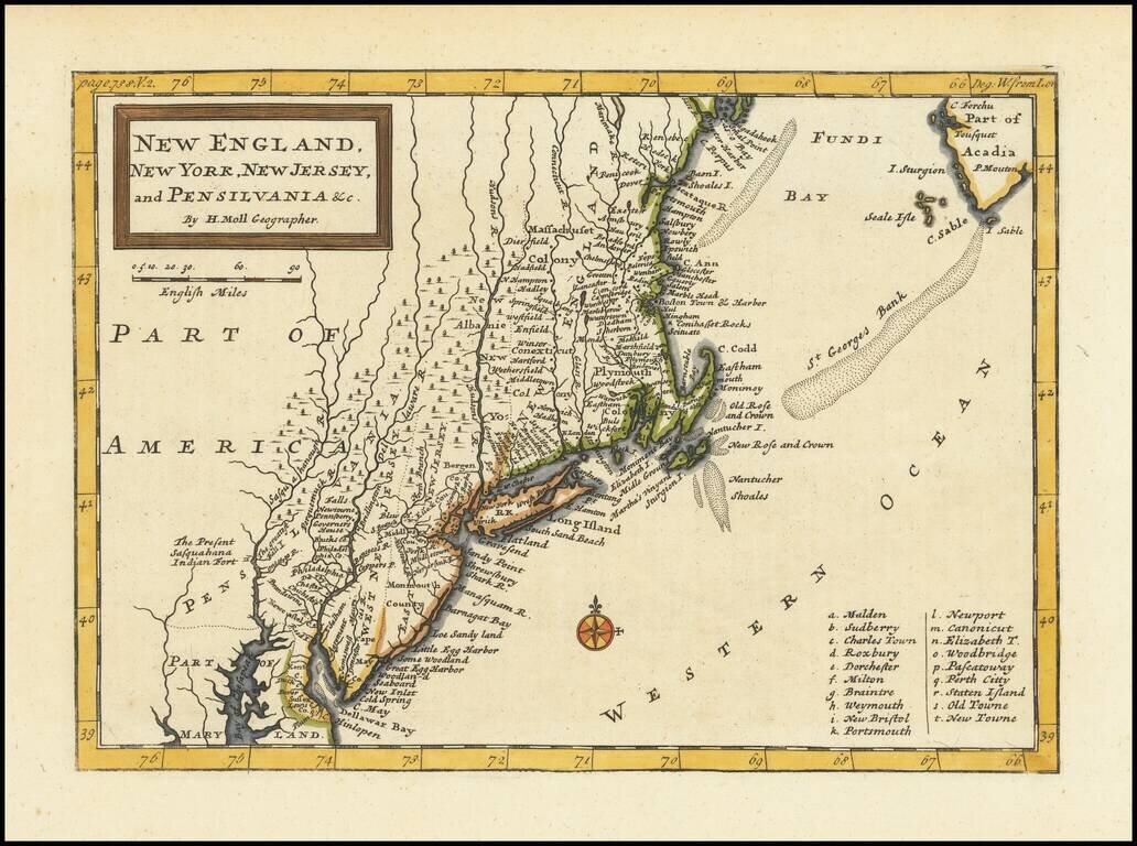
Highly detailed regional map of the Northeastern United States, from Moll's Atlas Minor. A fine early regional map of the American Colonies.

Fine example of Bellin's map of New England and the Northeast Region. An excellent early map of the region bounded by New England, Lake Ontario and the northern Chesapeake River, centered on New York and Connecticut from Bellin's Histoire Generale des...
![[Vermont / New Hampshire Grants]](/map/small/69612.jpg)
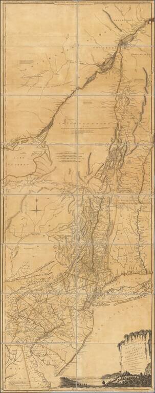
Manuscript Map Showing the New Hampshire Grants Which Would Become The State of Vermont Finely executed manuscript map delineating the New Hampshire Grants, the first meaningful delineation of the future state of Vermont. The map extends north to...
Rare First Edition, Second State, of Samuel Holland's Map of New York, Vermont, New Jersey, etc. Important colonial map of the Hudson River and its tributaries, including the Mohawk, and also with New Jersey and the upper course of the St. Lawrence...
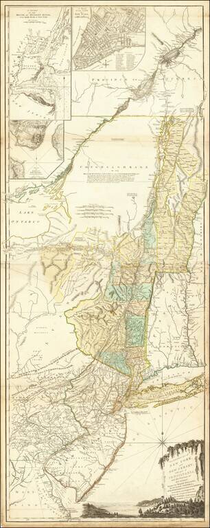
Rare Final State of Samuel Holland's Map of New York, Vermont, New Jersey, etc. Nice example of this important colonial map of the Hudson River and its tributaries, including the Mohawk, and also with New Jersey and the upper course of the St....
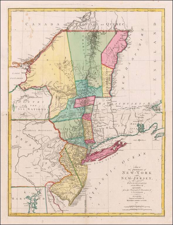
German edition of Sauthier's important map of the Provinces of New York and New Jersey, published at the outset of the American Revolution. A highly detailed extending from Delaware Bay, New Jersey in the South to New York-Canada border, and including...
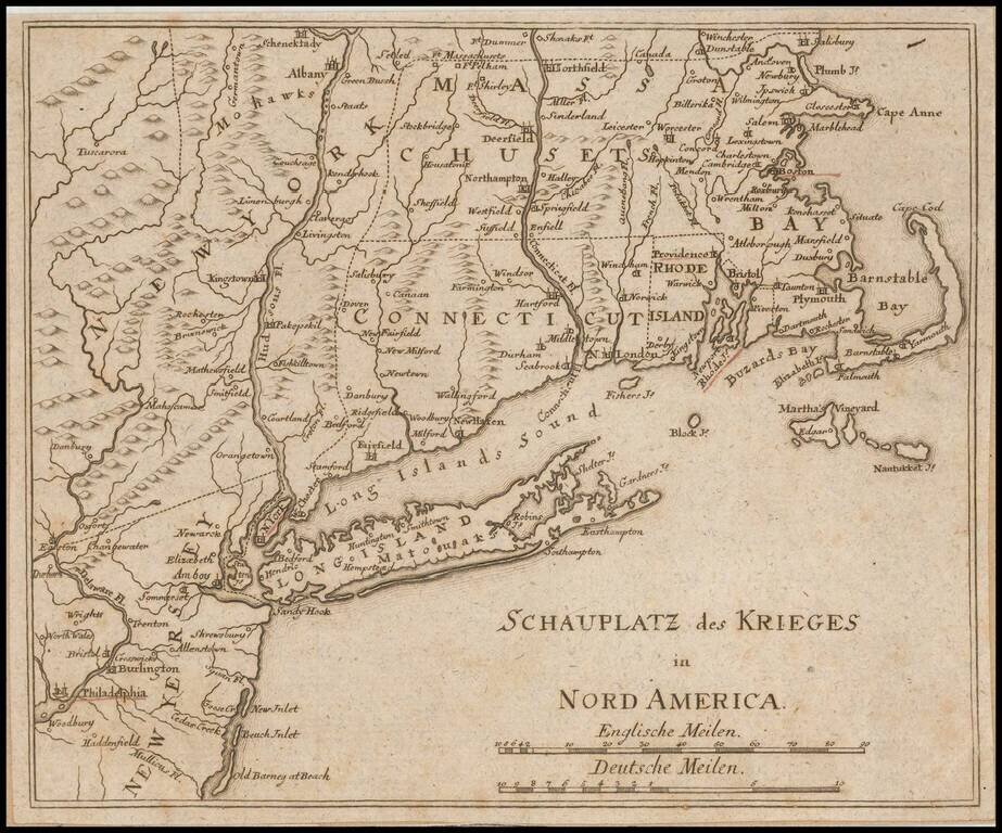
Unrecorded German map of the Theater of War in the northeast during the American Revolution. The towns of Boston, Providence, Newport, New York and Philadelphia are underlined in red. This is the first time we have ever seen the map and we can find...
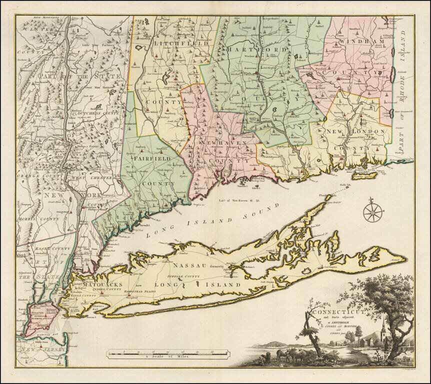
Bernard Romans' Map of Connectiuct -- A Revolutionary War Era Rarity Important early map of Connecticut and Long Island, originally published in New Haven by Bernard Romans and later in Amsterdam. This map was one of four Romans maps parts of the...
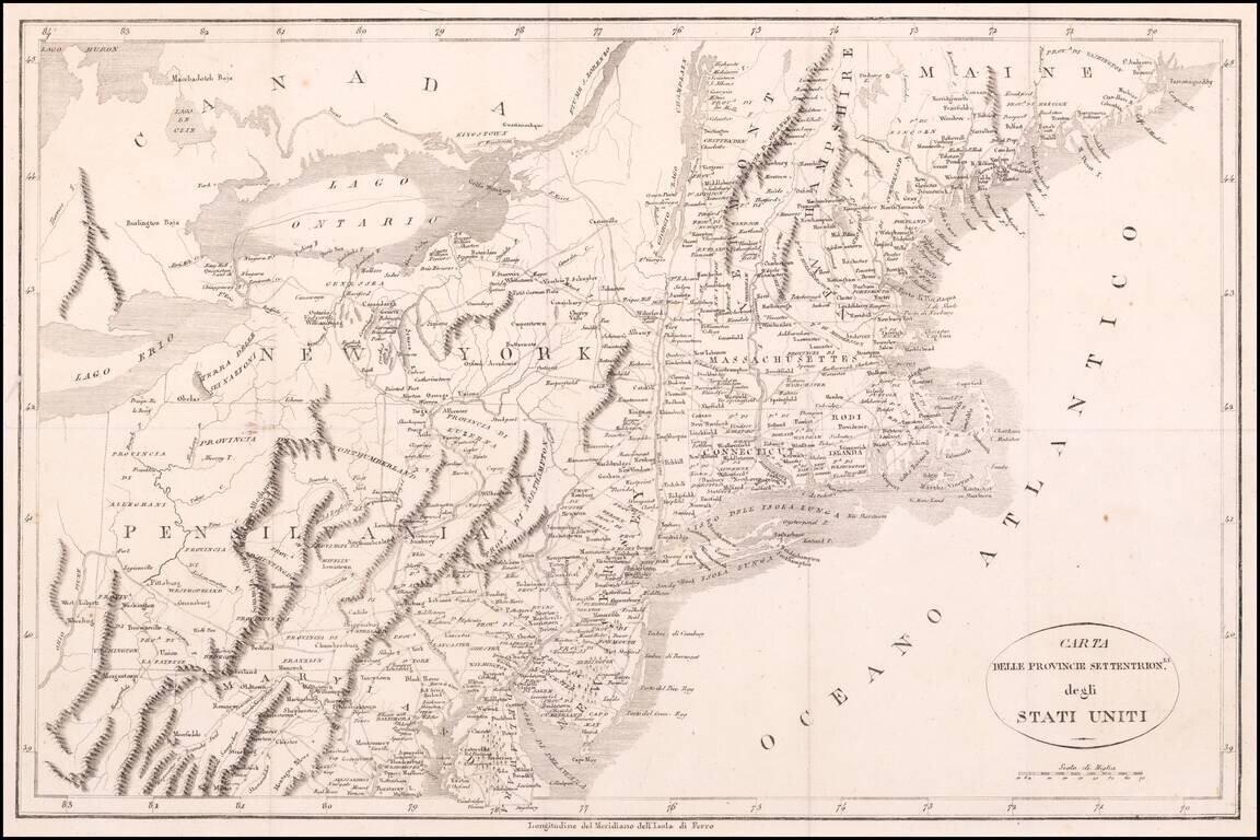
Interesting map of the Northern Part of the United States, from a scarce Italian Edition of La Rochefoucault-Liancourt's Travels in the United States, one of the most popular travel guides of the period. The map extends west to the Ohio River,...
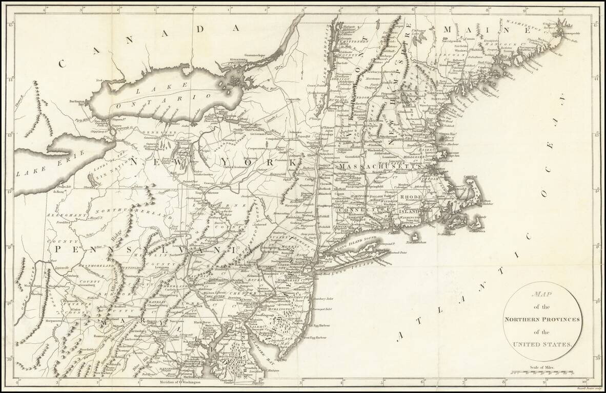
Detailed map of the Northeastern United States, extending south to Maryland and the Upper Chesapeake. The map includes excellent treatment of the early US roads throughout the region. The map appeared in La Rochefoucault-Liancourt's Travels Through...
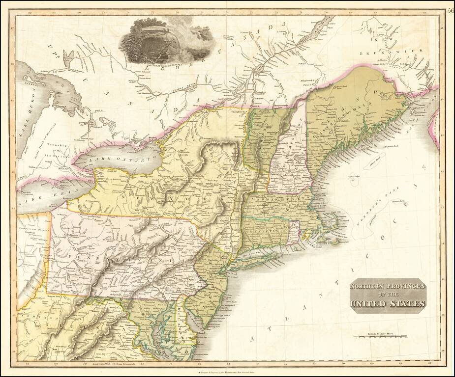
Interesting map of the Northeastern part of the United States, bounded by New England, New York, Pennsylvania, Virginia, Delaware, Maryland, New Jersey, etc. Indiana appears in northern Virginia. Connecticut reserve appears on the Cuyahoga River. The...
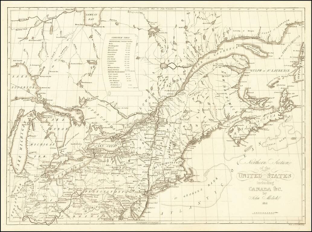
Rare map of the Northeastern United States, which first appeared in John Melish's Traveller's Directory… published in Philadelphia. This Northern Sheet, previously titled Map of the Seat of War…extends from the Great Lakes to Nova Scotia, New...
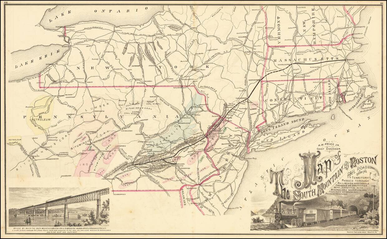
Decorative map of the Route of the South Mountain & Boston Railroad, from Harrisburg/Rockville to Boston, with a large decorative title vignette and a vignette showing a the Bridge where the railroad crosses the Hudson River. A relatively rare map...
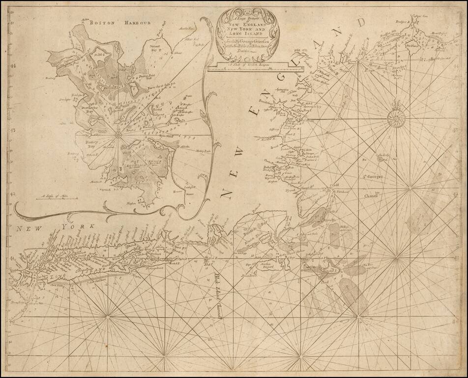
A "Pirated Dublin" Sea Chart of New England and Long Island A rare chart of the New England coast adapted from the work of Cyprian Southack and published in a Dublin edition of the English Pilot. The Fourth Book. The chart depicts the northeast...