Map size in jpg-format: 1.9982MiB
Click to open in high resolution (open in new tab).
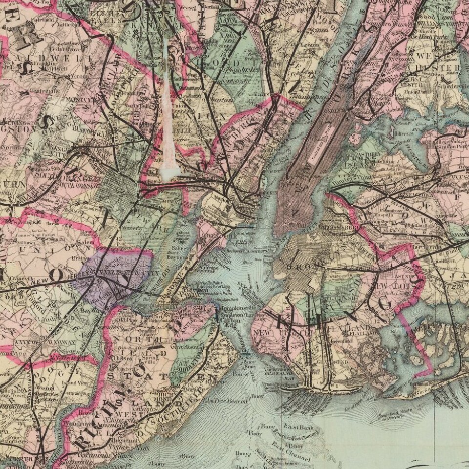
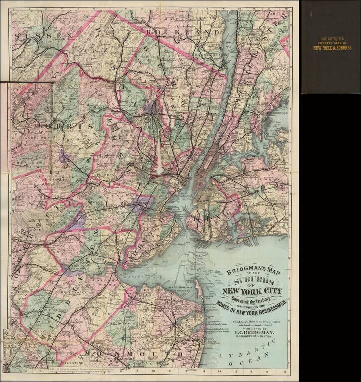
Very attractive hand-colored folding map of New York City and environs, showing the suburban towns of Long Island, New Jersey, and Westchester.
Shows rail lines, including commuter rail. Hand-colored in outline by county, and in wash for townships.
A nice New York-centric map.
If you are a student, write to us in telegram: @antiquemaps and indicate what material you need and for what work you need a map in high detail. We are ready to provide material on special terms. For students only!

![[Charles Lindbergh] Spirit of St. Louis](/map/small/69234.jpg)
![[Charles Lindbergh / New York to Paris View] Spirit of St. Louis](/map/small/69235.jpg)