Map size in jpg-format: 5.11193MiB
Click to open in high resolution (open in new tab).
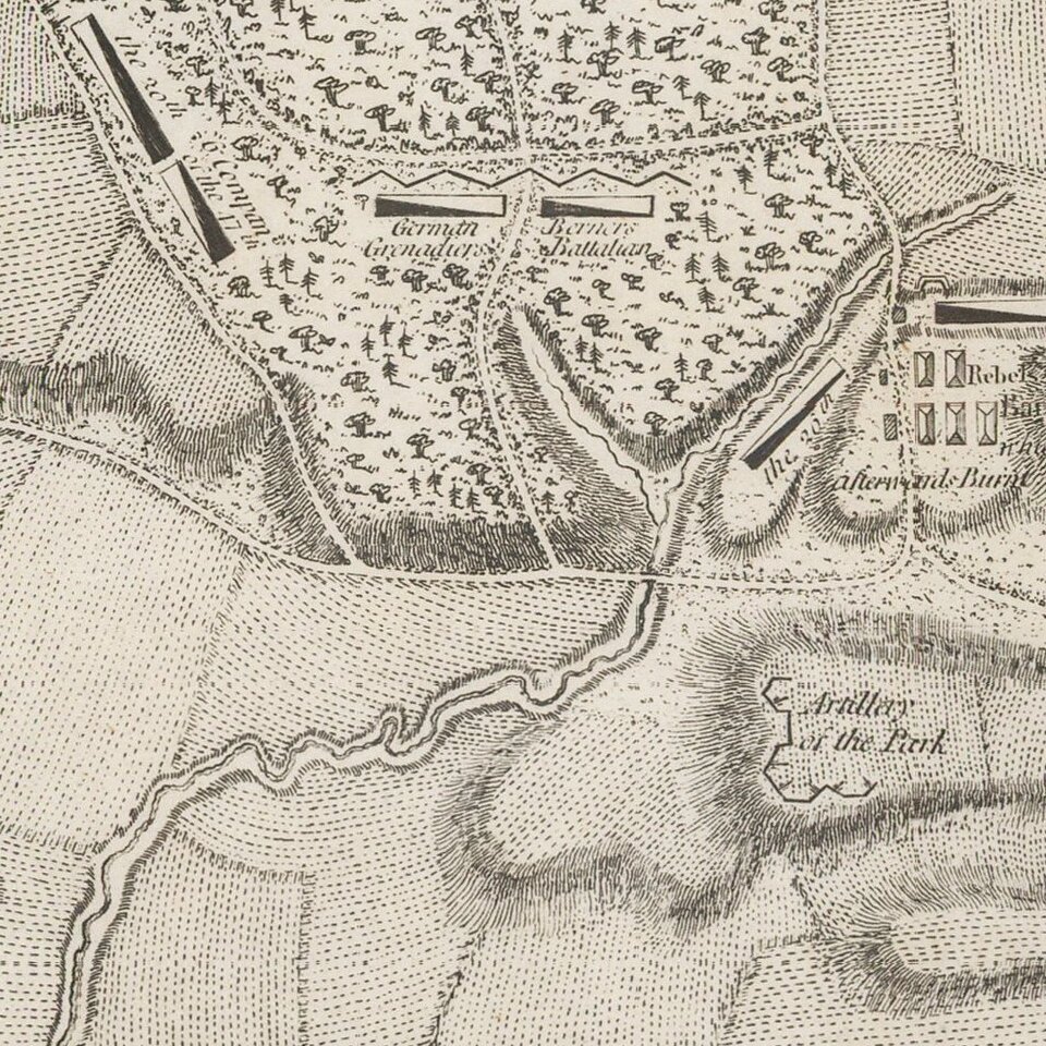
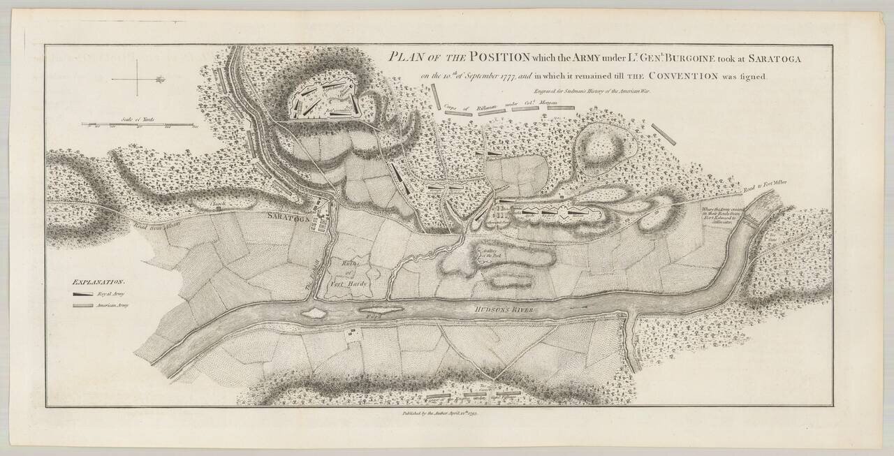
An important early battle plan, showing the position of the British and American Troops following the second battle of Saratoga.
Following the first battle, Burgoyne took a defensive position, while the Americans withdrew to wait for his next move. Burgoyne marched out and was attacked by Gates on both flanks. While his army survived the battle, the consequences were quite severe. With his supplies running low and his escape blocked by the American, Burgoyne set up a final defensive camp near Saratoga, where he remained until he negotiated terms of surrender on Oct. 17, 1777. The battle was a major turning point in the American Revolution, as it was the American's first major victory and contributed significantly to the French decision to back the Americans.
Originally engraved by Faden, the map shows the final encampment of Burgoyne's army, including troop placements and defenses across the Fish Kill from Saratoga and the American positions surrounding the British, including Gates' main army to the south of the Fish Kill, Morgan's riflemen in the woods to the west, and General Fellows troops blocking the escape route across the Hudson on the east.
If you are a student, write to us in telegram: @antiquemaps and indicate what material you need and for what work you need a map in high detail. We are ready to provide material on special terms. For students only!
![[Vermont / New Hampshire Grants]](/map/small/69612.jpg)