
![[Proietio Optica Hemisphaerii Polaris Arctici]](/map/small/59287.jpg)
Unusual World map on a North Polar projection, with a highly enlarged depiction of Greenland and Iceland and celestial model in the upper right. The map shows California as an Island and a potential NW Passage and also a possible continuous landmass...
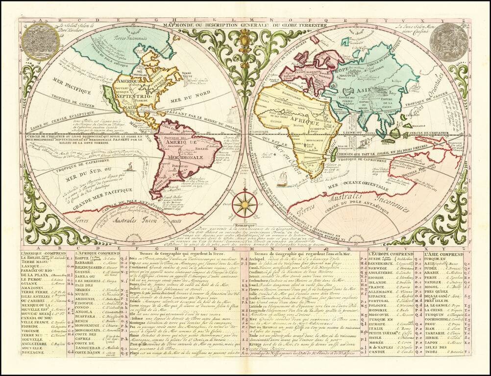
Decorative double hemisphere map of the World, published by one of Paris's leading mapmakers, Nicolas De Fer in 1700. In the west, the map shows California as an Island, the Northwest Passage, an interesting misprojection of the Great Lakes, and the...
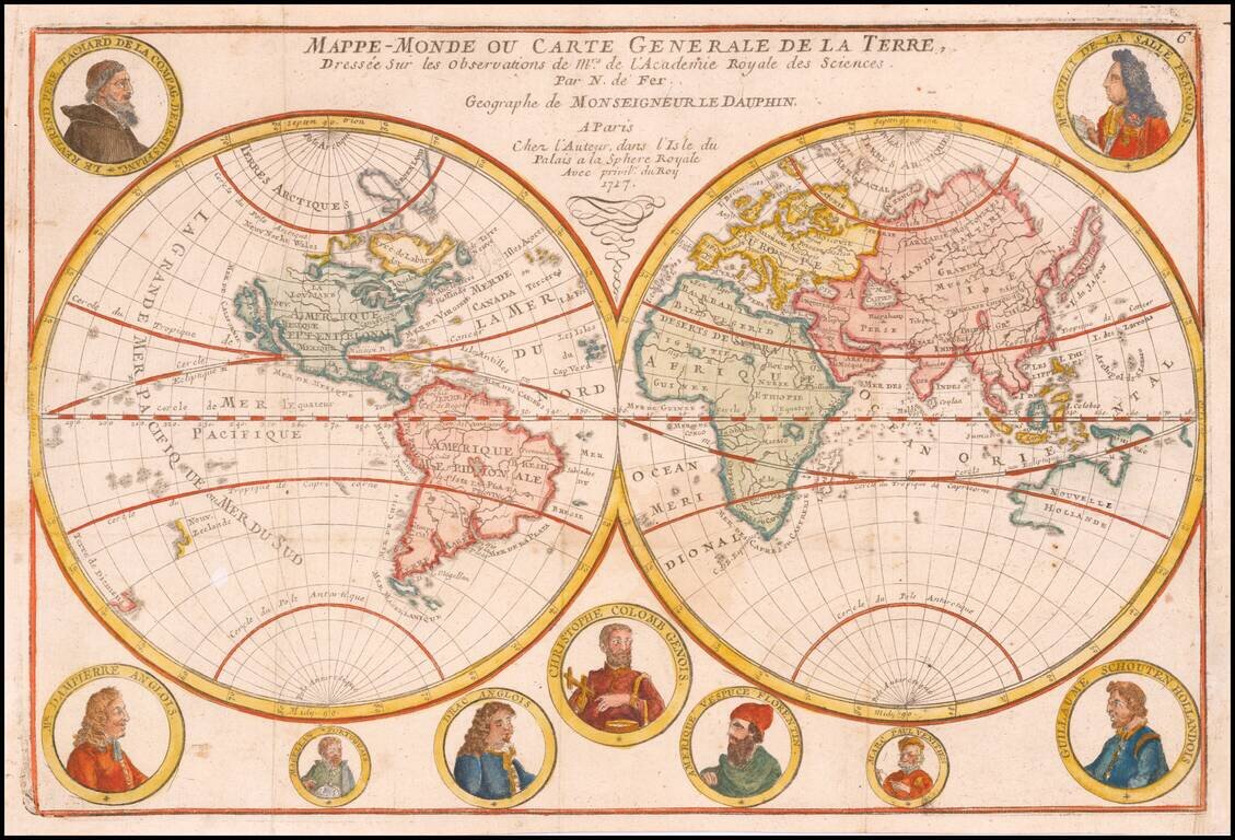
An Unusual Treatment of Australia and the Unknown Southern Continent Decorative world map, showing California as an island, the tracks of several explorers around the world and Celestial images of the sun Kircher and the moon by Cassini. The map...
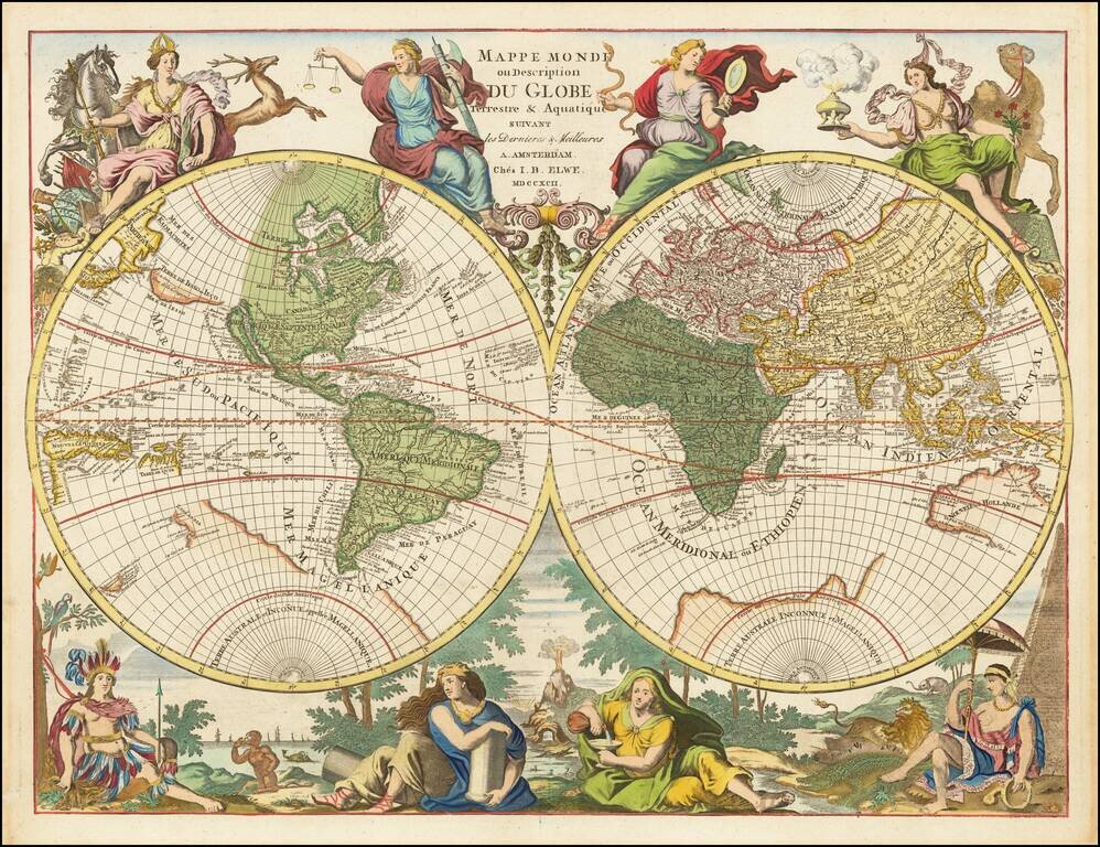
Hubert Jaillot's World Map Re-Issued At the End of the 18th Century Scarce Dutch decorative double hemisphere map of the World one of the most unique and decorative world maps of the period. By the end of the 17th Century, Paris was supplanting...
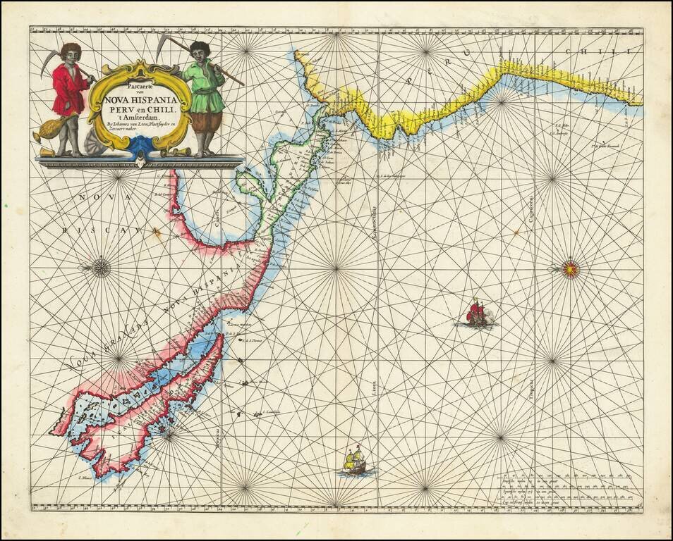
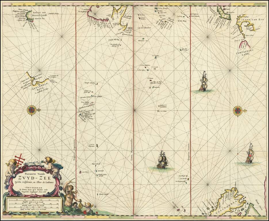
Rare Golden Age Dutch Sea Chart of the Island of California and Western Pacific Rare Johannes Van Loon sea chart of the Western Pacific. The map appeared in the first edition of Van Loon's Zee Atlas. It derives from Doncker's map of the Western...
![Amerique Septentrionale divisee en Ses Principales parties . . . . 1692 [California as an Island]](/map/small/69862.jpg)
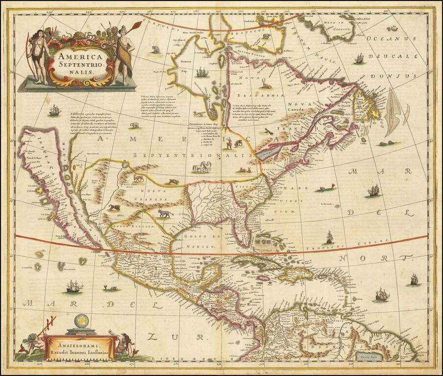
Jaillot’s Impressive Map of North America, with California as an Island Fine, dark impression of Jaillot's striking, large-format map of North America, showing California as an island. The map, printed in a wide-format, shows all that was then...
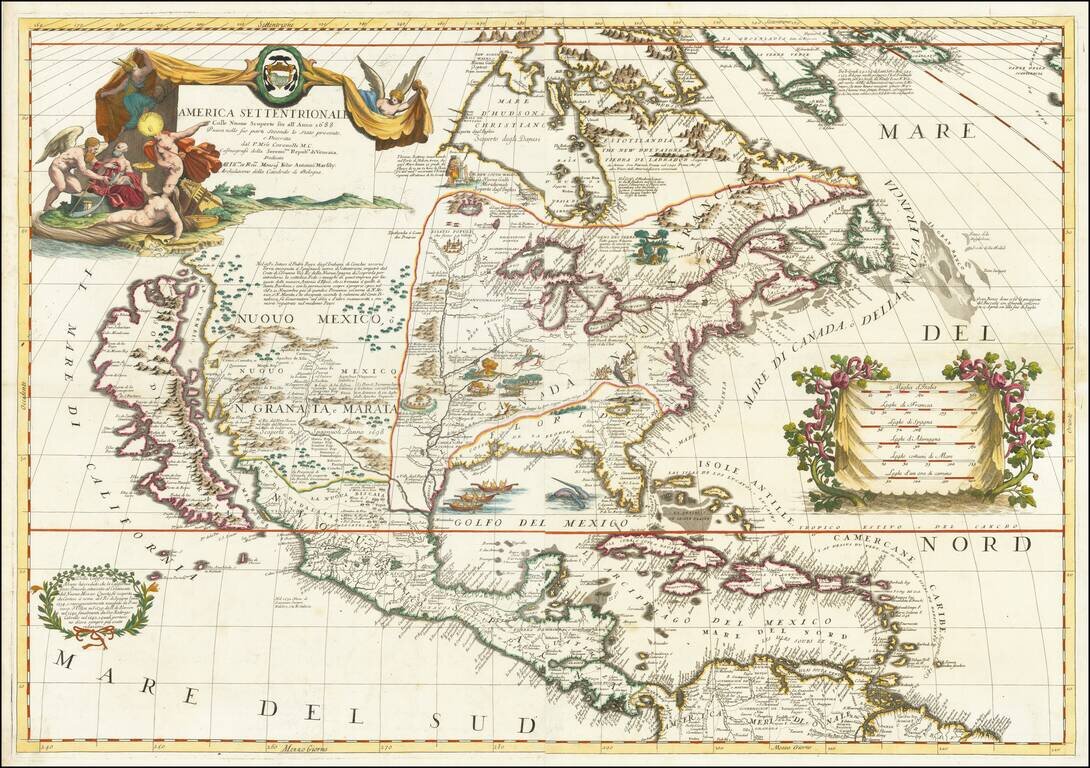
Landmark Map of North America by Coronelli with California as an Island Fine example of Coronelli's cornerstone map of North America, one of the most influential maps of the continent published in the late seventeenth century. The map is...
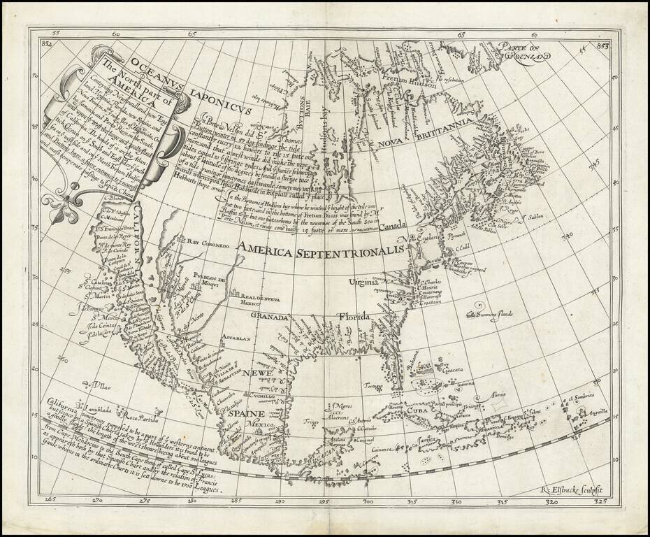
The Most Important Map of North America Published in England in the Seventeenth Century Fine example of Henry Briggs’ famous map of North America, one of the most important and influential printed maps of the seventeenth century. It was included in...
![Americque Septentrionale Par le Sr. Sanson d'Abbeville Geographe du Roy . . . 1705 [Rare Peninsular California edition, with unusual Mississippi River depiction]](/map/small/61024.jpg)
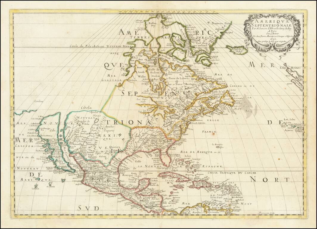
Antique Map of North America -- California as an Island Old color example of Sanson's revised map of North America. In 1705, Pierre Moullart Sanson radically revised this map of North America, modifying perhaps the three most significant features of...
One of the Most Influential American Maps of the 17th Century. Nice old color example of Sanson's landmark map of North America. One of the most influential American maps of the 17th Century Sanson is regarded as the founder of the 'French School' of...
Largest Separate Representation of the Island of California Striking large-format map of the island of California—the largest separate representation of the island of California on a printed map. It is a later representation of the island (1720),...
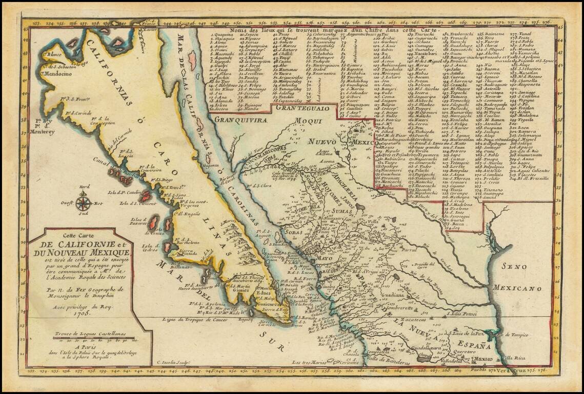
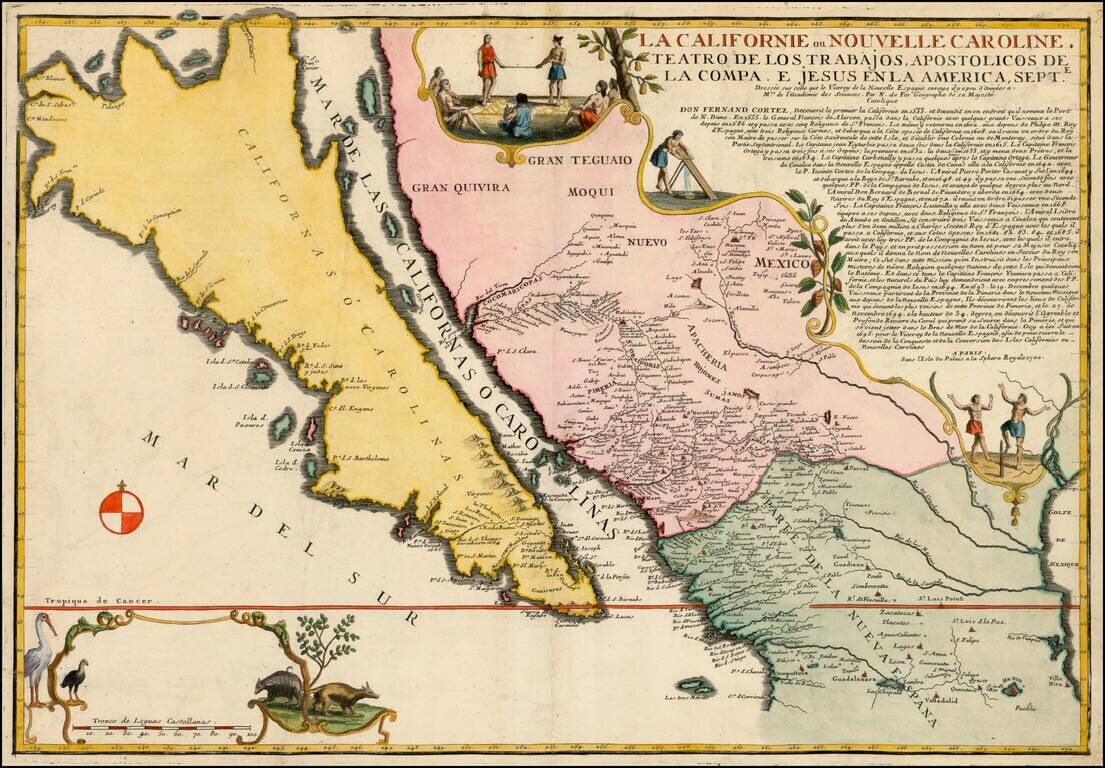
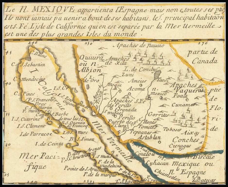
De Fer’s Map of the Southwest Based Upon the Earliest Reports of Father Kino -- One of the Few Regional Maps to Show the Island of California Scarce second state of De Fer's map of California, bearing the date 1705. This is one of a select few...
![[The 5 Californias] Carte De La Californie Suivant 1. La Carte manuscrite de l'Americque de Mathieu Neron Pecci olen dressee a Florence en 1604, 2. Sanson 1656 . . .](/map/small/67157.jpg)
Survey of the Fine Early Maps of California A historically important depiction of the 5 most influential cartographic depictions of California, showing the evolution of how California was mapped between 1604 and 1767. The earliest map is (upper...
"The first map devoted so much to California"-- Burden A little, very rare, gem of a map of California as an Island, stretching eastwards into lands little known. Many places throughout this region are named, and colonial claims are shown. A long...
Hondius and Jansson’s Map of North America, A Map Central to the Myth of California as an Island Striking example of the first state of Henricus Hondius’ and Jan Jansson’s map of North America, called by Burden the single most influential map in...
Rare Dutch Sea Chart of the Pacific Fine old color example of Pieter Goos' sea chart of the Pacific Ocean, extending from Australia, New Zealand and Japan to California. Oriented with west at the top, Goos's chart is among the earliest regional maps...