

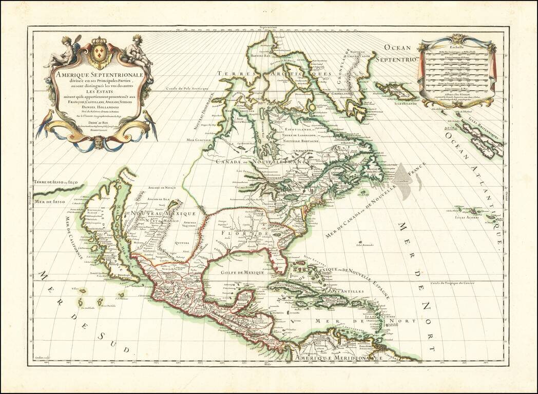
First edition of the Sanson-Marriette map of North America, first issued in 1669. Produced by Guillaume Sanson and Pierre Mariette, after the death of Guillaume's father Nicolas in 1667, this map is a reduced-size copy of Nicolas Sanson's 4-sheet wall...
![A Chart of the South Sea [1st English Map of the Pacific Ocean]](/map/small/47376.jpg)
Unrecorded state of John Seller's map of the Pacific Ocean, the first English map of the Pacific. John Seller's map of the Pacific Ocean is the first English map of the Pacific. First issued in 1675, it is a map of exceptional rarity and importance...
Striking map of North America, published in 1689 by Jaillot. A scarce map of California as an Island, which derives from Sanson's earlier maps of North America. The Great Lakes are shown as open ended. Florida and the Southeast have not yet been...
![L'Amerique Septentrionale [Unrecorded map showing California as an Island]](/map/small/70283.jpg)
Unrecorded map of North America, showing California as an island, with a very curious shape. A close study of the lower part of California suggests a knowledge of De L'Isle's 1700 map of North America, which was one of the first maps to show...
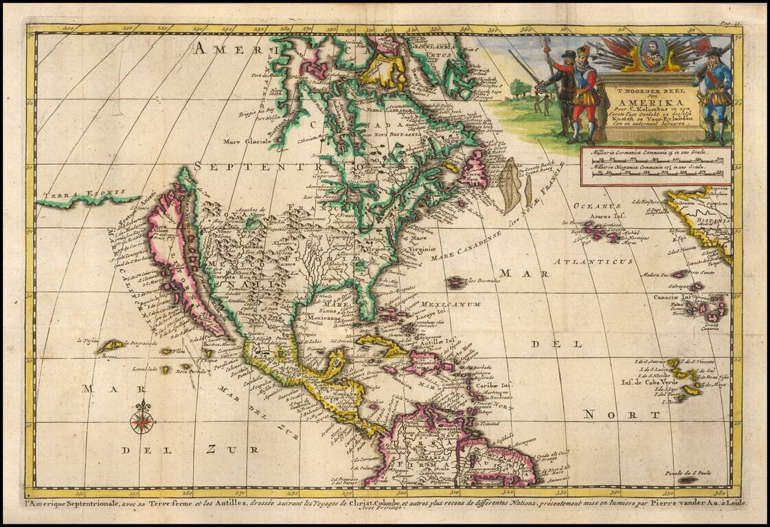
Decorative map of North America, which appeared in the Dutch translation of the Narrative of Columbus' first voyage to the New World. The map shows California as an Island, highly inaccurate Mississippi River and open Great Lakes, with no sign of the...
![A New Map of North America. According to the Newest Observations [California as an Island]](/map/small/70205.jpg)
Handsome example of Moll's miniature map of North America. California is shown as an Island. The map features a curious depiction of the Florida coastline. The Mississippi is west of its correct location, with a rudimentary illustration of its major...

Terrific map of the North Polar region, which shows the Northeast Passage, but no definite Northwest Passage. California is shown as an Island, along with the River systems of North America. Nice detail in the Polar regions, especially New Denmark and...
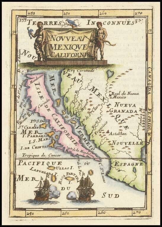
Fine, Distinct Map of the Island of California Striking and exciting map of California as an island, one of the few maps to focus so closely on the California region. First published in Paris in 1683, Mallet’s map is notable because it follows...
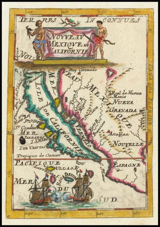
Fine, Distinct Map of the Island of California Striking and exciting map of California as an island, one of the few maps to focus closely on the California region exclusively. First published in Paris in 1683, Mallet’s map is notable because it...
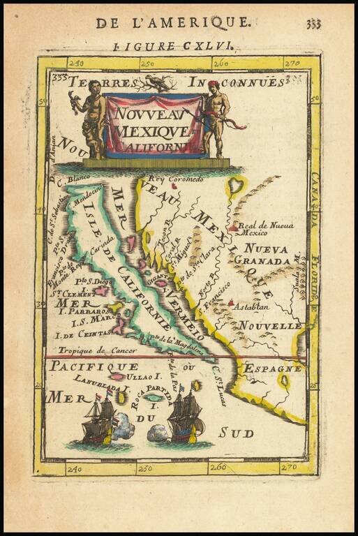
Fine, Distinct Map of the Island of California Striking and exciting map of California as an island, one of the few maps to focus closely on the California region exclusively. First published in Paris in 1683, Mallet’s map is notable because it...