
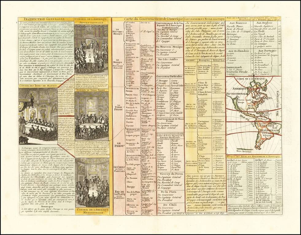
Interesting map of North America, showing California as an island, from Chatelain's monumental 7 volume Atlas Historique. Includes 4 printed views of the counsels of the West Indies, North America, South America and Terre Ferme.
![Americae Aucta Delineatio [California as an Island]](/map/small/67220.jpg)
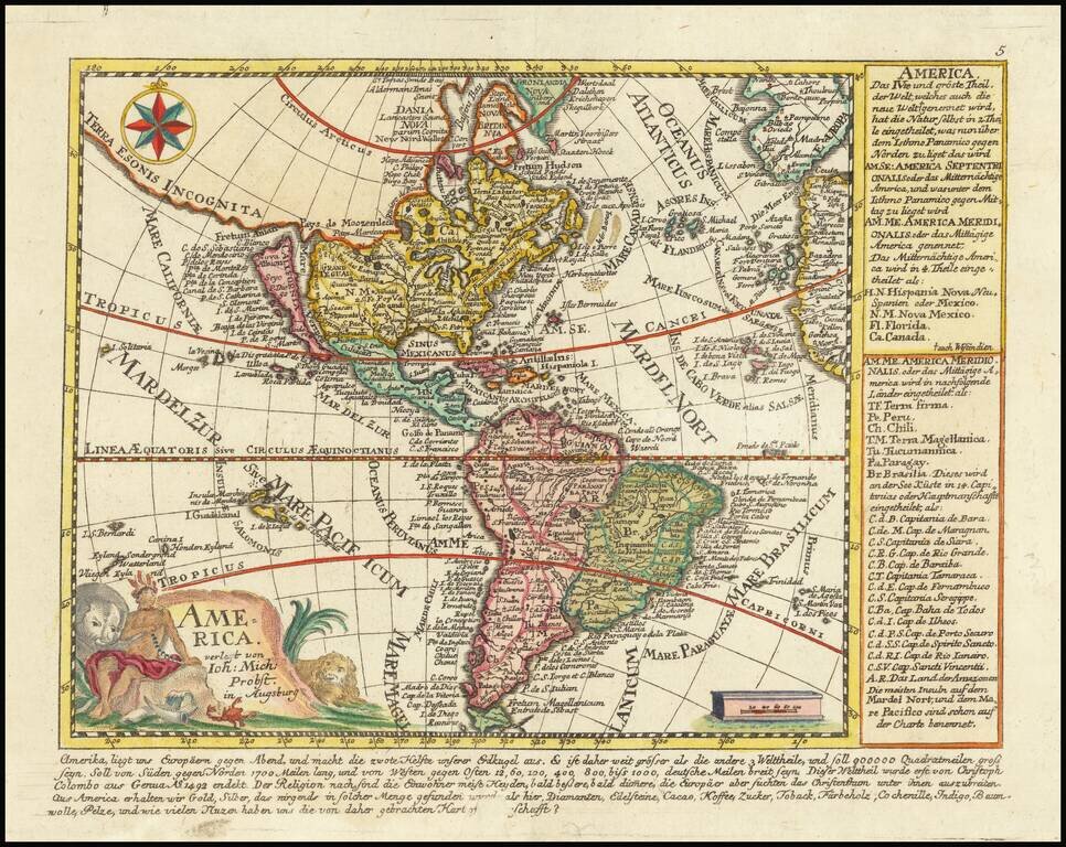
Decorative map from a scarce A.F. Zurner atlas. Full original color. Shows a unique projection of California as an island, and marvelous Terra Iesso, running from Fretum Anian to Japan. Bits of Australia are shown as Quiri Regio. A nice scarce map.
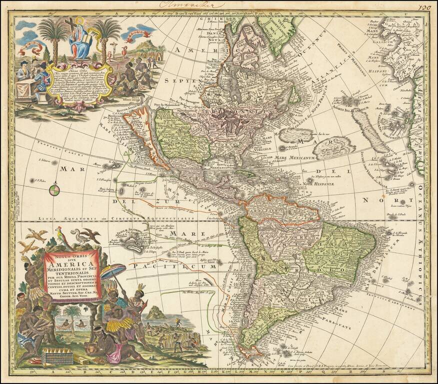
Striking, Richly Engraved Map of the Americas Fine, decorative and detailed map of the Americas, with California as an island and two richly illustrated cartouches. The present map depicts the Americas and parts of France, Spain, Portugal, and...
![Nov. Orbis sive America Septentrionalis . . [California as an Island]](/map/small/66995.jpg)
Decorative map of North America, showing California as an Island, based upon the second Sanson Model. The present example is from the private collection of Glen McLaughlin, author of The Mapping of California as an Island. (Letter available upon...
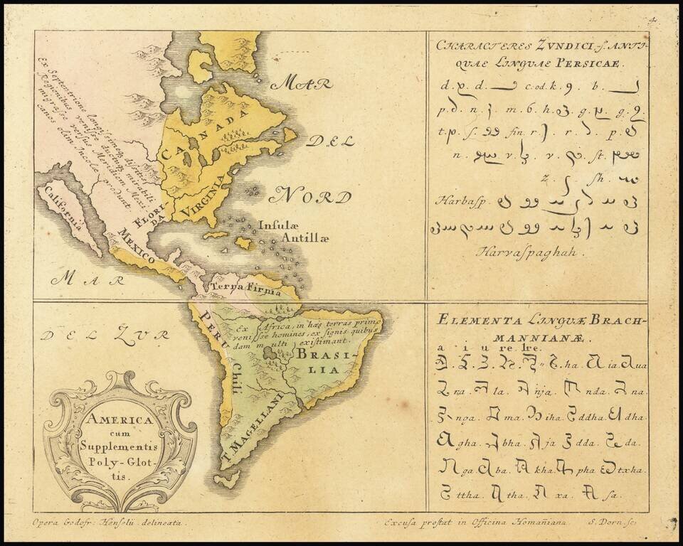
Rare map of America identifying the prevalent languages of the world. Includes two text tables with the Characters of the Persian and Brahmam languages. California is shown as an Island. From Synopsis Universae Philologiae.
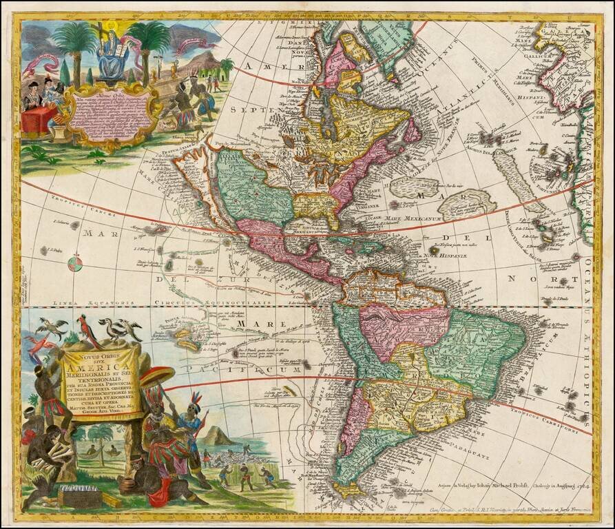
Striking, Richly Engraved Map of the Americas—One of the Last to Feature California as an Island Fine, detailed map of the Americas, with California as an island and two richly illustrated cartouches. This is one of the last maps to be printed with...
Rare map of America, showing California as an Island. California is shown as an Island, with the extended westward land mass to Asia and the Mississippi River extending to the Straits of Anian. Odd Great Lakes Projection and other interesting...
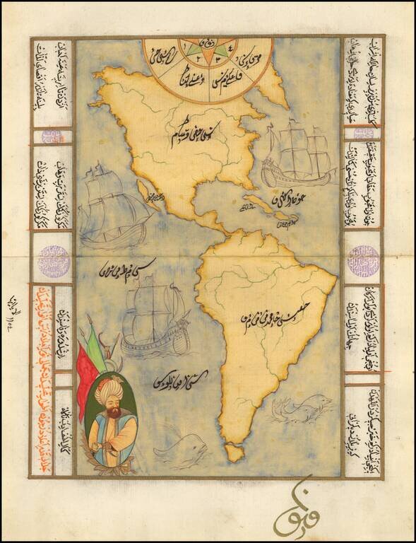
Decorative manuscript map of America, showing California as an island, with decorative embellishments. Maps of this type are typically hand drawn for tourists in Istanbul, using old paper which frequently includes earlier manuscript writing in...
![Pascaart vertoonende de zeecusten van Chili, Peru, Hispania Nova, Nova Granada, en California…. [Early New Zealand Inset]](/map/small/65168.jpg)
Fine Golden Age Dutch Chart with the Island of California and an Early Mapping of New Zealand Scarce early sea chart by Doncker, showing the West Coast of the Pacific Ocean, which extends from the island of California to Chile, with noteworthy insets...
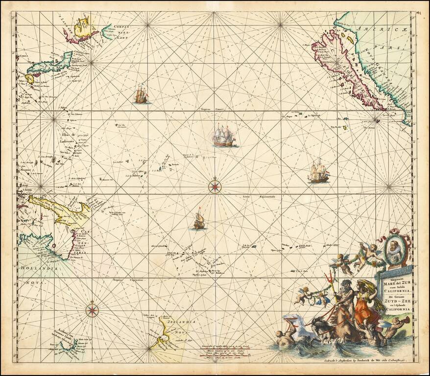
Fine old colored example of first state of De Wit's map of the Pacific Ocean, featuring California as an Island and important early projections of Australia and New Zealand. The finely engraved sea chart was first published in De Wit's Orbis Maritimus...
![[Miniature on Vellum in gold and colors] Orbis Nulla Plaga est, Quam Sol non Ditet Jesus](/map/small/62347.jpg)
An Illuminated Manuscript Map of the World on Vellum! Finely executed hand drawn miniature map of the world, celebrating the spread of Catholicism by the Jesuits. A representation of the baby Jesus is shown between the two hemispheres, with the...
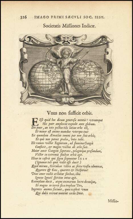
Rare map of the world, showing California as an island from a rare Jesuit emblem book, entitled Imago Prrimi Aaeculi Soc. Iesu a Provincia Flandro-Belgica Ejusdejm . . . representation of the baby Jesus is shown between the two hemisphere Within...
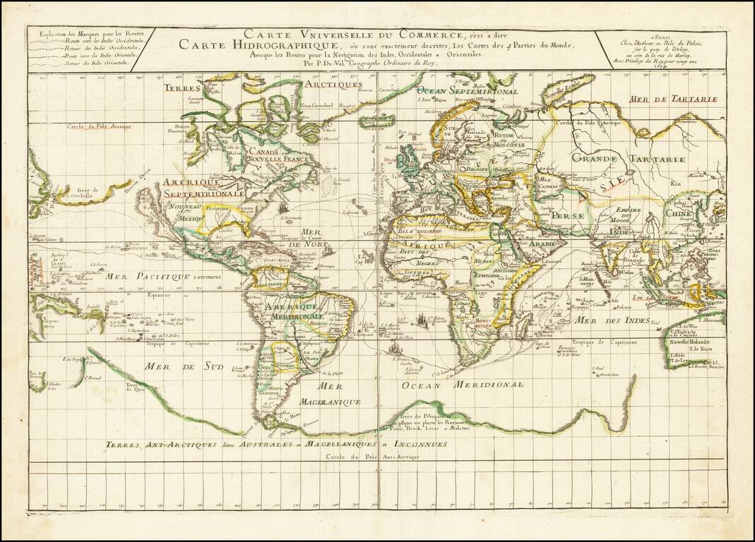
Illustrating the Major Commercial Sea Routes of the 17th Century First state of Pierre Du Val's scarce 17th Century map of the World, illustrating the most important world trade routes during the middle of the 17th Century. Du Val's map is...
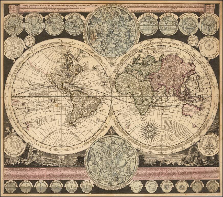
Visually Striking Double Hemisphere Map of the World Fine example of Adam Freidrich Zürner's complex and informative double hemisphere map of the world, artfully embellished with a multitude of decorative scenes and projections of celestial bodies....
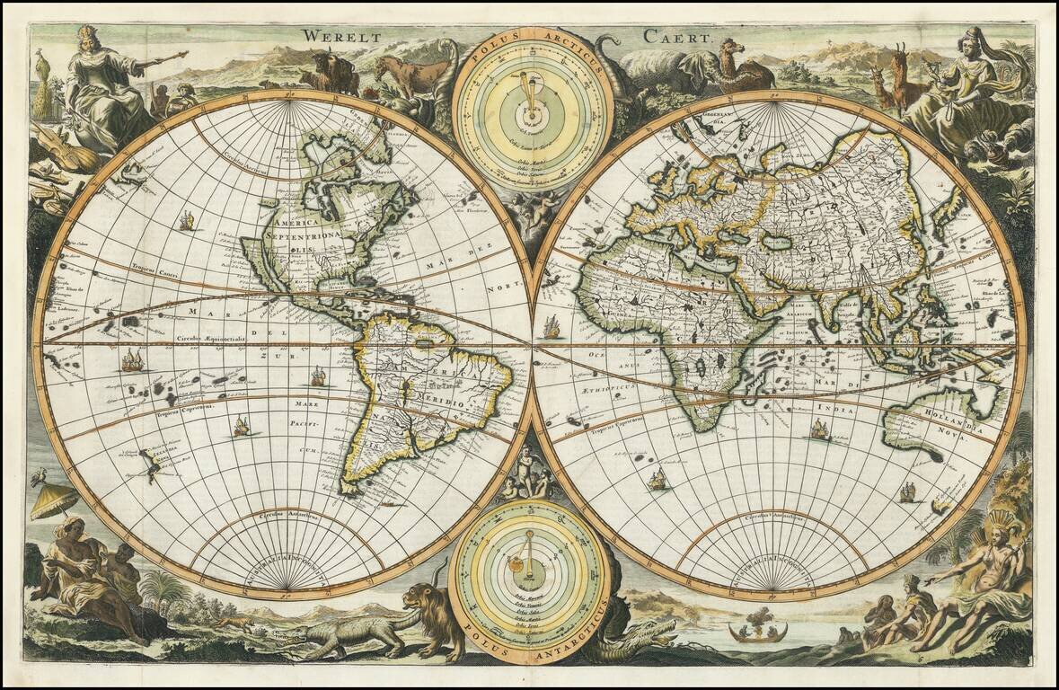
Very attractive double-hemisphere map with California depicted as an island. Decorative banner contains title. In the center of the banner there is a smaller sphere showing the North Pole. This map shows a number of place names along with the names of...
Decorative double hemisphere map of the World, showing California as an Island, with the Continents represented in the female form. The map is based upon Visscher's earlier Bible maps. There are a number of variants with subtle changes, issued in the...