
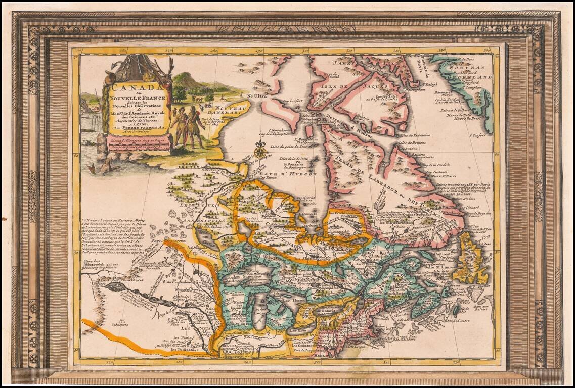
Decorative example of Vander Aa's map of Canada and the Great Lakes. Nice example, with the picture frame border, which appeared in Vander Aa's Nouvelle Theatre Du Monde, published in 1713. The map extends south to the Chesapeake and west to the...
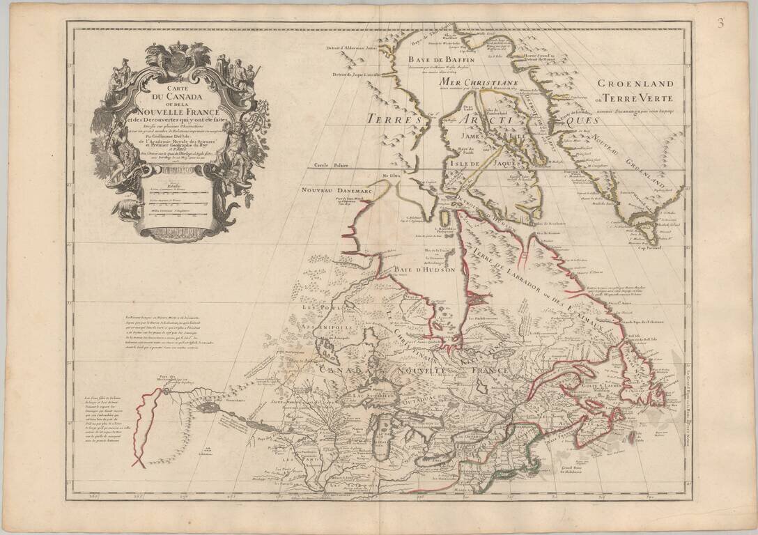
Seminal Early Map of Canada & The Great Lakes -- One of The First Maps To Reference The Rocky Mountains Nice example of Guillaume De L'Isle's map of Canada, the Great Lakes and Upper Midwest, one of the most important and influential maps of...
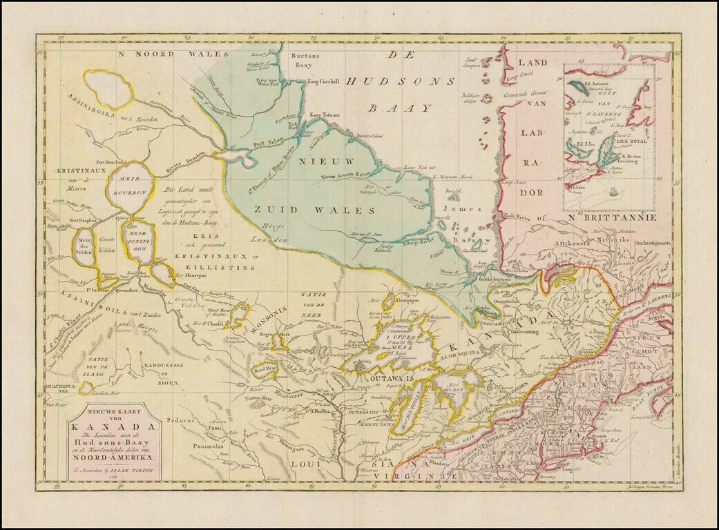
Interesting map of Canada and the Upper Midwest, centered on the Great Lakes and Hudson's Bay, published by Issak Tirion. The map shows the region shortly after the conclusion of the French and Indian War. Included are the Hudson Bay Company forts and...
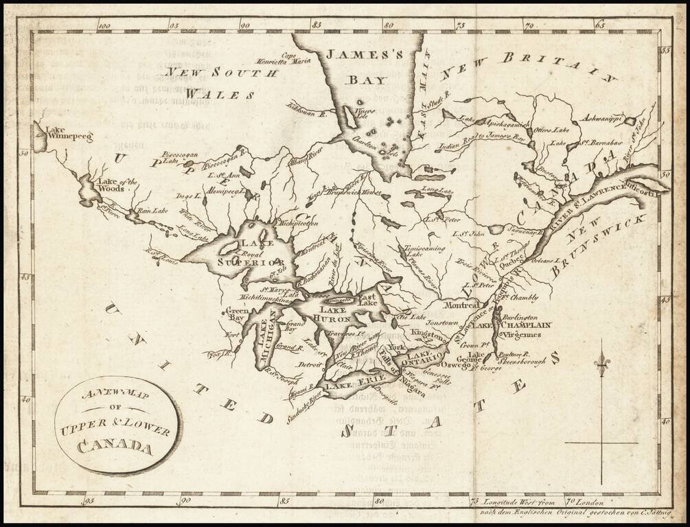
Interesting map of the Great Lakes and Canada, from a German edition of Isaac Weld's Travels Through the States of North America During the Years 1795-97, first published in London in 1798. The map extends from the St. Lawrence to Lake Winnipeg,...
Nice example of Carey & Lea's map of Canada and the Great Lakes. The map covers Upper and Lower Canada and the Great Lakes, extending west to the Lake of the Woods and Red Land House and the Severn River, showing nice Indian details. The map is...
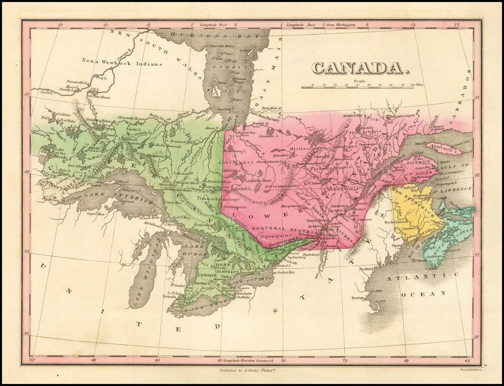
![Canada [with Great Lakes]](/map/small/53469.jpg)
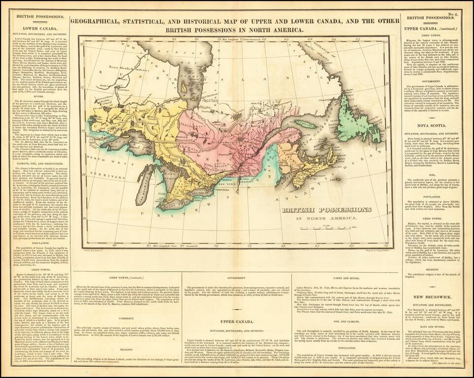
Striking map of Canada, colored by territories. The map shows towns, rivers, lakes, mountains, etc. Fielding Lucas produced the best engraved an most attractive of all general atlases published in America (the 1823 Tanner and 1825 Finley being...
Detailed map of the Great Lakes and Eastern Canada, colored by regions and showing towns, rivers, lakes, islands, bays ,etc. Early roads are also shown.
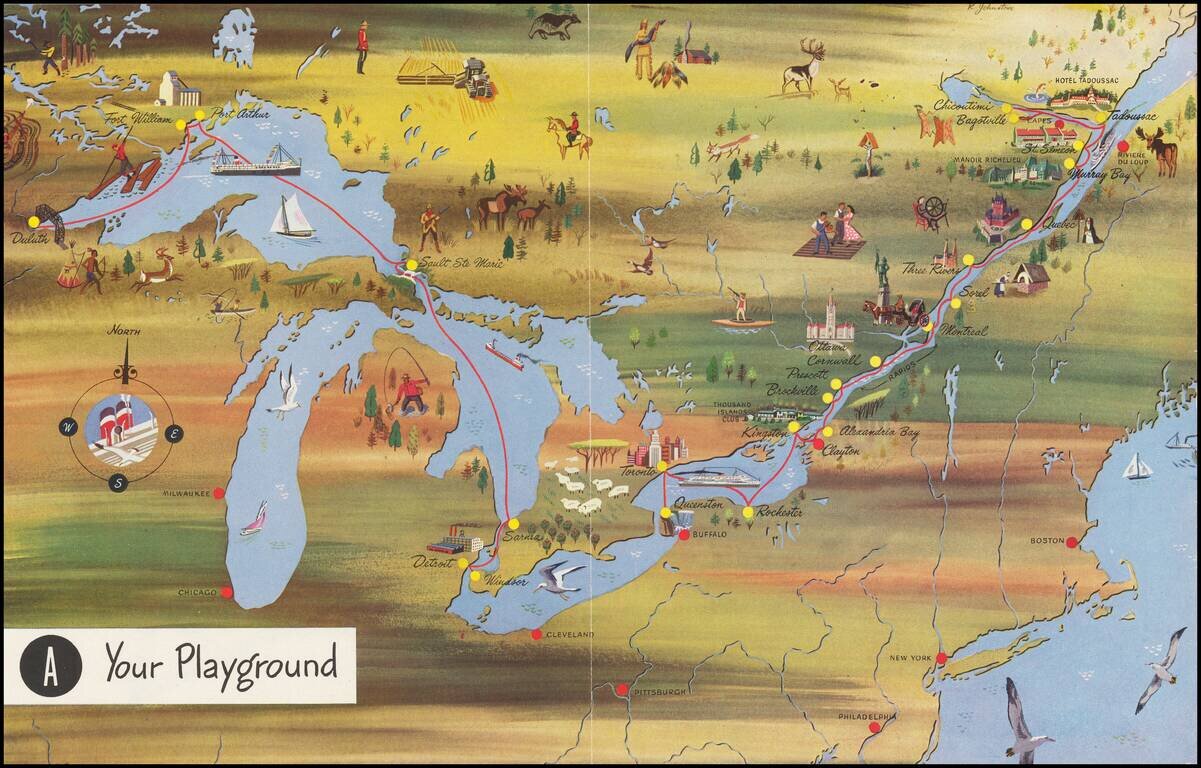
Interesting pictorial map, advertising for Canada Steamship Lines. The route shown goes from Duluth, Fort William and Port Arthur to Sault Ste Marie, Darnia, Detroit and Windsor, with a second route from Buffalo and Toronto to the mouth of the St....
The First Sea Chart of Hudson Bay and Hudson Strait Fine example of the first edition of Robert Dudley's chart of Hudson Bay and Hudson Strait, the earliest sea chart of the region and the first printed map to focus on Hudson Bay. Dudley's chart is...
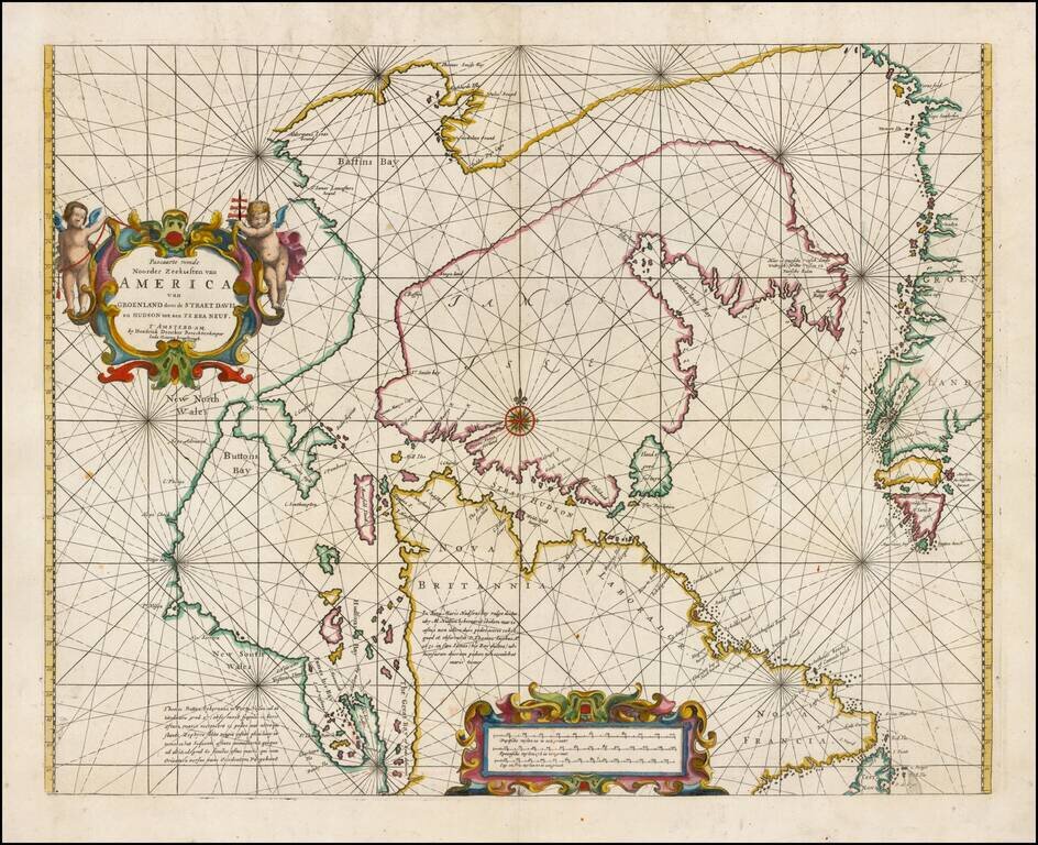
Fine example of Doncker's rare early map of the Northern part of America, including Hudson Bay, Davis Straits, Button Bay and the west coast of Greenland. Doncker's chart is one of the earliest obtainable charts to show this configuration and much of...
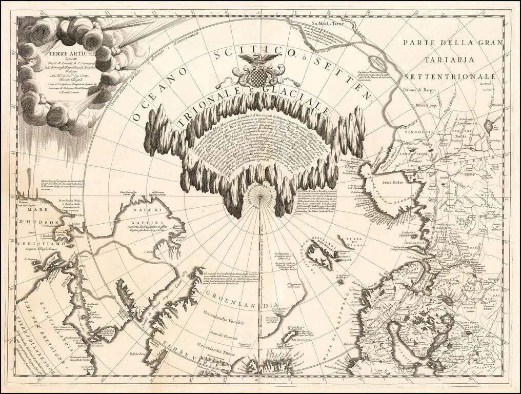
Fine example of Vincenzo Maria Coronelli's map of the North Polar Regions, published in Venice circa 1690. Coronelli's map provides a remarkable depiction of the Arctic Circle, North Pole, Greenland, and Baffin Bay, with parts of Canada, parts of...
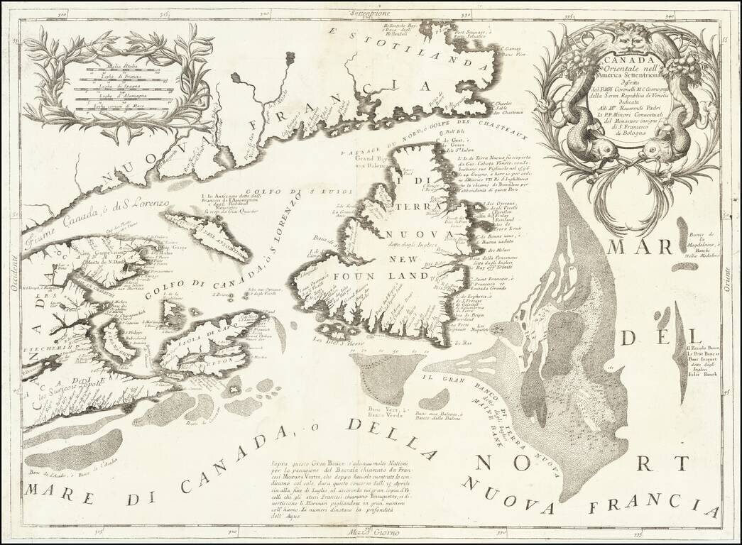
Detailed map of the Newfoundland, Labrador, Nova Scotia and the Gulf of St. Lawrence, by Vincenzo Maria Coronelli. The map comes from Coronelli's rare Atlante Veneto, one of the most decorative and ornate of all 17th Century Atlases. It exhibits the...
![[Unique Extra-Illustrated Example!] Carte Nouvelle Contenant La Partie d'Amerique La Plus Septentrionale, . . . Le Canada ou Nouvelle France, La Nouvelle Ecosse, La Nouvelle Angleterre, Les Nouveau Pais Bas, La Pensylvanie . . . Et Jle. de Terre Neuve . .](/map/small/47720.jpg)
Heavily embellished example of the eastern part of Visscher's 2-sheet map of the Northeastern part of North America, first published in 1696. Cartographically, the map extends from Nova Scotia and Acadia to Newfoundland, the St. Lawrence Gulf and St....
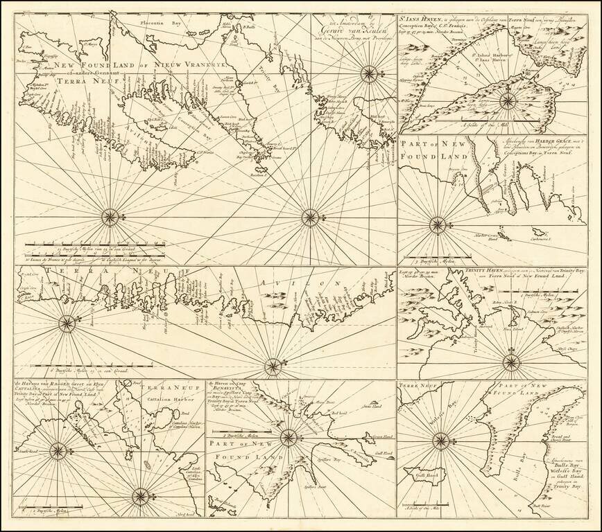
Rare sea chart of of the Coast of Newfoundland, published by Gerard Van Keulen. The chart incorporates eight insets showing various portions of Canada's Newfoundland coast. Include twelve compass roses with rhumb lines, with separate delineations of...
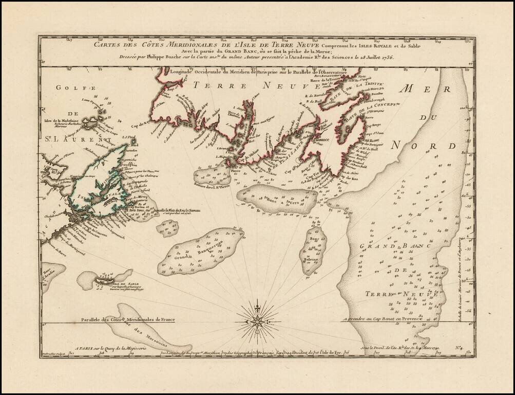
Philippe Buache Responds To Errors In Popple's Map of the British Colonies. Scarce map of the coast of Southern Newfoundland and part of Nova Scotia by Philippe Buache in 1736, as part of his critique of the accuracy of Henry Popple's map of 1733....
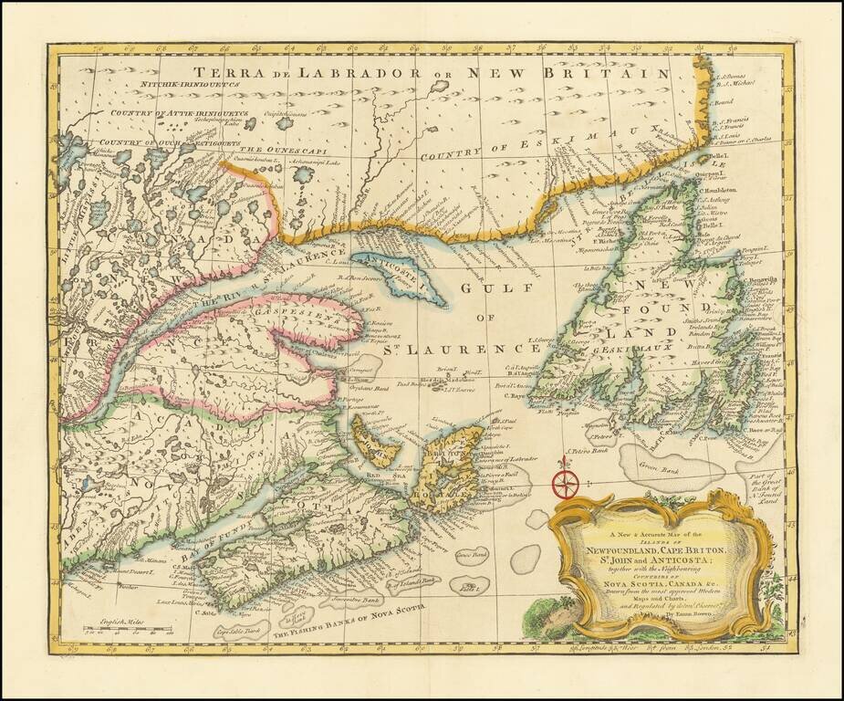
Striking and highly detailed map of Northeastern Canada, etc. published by Emanuel Bowen in London. The map covers the region bounded by Newfoundland, Nova Scotia, Acadia and Labrador. Decorative cartouche, compass rose and excellent detail...