
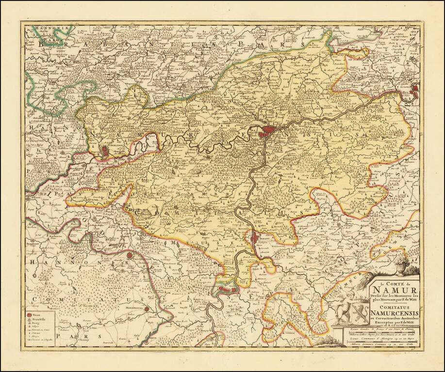
Detailed map of the County of Namur, published in Amsterdam by Ottens.
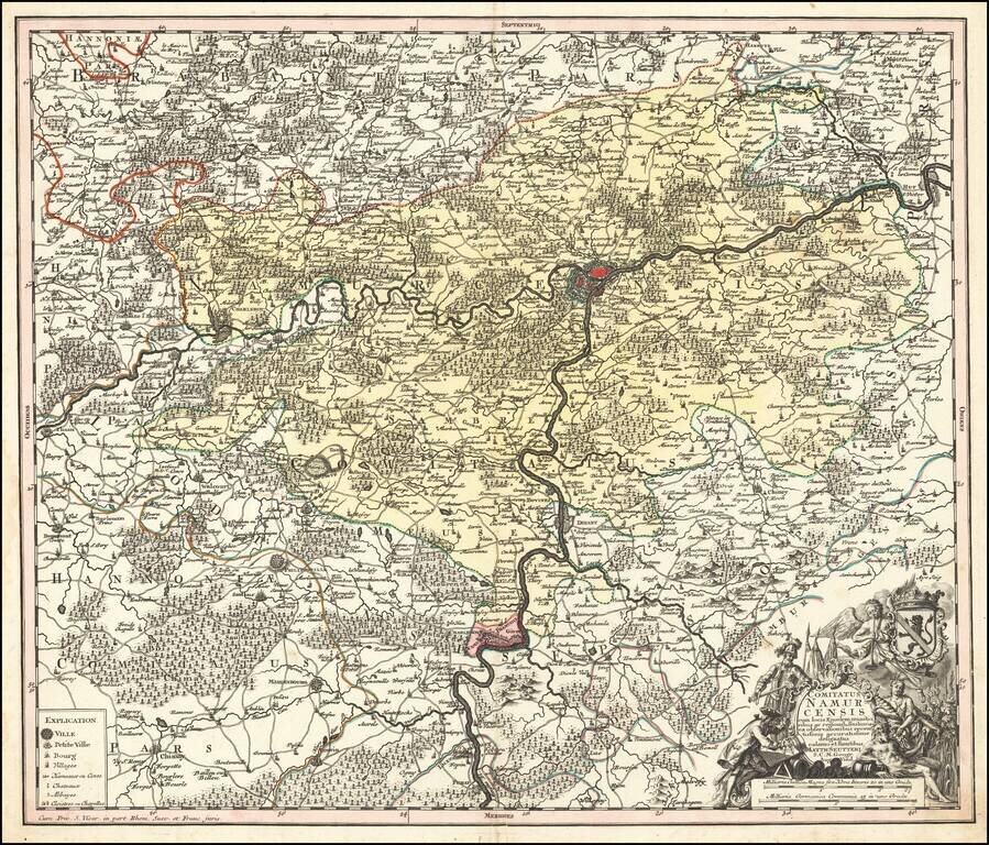
Decorative map of Namur, published in Augsburg by Seutter. Includes an elaborate allegorical cartouche and coat of arms.
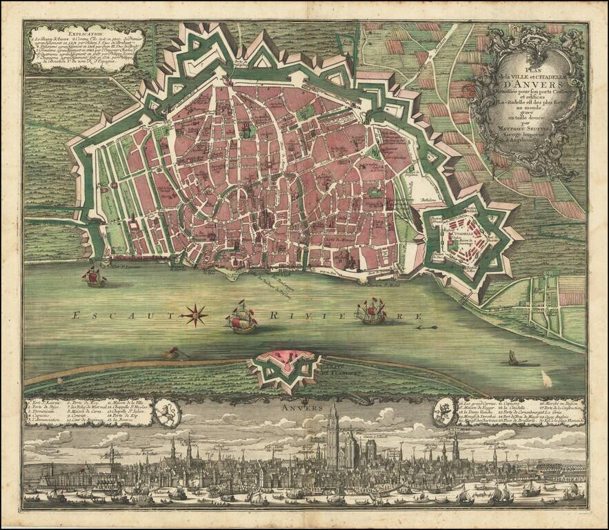
Fine old color example of Seutter's decorative and highly detailed plan of Antwerp, with a striking view of the City below. A fine dark impression.
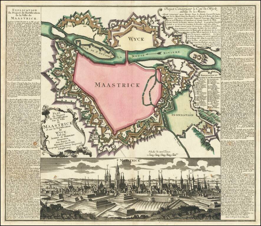
Fine plan of the fortification of Maastricht, showing the impressive defensive walls of Maastricht and Wyck, published circa 1748. The plan includes a detailed view the city, and an extensive engraved text and key in French down the sides. The plan...
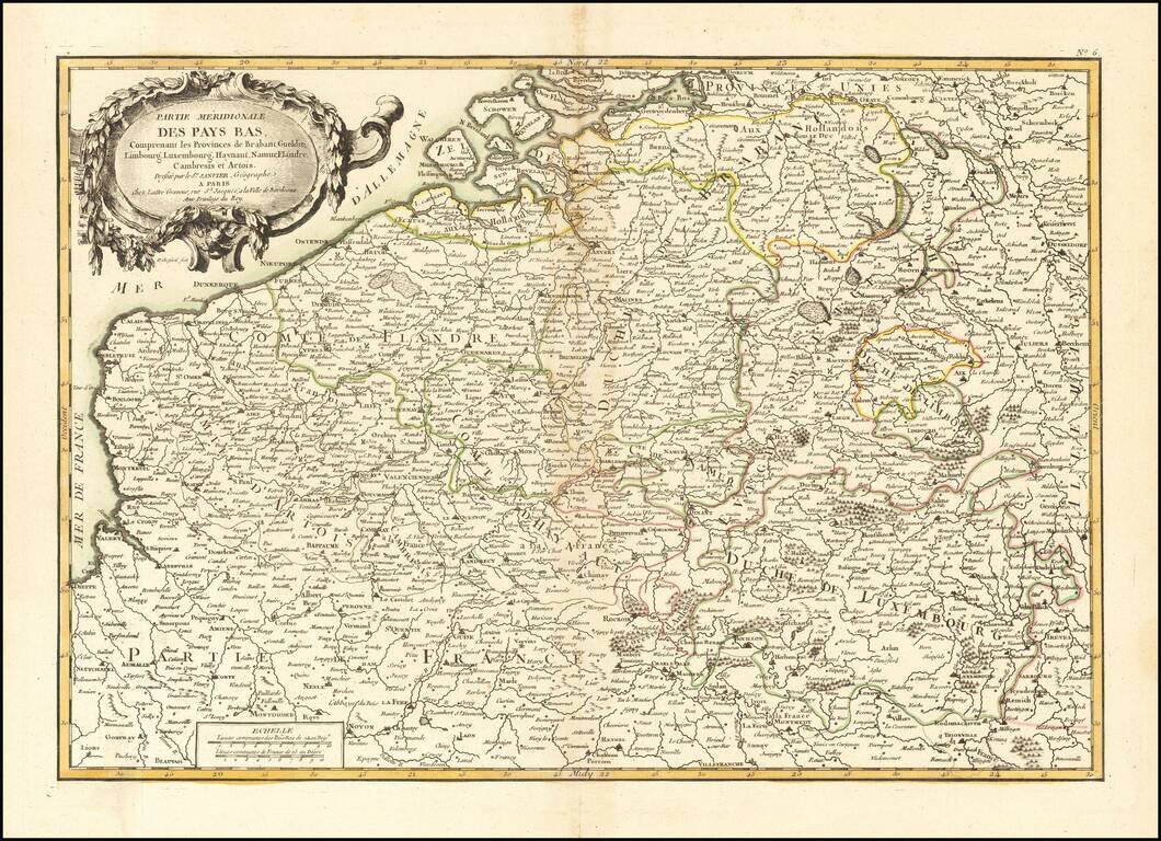
Decorative map of the Southern part of the Low Countries, published in Paris.
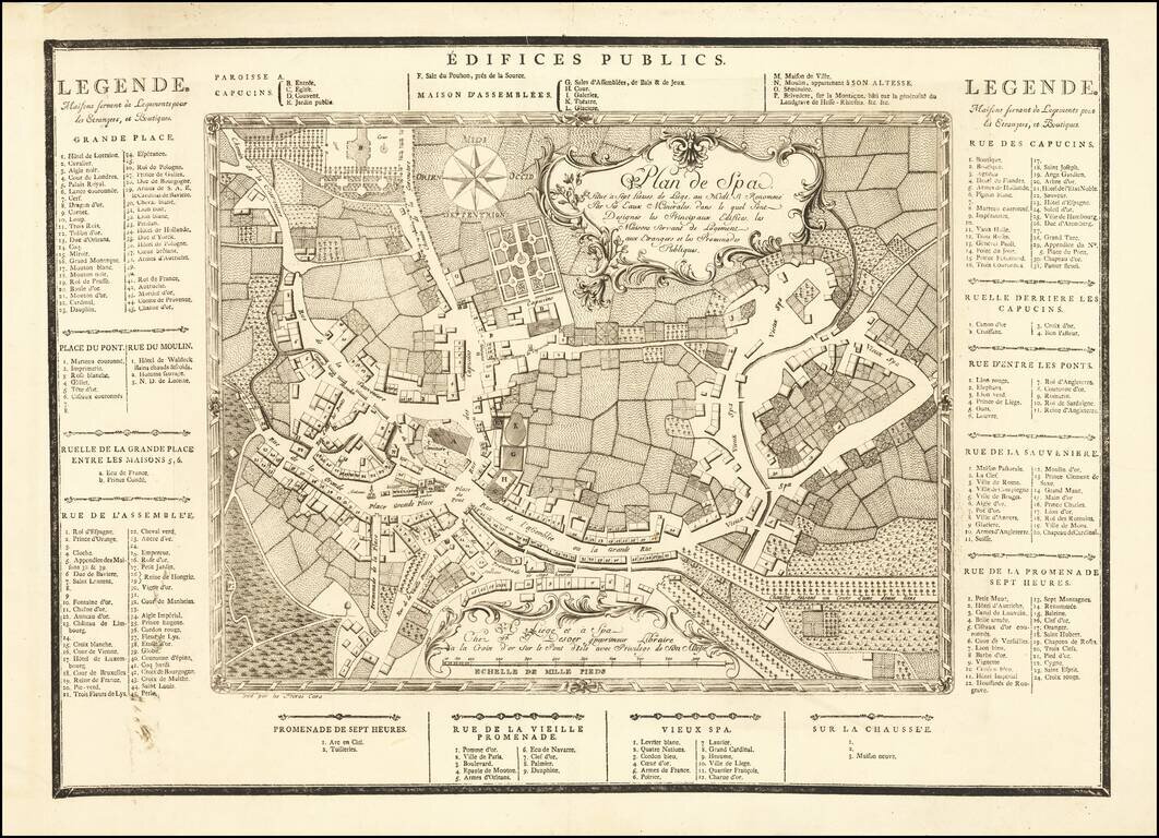
A remarkable early tourist map of Spa, locating its principal buildings, housing for foreigners and public promenades. The map was printed by Freres Caro in Liege and Spa for "Chez F. J. Desoer imprimeur Libraire à la Croix d'or, sur le Pont-d'Isle,...
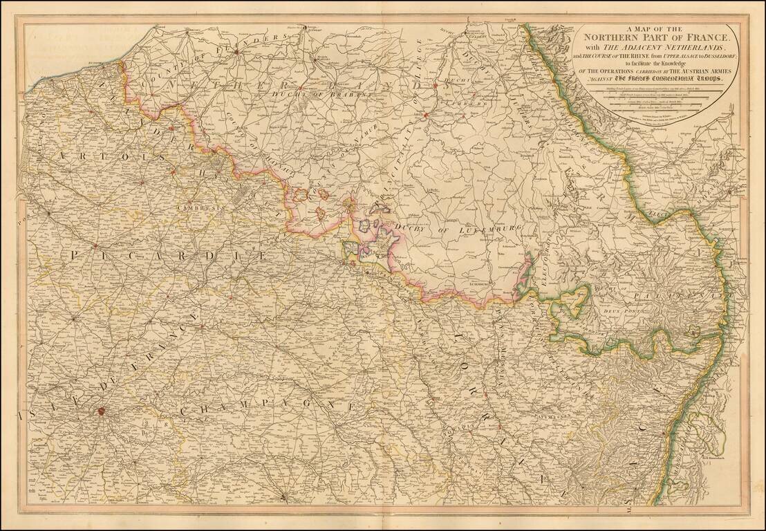
William Faden's large format map of Northern France, Luxembourg, Belgium and western Germany, showing the Theater of War between the Austrian and French Troops. A number of roads are shown. One of the most detailed English language maps of the region...
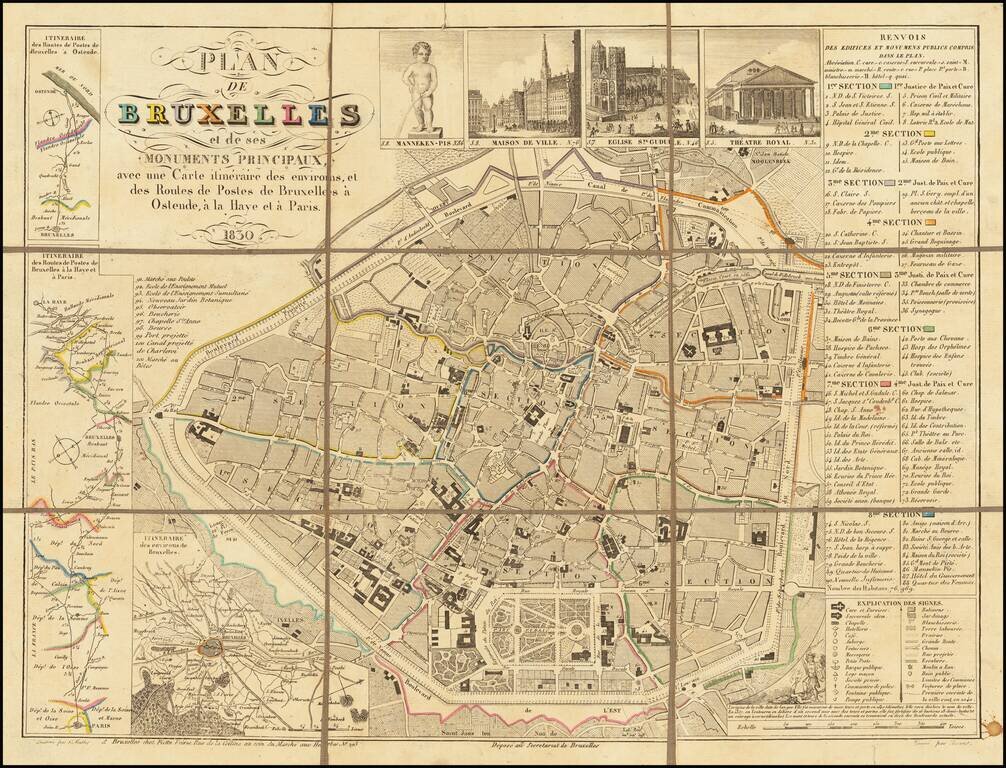
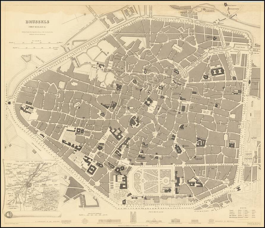
Rare illustrated map of Brussels, featuring the Mannequin Pis, perhaps the most famous of the monuments of the city, along with other famous monuments. Several smaller maps and roads maps adorn the sides and corners.
![Antwerp [Antwerpen/Anvers]](/map/small/66050.jpg)
Highly detailed town plan of Antwerp, including a comparison of principal buildings and an inset of local forts along the Schelde River. One of the best published in a commercial atlas in the 19th Century.
A highly detailed town plan of Brussels, with profile views of eight principal buildings and a smaller inset of the environs of the city. This is one of the best-detailed published maps of Brussels available in a commercial 19th-century atlas. The map...
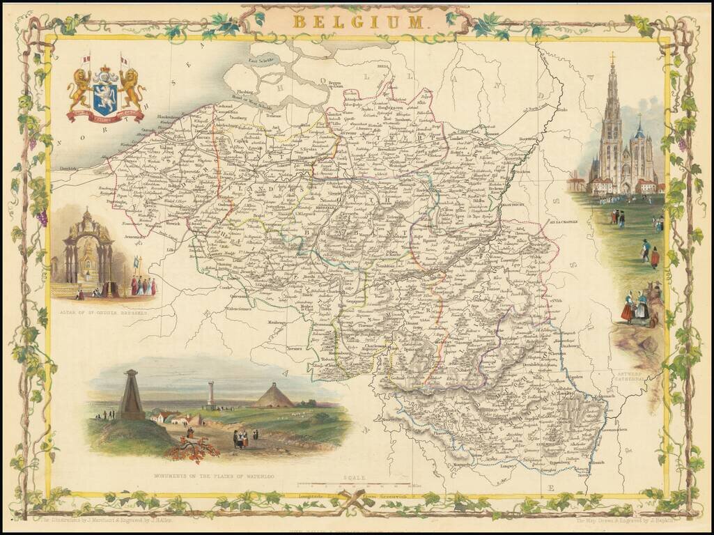
Stunning full color example of this decorative map of Belgium. The map shows vignettes of the Altar of St. Gudula, Brussels, monuments on the Plains of Waterloo, Antwerp Cathedral and Coat-of-Arms. Engraved for R. Montgomery Martin's Illustrated...
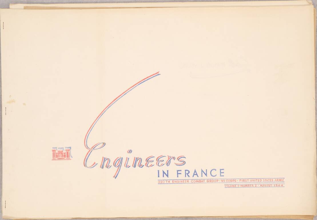
A Series of Albums Commemorating American Engineer's Roles in the Liberation of Europe, Made for a Decorated Colonel This is a truly outstanding work consisting of three booklets, each showcasing the role of the 1120th Engineer Combat Group, attached...

Old hand-color example of this early plan of Luxembourg, from Braun & Hogenberg's Civitates Orbis Terrarum, the first major atlas of City Plans and Views, based upon the work of Jacob Van Deventer. The cartouche translates as follows: Luxembourg,...
Nice example of this scarce map of Luxembourg. The present map was produced by two of the primary Cologne School mapmakers, Johann Bussemacher and Matthias Quad. The Cologne School of cartography, was perhaps the only group of mapmakers competing with...
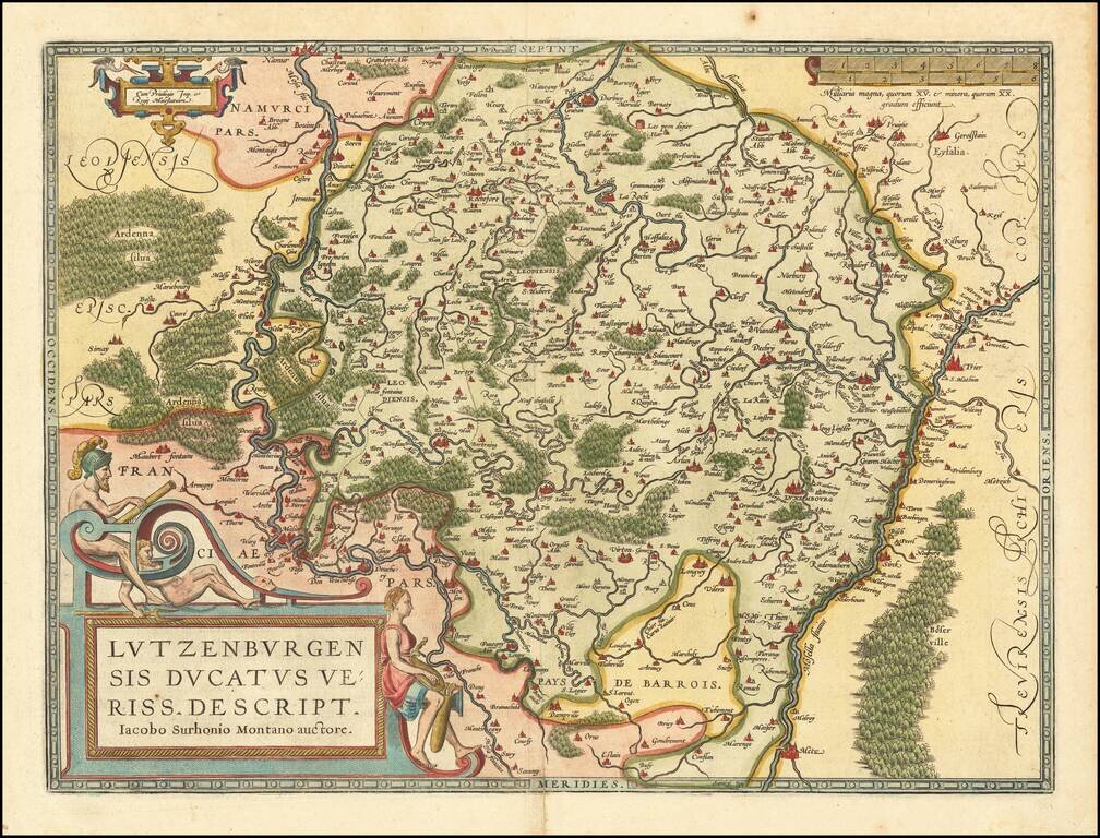
Fine old color example of this early map of Luxembourg from Ortelius' Theatrum Orbis Terrarum, the first modern atlas of the world. Large cartouche, smaller cartouche and scale of miles.
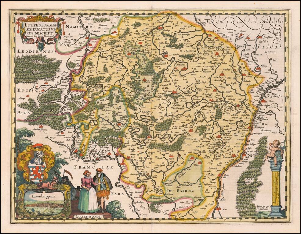
A fine early map of Luxembourg which appeared in Petrus Kaerius's (Peter Van der Keere) Germaniae Inferior id est, XVII Provinciarum ejus novae et exactae Tabulae Geographicae, first published in Amsterdam in 1617. The map includes a view of the City...