Map size in jpg-format: 60.4278MiB
Click to open in high resolution (open in new tab).
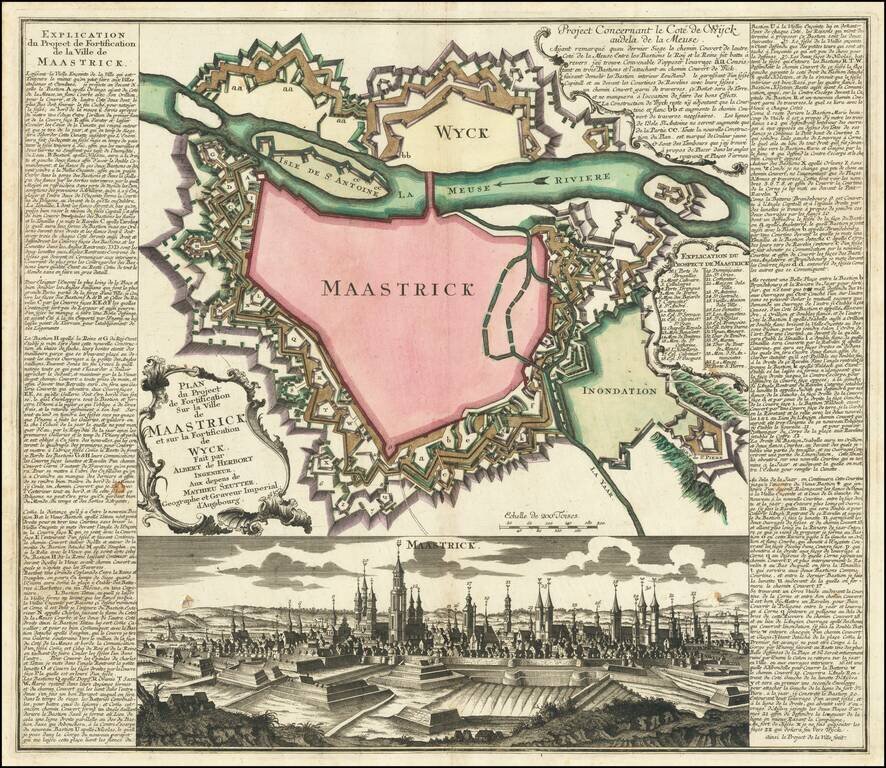
Fine plan of the fortification of Maastricht, showing the impressive defensive walls of Maastricht and Wyck, published circa 1748.
The plan includes a detailed view the city, and an extensive engraved text and key in French down the sides.
The plan was prepared during the 'War of Austrian Succession' (1740-8) when Maastricht was a prime target for the French because of the city's strategic location. The city was conquered by the French under Marshal Moritz von Sachsen in 1748, but was returned according to the Treaty of Aix-la-Chapelle later in the year.
Matthäus Seutter (1678-1757) was a prominent German mapmaker in the mid-eighteenth century. Initially apprenticed to a brewer, he trained as an engraver under Johann Baptist Homann in Nuremburg before setting up shop in his native Augsburg. In 1727 he was granted the title Imperial Geographer. His most famous work is Atlas Novus Sive Tabulae Geographicae, published in two volumes ca. 1730, although the majority of his maps are based on earlier work by other cartographers like the Homanns, Delisles, and de Fer.
Alternative spellings: Matthias Seutter, Mathaus Seutter, Matthaeus Seutter, Mattheus Seutter
If you are a student, write to us in telegram: @antiquemaps and indicate what material you need and for what work you need a map in high detail. We are ready to provide material on special terms. For students only!