
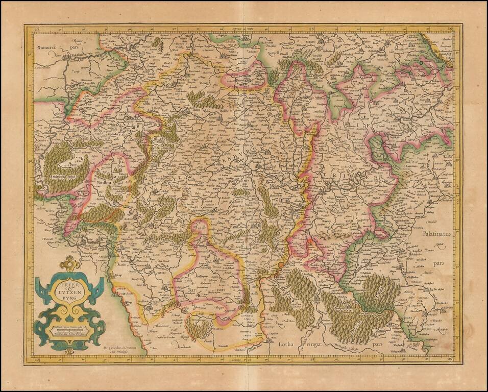
Nice old color example of Mercator's detailed map of Trier and Luxembourg.
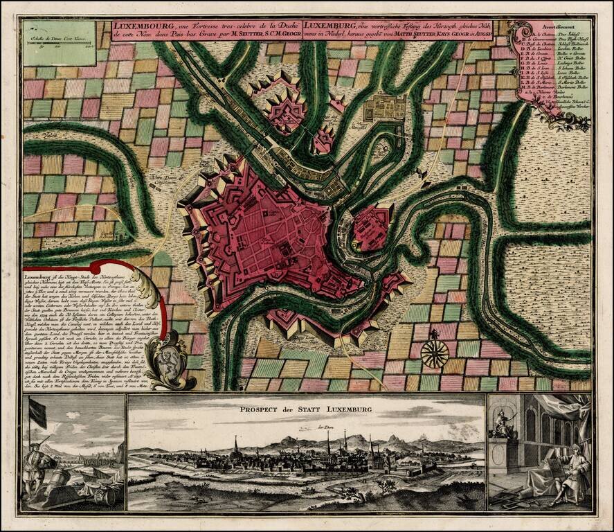
Fine old color example of Seutter's decorative and highly detailed plan of Luxemburg, with a striking view of the City below. The view below the map shows the city and two military views to the left and right of the main prospect of the City.
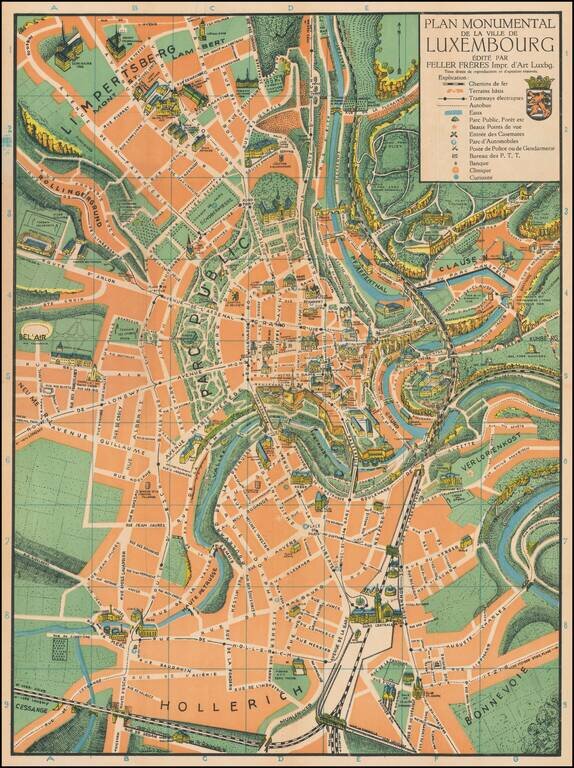
Superb color-printed view of Luxembourg City, with the monuments and landmarks of the city rendered pictorially. The map differentiates between parks, rivers, and built areas with green, orange, and blue, and the visual effect is quite pleasing. This...
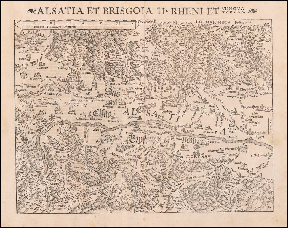
One of the earliest Modern Maps of the Rhine River Valley Detailed map of the Rhine River Valley, from Strasbourg and Argentina to Basel and Laufenberg, centered on Brisach and Kappel and showing Colmar. West is at the top of the map. The map is...
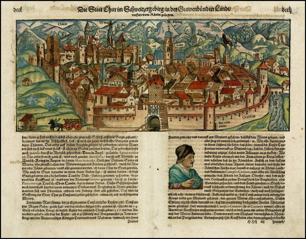
Early decorative birdseye view of Chur from an early German edition of Munster's Cosmography, one of the most influential georgaphical works of the 16th Century.
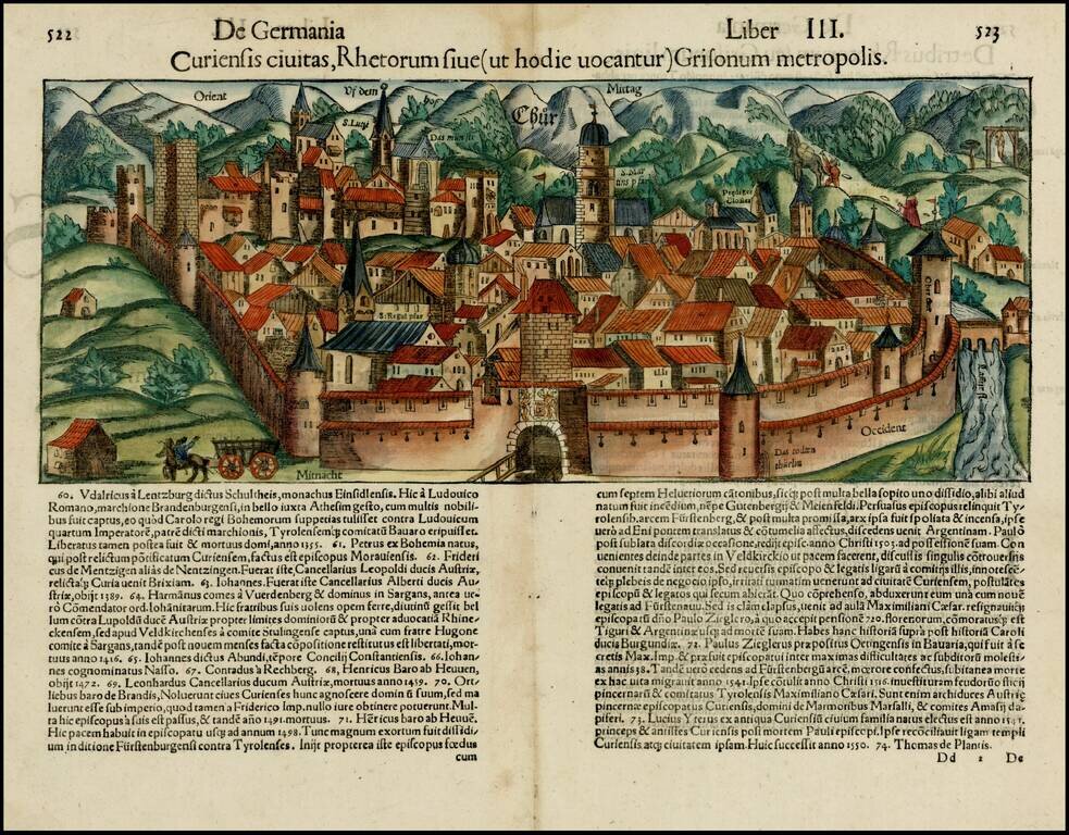
Fine early view of Chur, from and early edition of Munster's Cosmographia. Woodcut view of the walled city of Chur, in the Swiss canton of Grabünden. The area, settled over five thousand years ago, lays claim to being the oldest city in Switzerland....
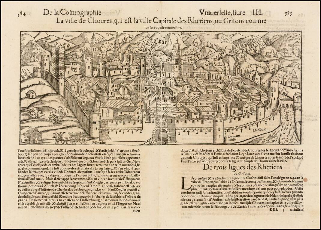
Early decorative birdseye view of Chur from a French edition of Munster's Cosmography, one of the most influential georgaphical works of the 16th Century.
![[Zurich Kanton] Eigentliche Verzeichnuss der Stätten, Graffschafften vnd Herrschafften, welche in der Statt Zürich Gebiet vnd Landscafft gehörig seind](/map/small/59976.jpg)
Striking, Extremely Rare Sixteenth-Century Map of the Canton of Zurich Spectacular, large map of the canton of Zurich printed on six sheets and first issued by Jodocus Murer in 1566. This is a 1670 reissue, which exists in only four known examples,...
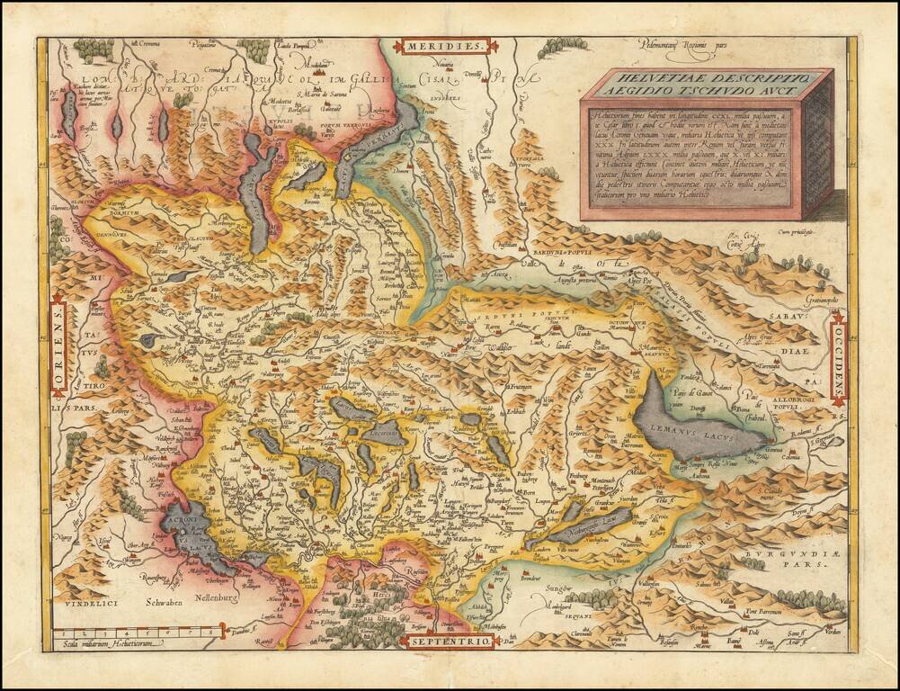
Nice full color example of Ortelius' map of Switzerland, from his Theatrum Orbis Terrarum, the first modern atlas of the world. This is the second state of the map, with the additional place names around Lake Geneva, which first appeared in 1584. The...
![[Swiss Cities] Decem Et Tria Loca Confoederatorum Helvetia](/map/small/54682mp2.jpg)
Braun & Hogenberg's set of 13 views of Swiss towns, first issued in 1572. The towns illustrated are Schwyz, Unterwalden, Zug, Glarus, Basel, Zurich, Bern, Lucerne, Uri, Fribourg, Solothurn, Schaffhausen, and Appenzell. Between 1291 and 1512, the...
![[St. Gallen] S. Galli Opp. et Monasterium Helvetiorum, asterente Ottone Frisingensi](/map/small/61408.jpg)
Nice old color example of Braun & Hogenberg's view of St. Gallen in Switzerland.
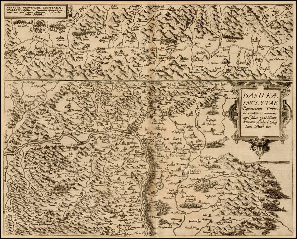
Nice example of De Jode's maps of Canton Valais and the Basel region, from the Speculum Orbis Terrarum, which along with Ortelius' Theatrum Orbis Terrarum are the earliest modern atlases of the World. As noted by Burden: In 1578 Gerard de Jode...
Rare modern map of Switzerland, published in Cologne by Johannes Metellus in 1579 in fine original color. The map is one of the earliest obtainable modern maps published by the so-called Cologne School of mapmakers, which consisted primarily of Flemish...
![Gallia Narbonensis Ora Marittima Recenter descripta [and] Sabaudiae Et Burgundiae Comitatus descriptio . . .](/map/small/57206.jpg)
The regions include a detailed area map of the Avignon region on the upper Rhodanus River (and coastline from Narbone to Marseille) and the area around Lake Geneva, extending west to Lyon, and showing Grenoble, Geneva, San Moritz, and Torino (Italy)....
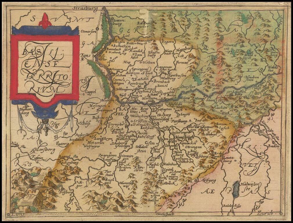
![Basiliensis Territorii Descriptio Nova [with] Circulus Sive Liga Suevia Vulgo Schwabische Kraiss](/map/small/65392.jpg)
Two detailed regional maps by Ortelius, from his Theatrum Orbis Terrarum, the first modern atlas. The first map shows the region around Basel, in Switzerland, based upon the work of Sebastian Munster. The second map shows the region bounded by the...
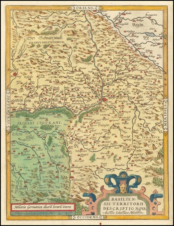
Old color map of the Basel region by Abraham Ortelius, from his Theatrum Orbis Terrarum, the first modern atlas. The first map shows the region around Basel, in Switzerland, based upon the work of Sebastian Munster.