Map size in jpg-format: 4.8791MiB
Click to open in high resolution (open in new tab).

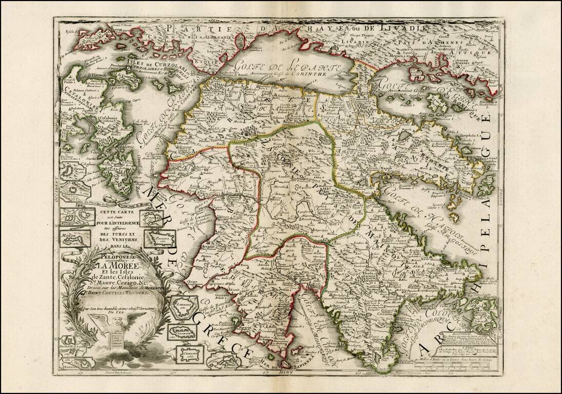
Scarce map of Peloponese and part of Greece and the Greek Isles, published by De Fer.
Highly detailed map, which includes 12 inset plans of fortified towns and harbors for places within the bounds of the map. The dedication note that the map was prepared from Intelligence gathered from the Venetians and Ottoman Turks, with the plans of each of the forts bearing a date between 1685 and 1687. Zacharachis notes that most editions of the map have the dates in the lower right corner changed in manuscript. We were unable to find any examples of the map appearing at auction or in dealer catalogues in the past 30 years, but we do note the copy in the Catalogue of Maps, Prints & Engravings ... Presented by HIs Majesty King George the Fourth To The British Musuem (Vol. II; p 58).
De Fer's maps are very rare. The maps were typically separately issued or bound into composite atlases by other publishers and there are very few surviving atlases which are De Fer's maps only. De Fer's maps are also noteworthy for being consistently updated. For example, there are 6 known editions of this map, plus 2 variant states with different titles.
If you are a student, write to us in telegram: @antiquemaps and indicate what material you need and for what work you need a map in high detail. We are ready to provide material on special terms. For students only!

![Patriarchatus Antiocheni Geographica Descriptio . . . [shows Cyprus]](/map/small/54177.jpg)
