Map size in jpg-format: 20.3227MiB
Click to open in high resolution (open in new tab).
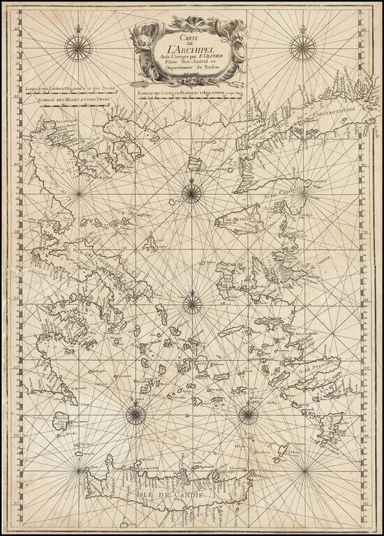
Fine example of this rare map of the Greek Islands, published by Francois Olivier in Toulon in 1746.
The title is set within a fine title cartouche depicting sea monsters. Below are Dutch, English and French scale bars. The chart itself is finely engraved with rumb lines and several compass roses.
Little is know of Francois Olivier (fl.1746-1782), however, he must have been a fine seaman as he present chart gives him the title of Vice-Admiral of the Toulon region ("Vice-Amiral au Departement de Toulon"). By the middle of the eighteenth century Toulon had become one of France's most important naval bases, from where she opperated her large Mediterranean fleet.
If you are a student, write to us in telegram: @antiquemaps and indicate what material you need and for what work you need a map in high detail. We are ready to provide material on special terms. For students only!

![Patriarchatus Antiocheni Geographica Descriptio . . . [shows Cyprus]](/map/small/54177.jpg)
