
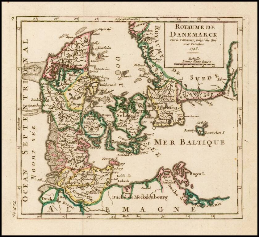
Detailed map of Denmark, colored by Dioceses, and showing towns, rivers, mountains, ports, islands, etc. From De Vaugondy's Atlas Portatif.
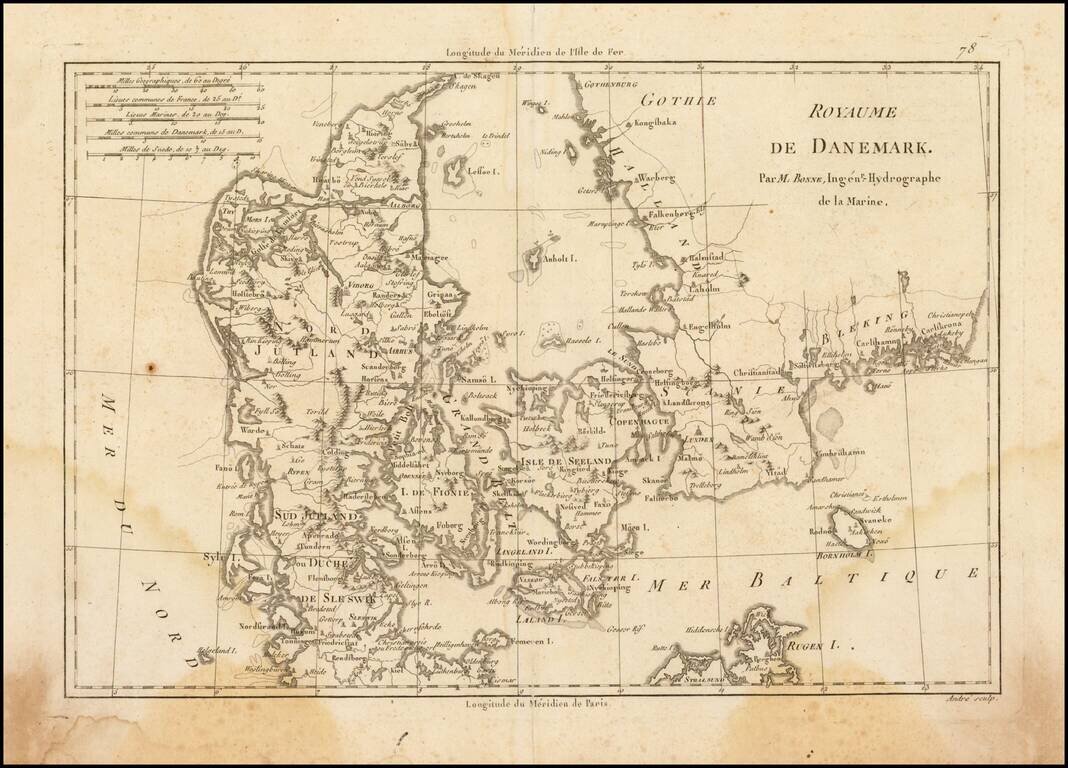
Attractive map of Denmark, with details of cities, rivers, land masses, and oceans. Rigobert Bonne was the official Hydrographer to the King of France.
![[Odense Fyord Manuscript Map] Beschreibung dess Haffens beij Metsundt Indieser Haffen ist class wasser unterveilen . . .](/map/small/39966se.jpg)
Finely executed manuscript map of the Odense Fjord, prepared at the end of the 18th Century.
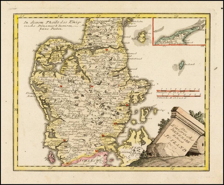
Very scarce regional map of Jutland. Shows rivers, roads, towns, castles, forests, lakes and a host of other details. From Von Reilly's exceedingly scarce Grosser Deutscher Atlas. Von Reilley & Schaembl led a revival of map making in Vienna in...
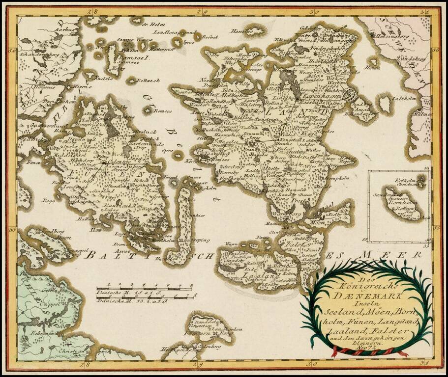
Very scarce regional map of part of Denmark. Shows islands, harbors, rivers, roads, towns, and a host of other details. From Von Reilly's exceedingly scarce Schauplatz der funf Theile der Welt. Von Reilley & Schaembl led a revival of map making...
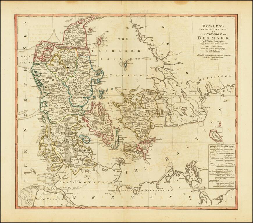
Highly detailed map of Denmark, from a scarce atlas by Bowles & Carver.
![[Jutland and Fyn Island]](/map/small/39278.jpg)
Scarce separately issued map of Jutland and Fyn Island, likely published in Denmark.
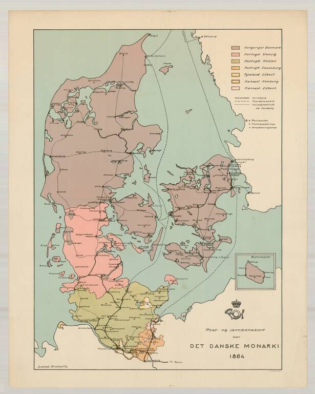
Rare postal and railroad map of the Danish Monarchy, dated 1864. The map identifes Svend Arnholtz as the mapmaker. We have located no information about the map.